Storm Chase Details
Miles Logged: 1260
States Chased: IA, MO
Tornadoes Witnessed: 3
Largest Hail Encountered: 0.75 in.


Spotter Network Reports: 4
- Tornado 4 miles NNW of VILLISCA, IA
- Tornado 4 miles NNW of VILLISCA, IA
- Tornado 3 miles N of NODAWAY, IA
- Tornado 3 miles NNE of KENT, IA
Severe Reports: Storm Reports
Another strong impulse slamming into the warm sector in NW Missouri and SW Iowa definitely had my attention. I ended up departing on Monday evening and heading up to the KC Metro area where I got a room so I could be in position early on Tuesday. Initiation seemed likely by noon or 1pm.
I would end up seeing multiple tornadoes along US34 in Southwestern Iowa near the towns of Villisca, Corning and Prescott.
Forecast
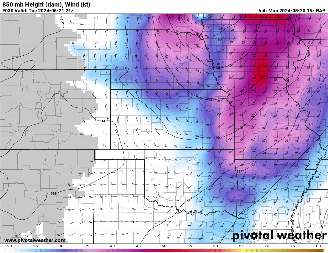
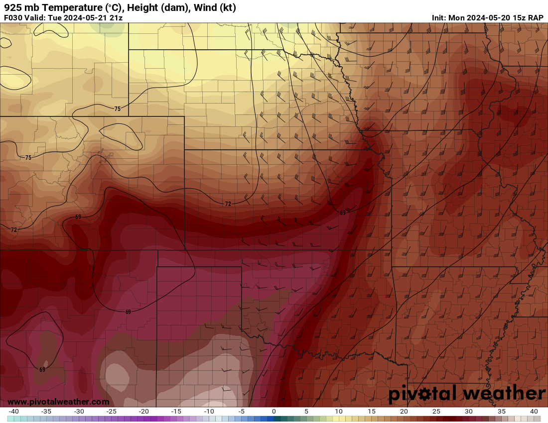
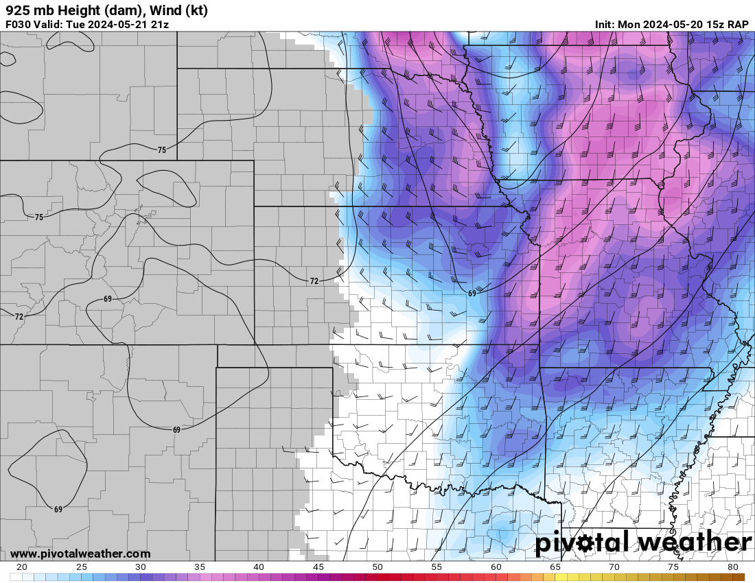
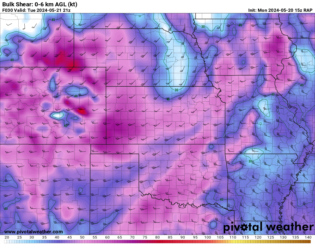
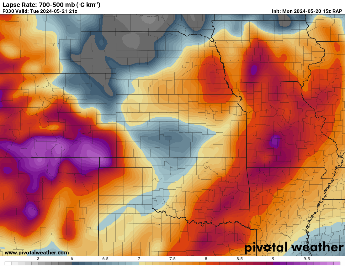
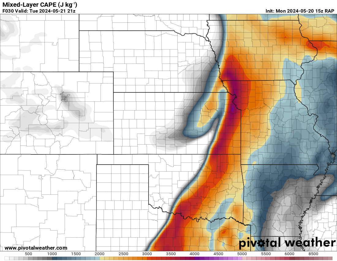
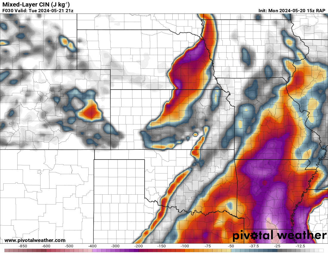
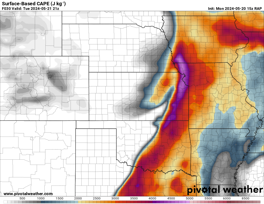
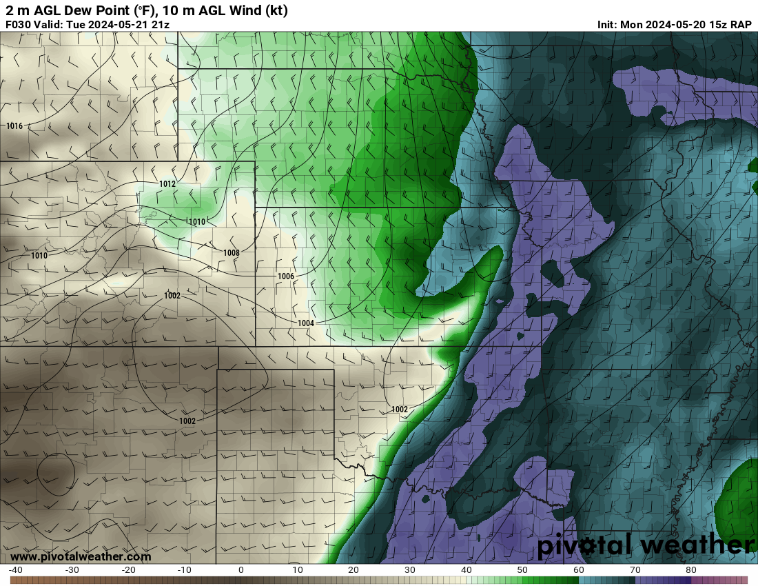
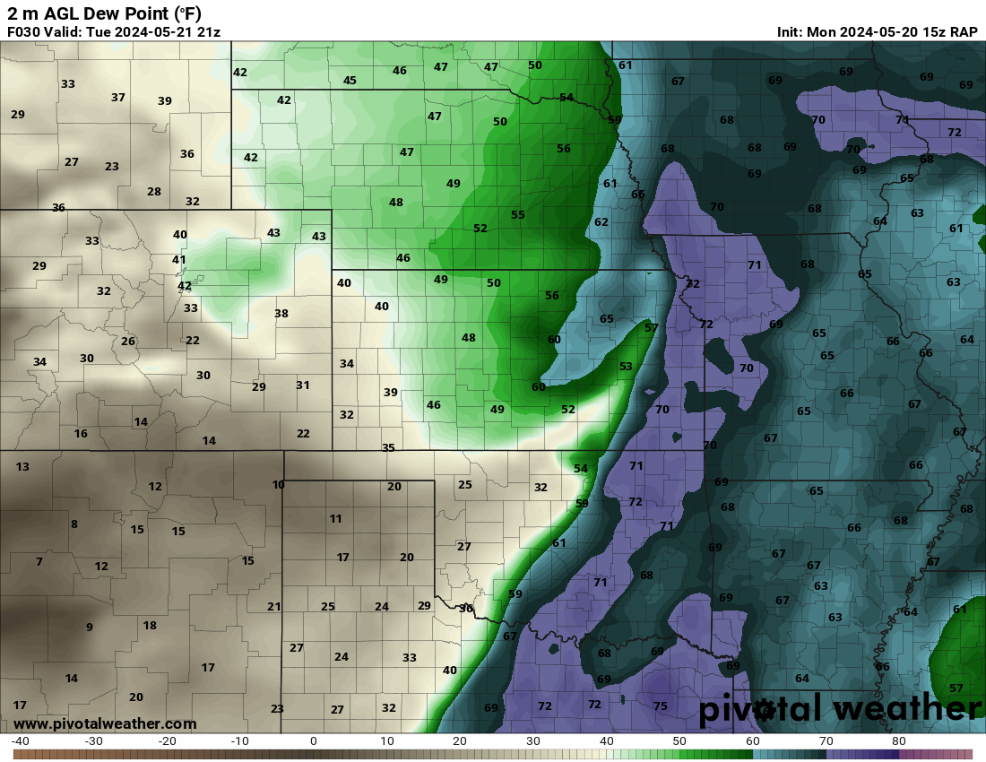
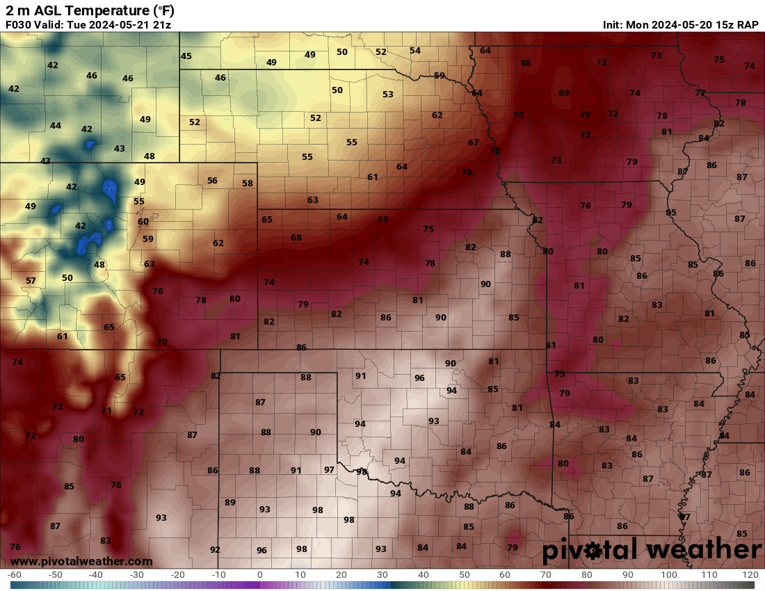
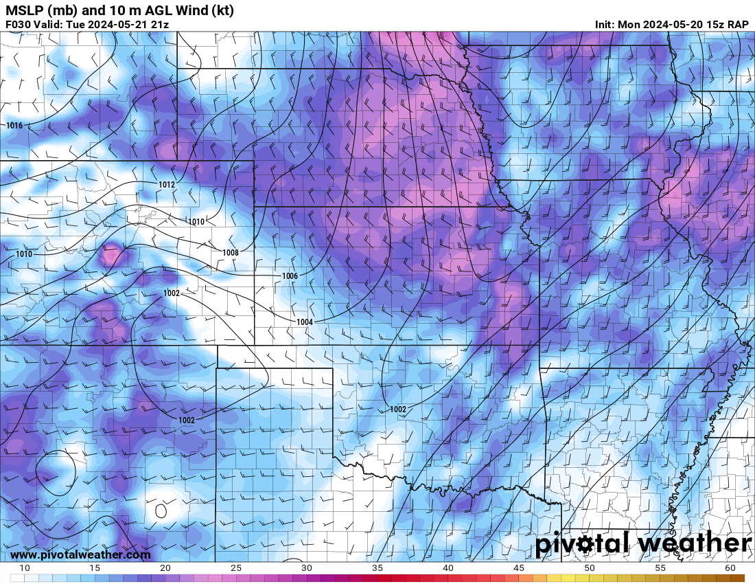
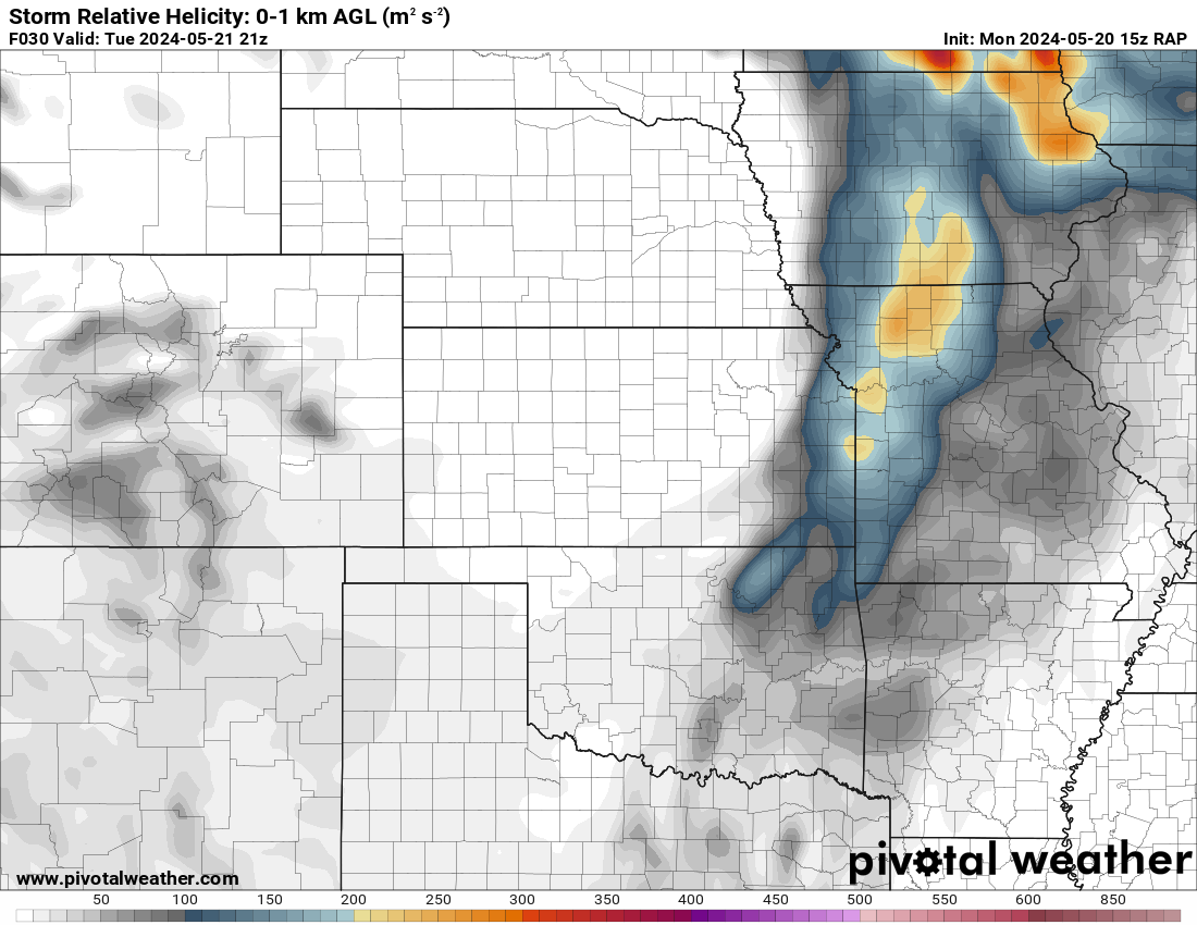
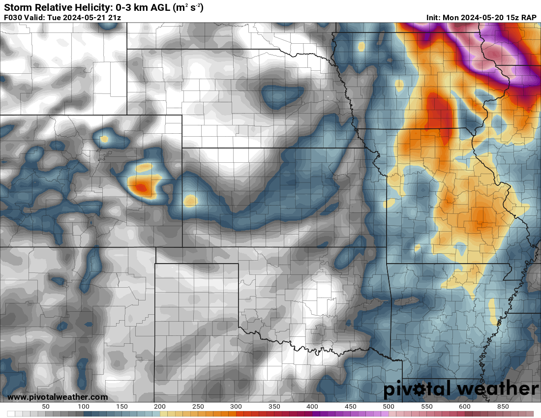
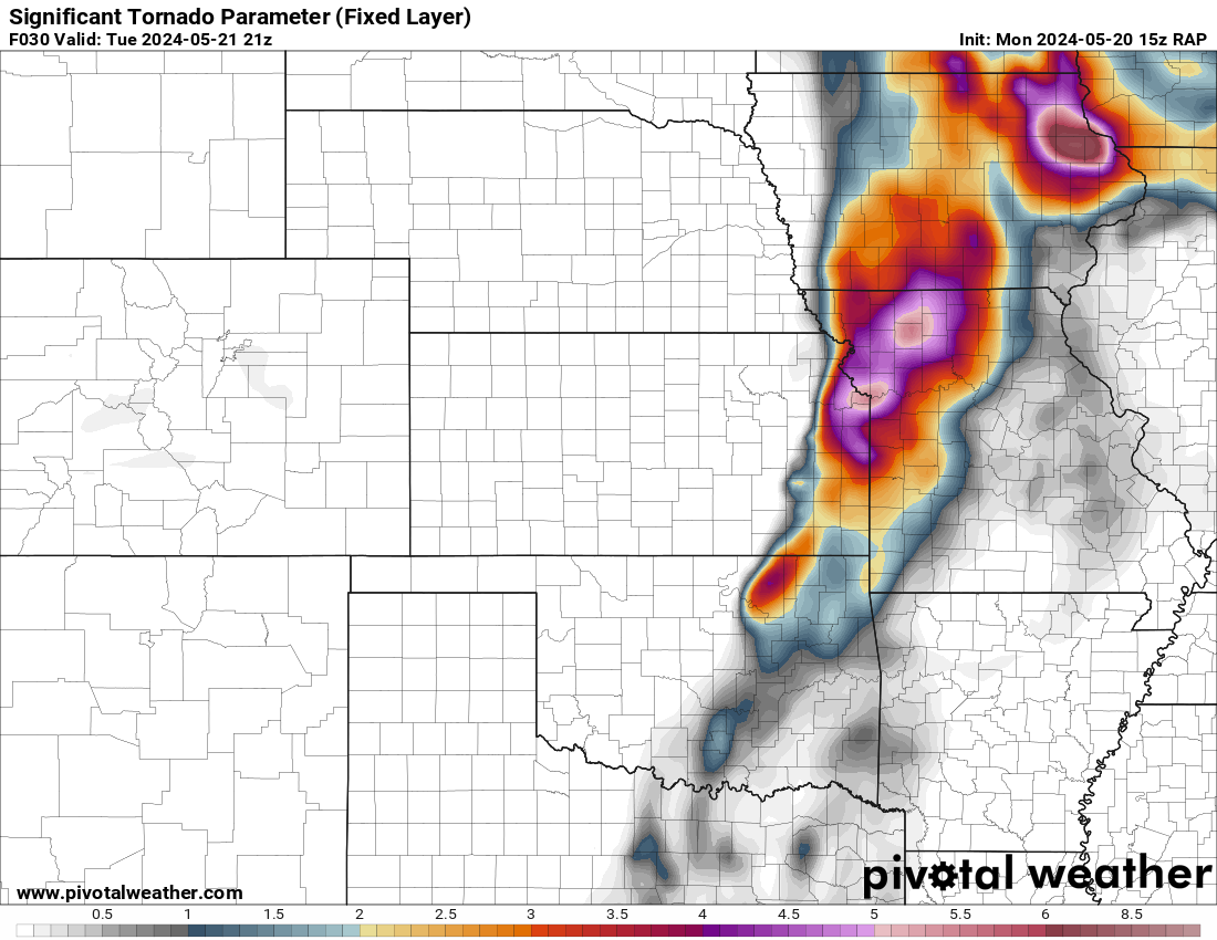
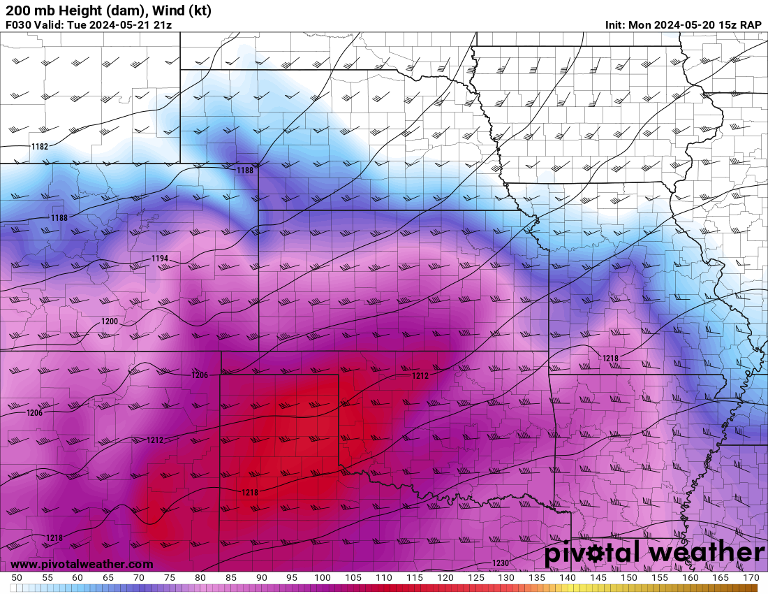
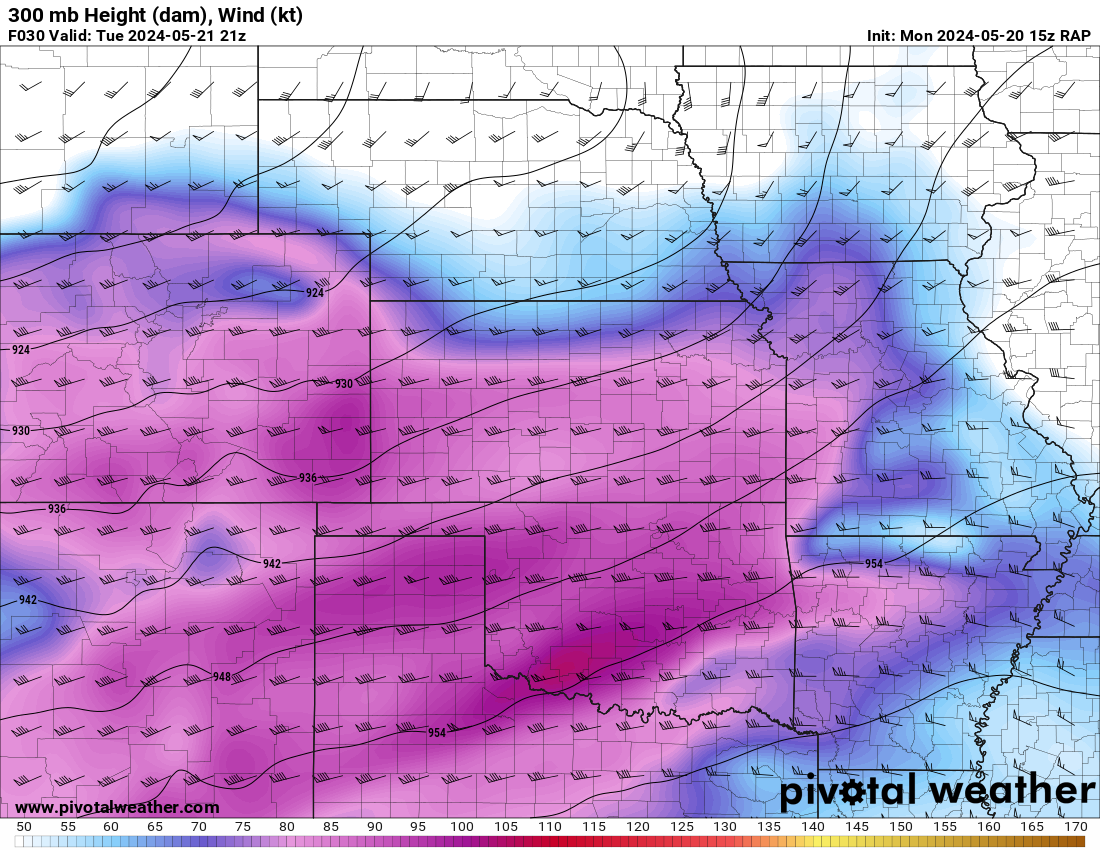
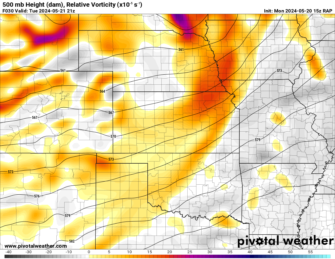
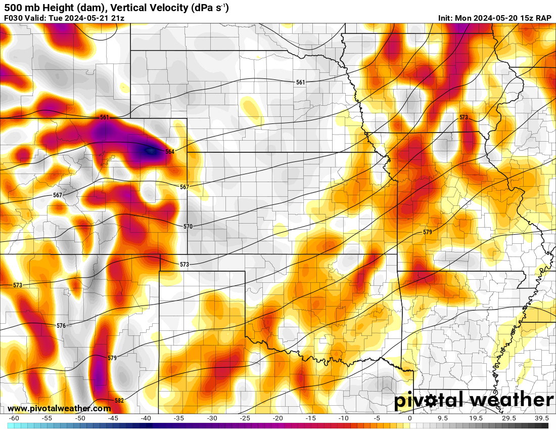
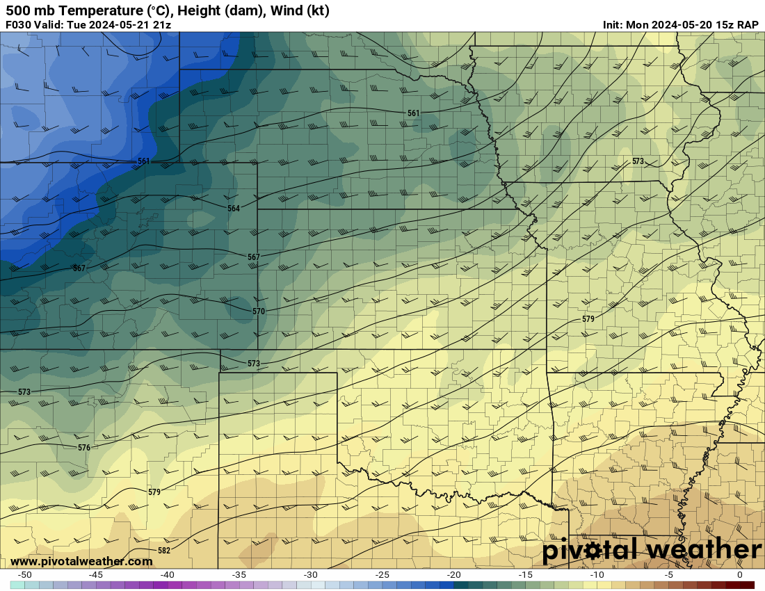
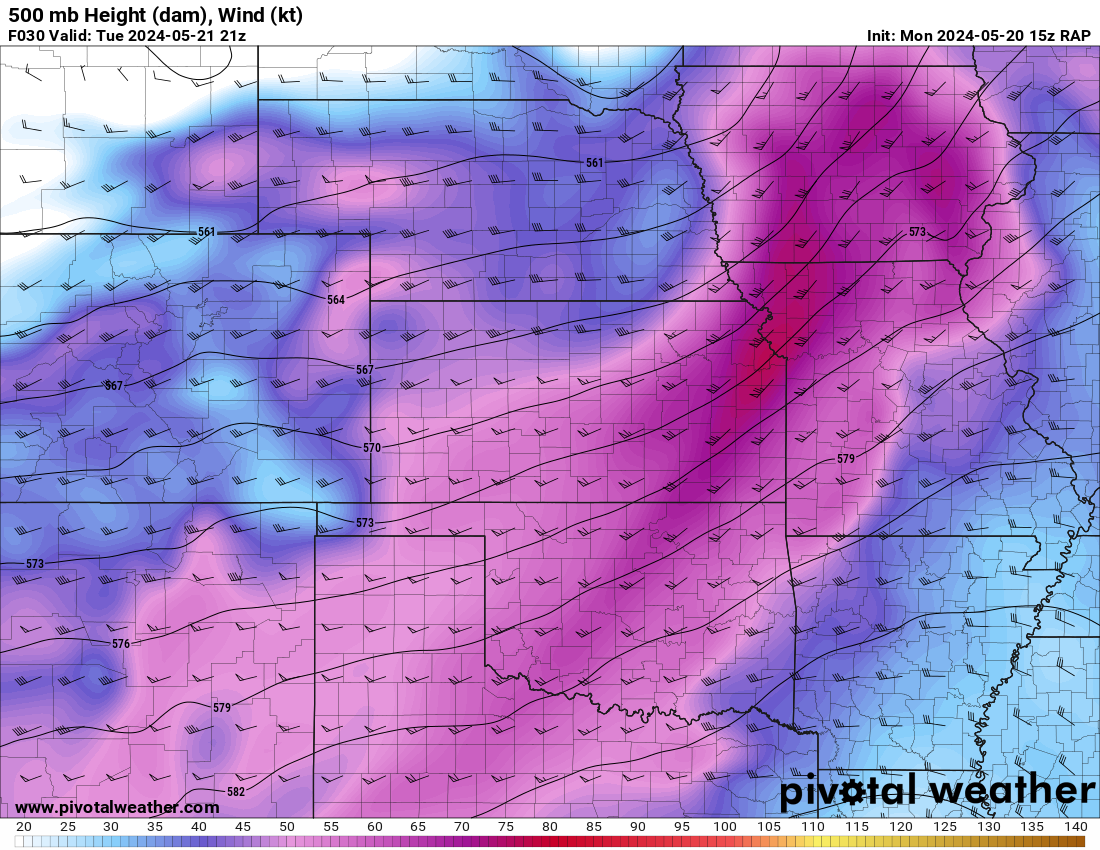
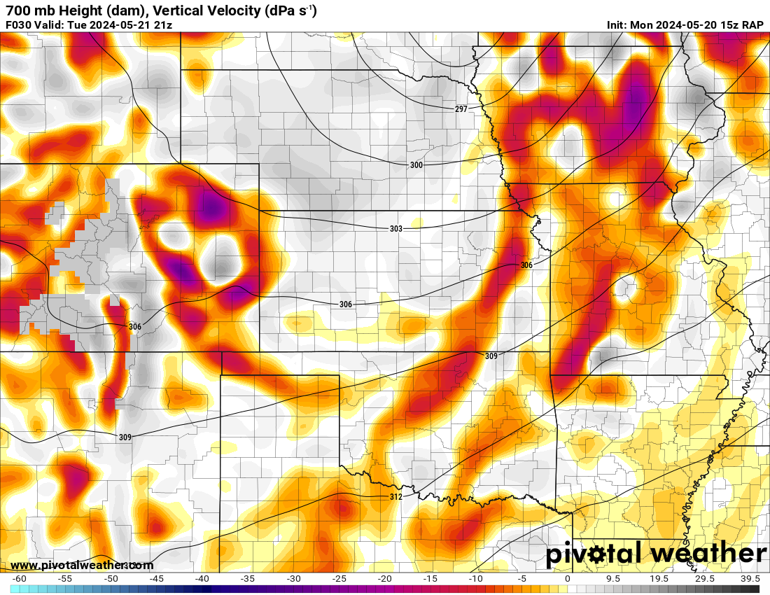
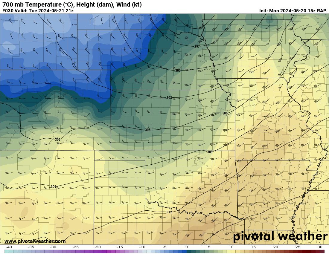
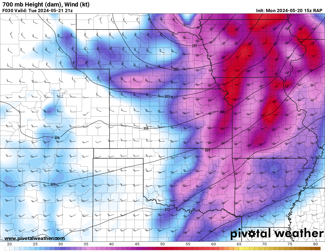
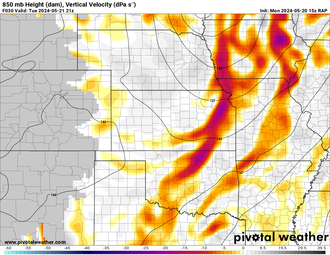
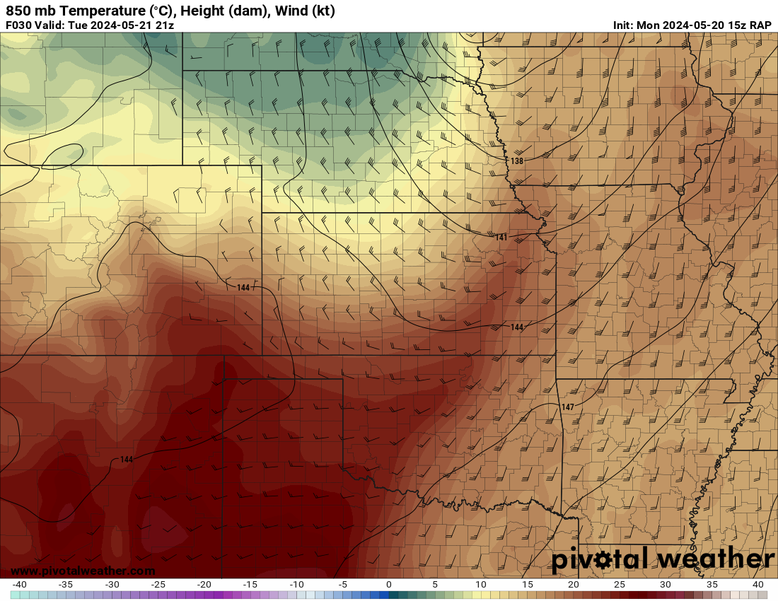
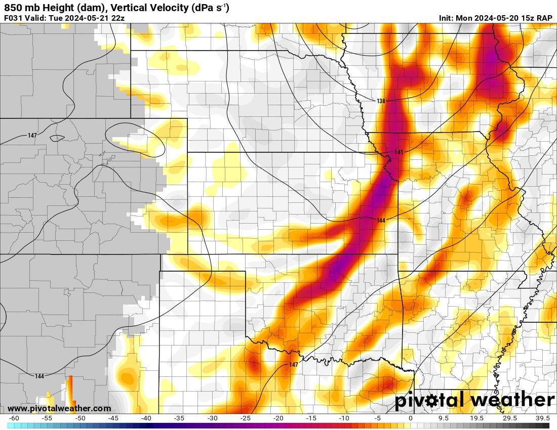
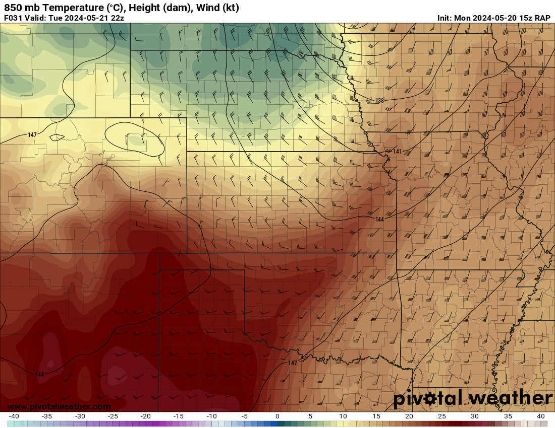
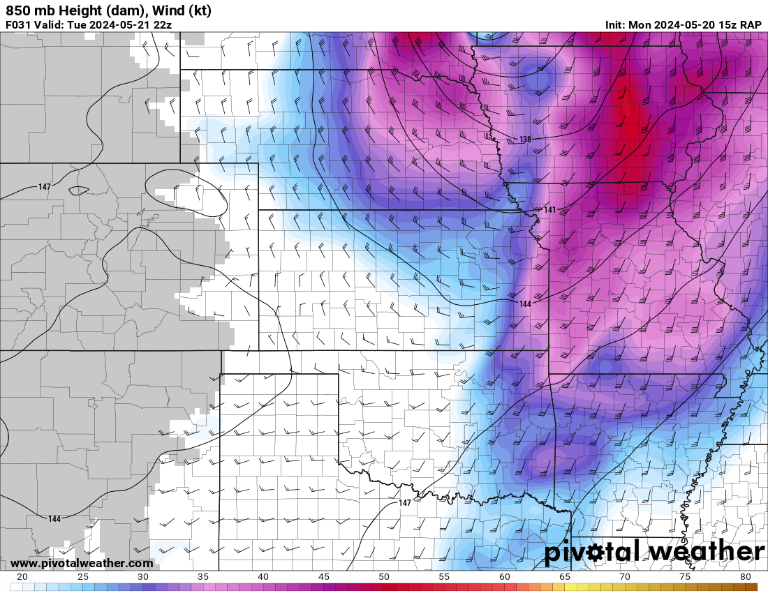
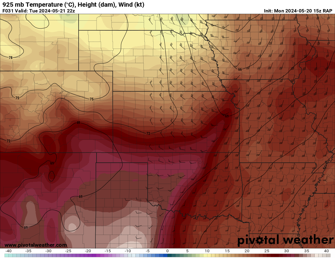
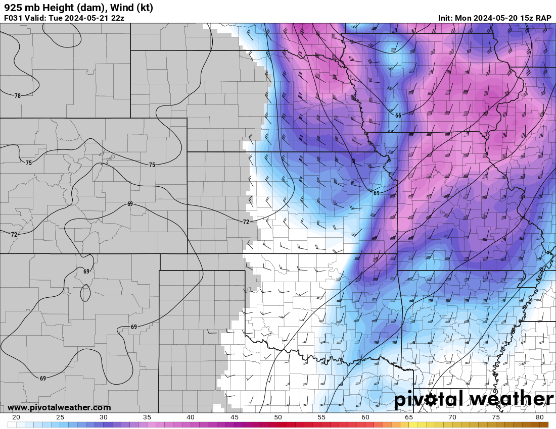
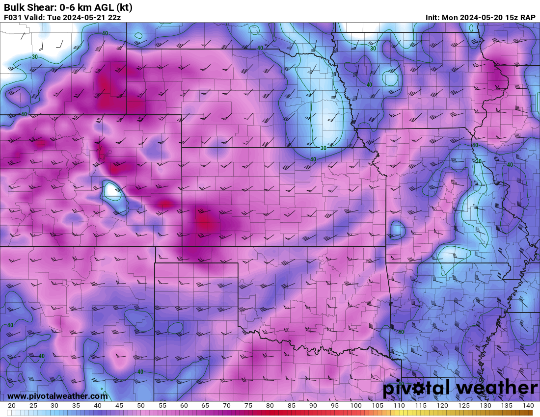
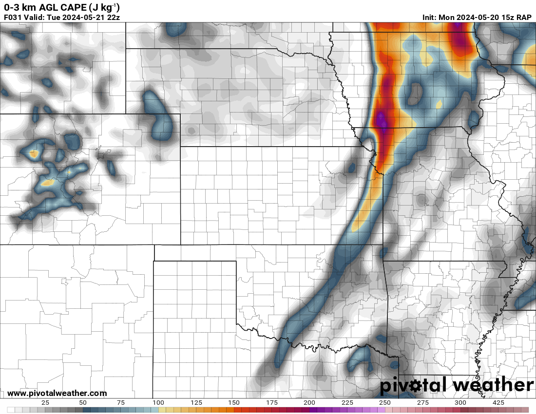
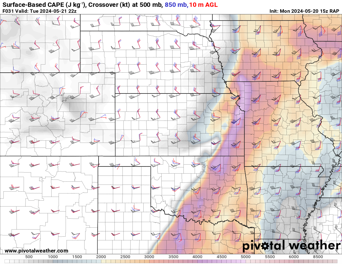
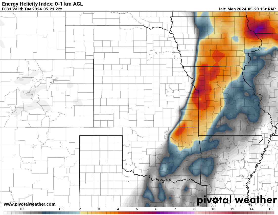
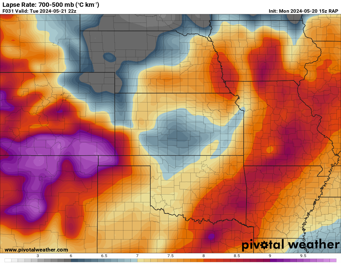
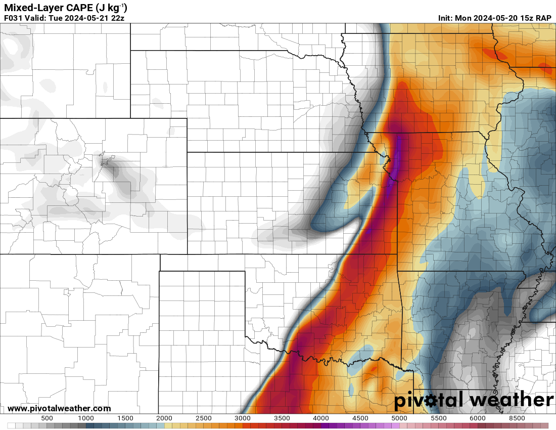
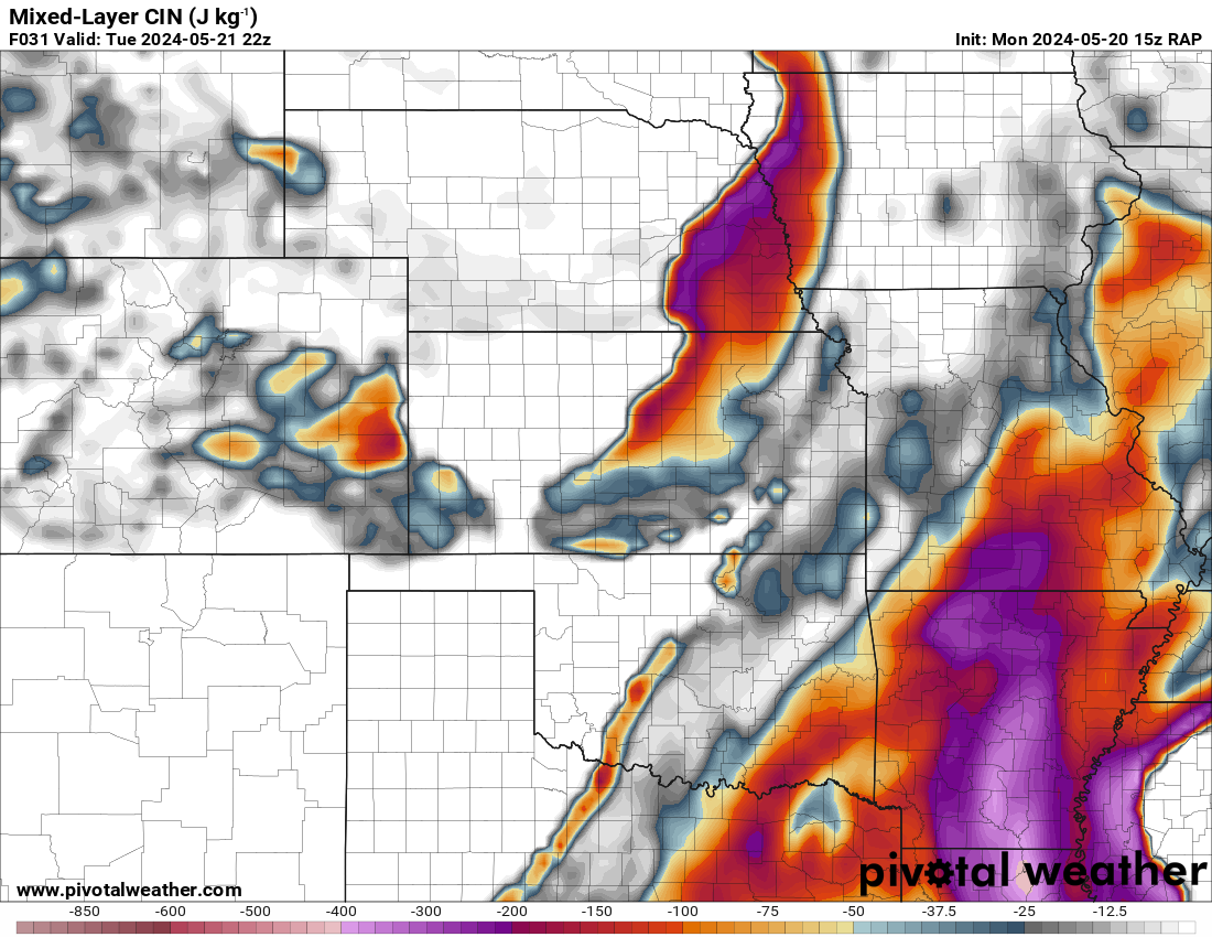
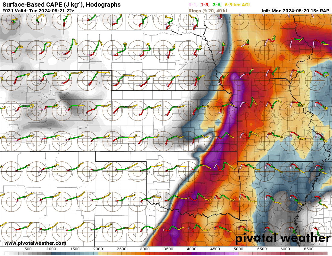
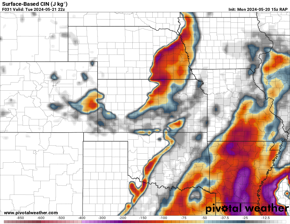
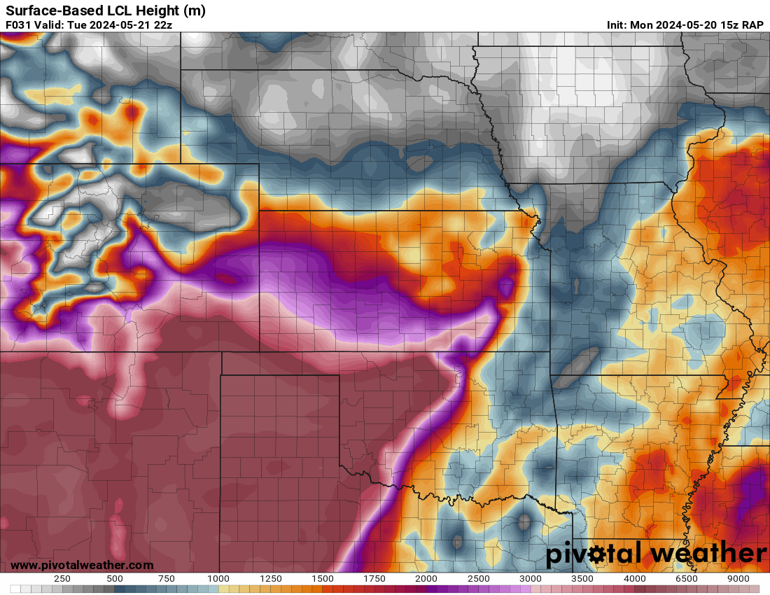
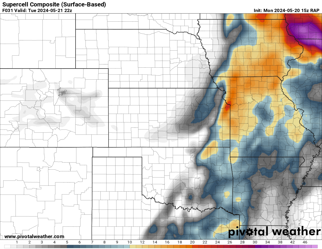
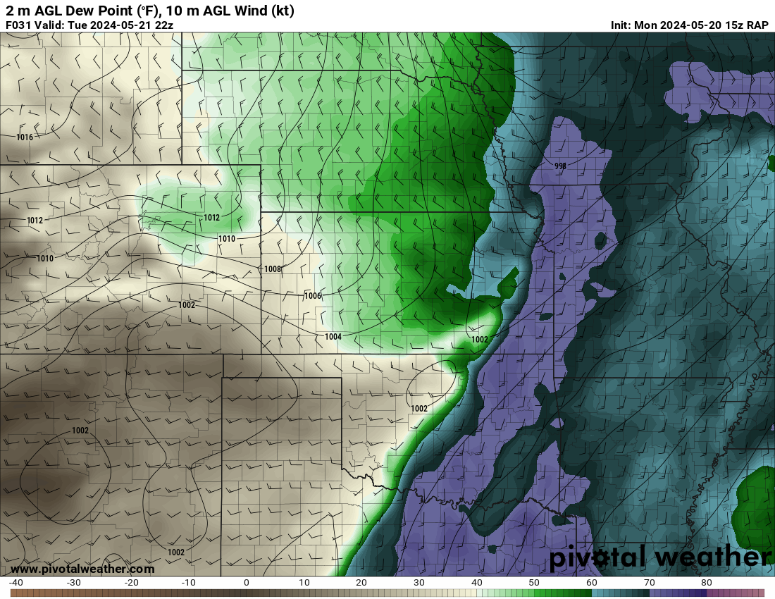
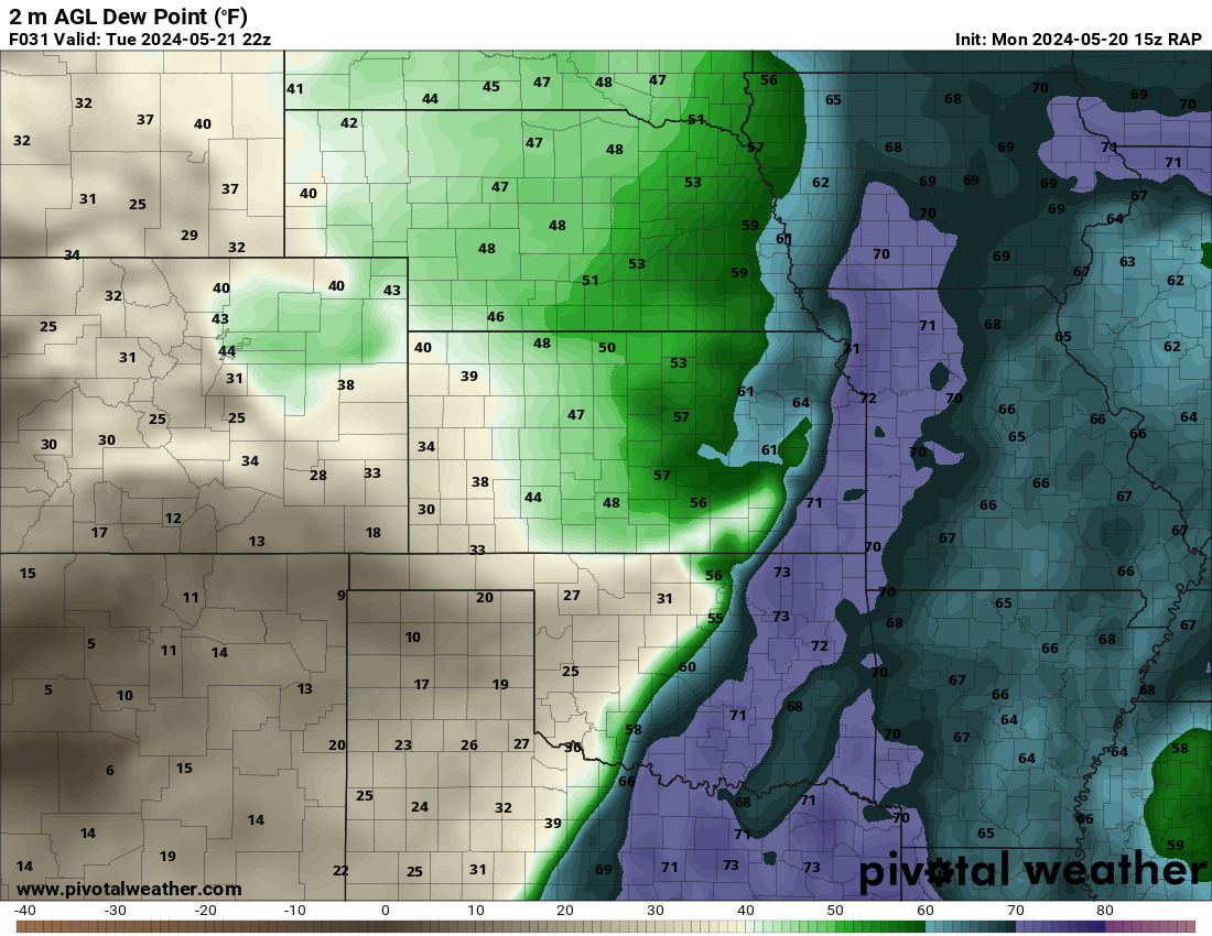
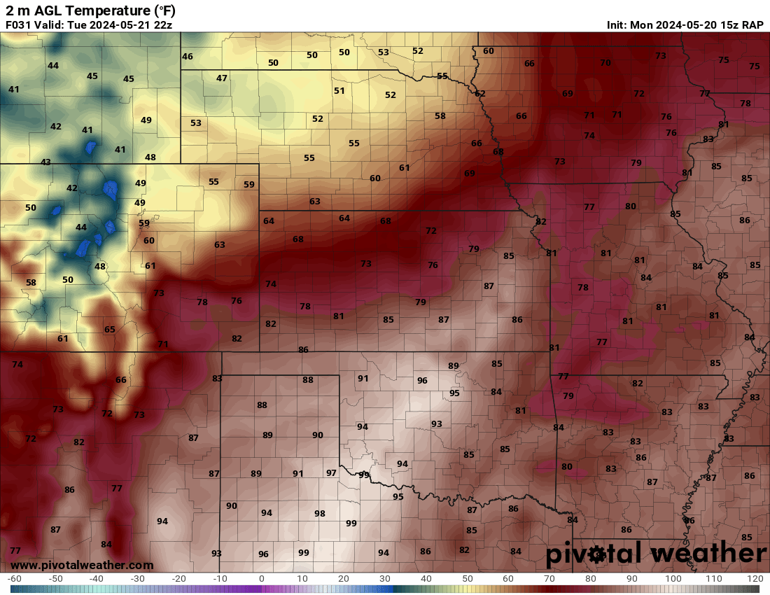
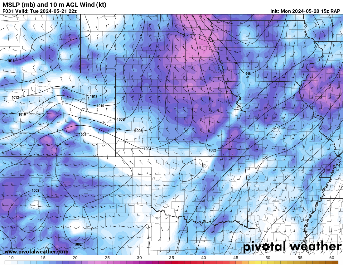
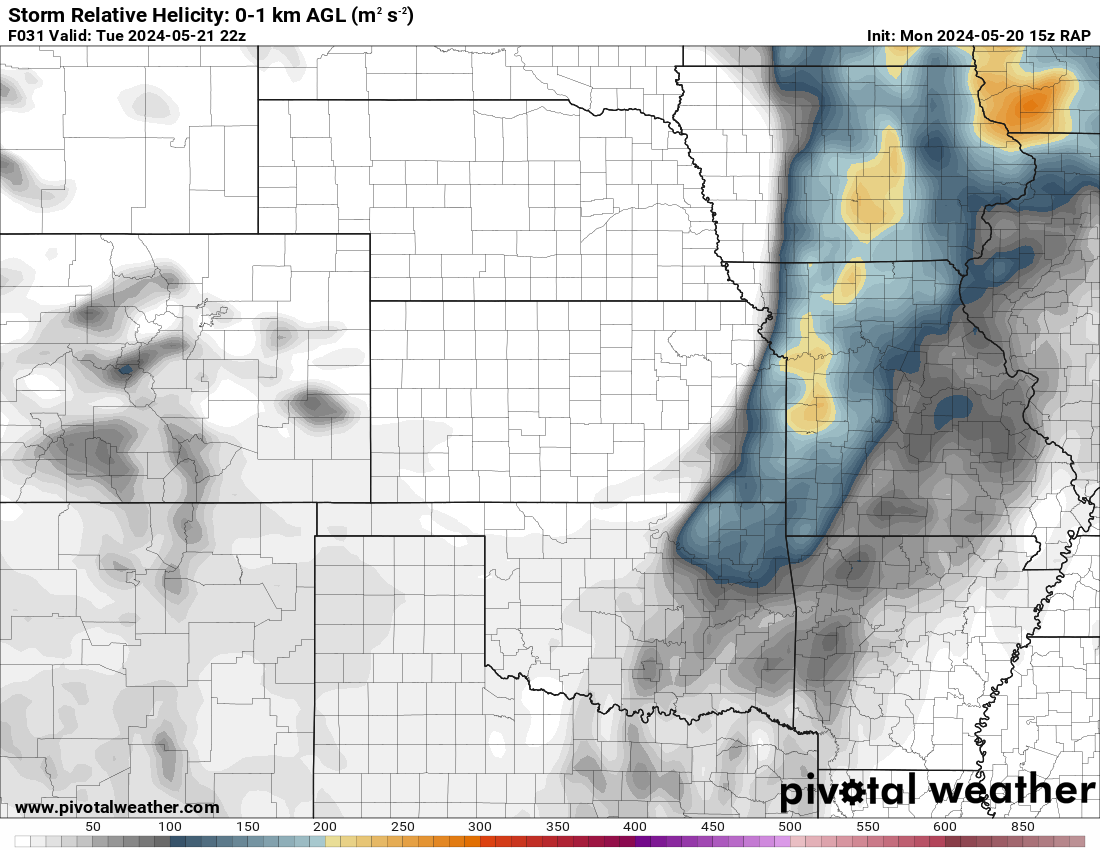
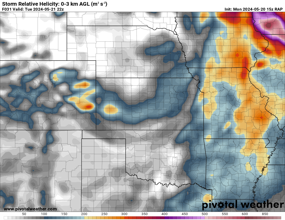
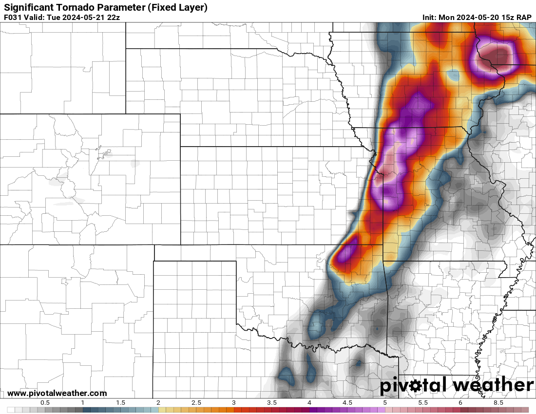
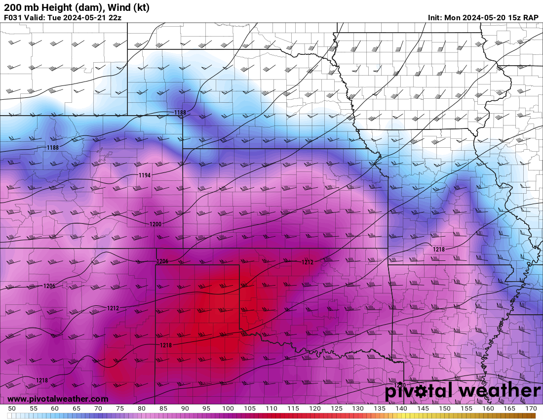
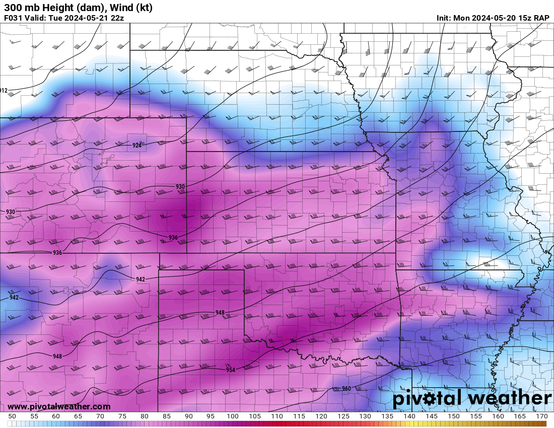
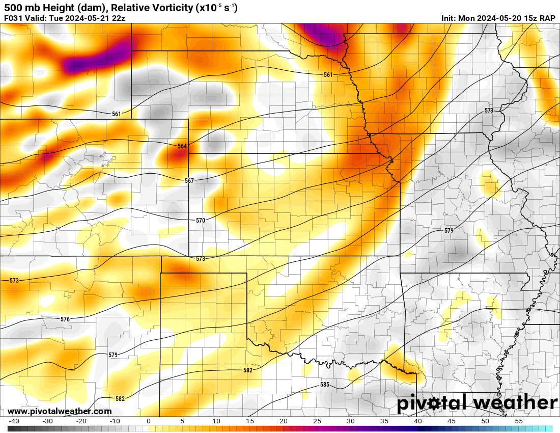
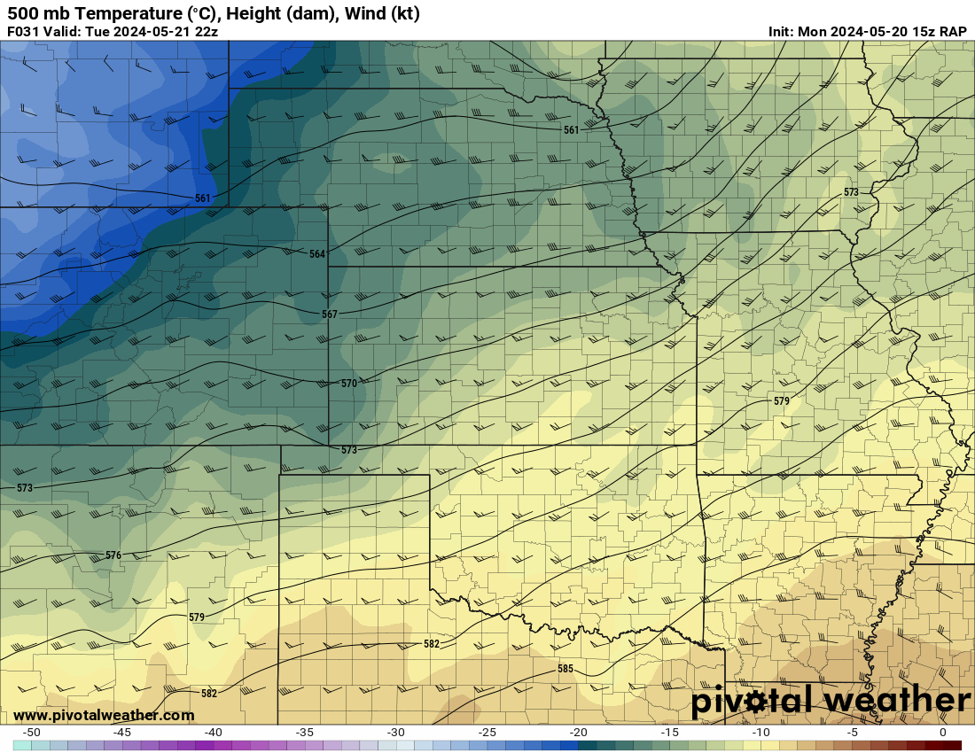
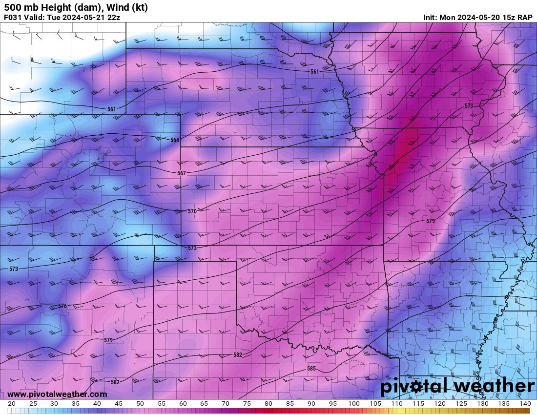
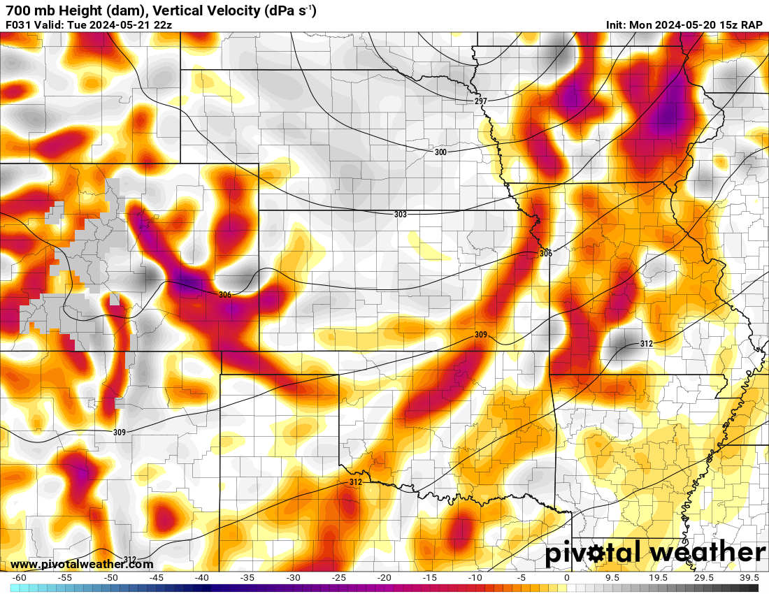
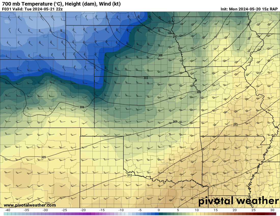
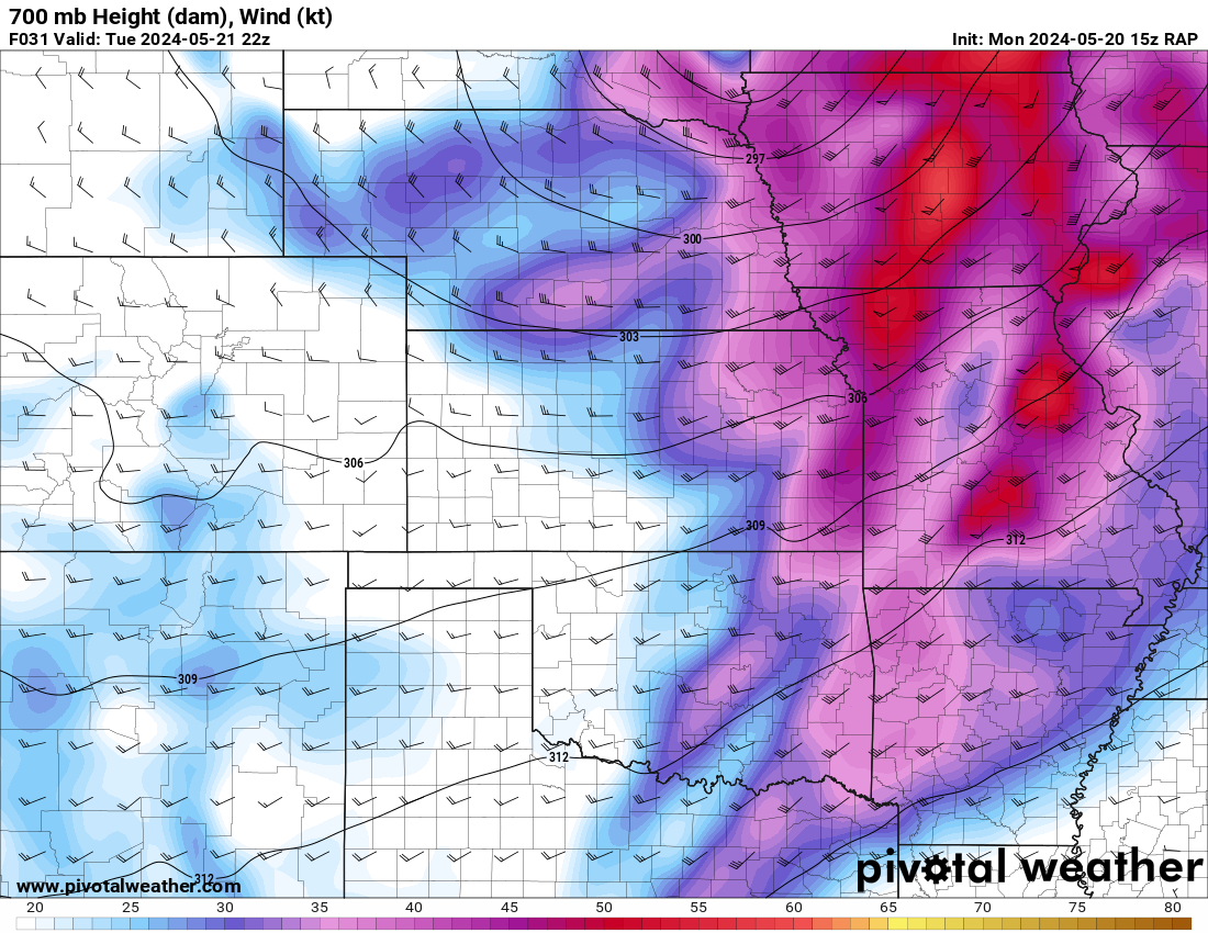
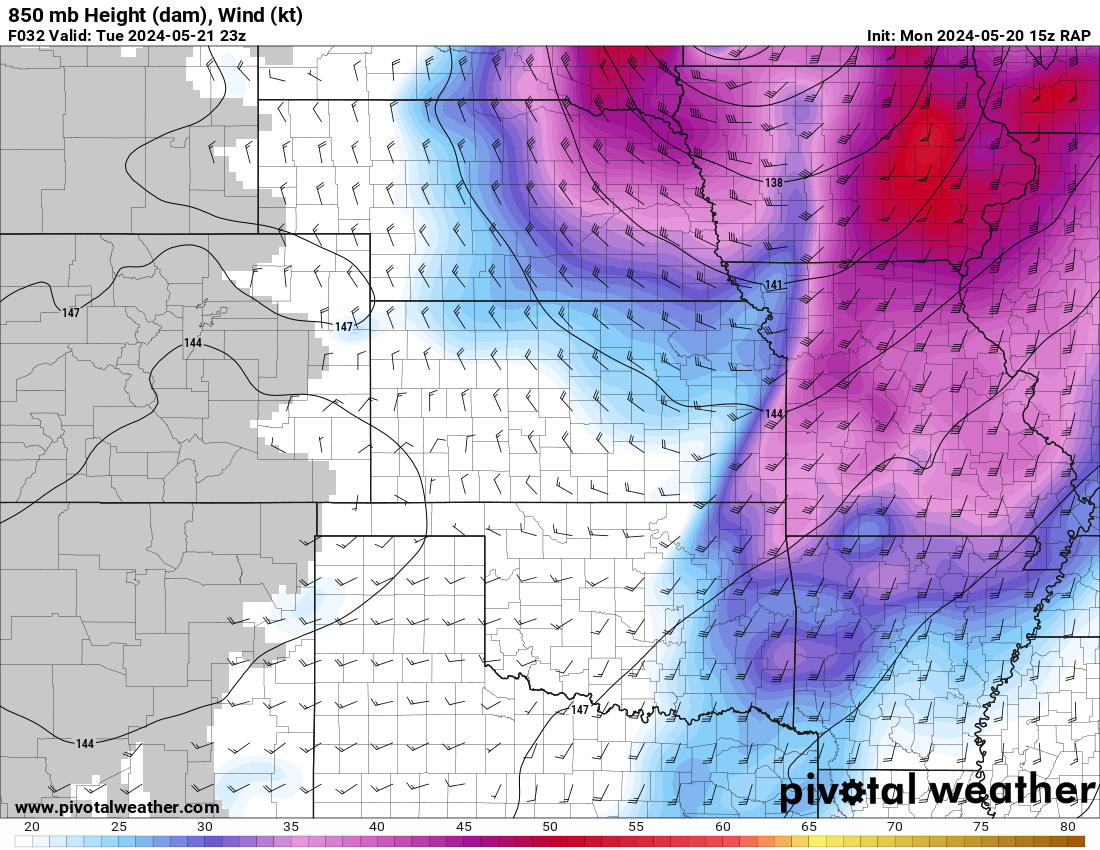
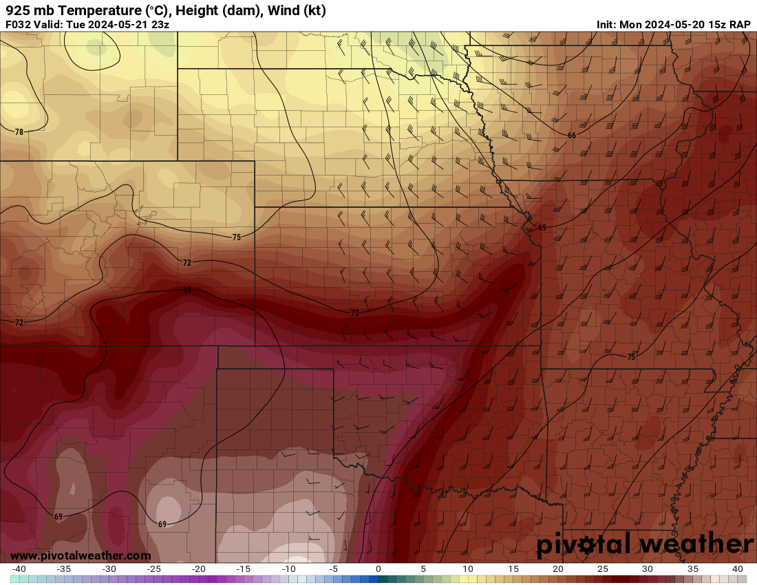
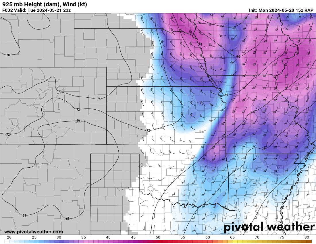
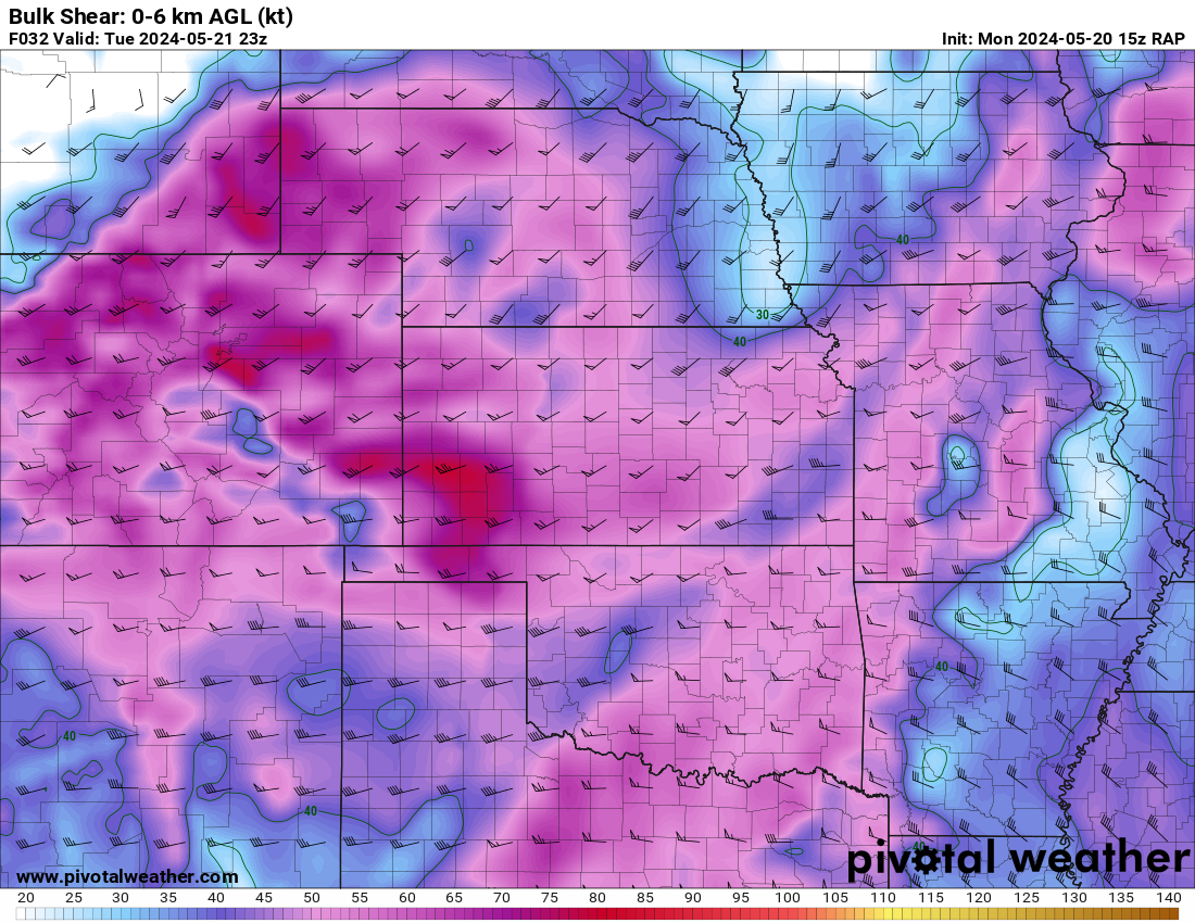
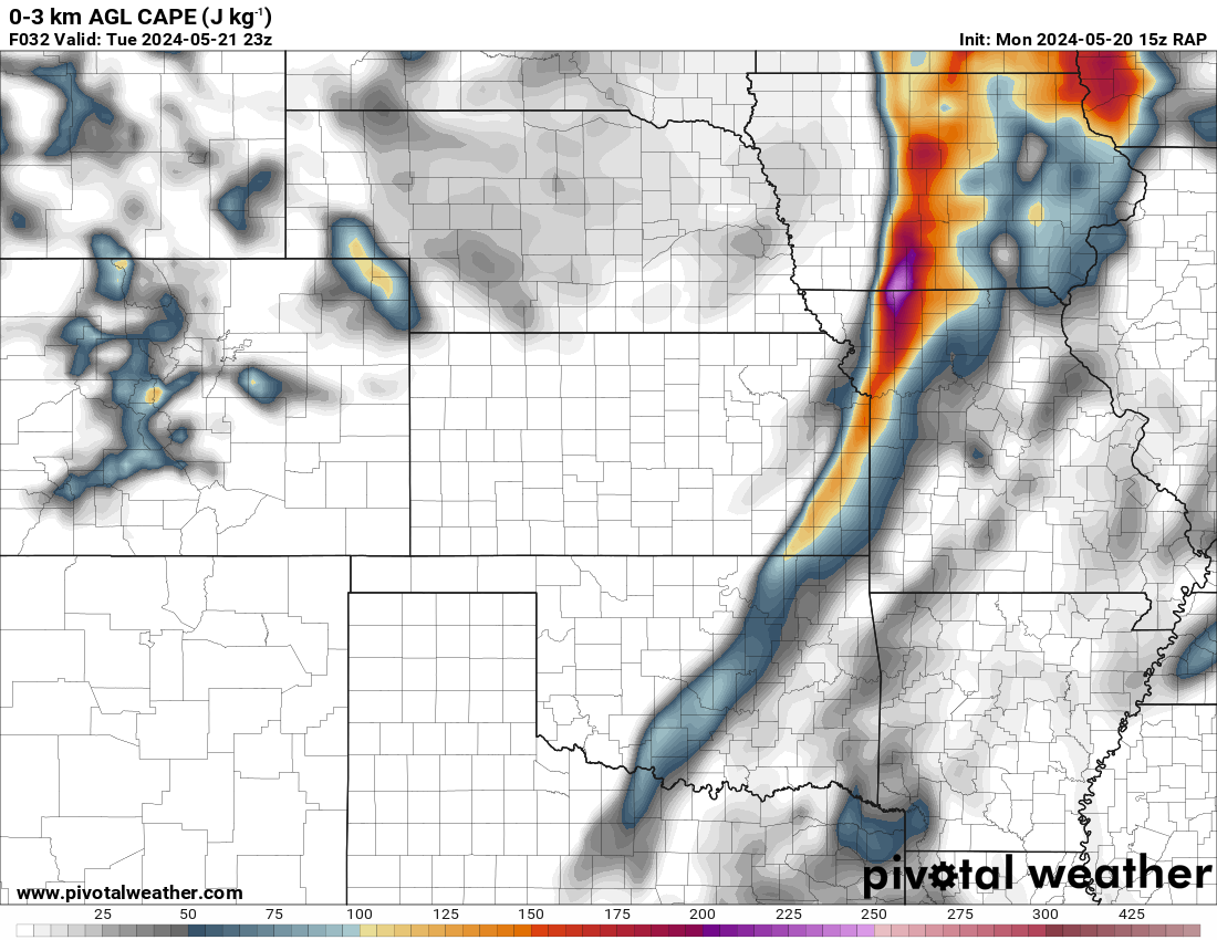
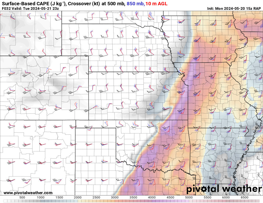
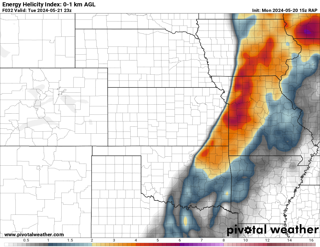
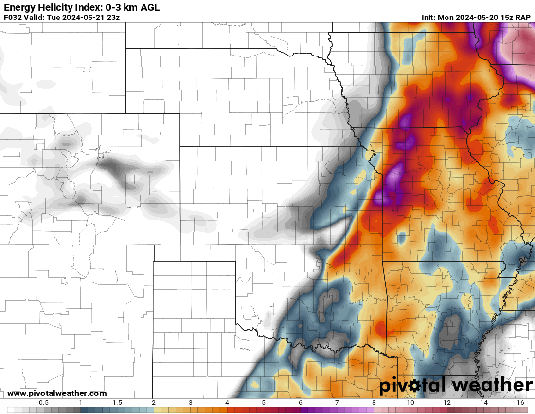
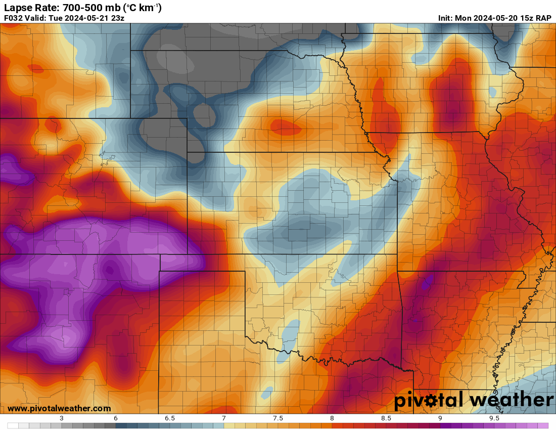
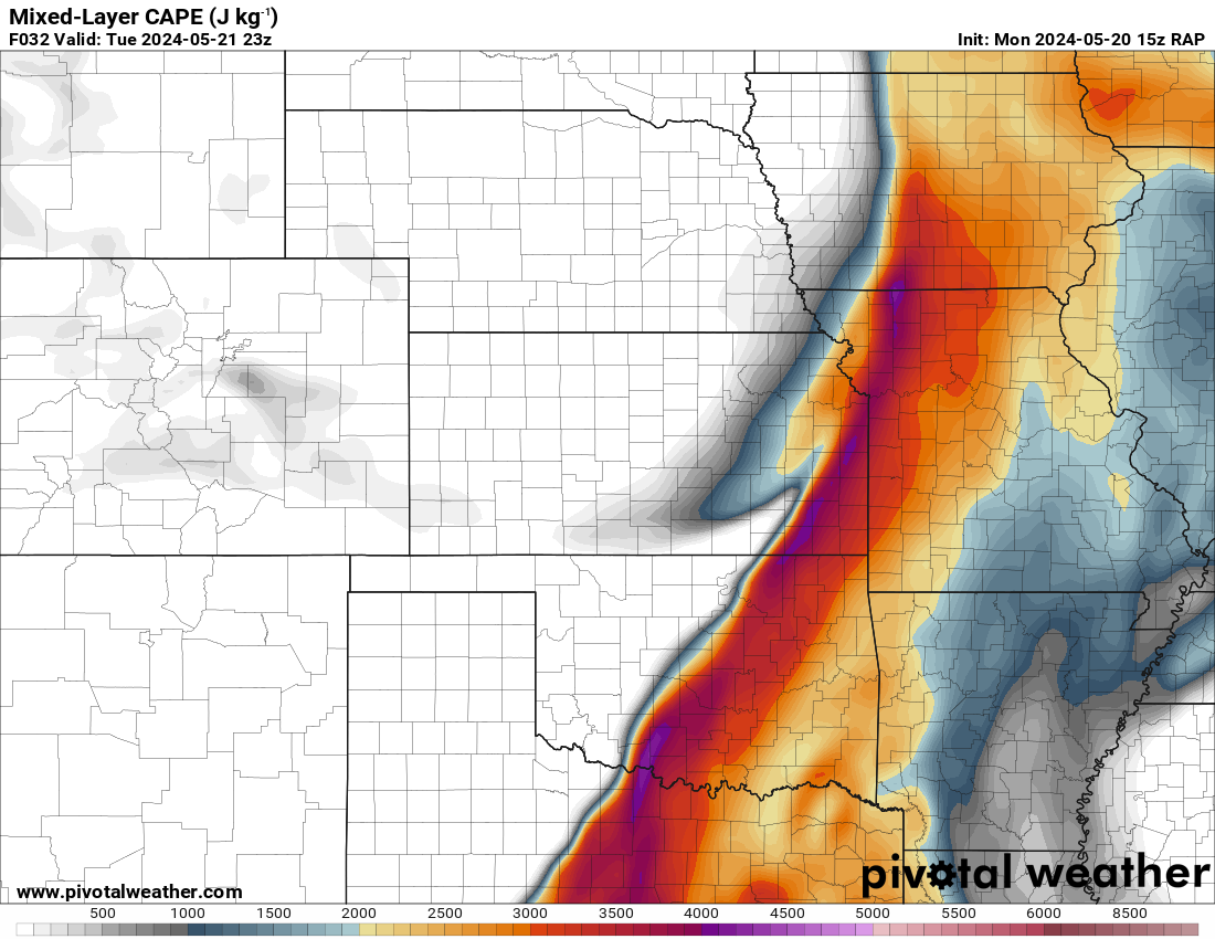
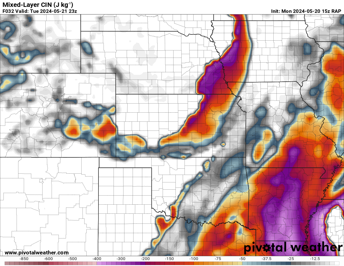
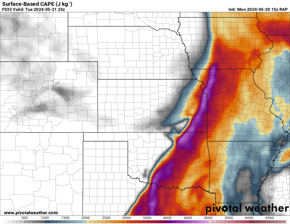
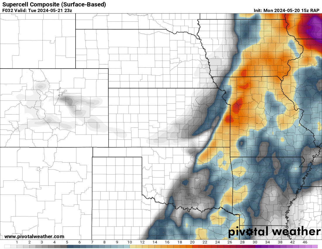
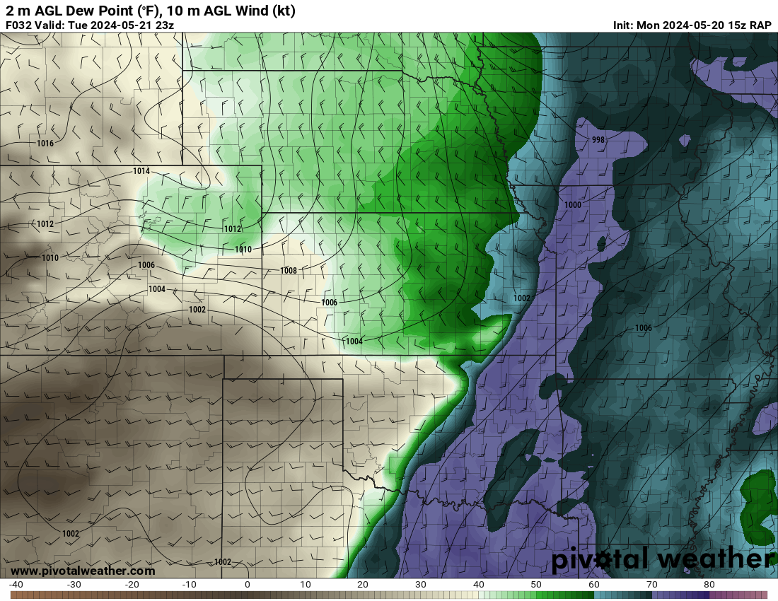
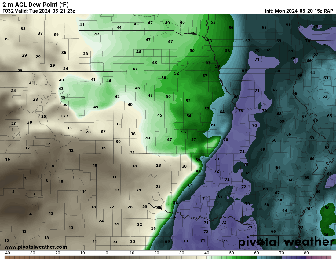
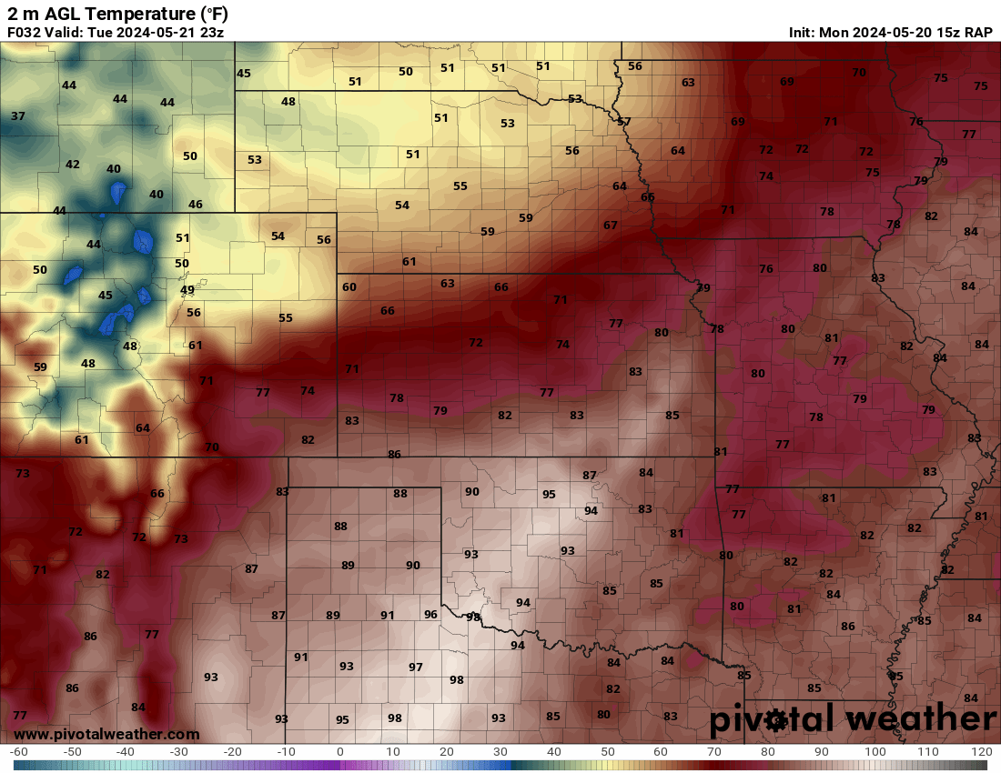
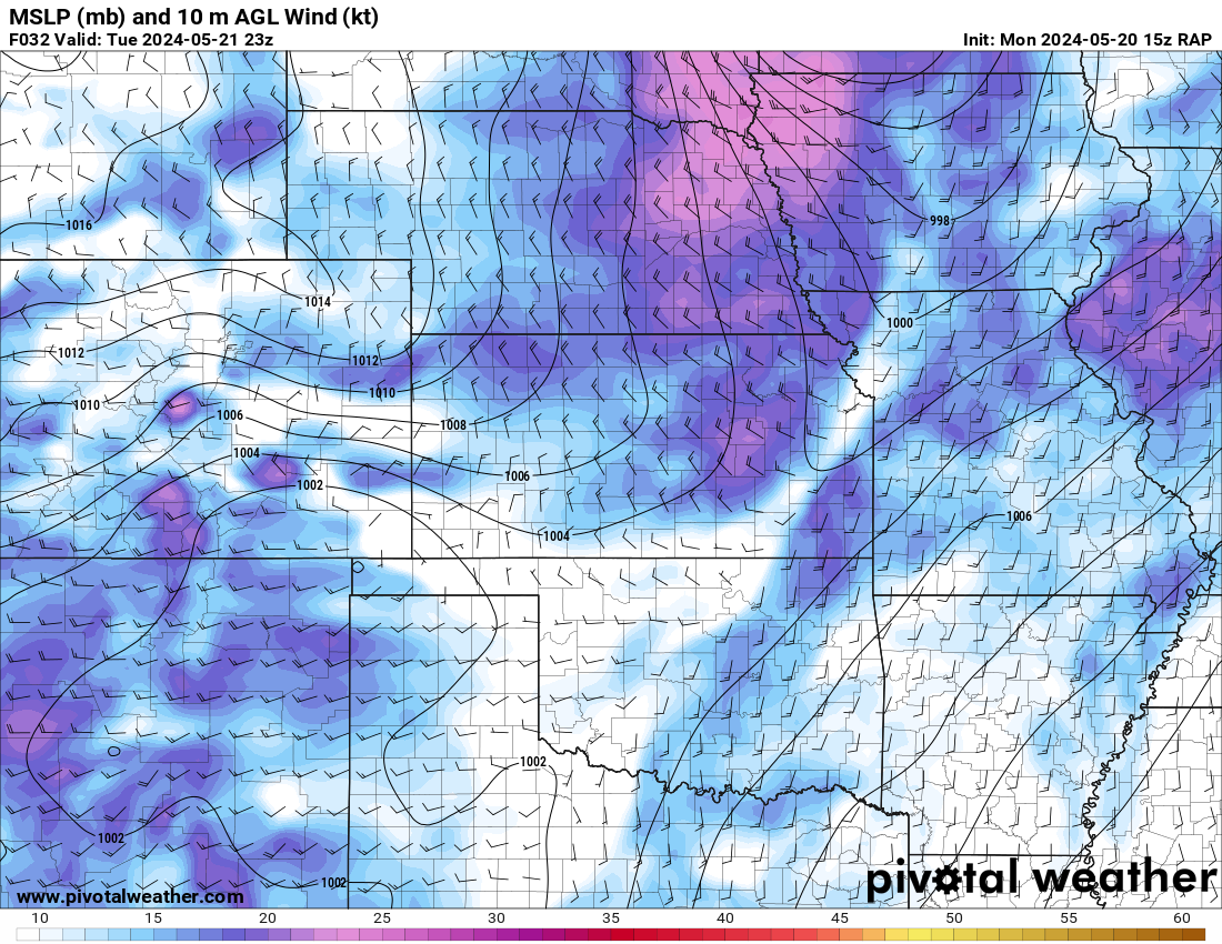
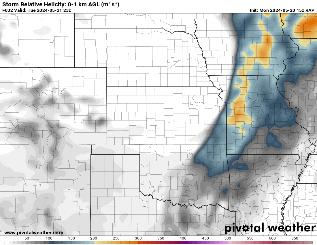
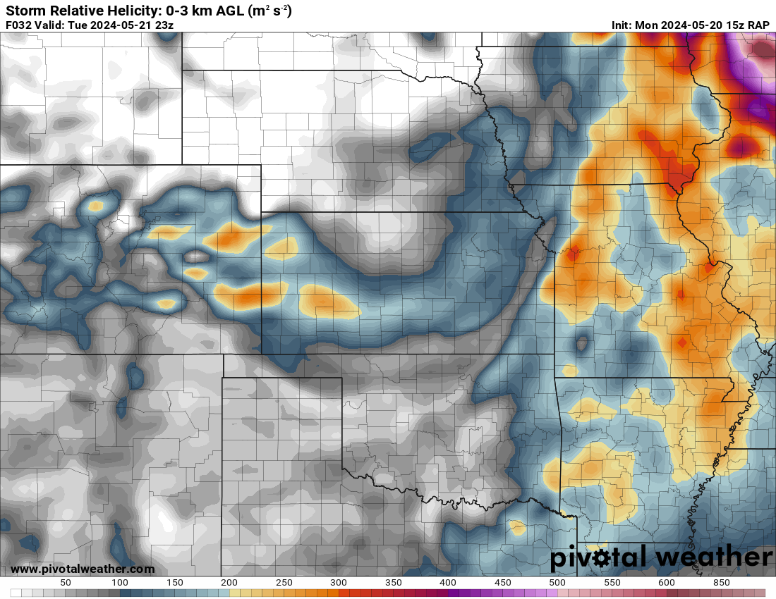
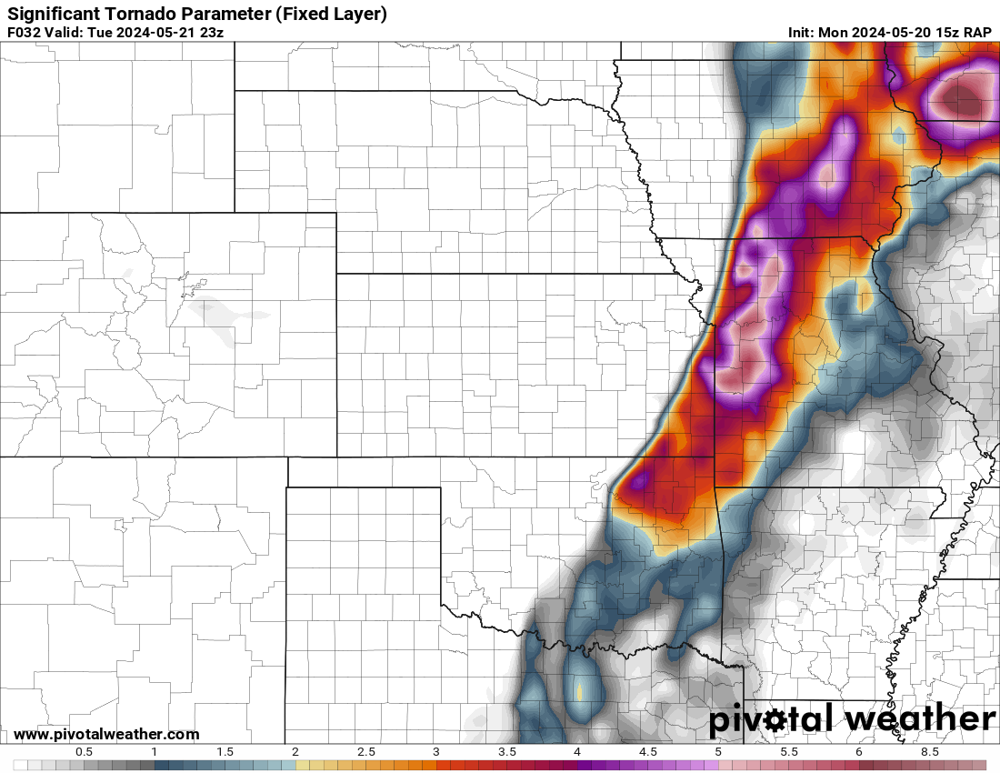
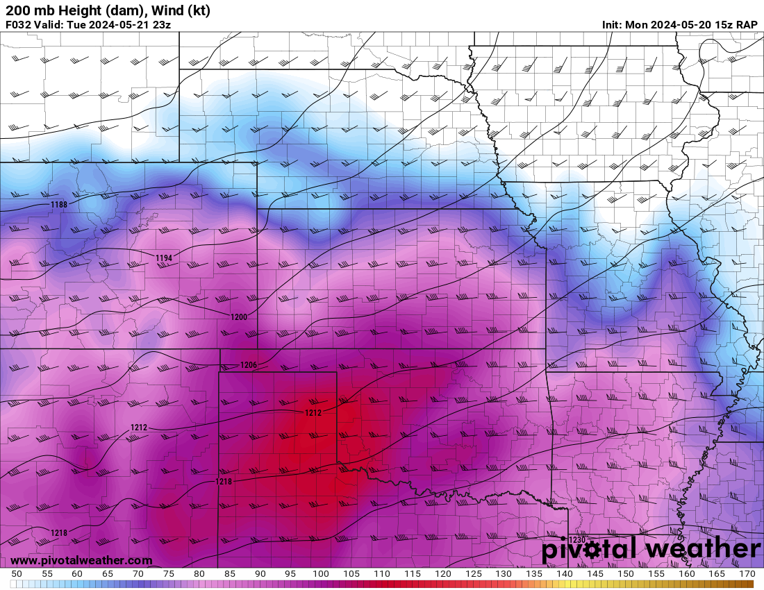
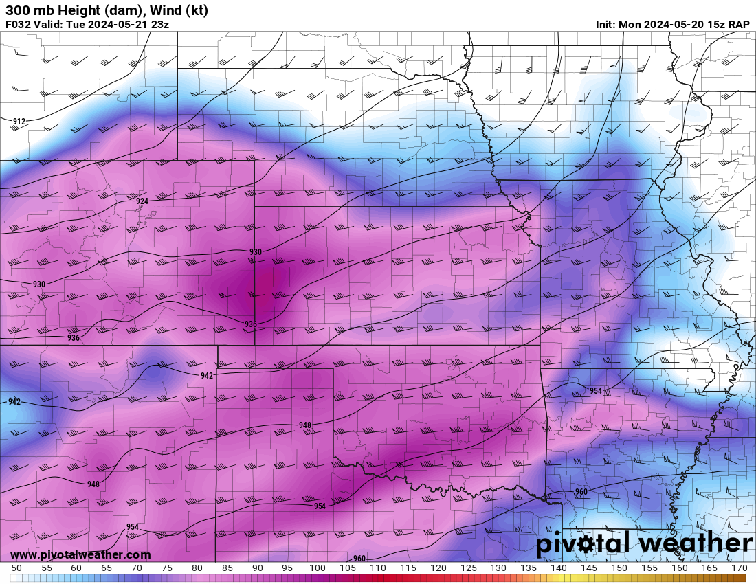
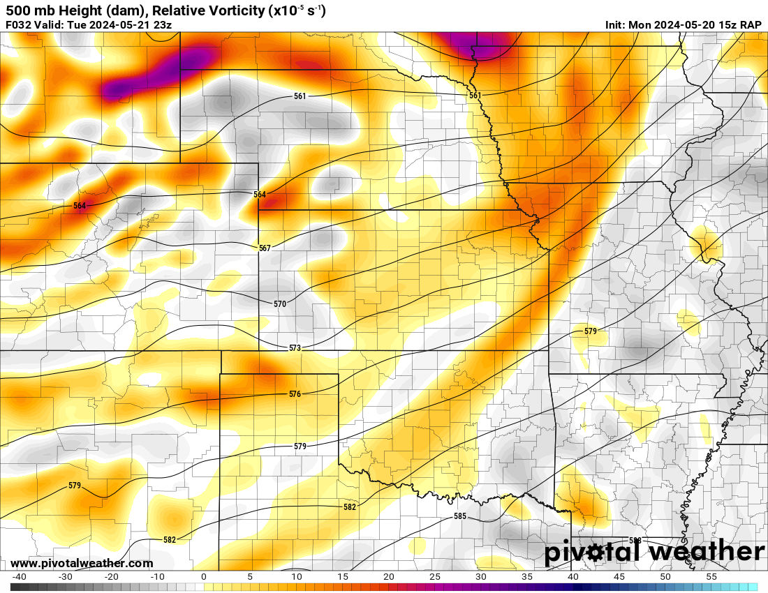
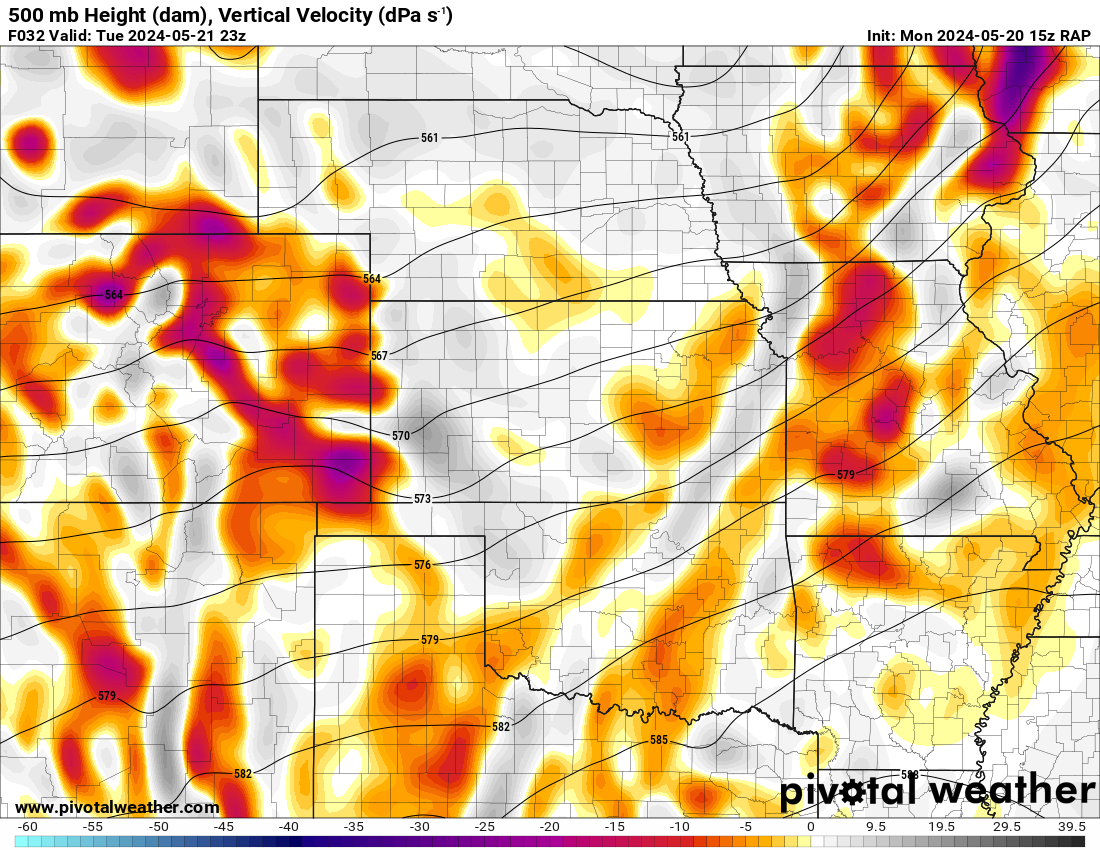
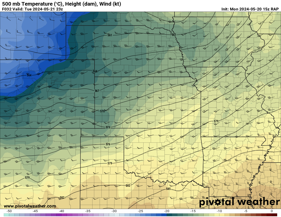
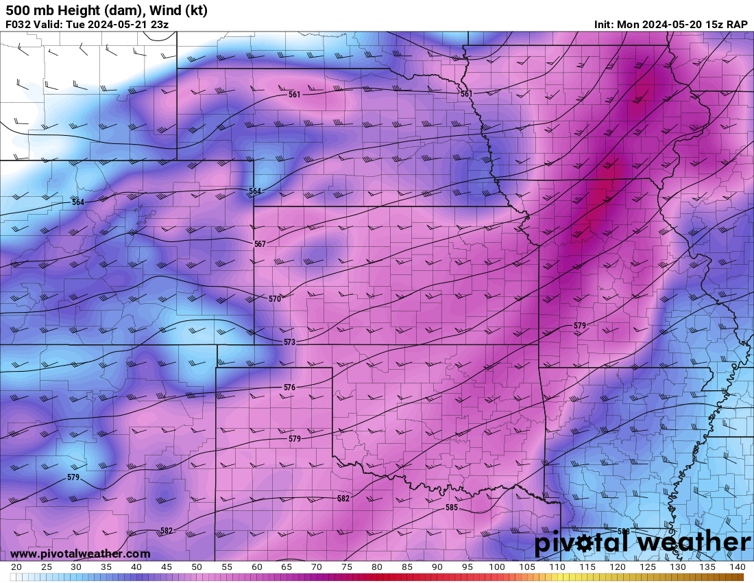
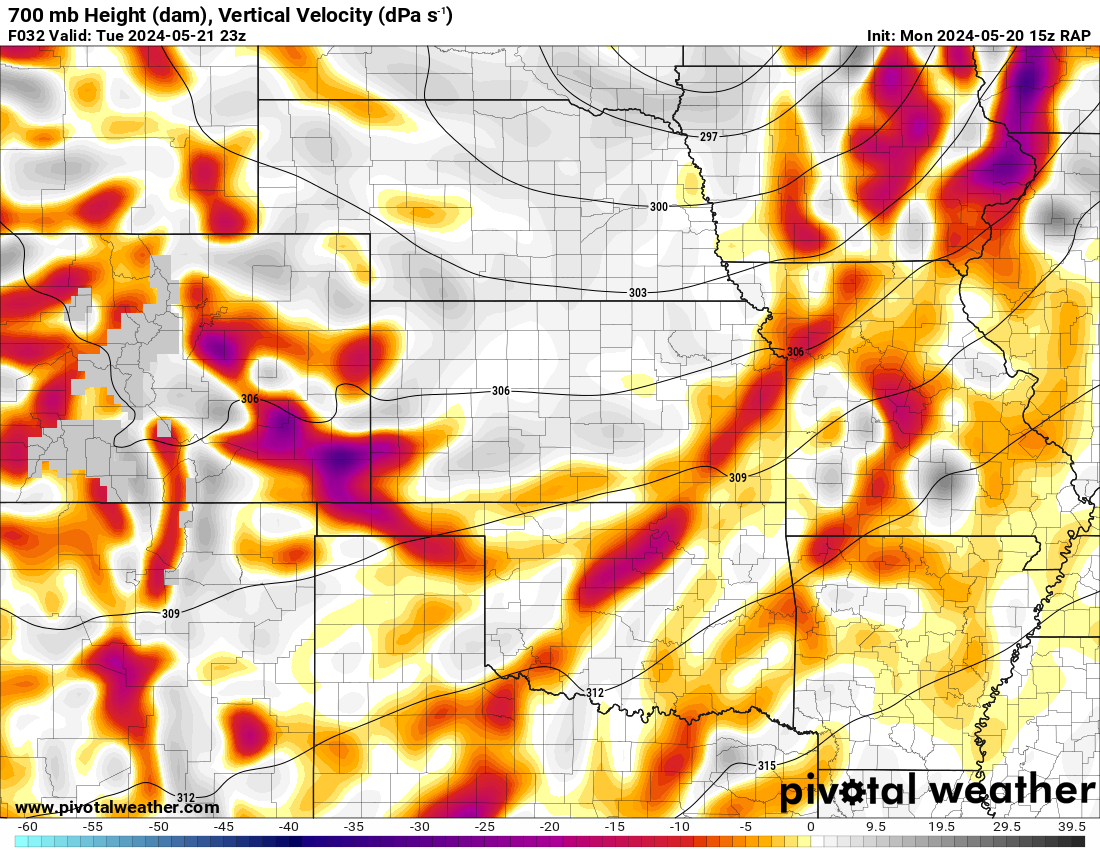
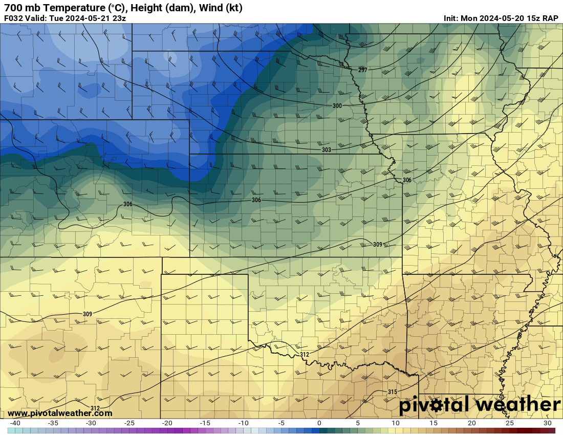
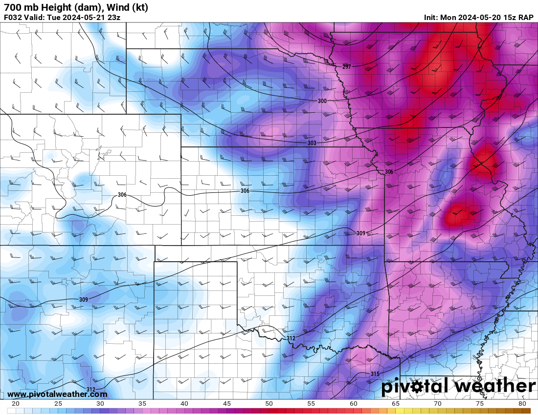
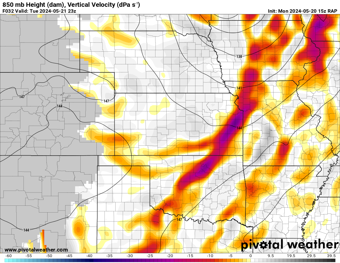
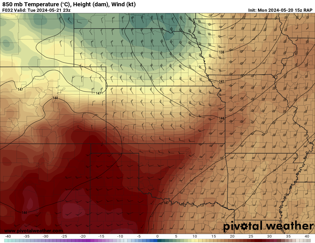
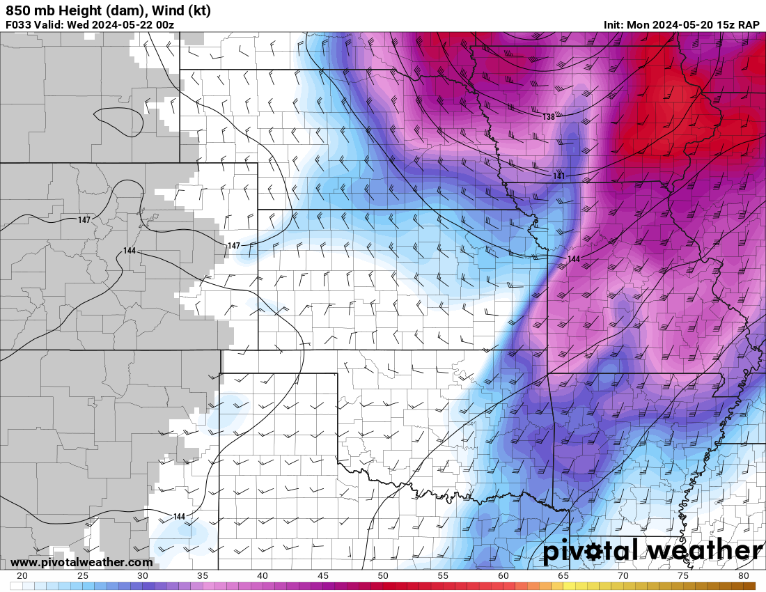
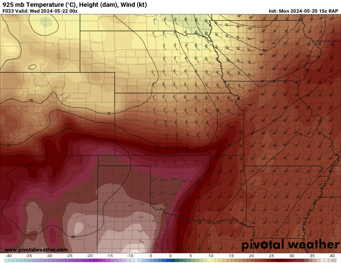
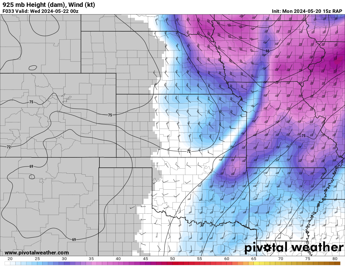
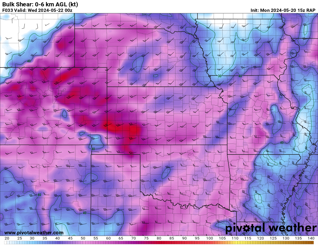
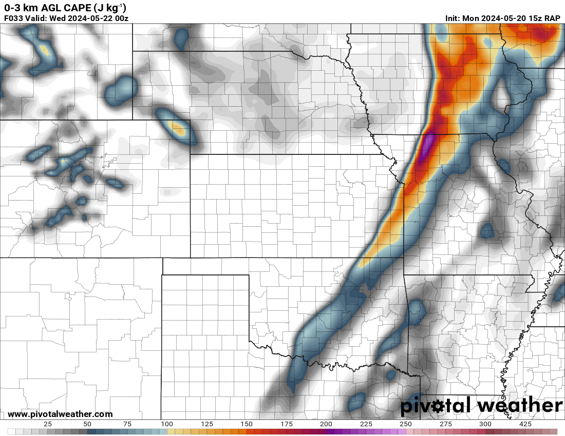
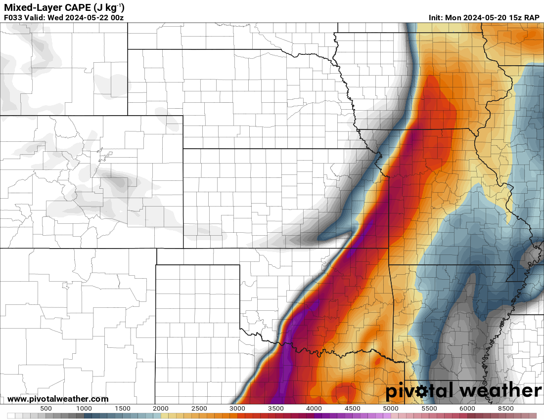
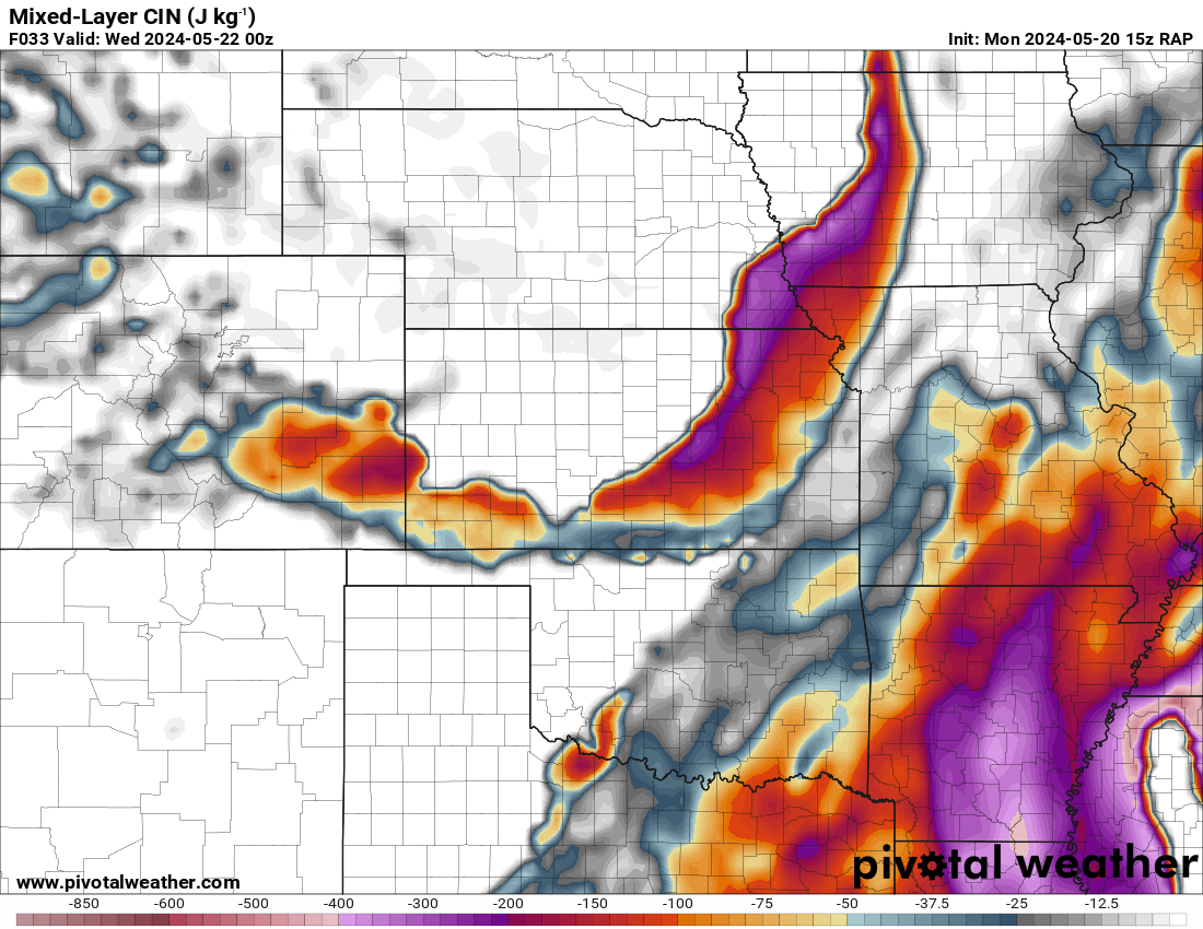
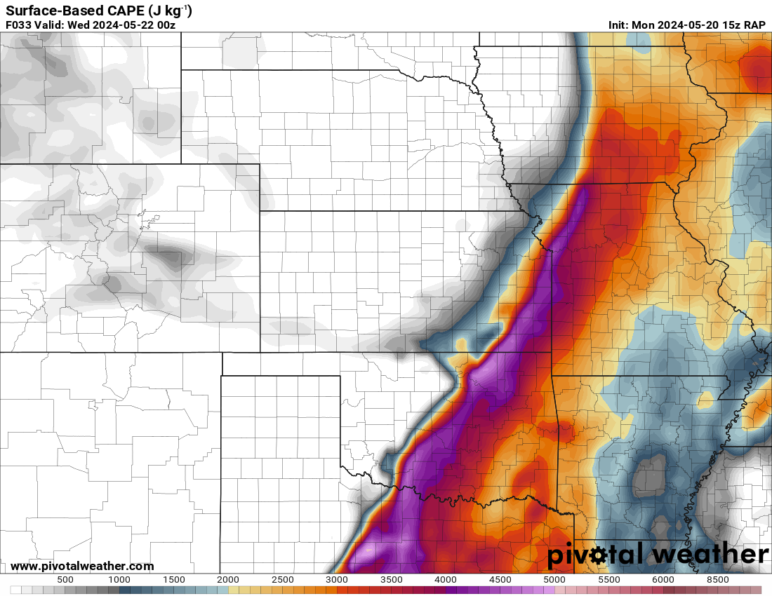
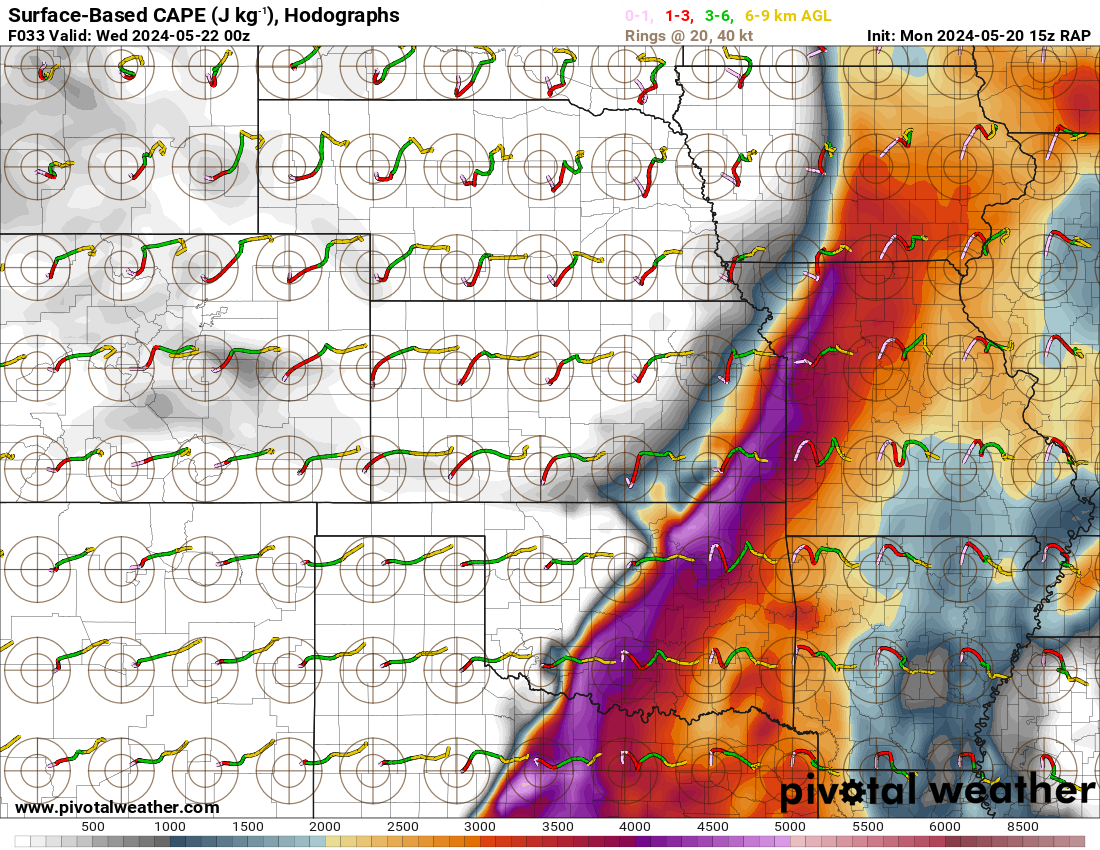
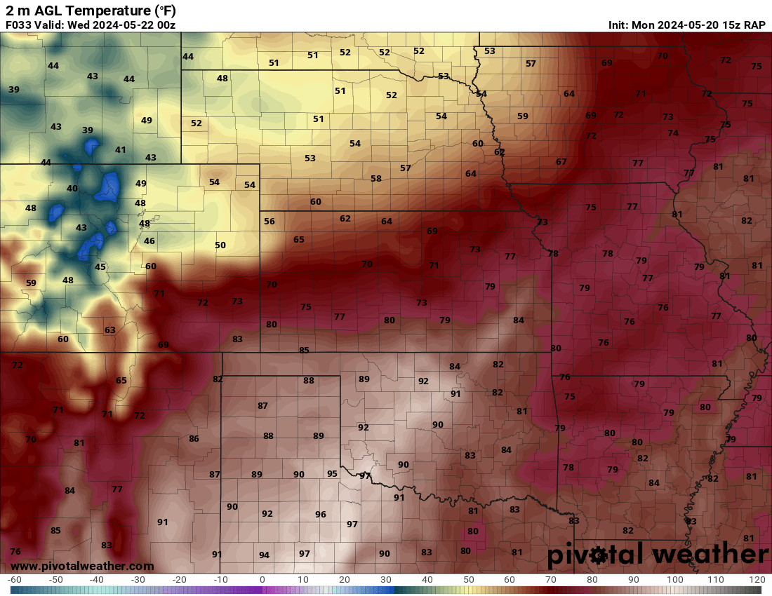
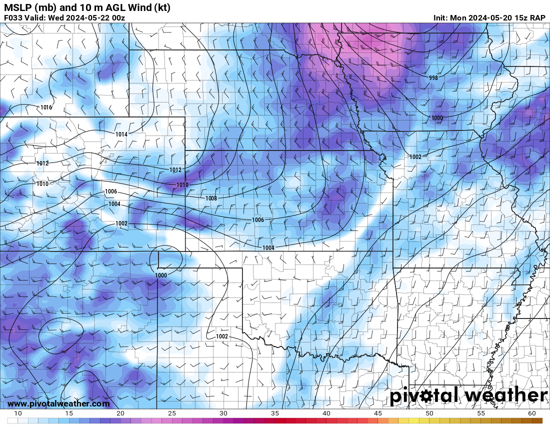
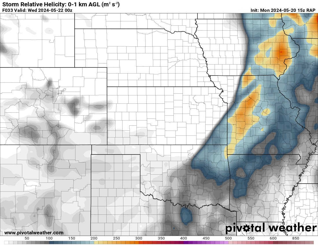
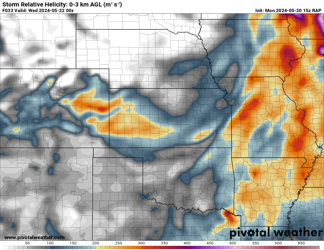
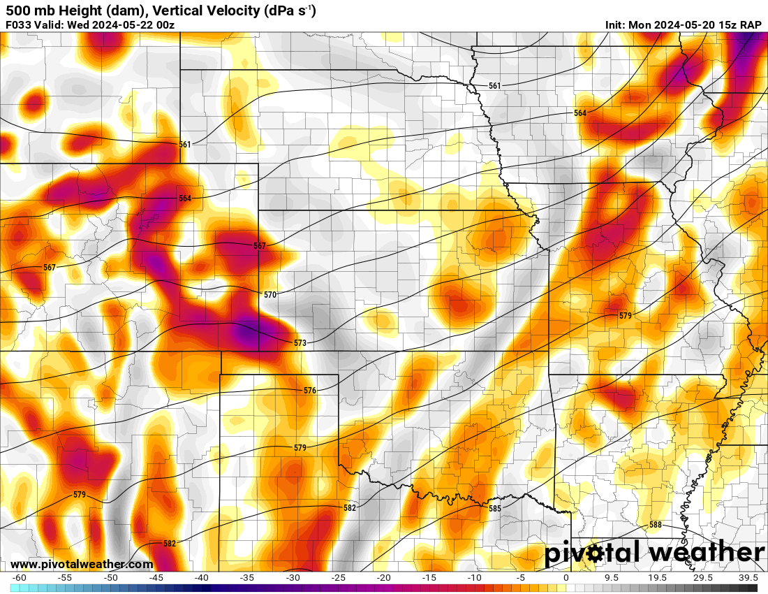
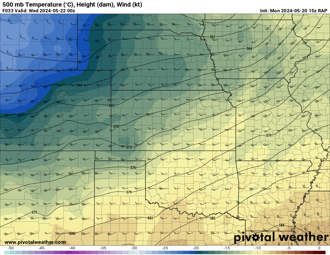
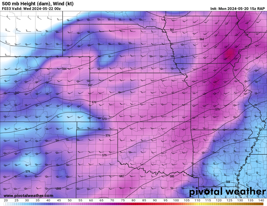
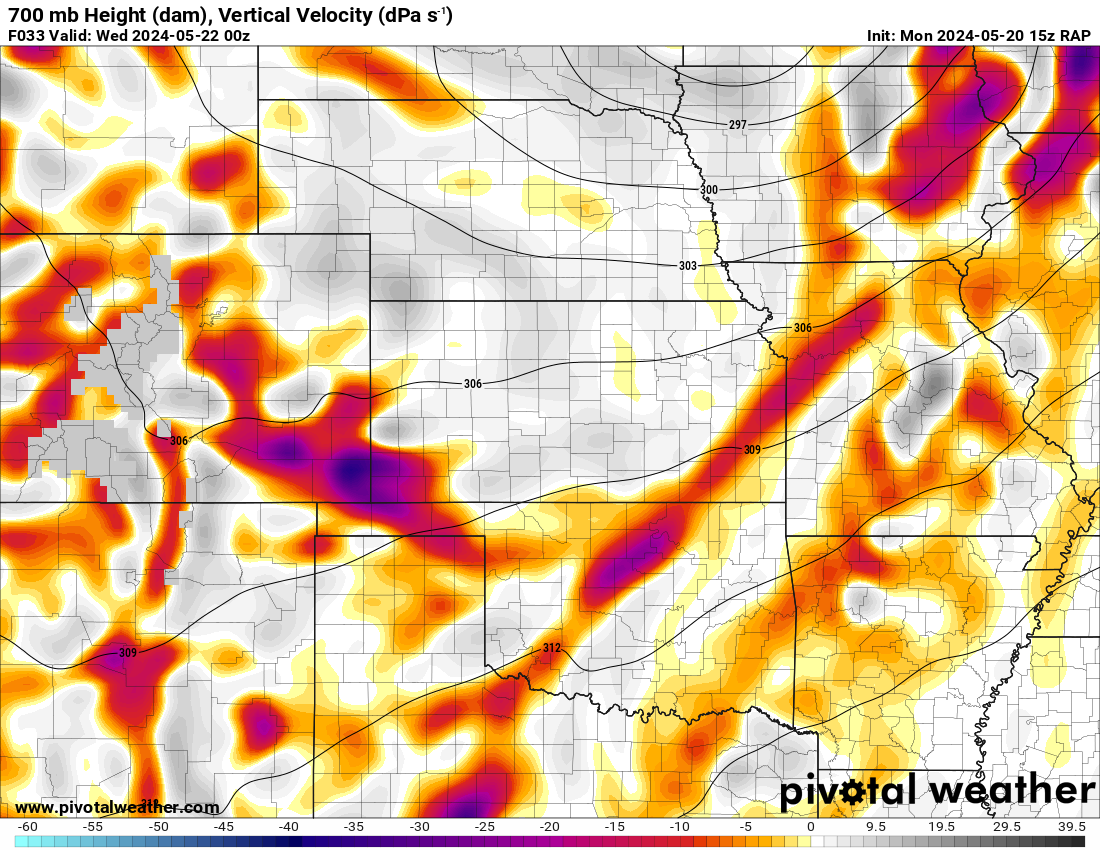
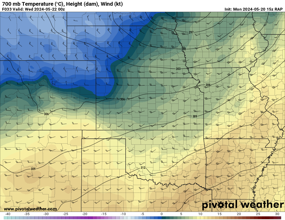
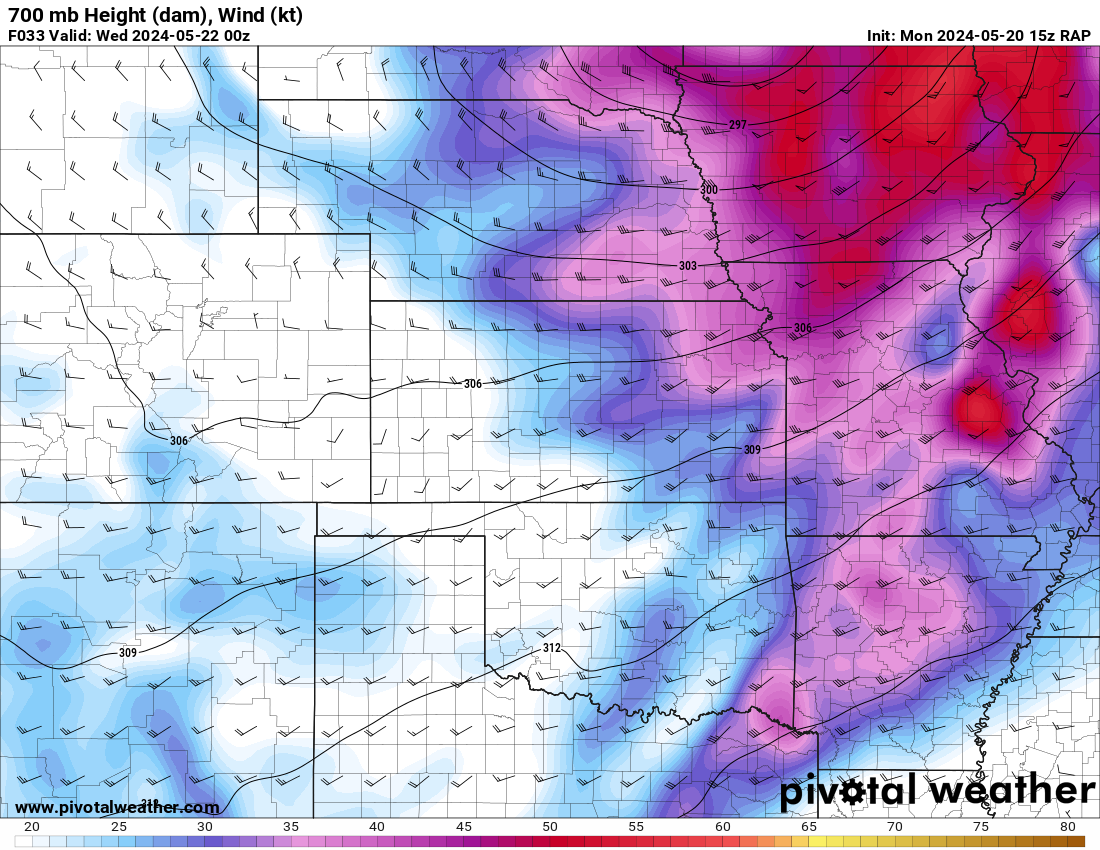
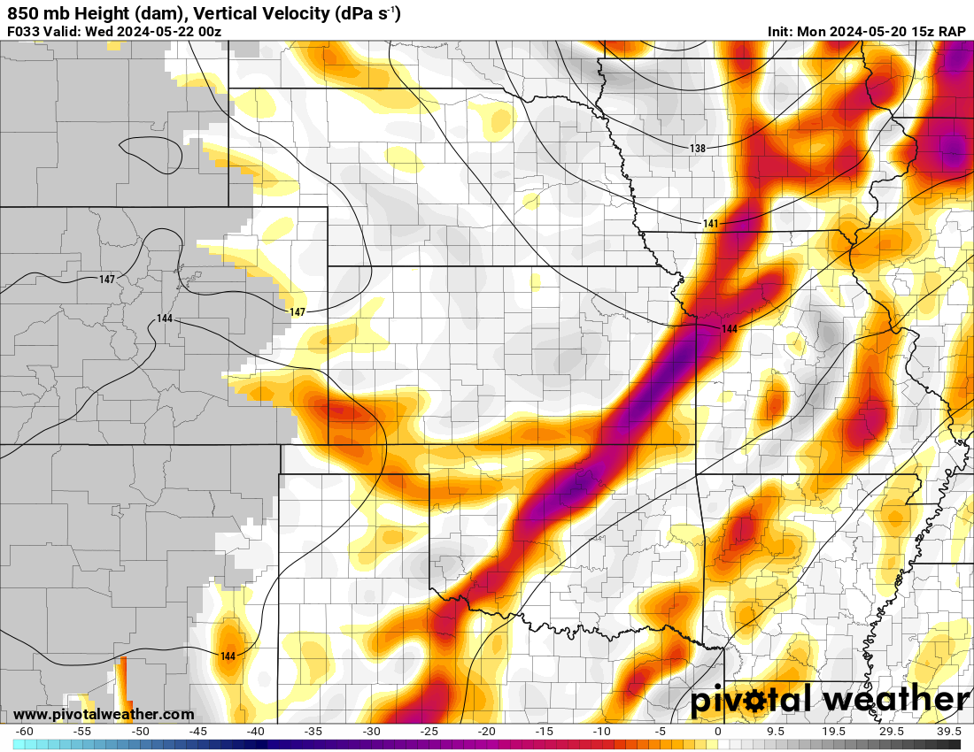
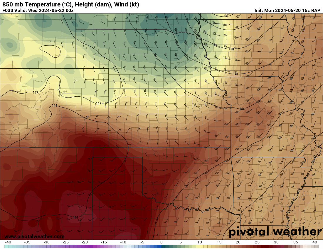
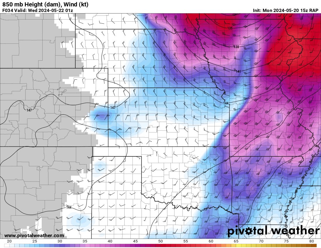
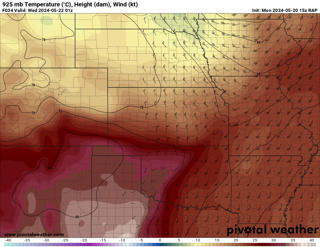
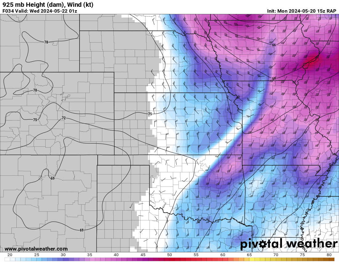
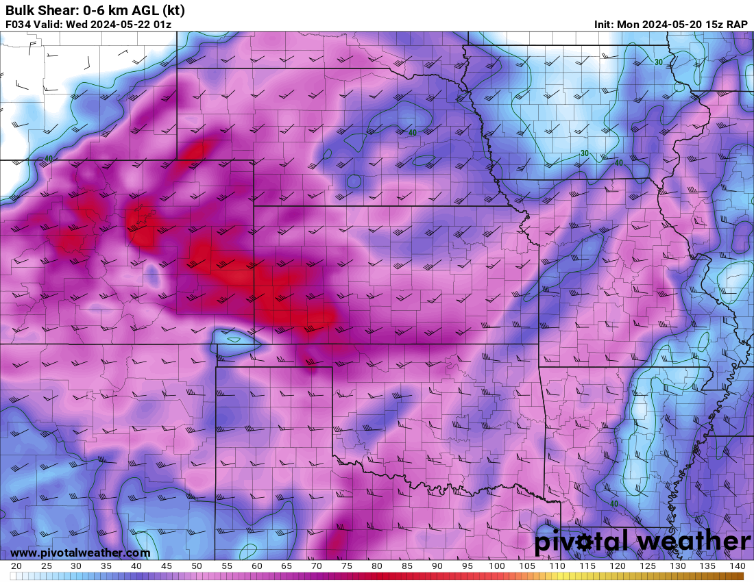
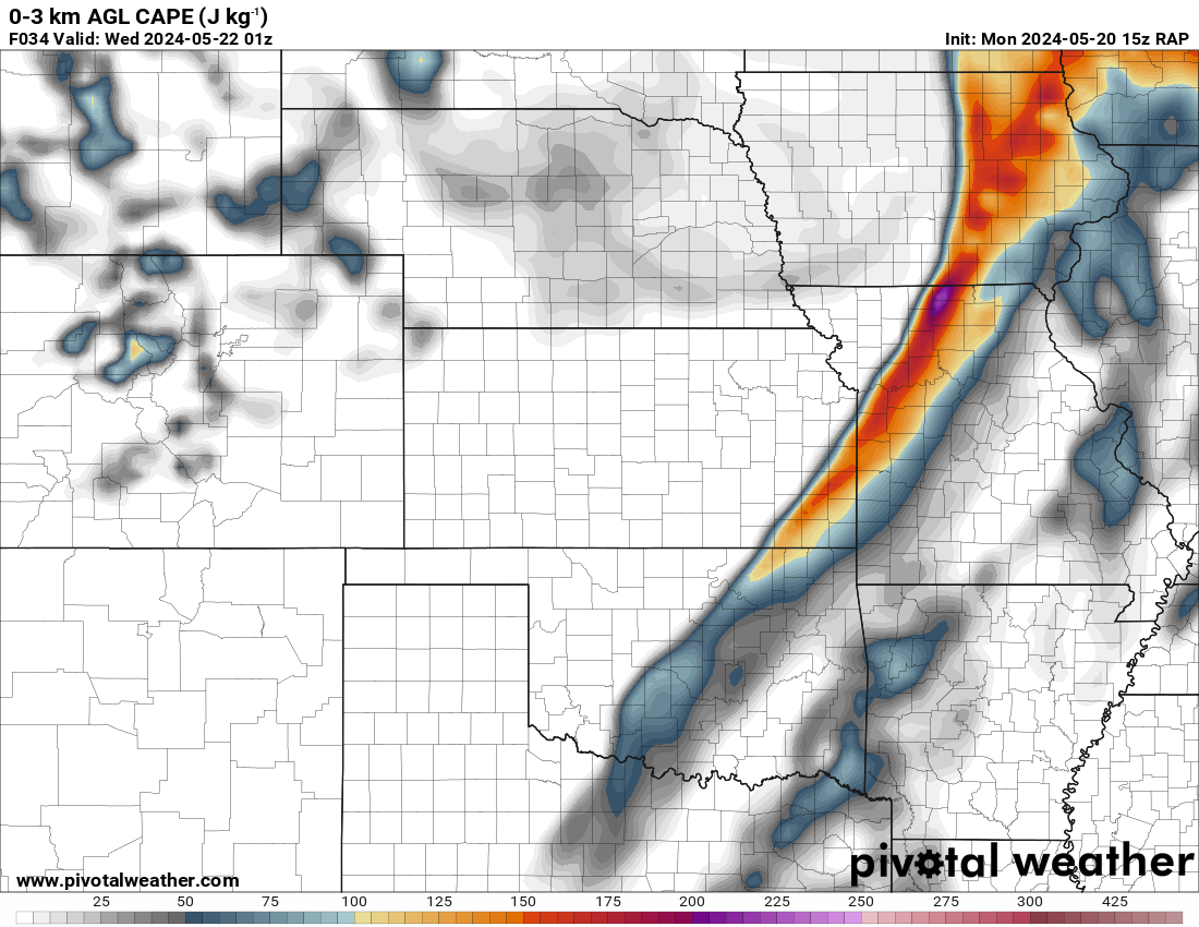
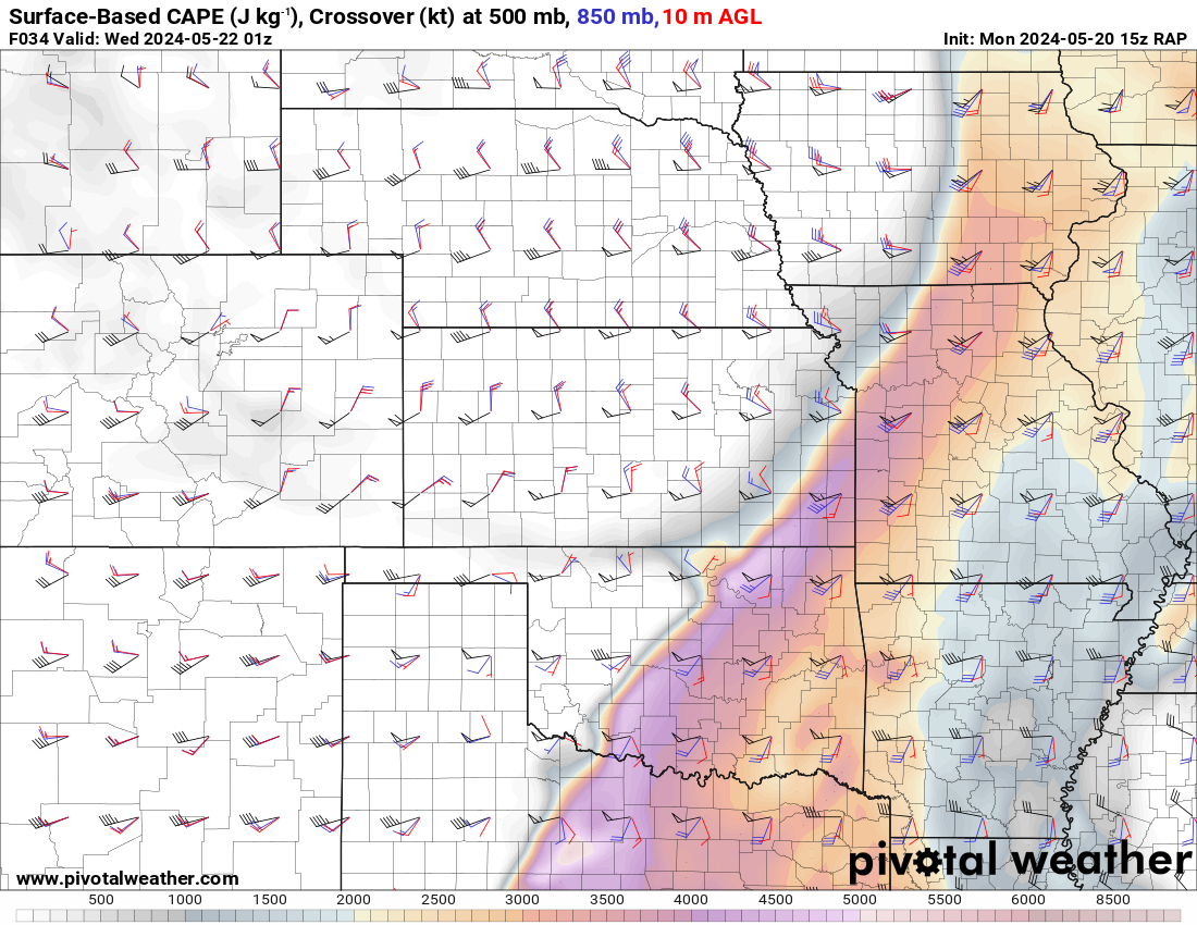
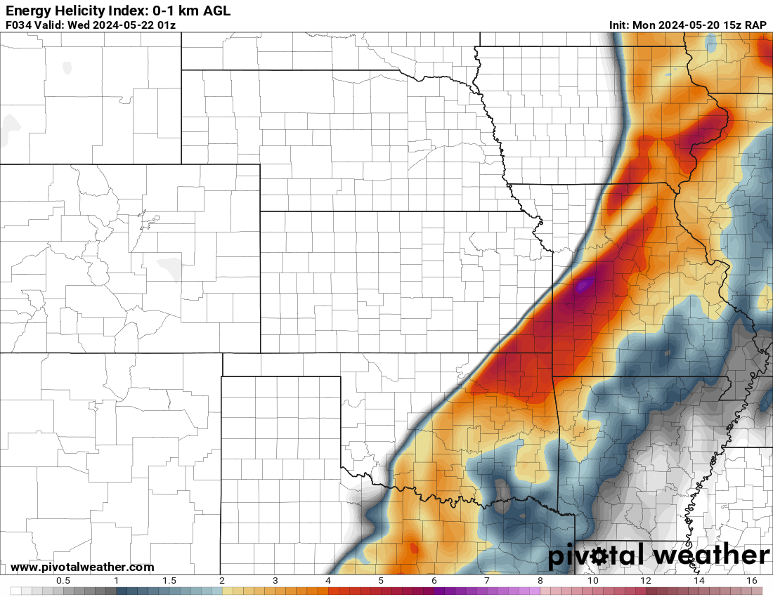
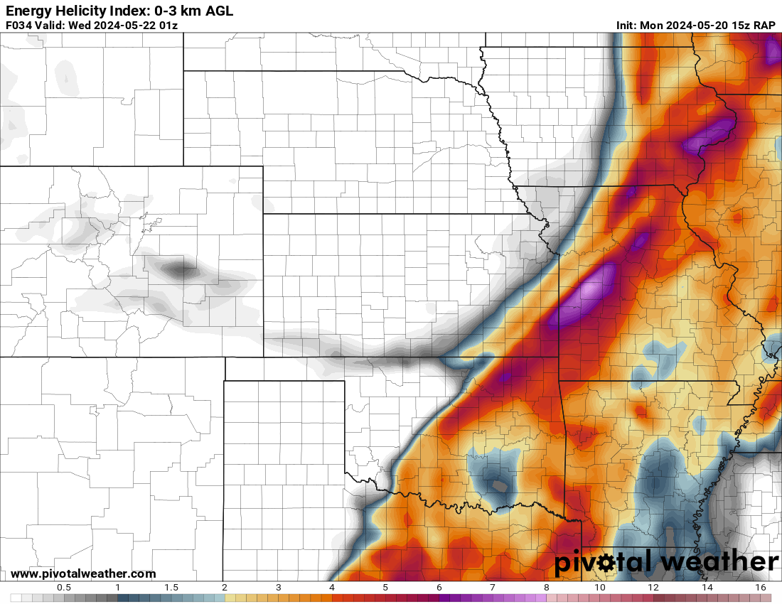
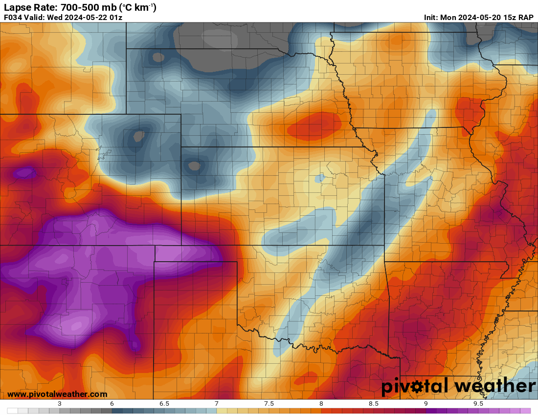
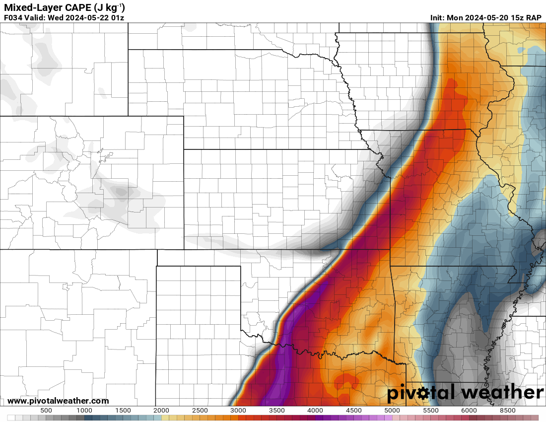
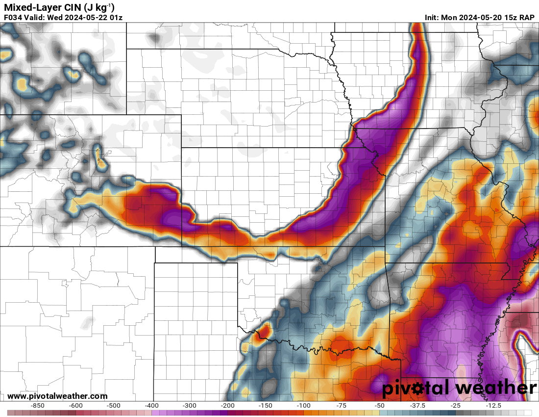
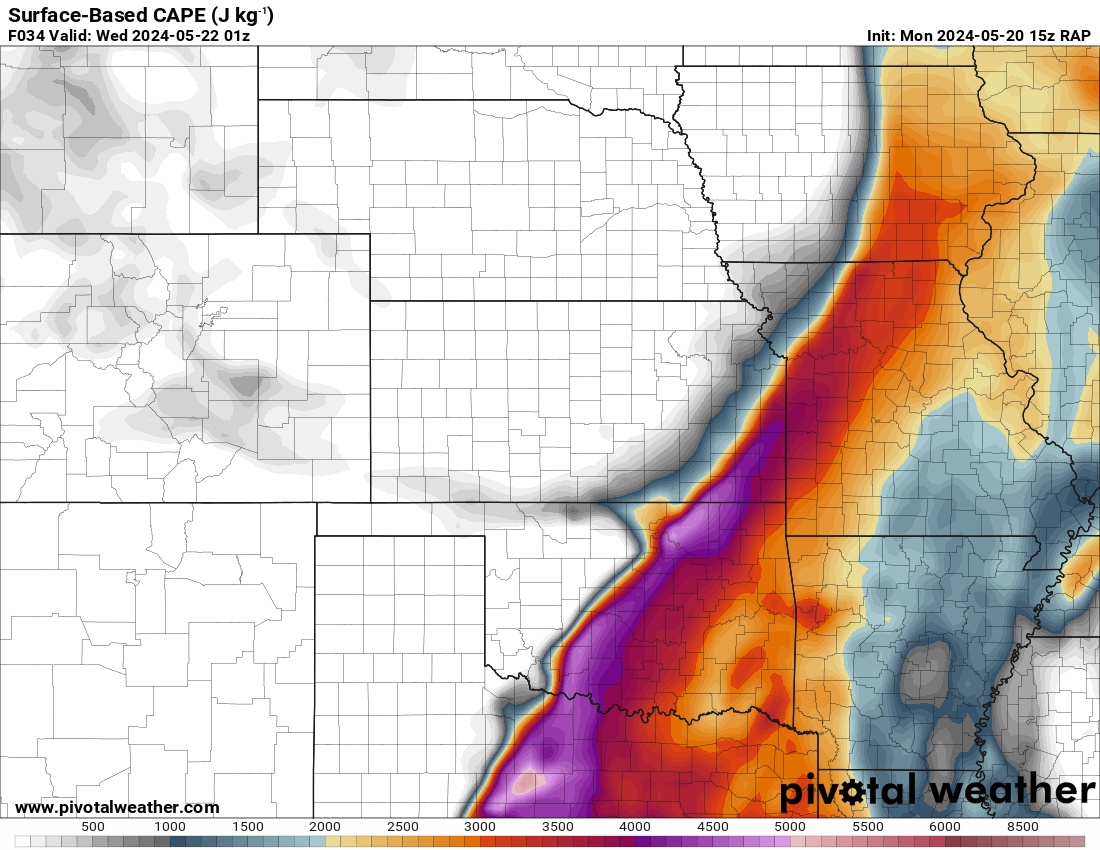
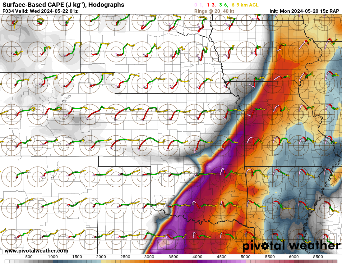
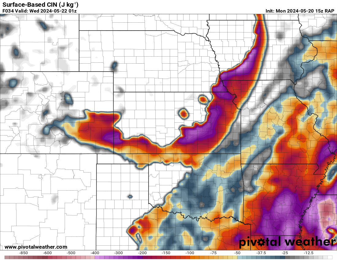
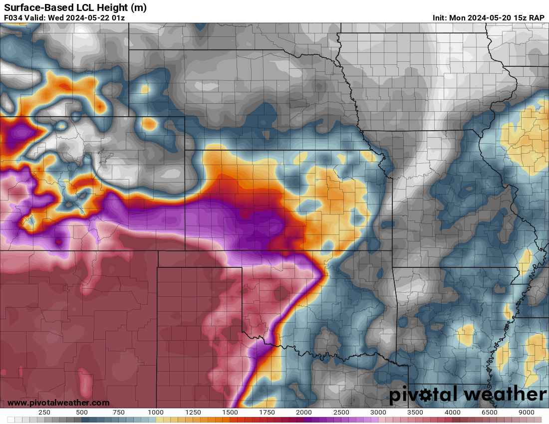
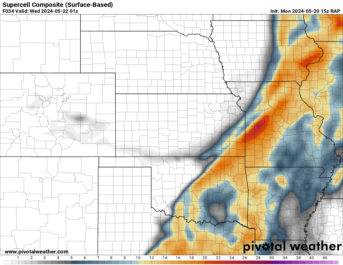
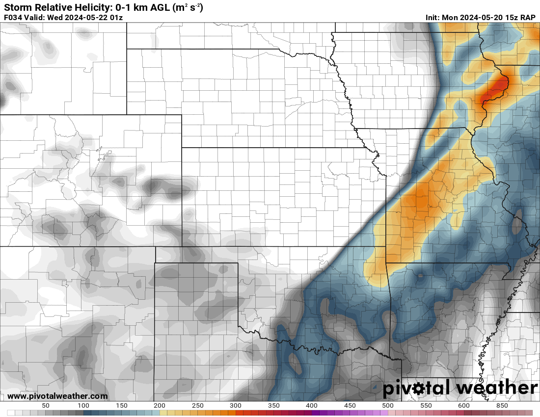
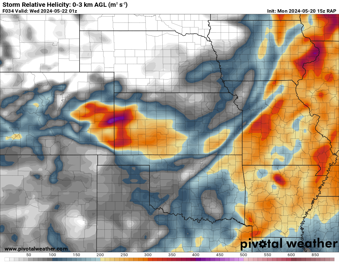
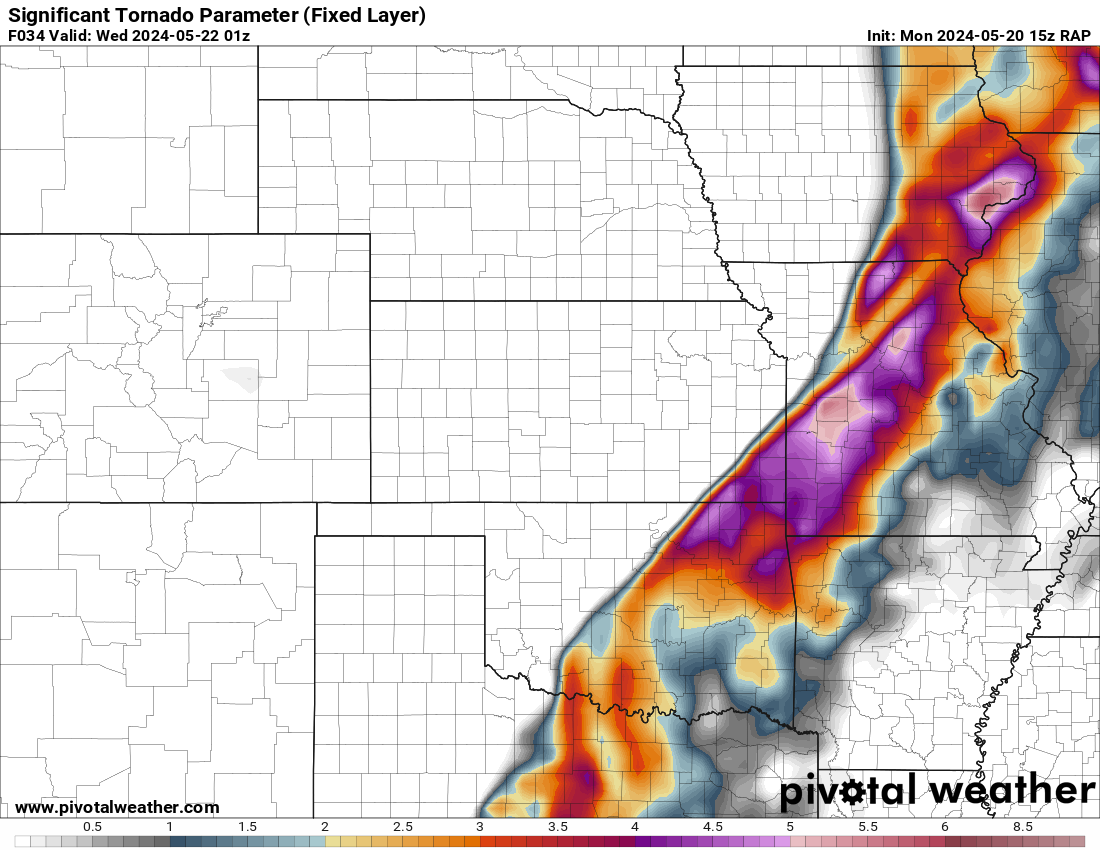
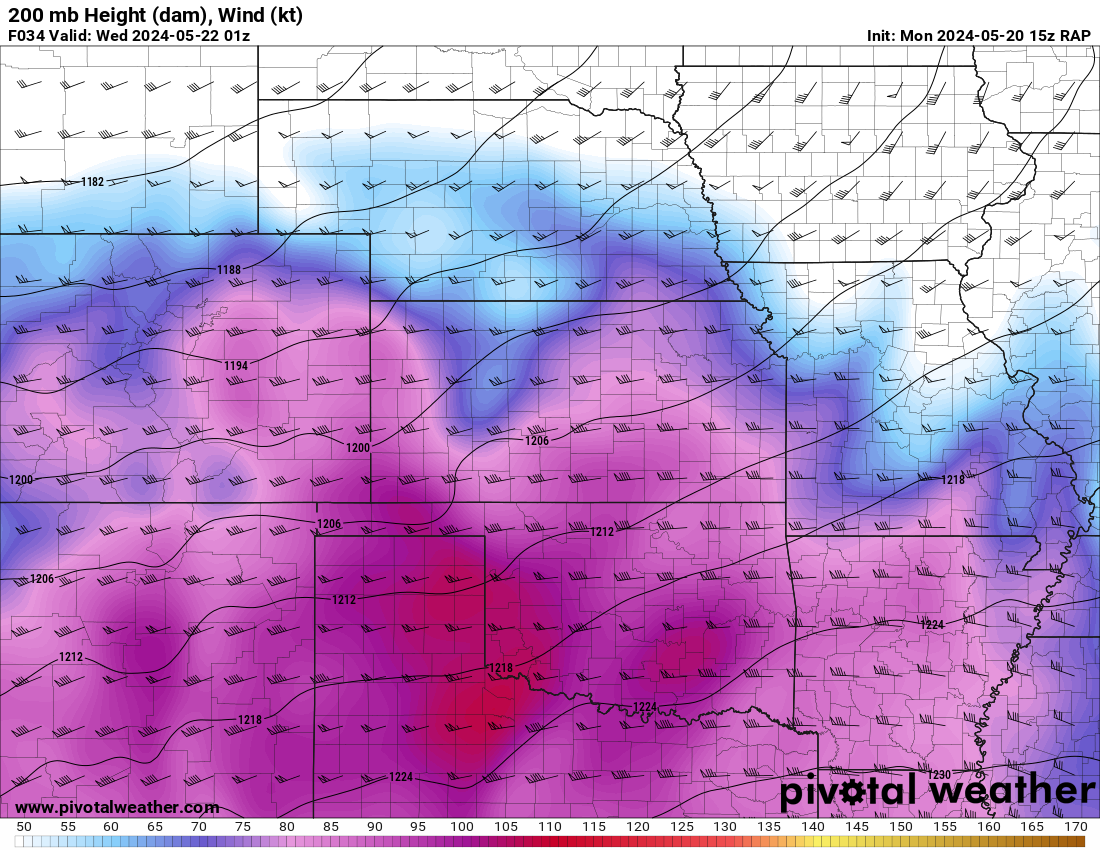
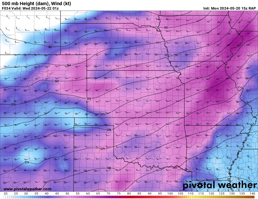
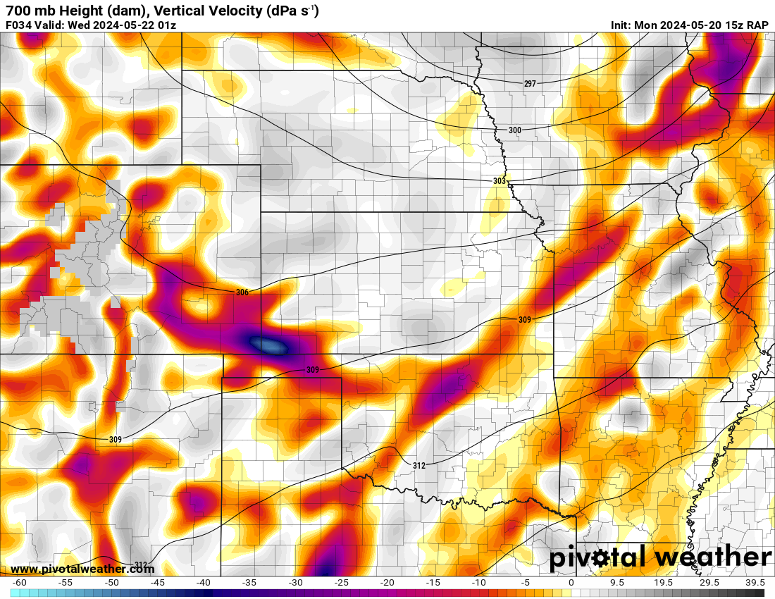
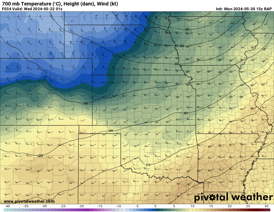
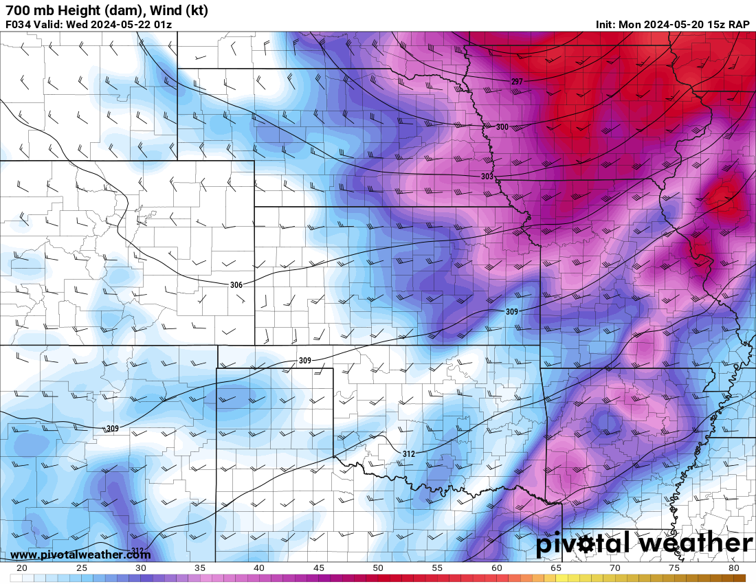
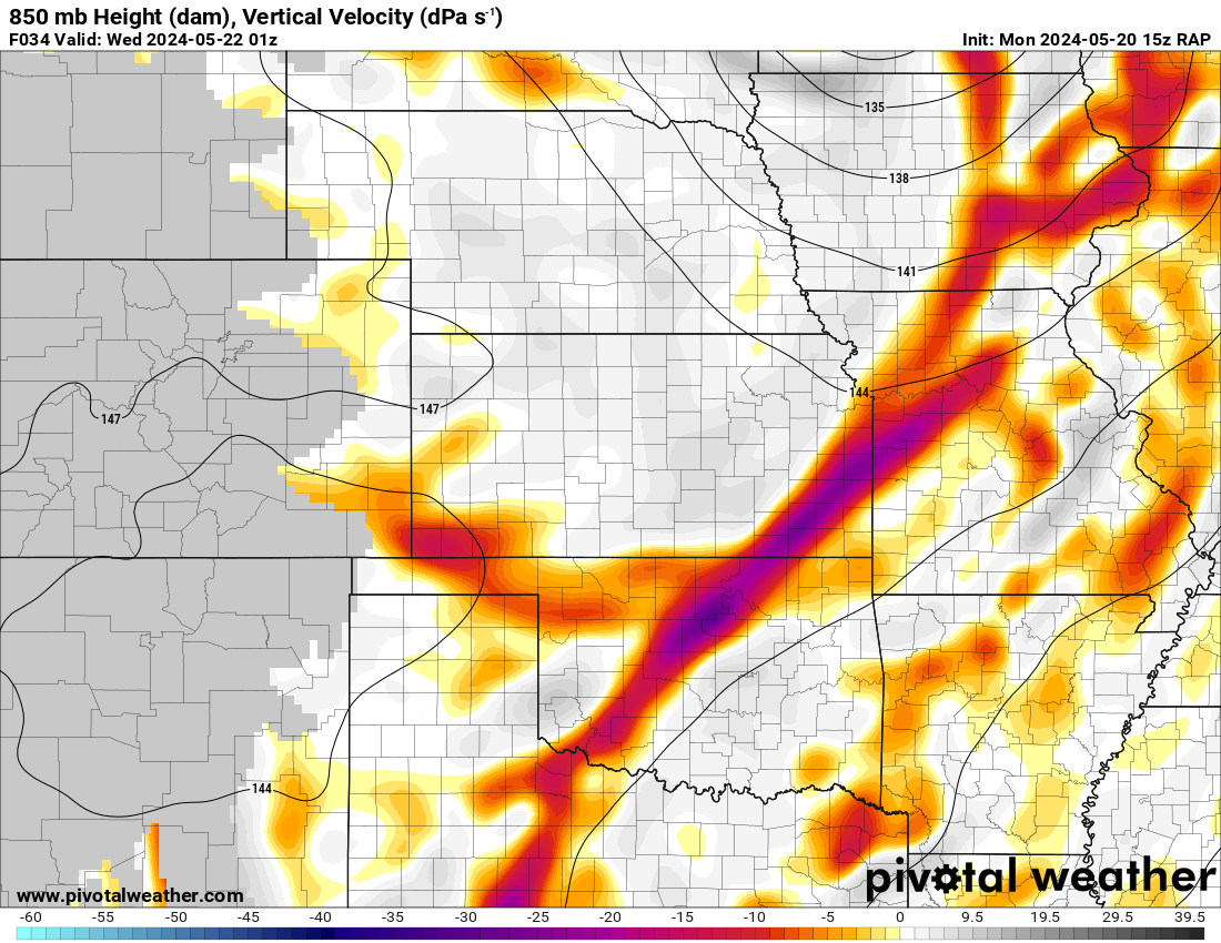
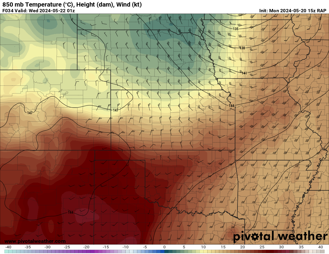
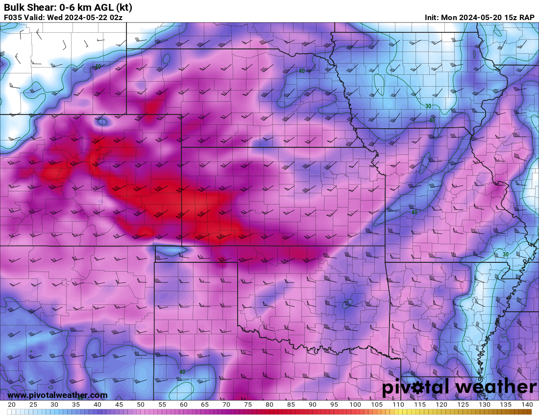
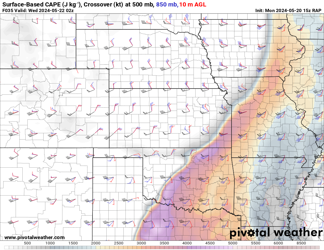
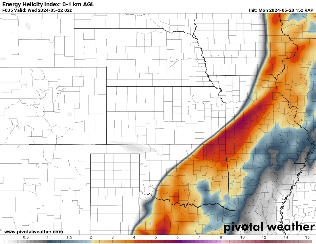
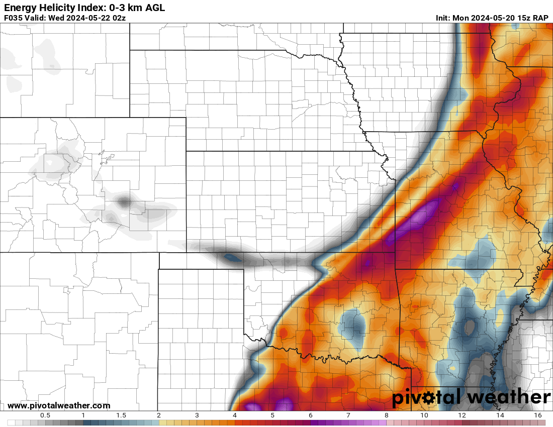
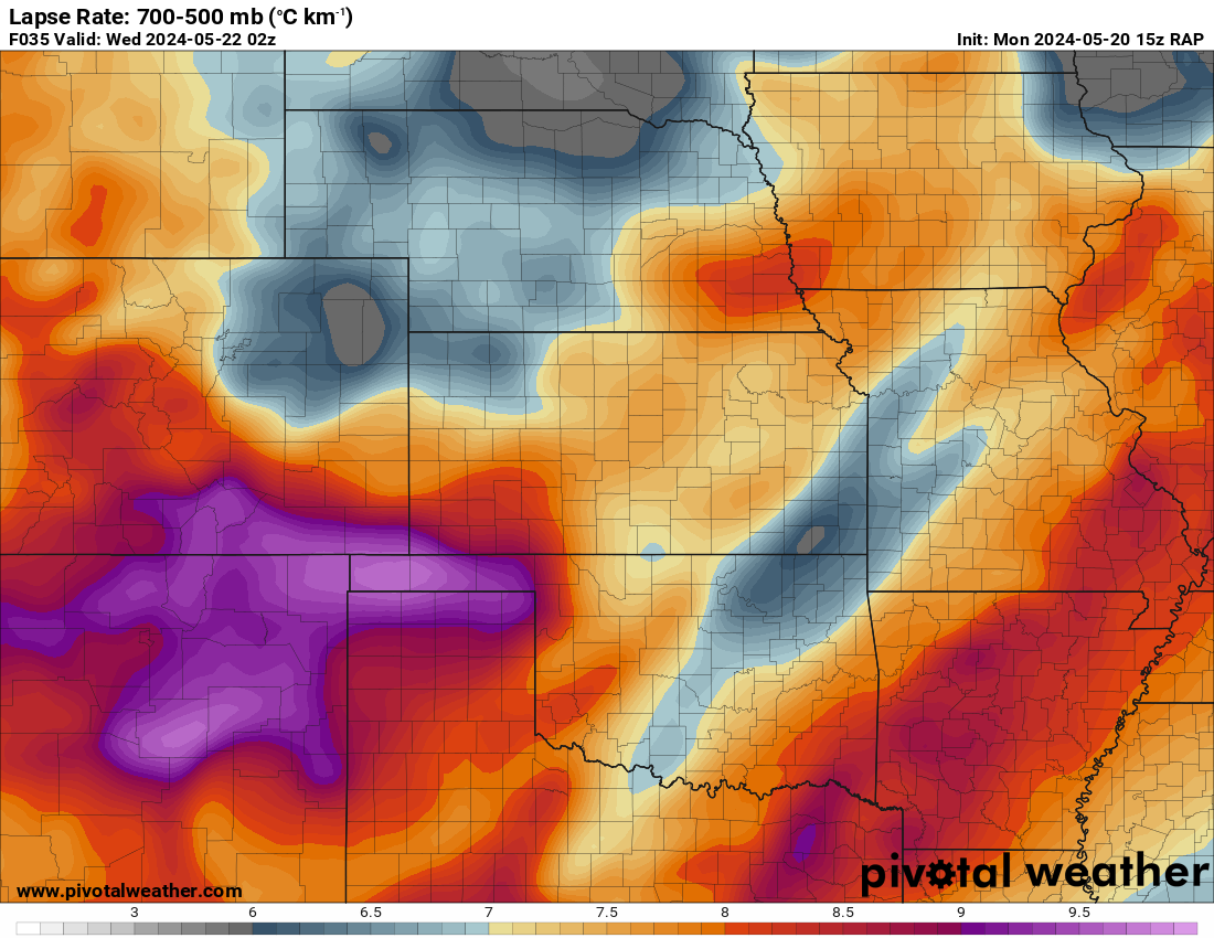
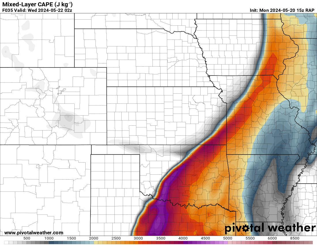
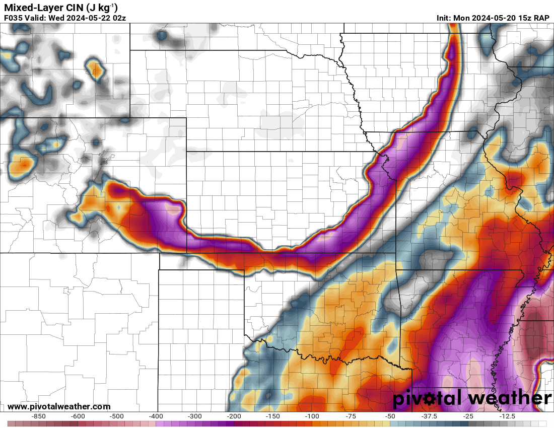
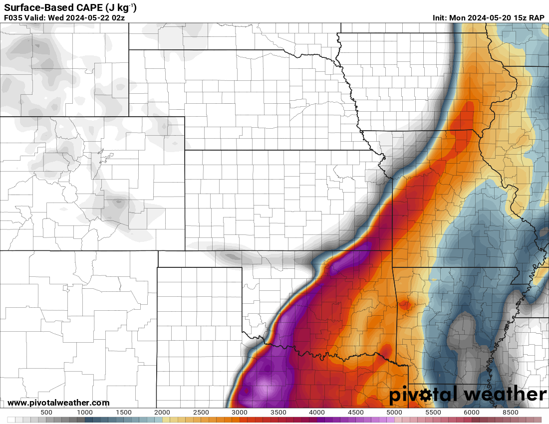
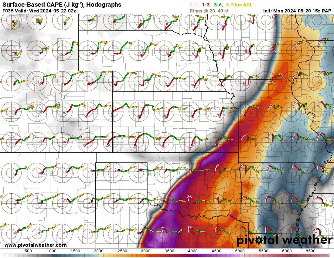
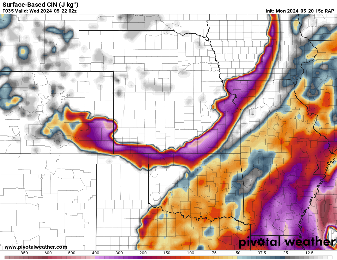
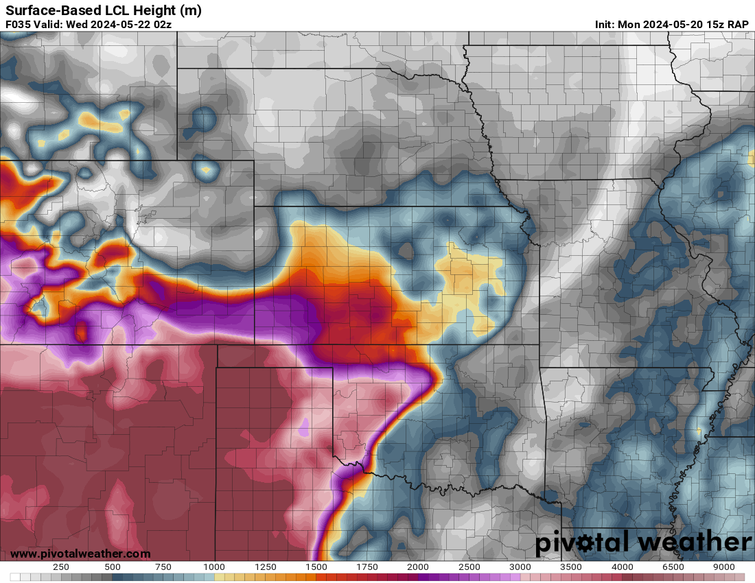
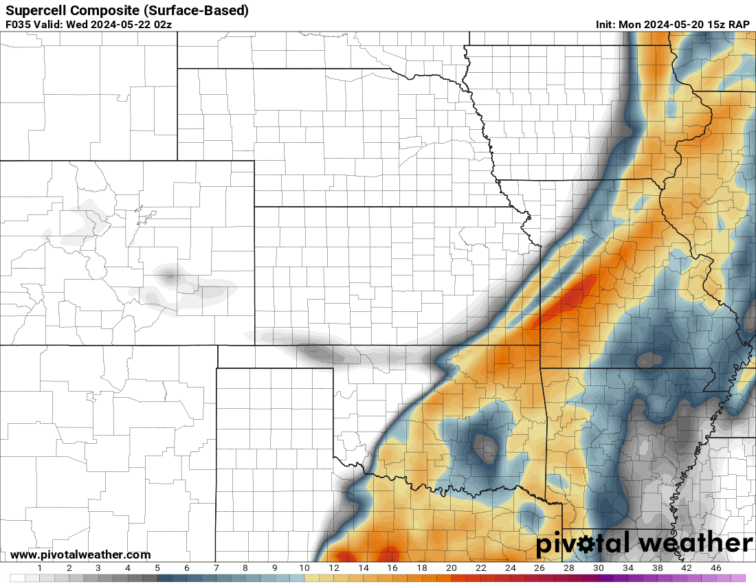
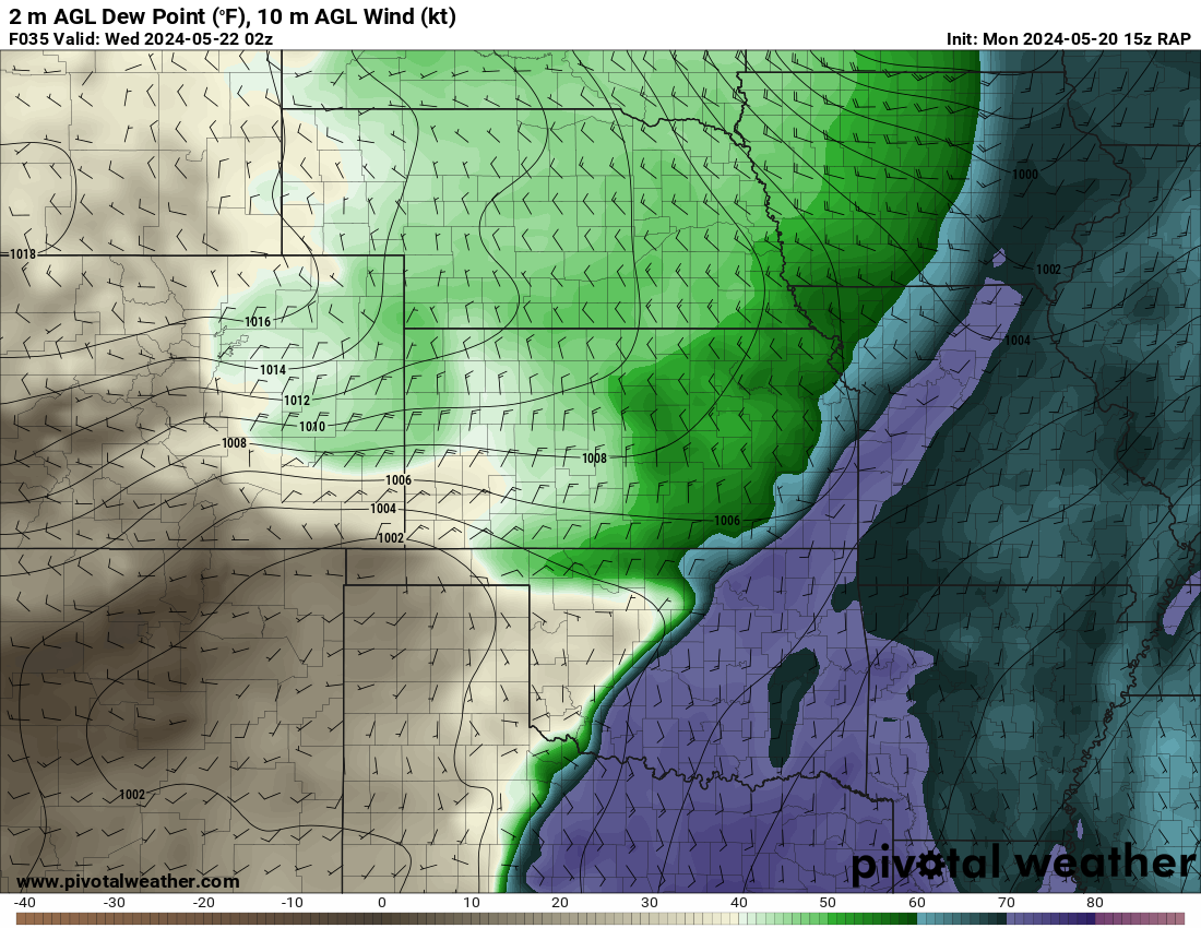
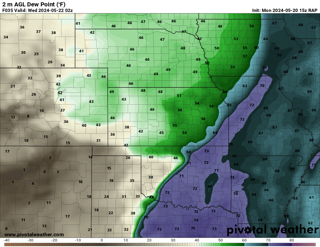
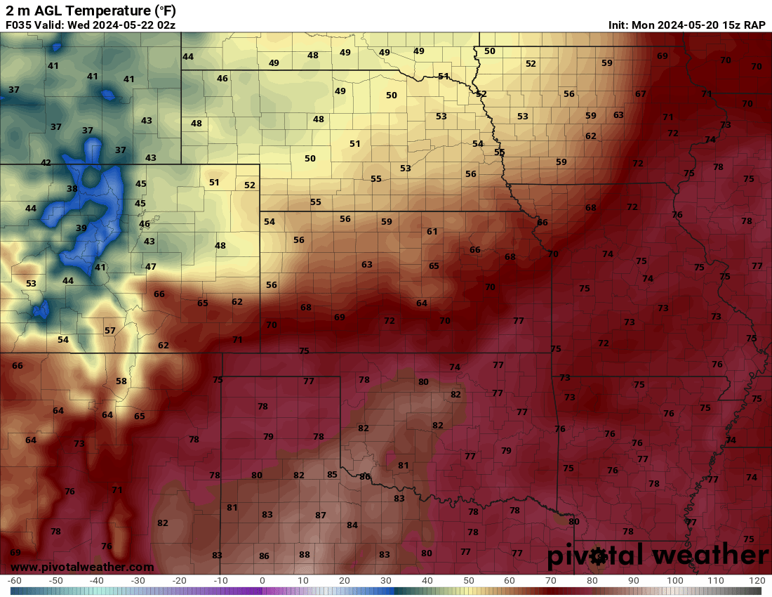
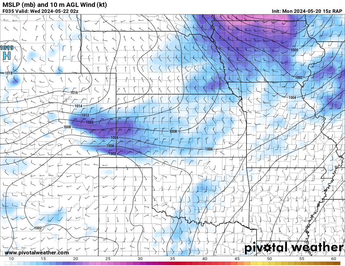
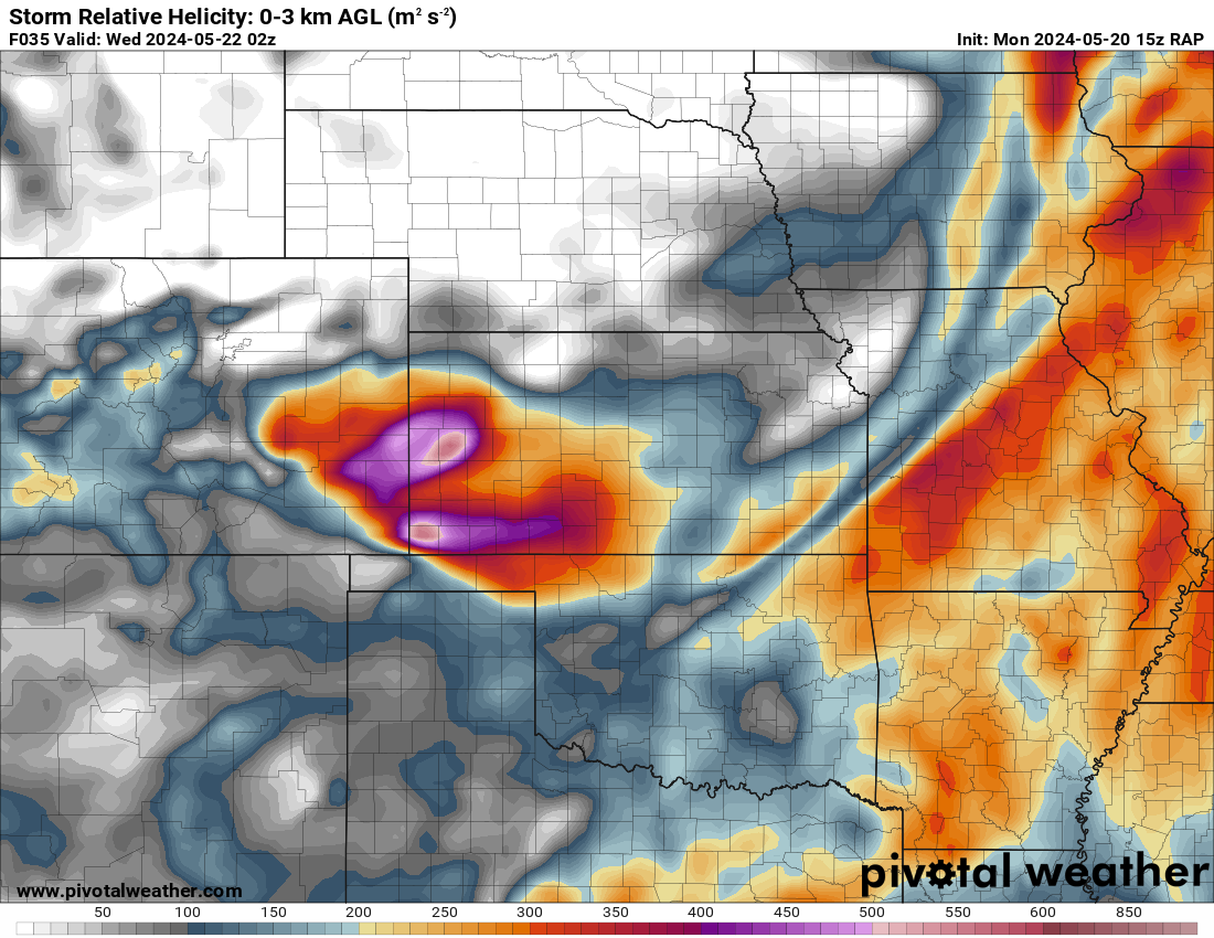
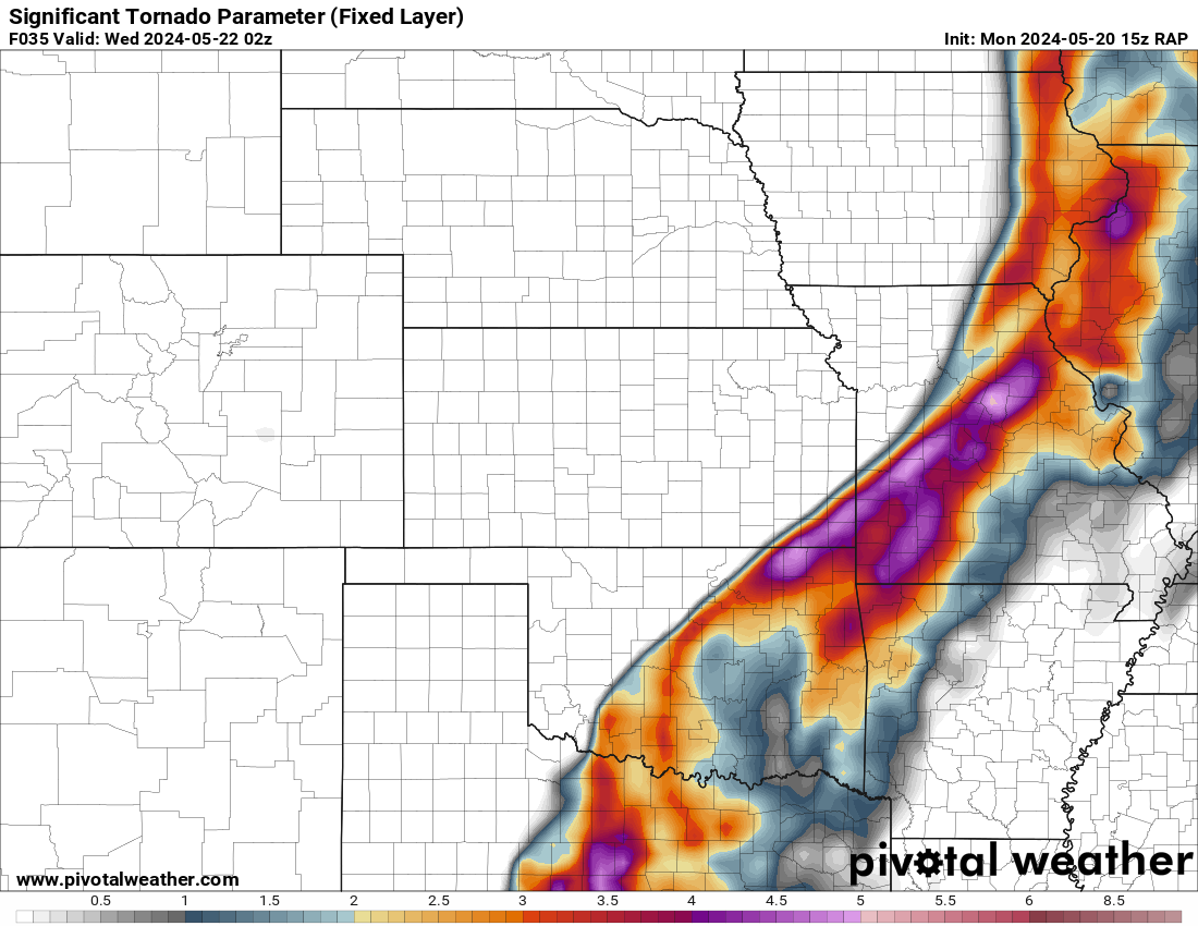
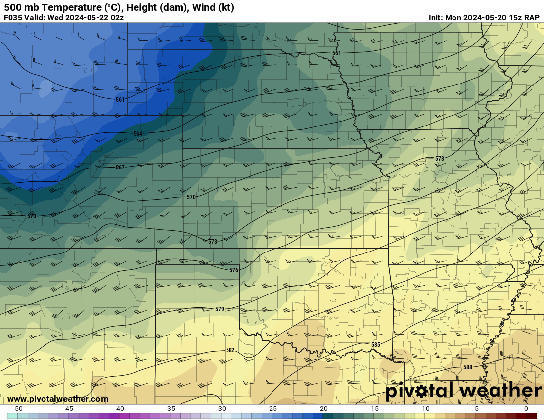
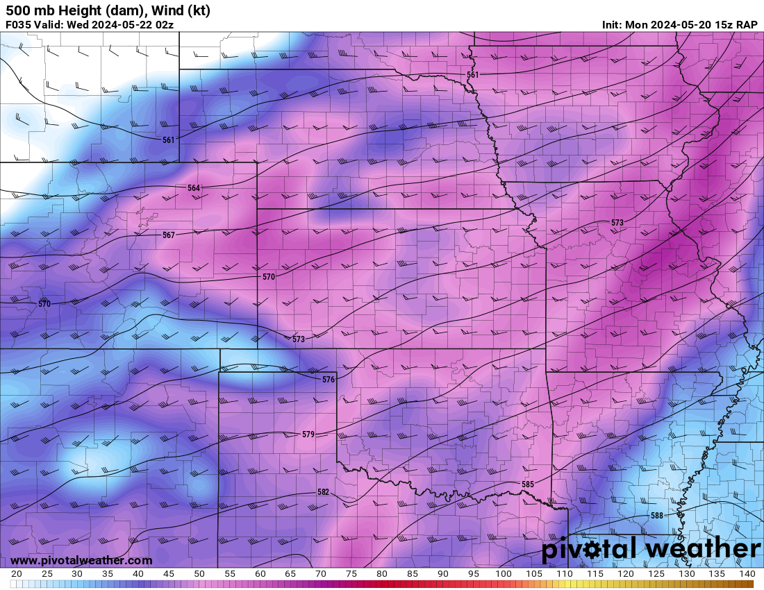
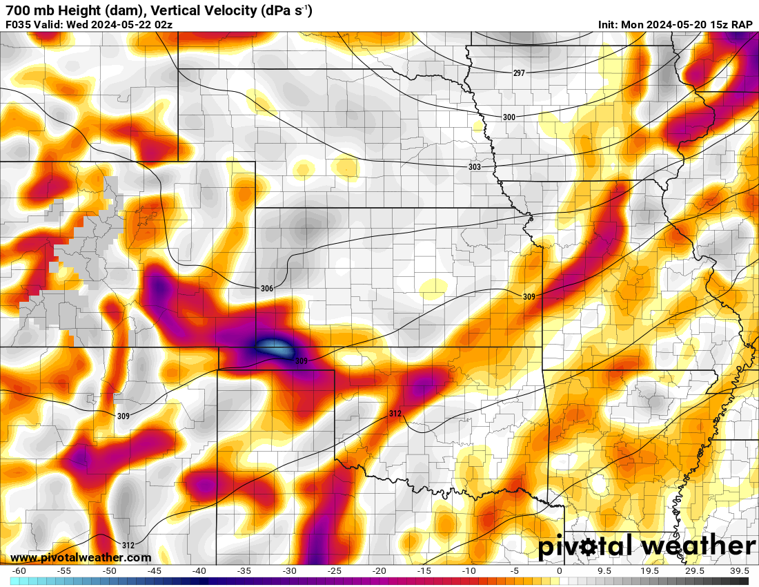
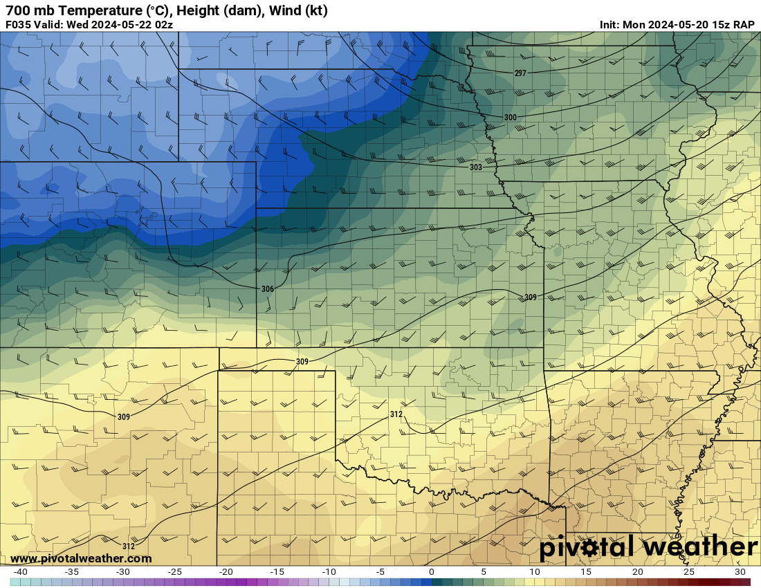
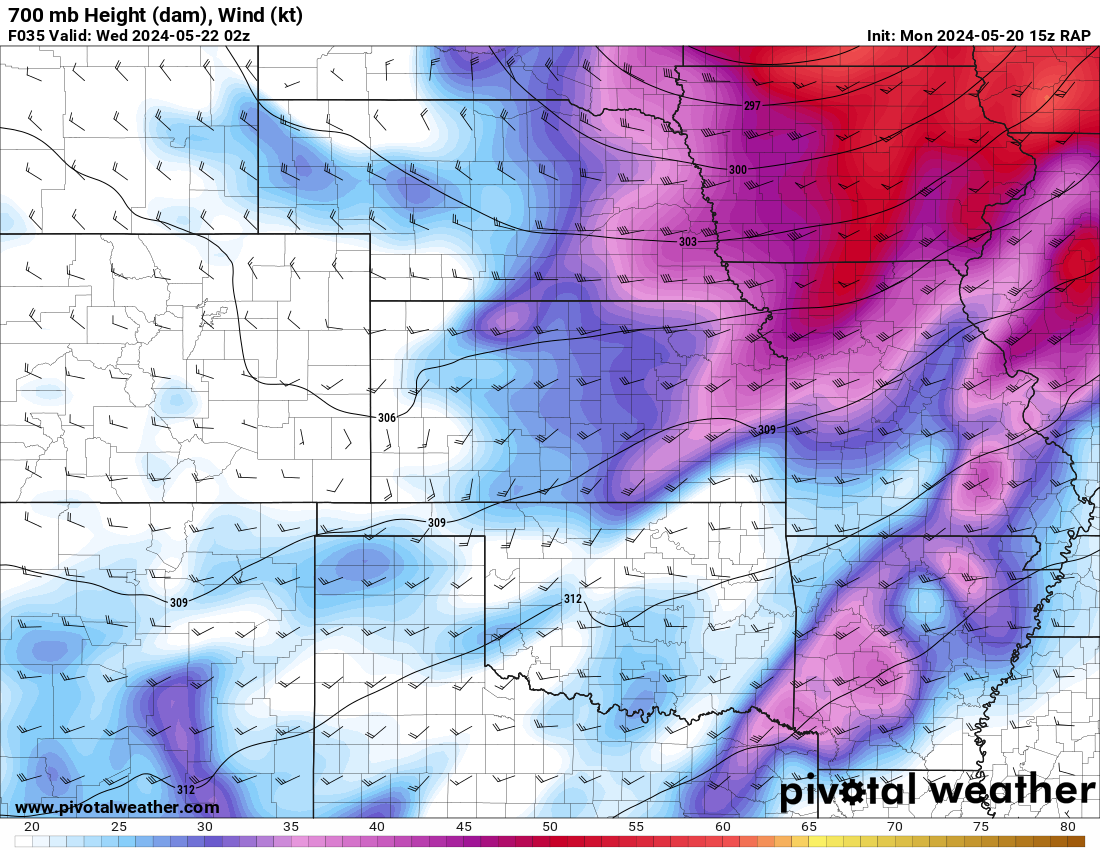
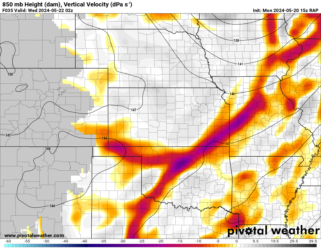
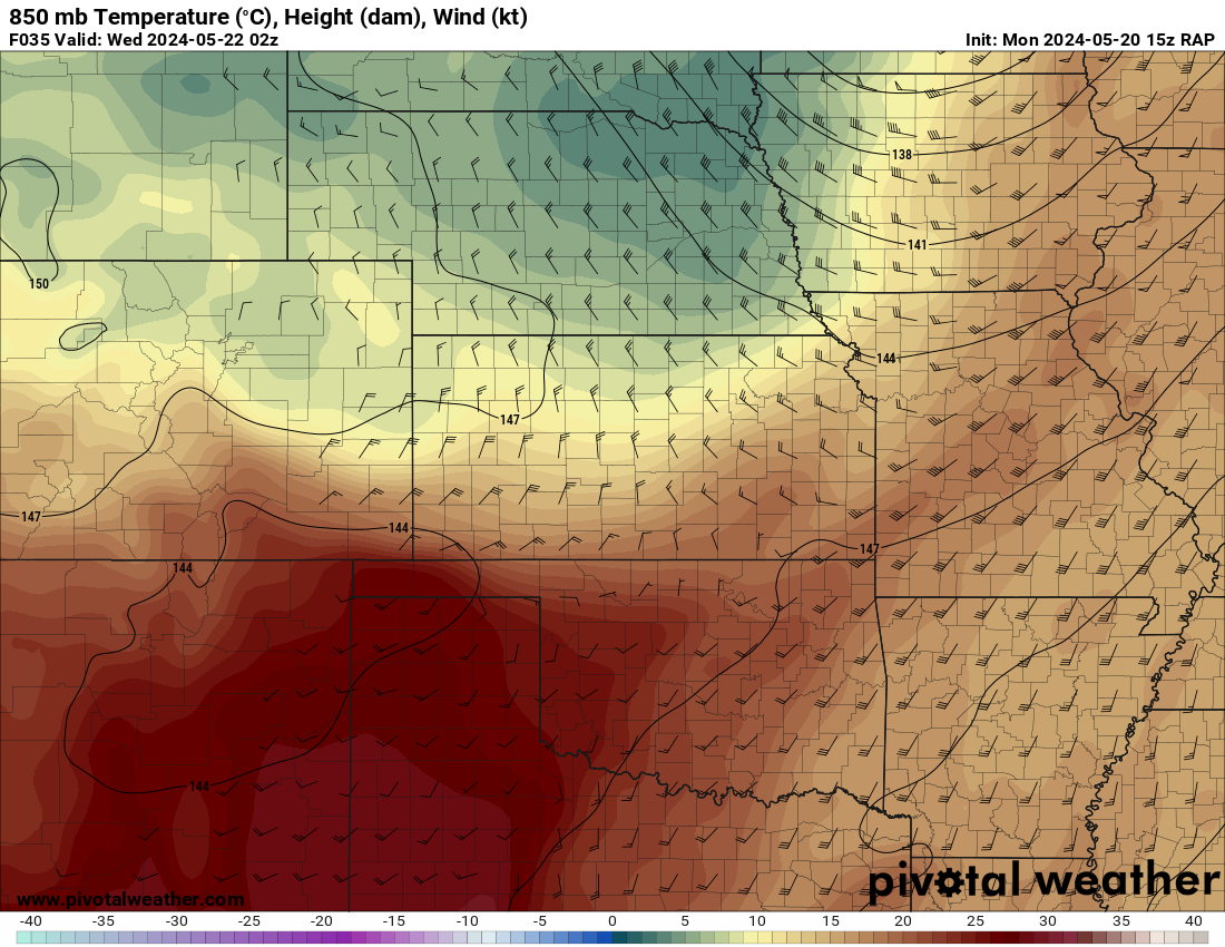
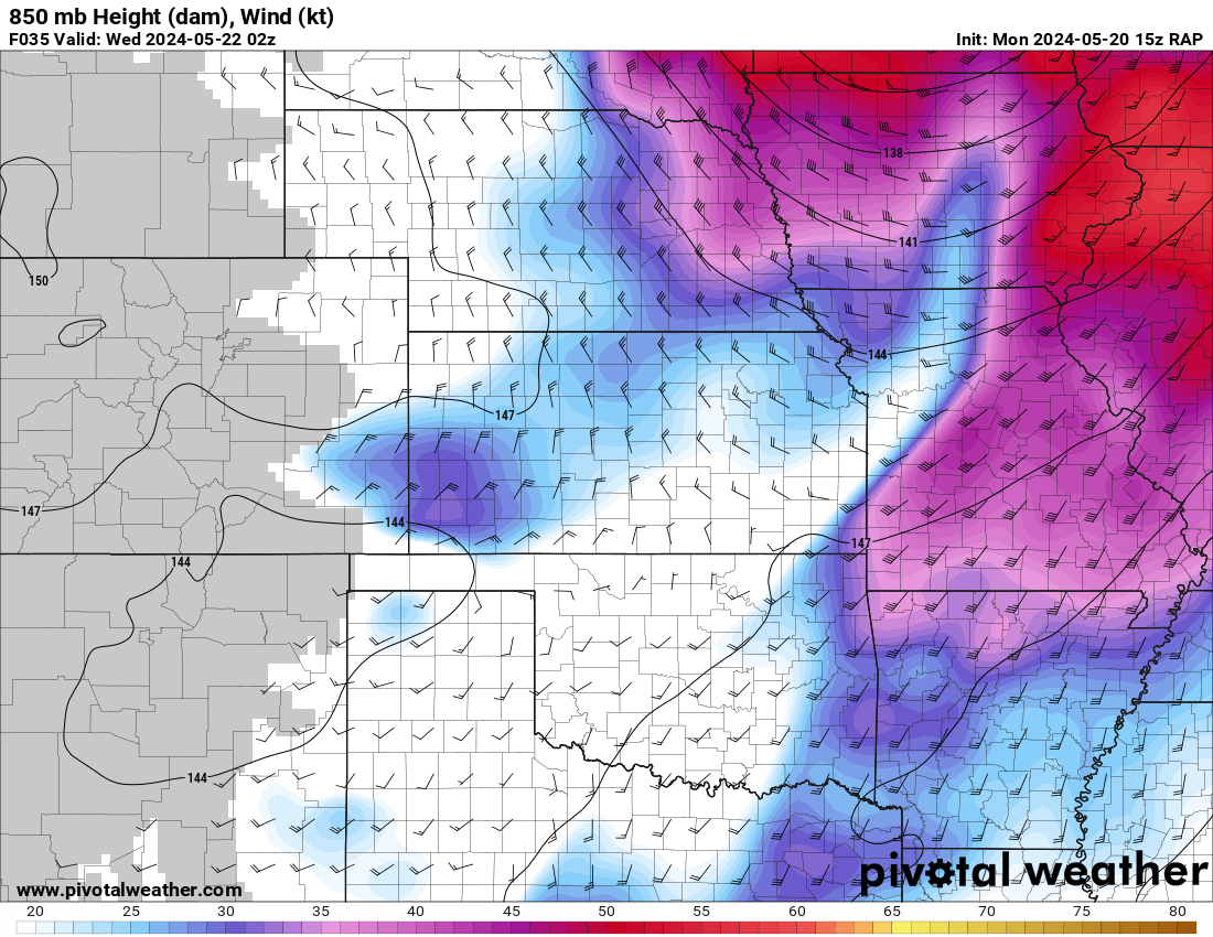
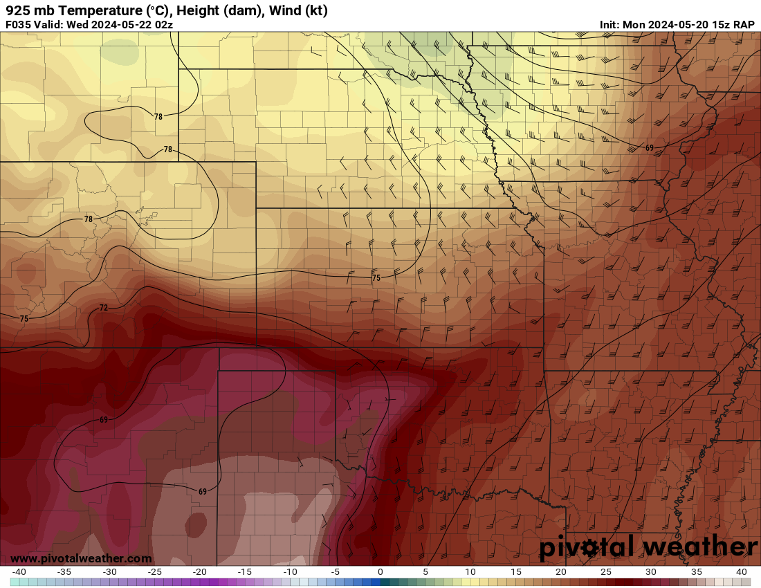
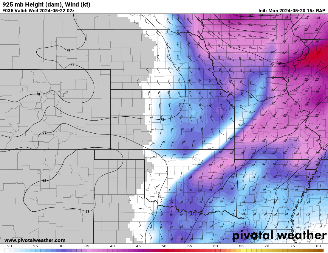
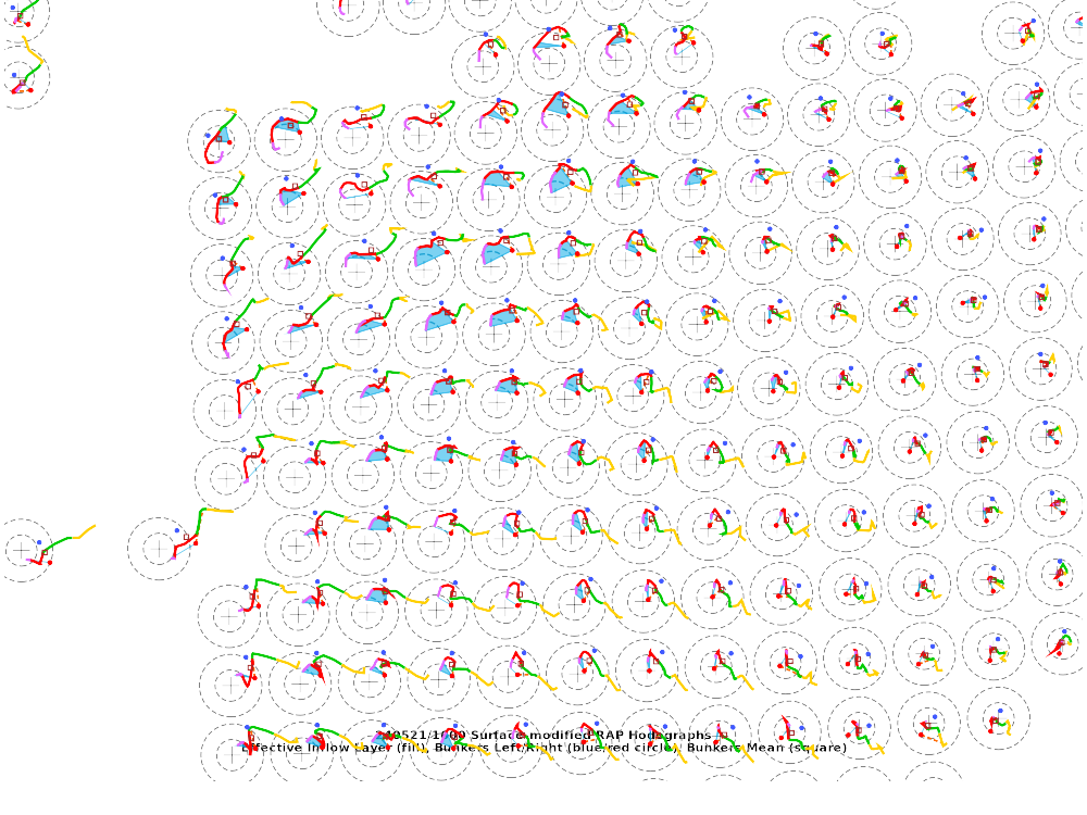
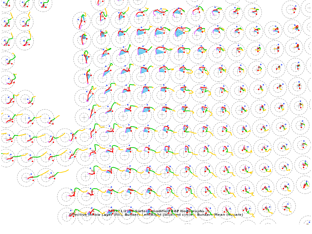
I relied heavily on the RAP but also consulted the NAM and HRRR while forecasting. I had focused in on the area of Northwest Missouri/Northeast Kansas/Southeast Nebraska/Southwest Iowa. I was hoping I’d be able to stay out of Iowa, but that would not end up being the case. Early initiation seemed to be likely, so I planned to be out the door no later than 9.
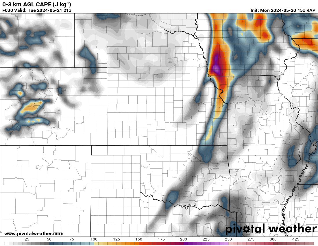
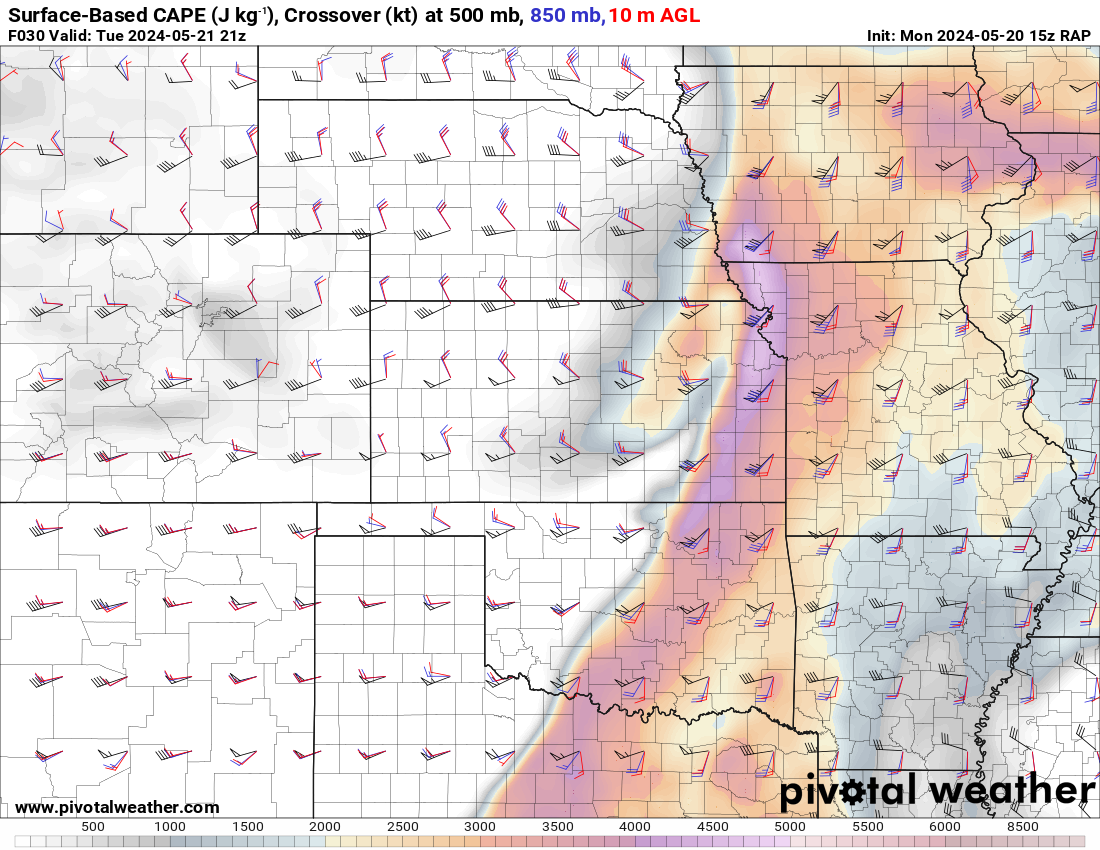
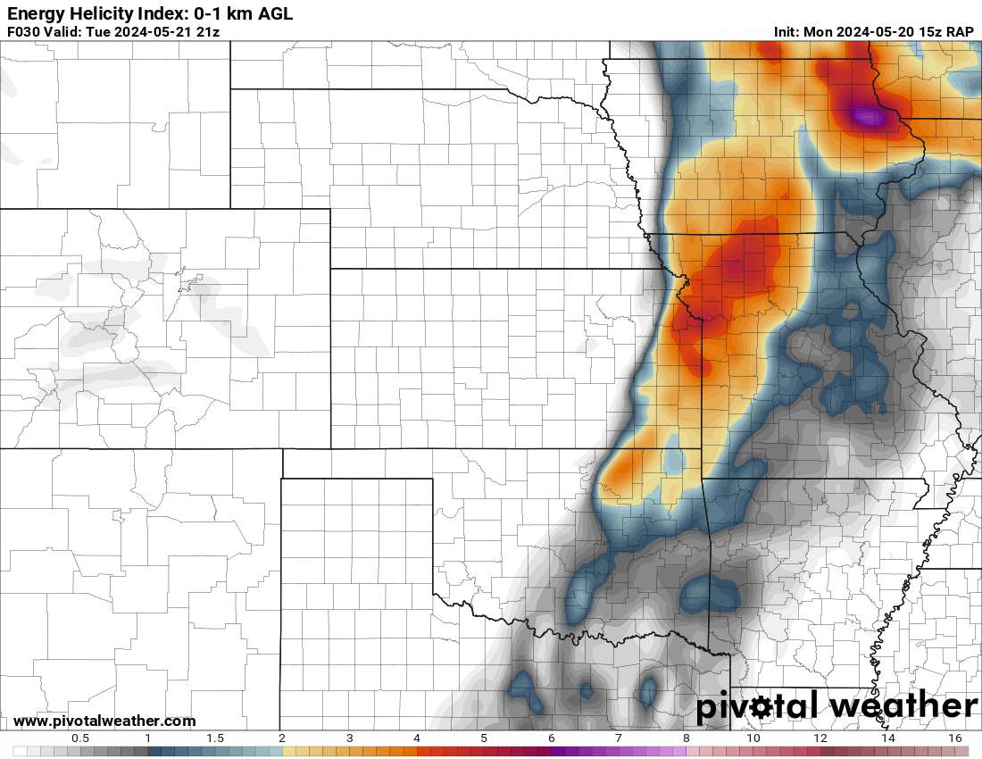
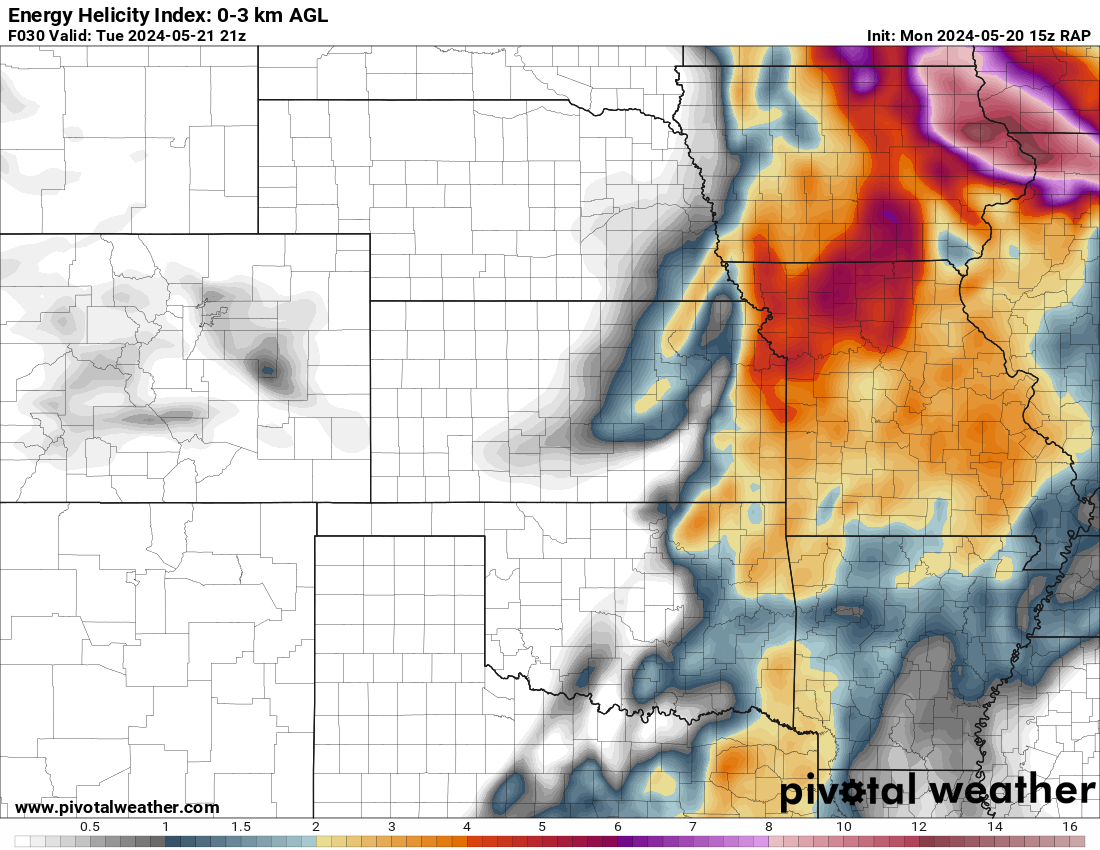
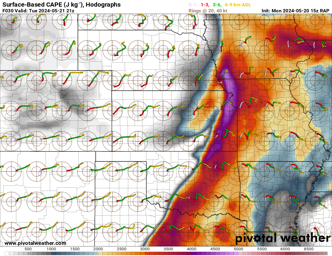
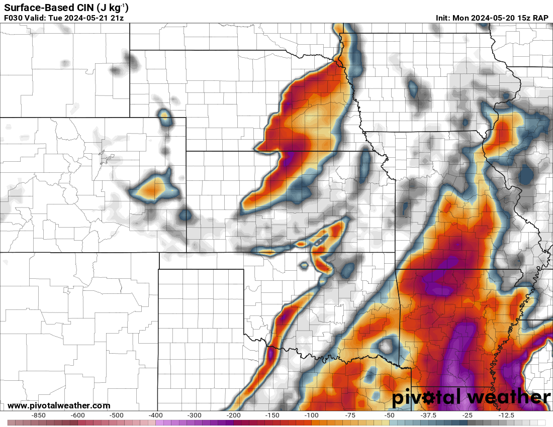
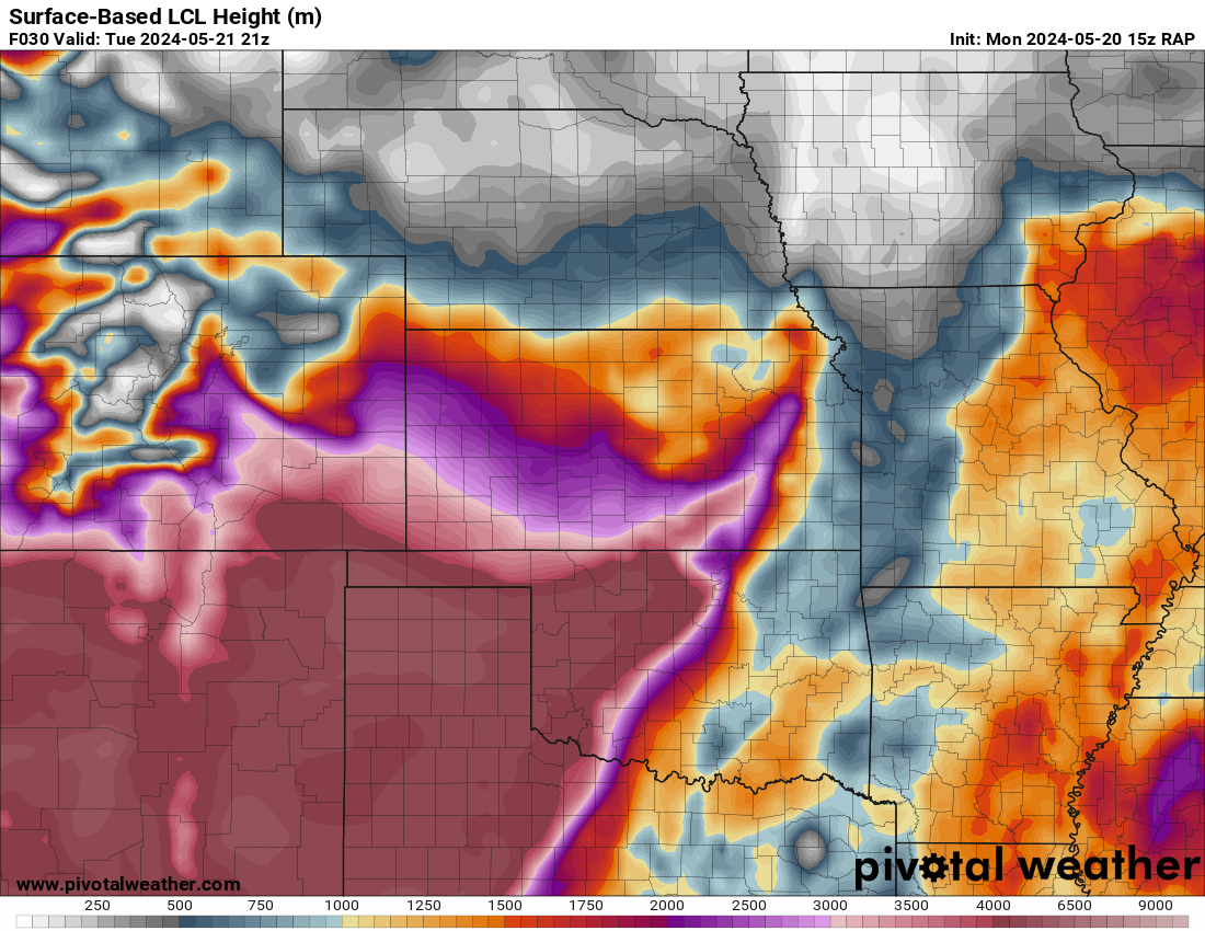
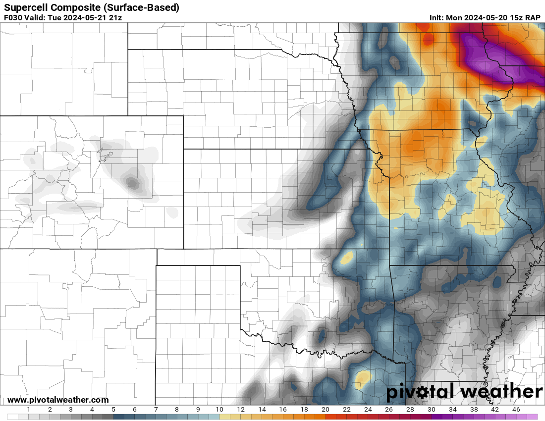
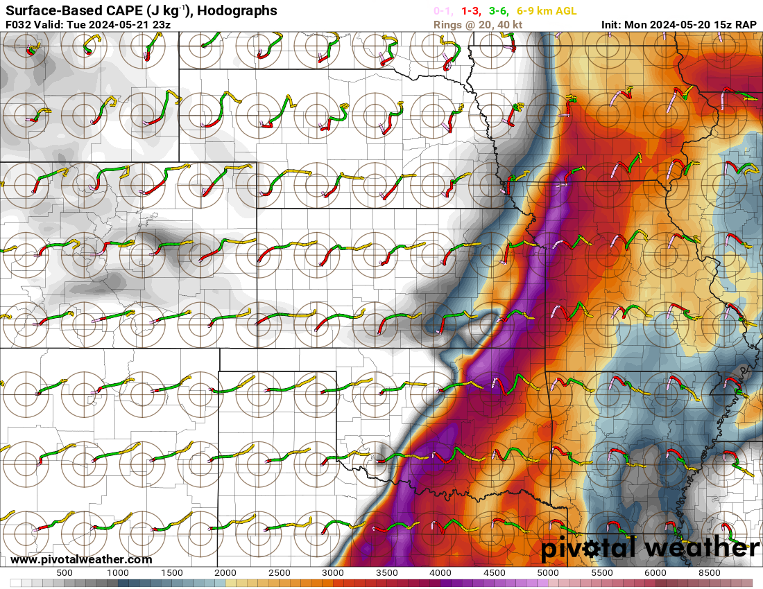
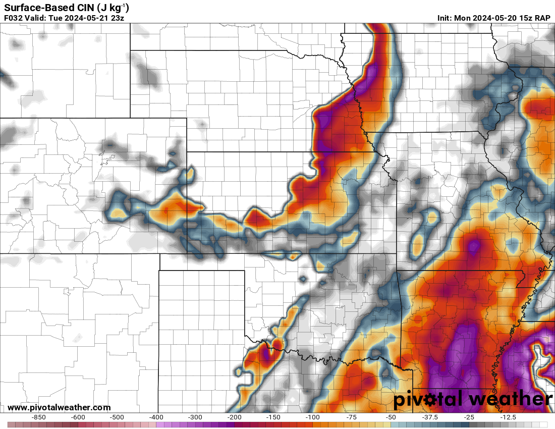
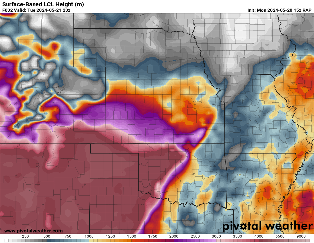
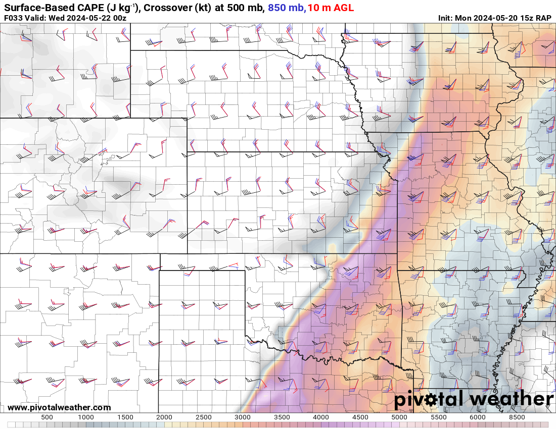
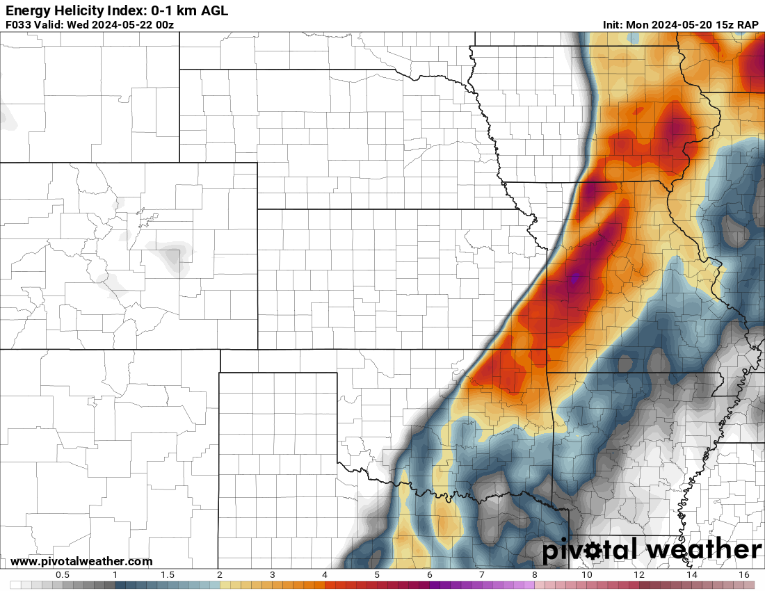
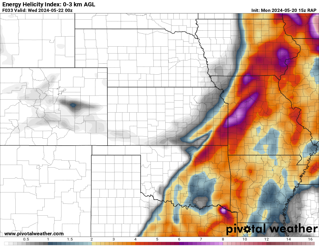
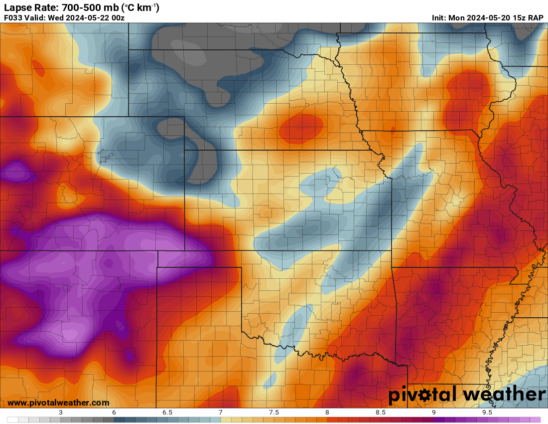
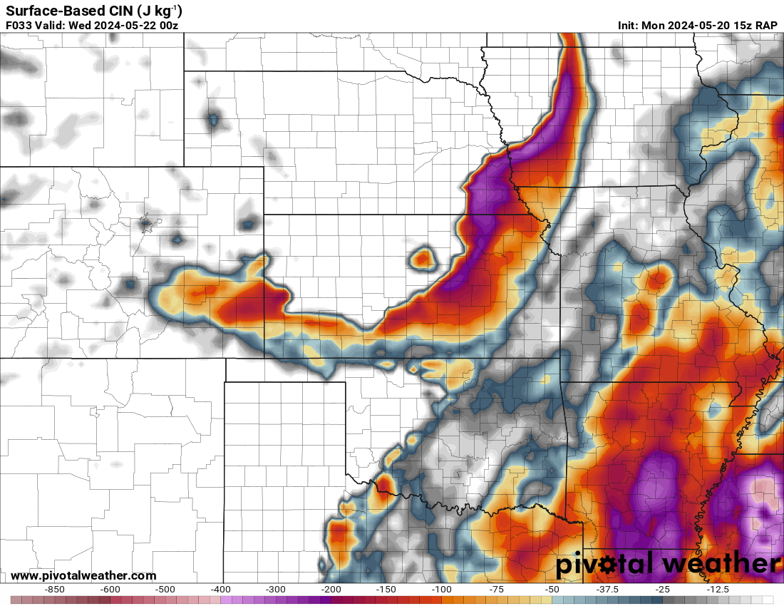
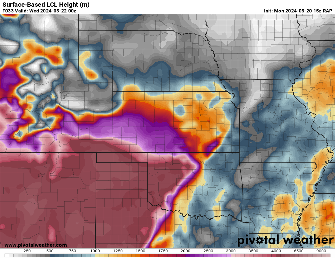
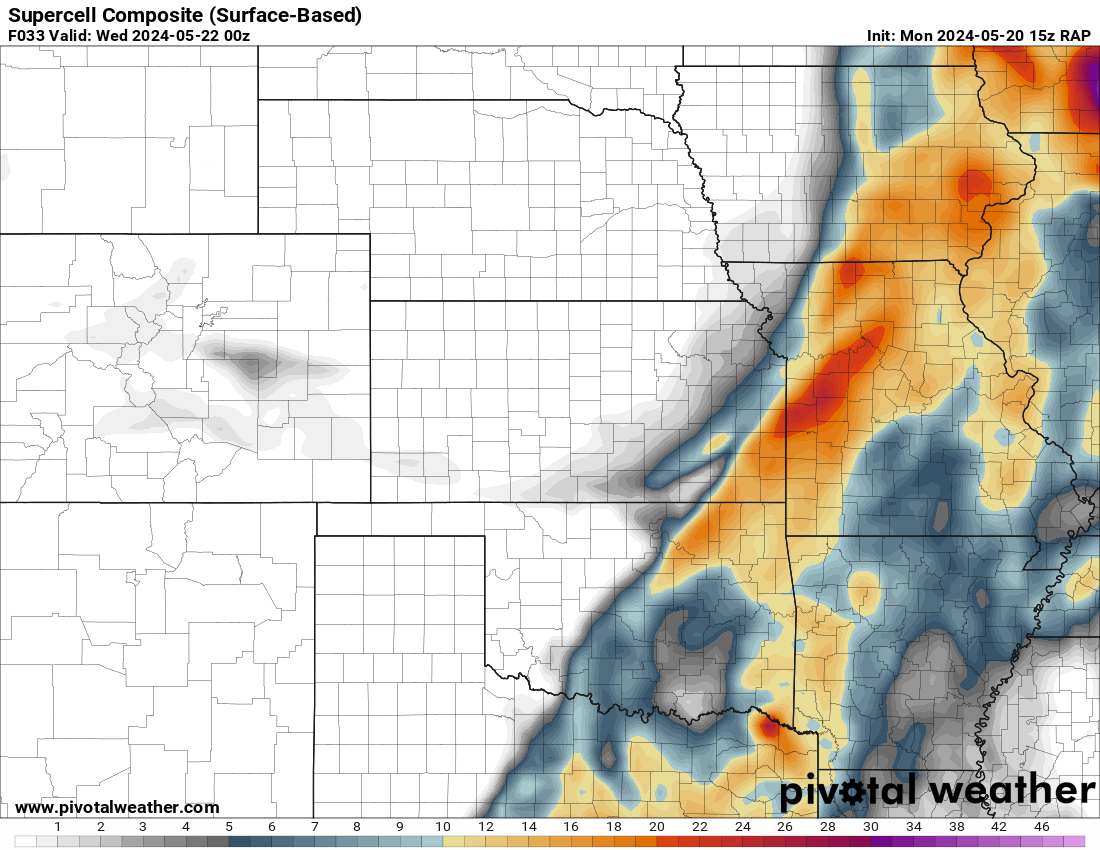
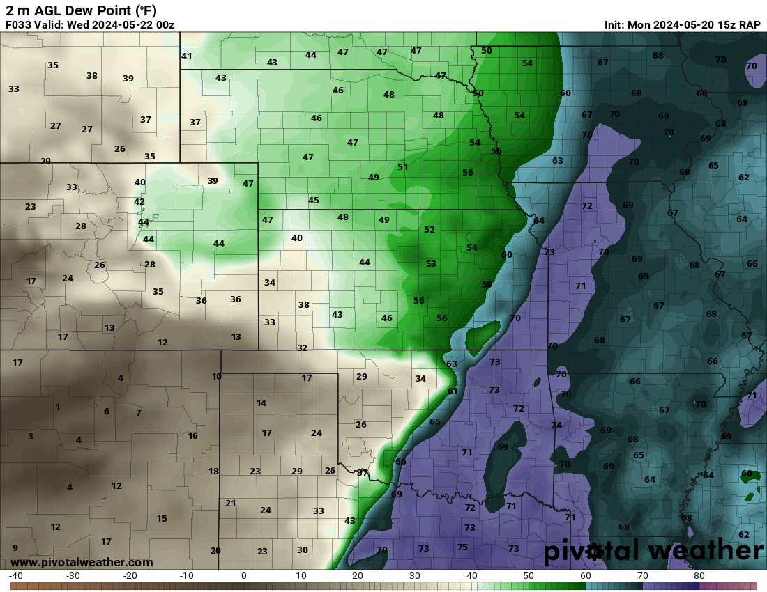
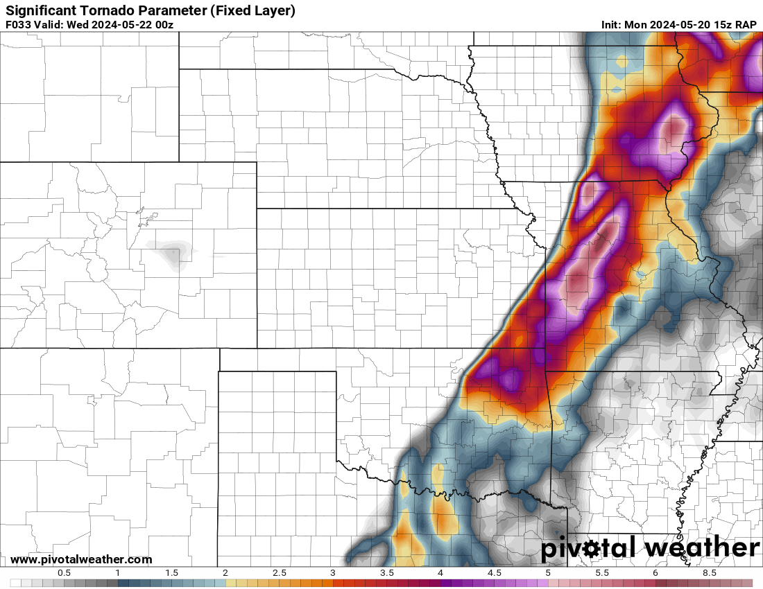
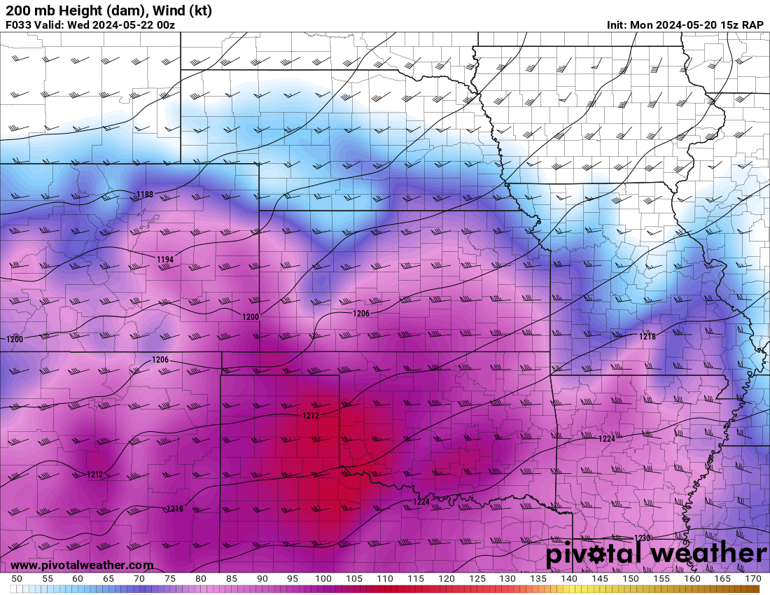
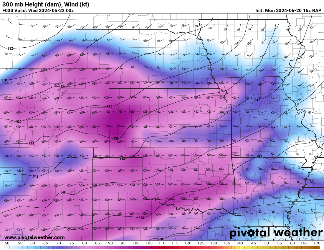
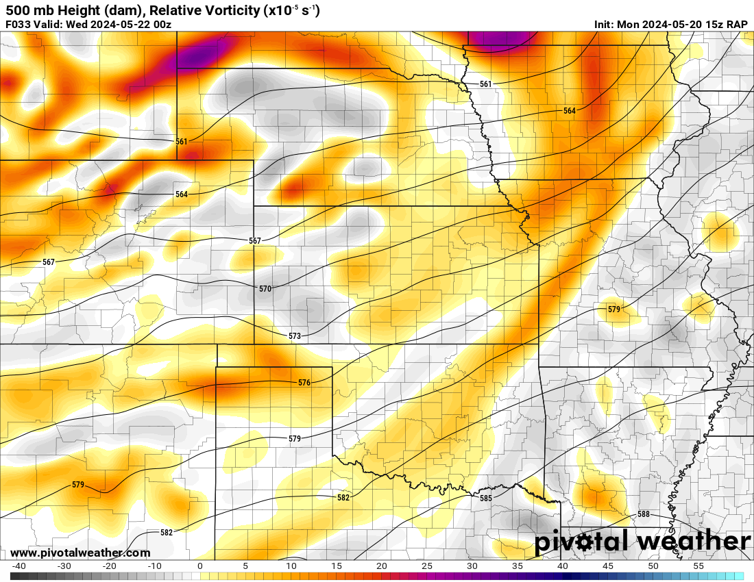
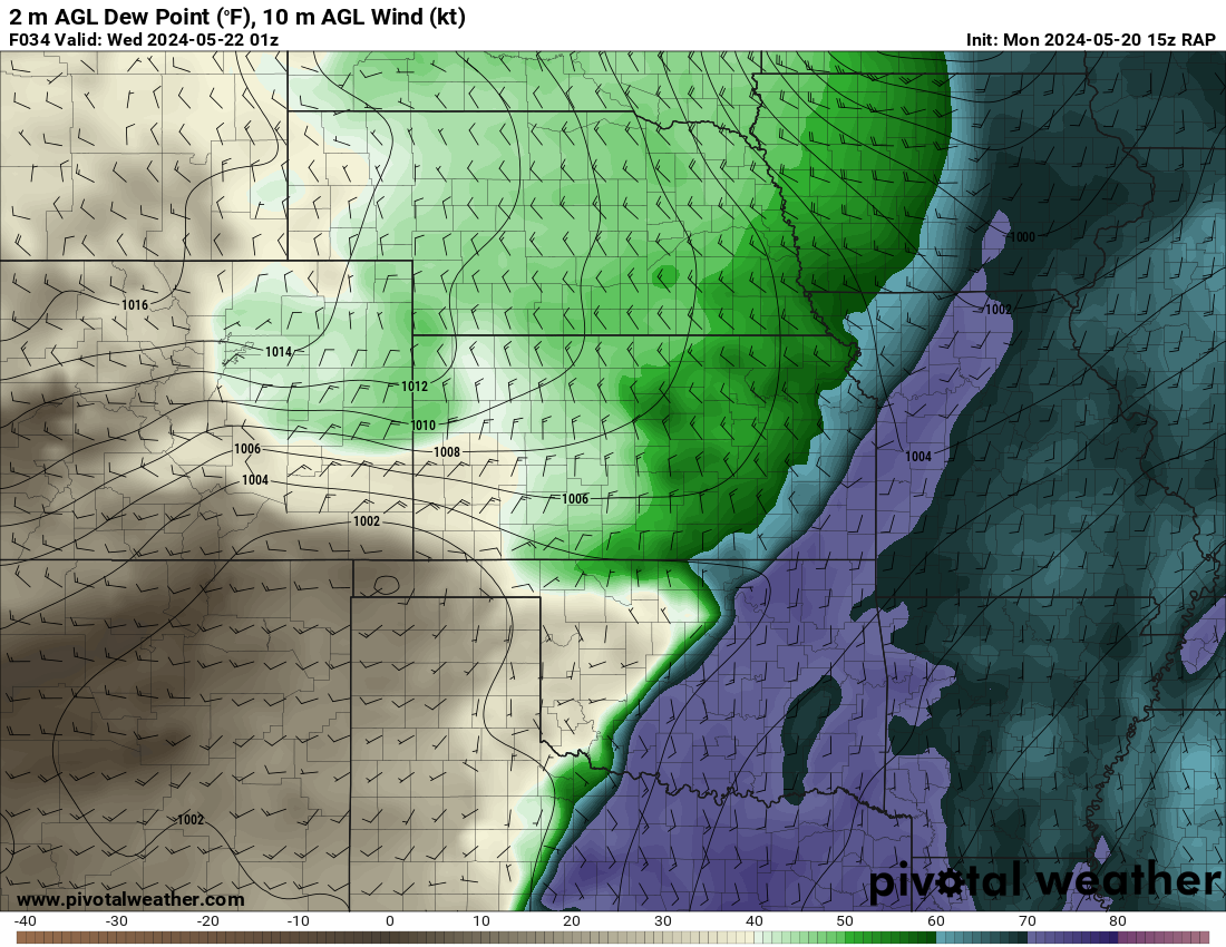
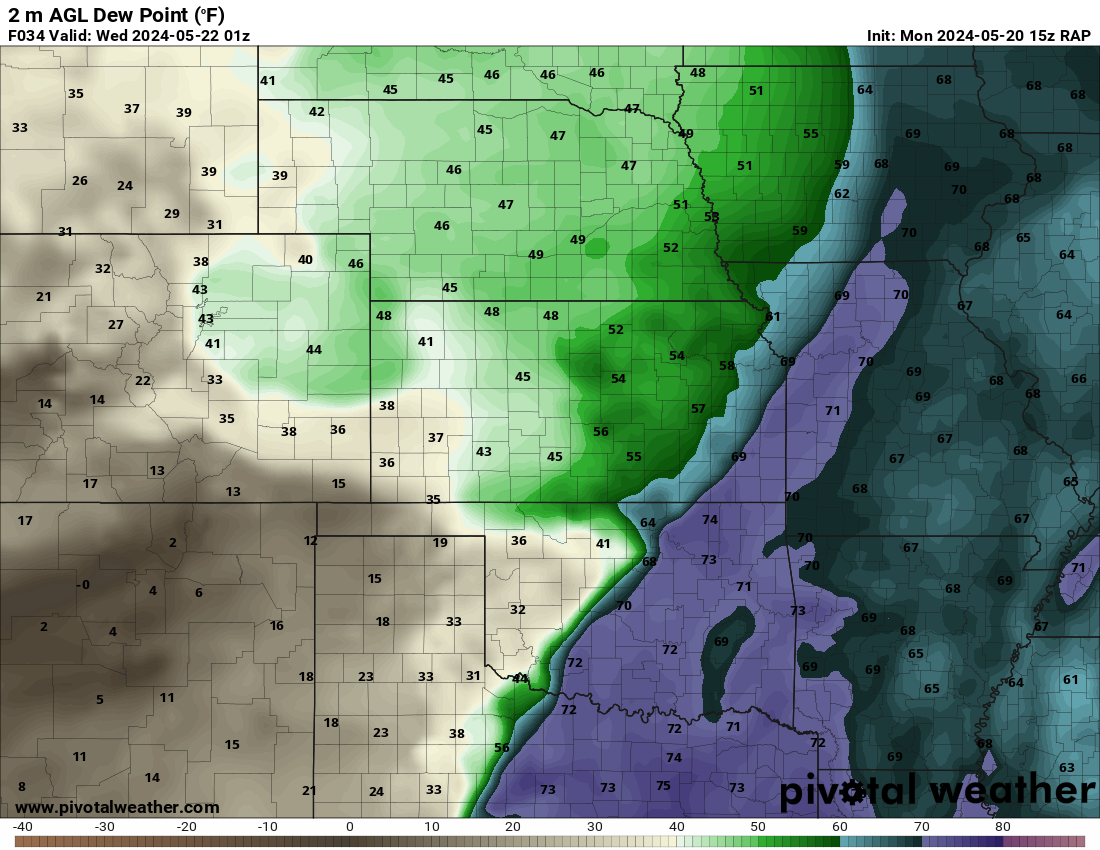
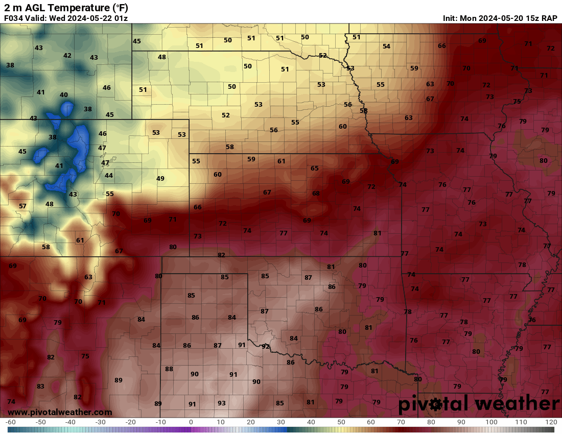
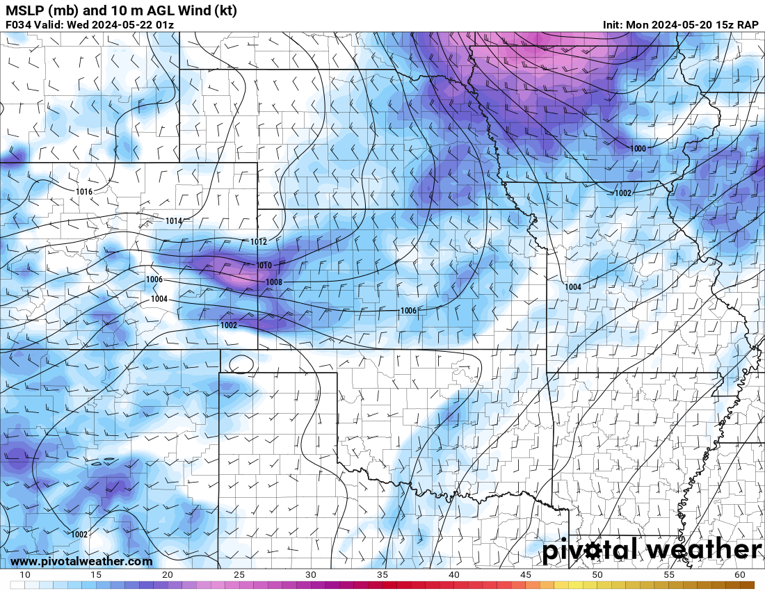
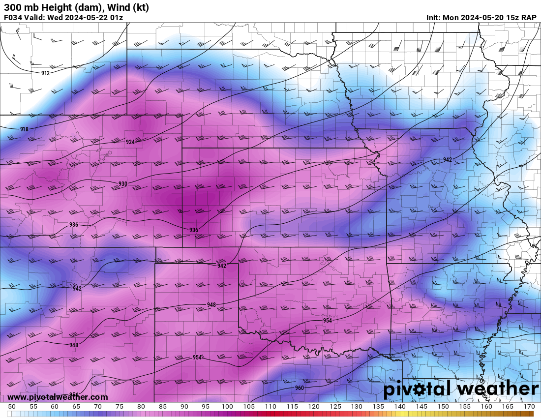
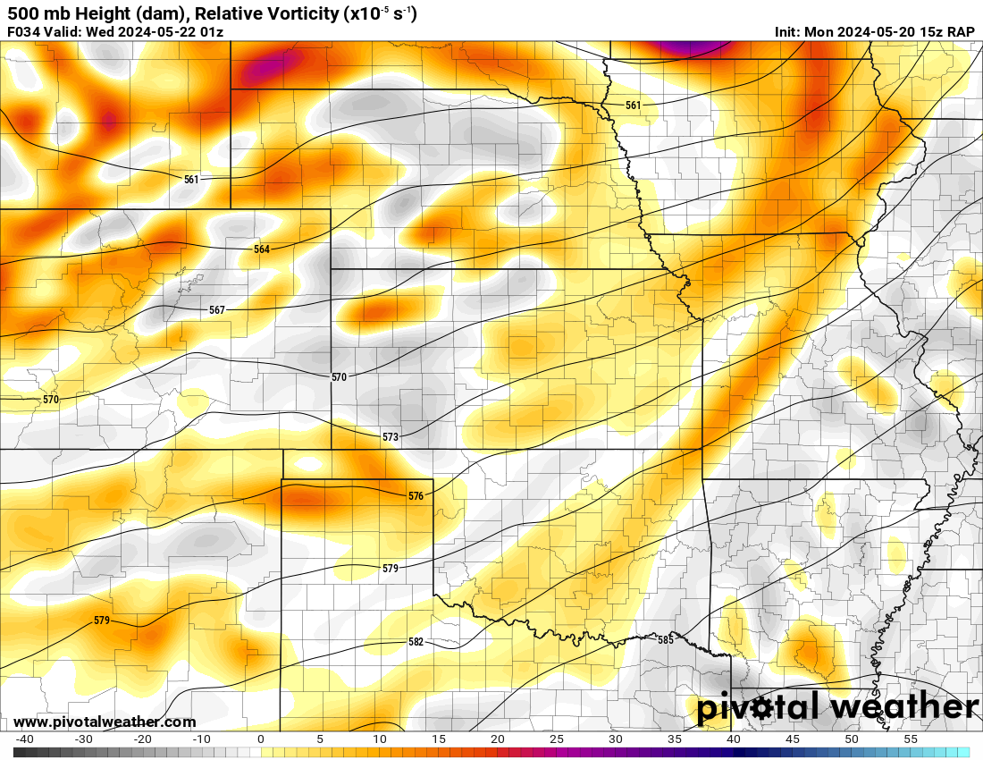
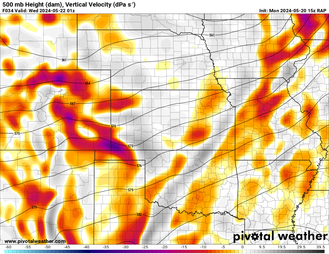
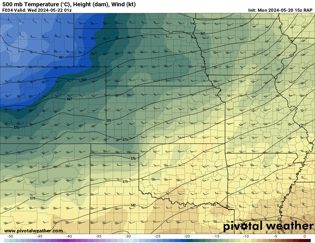
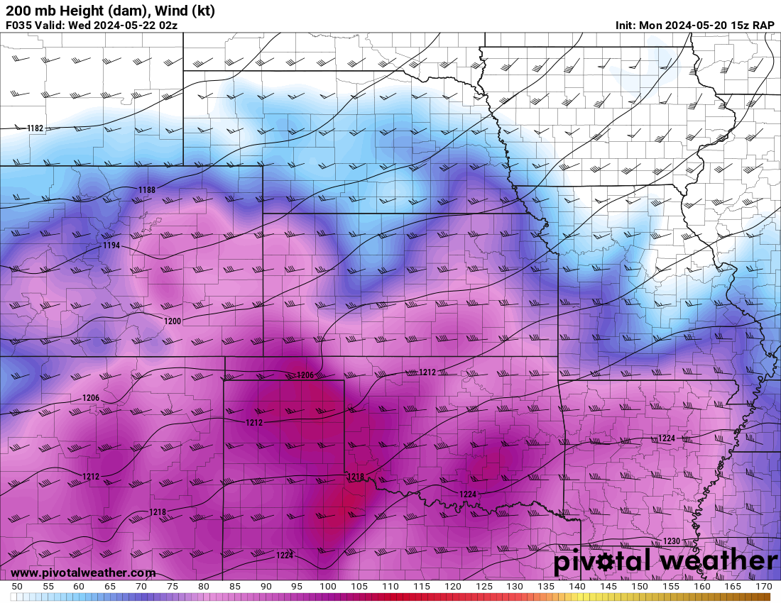
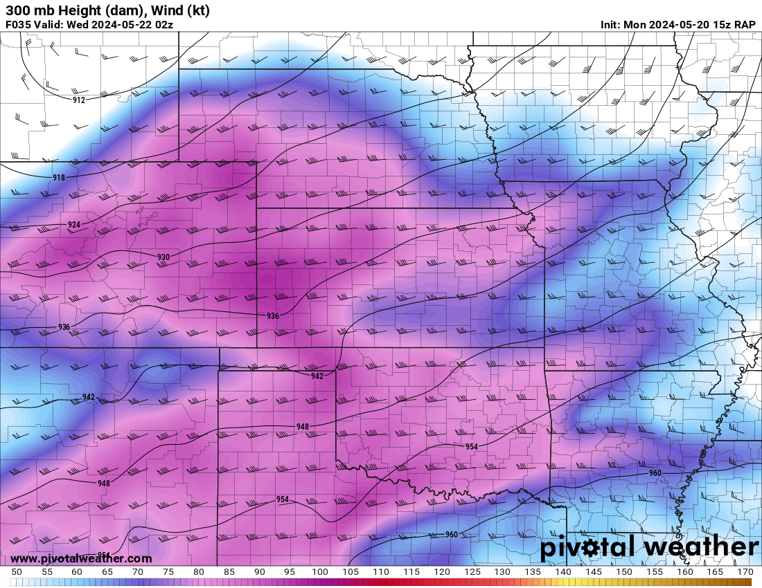
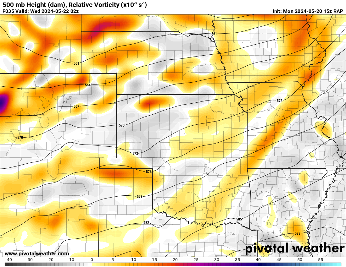
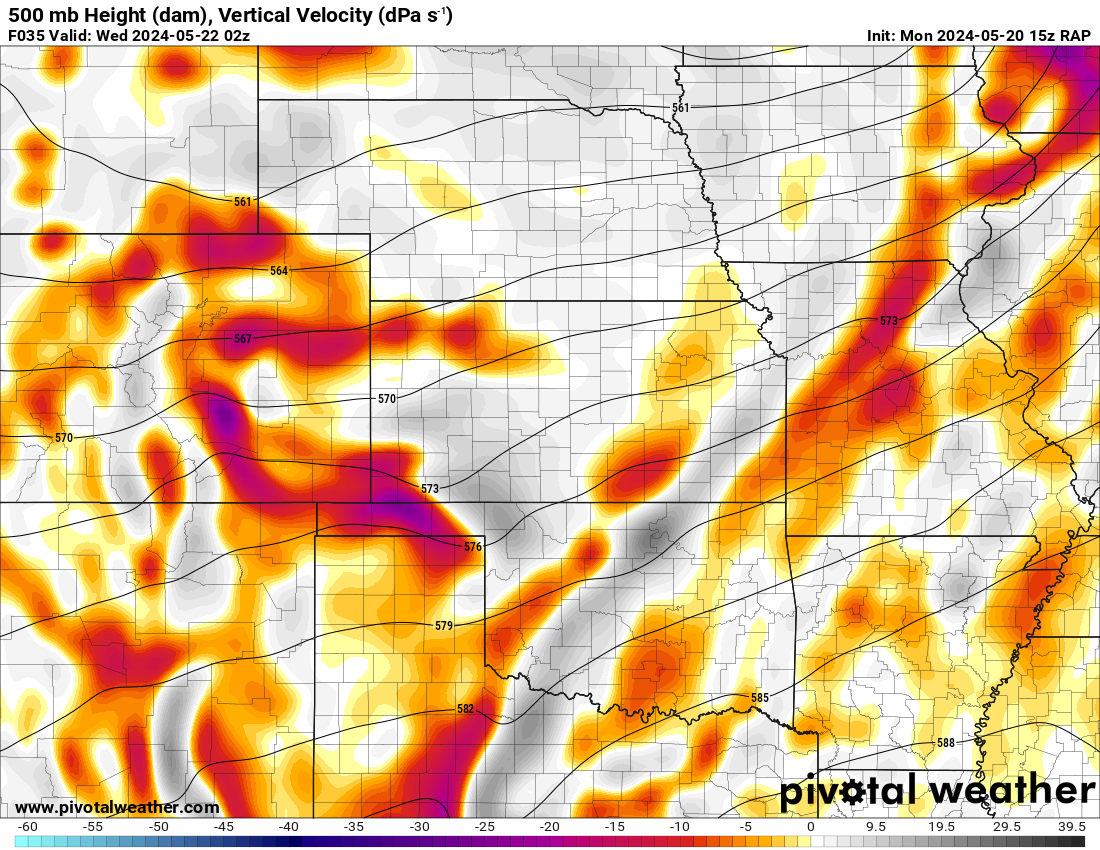
15Z RAP Monday May 20th


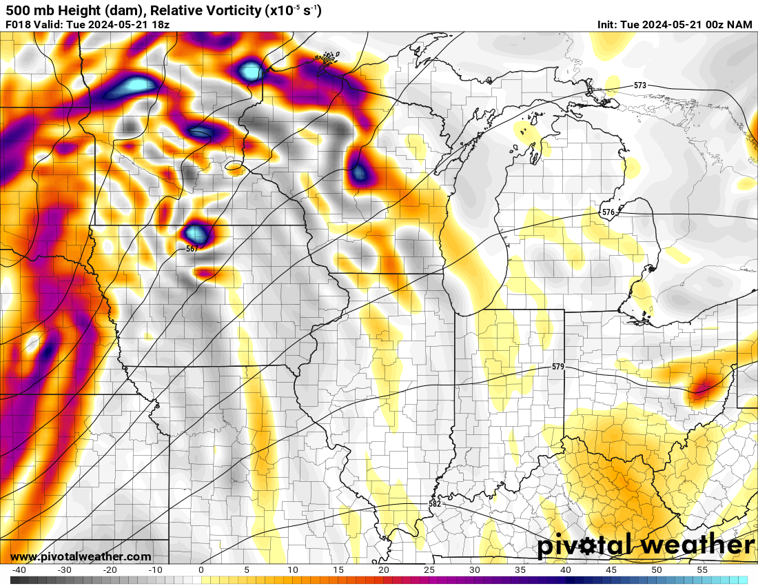
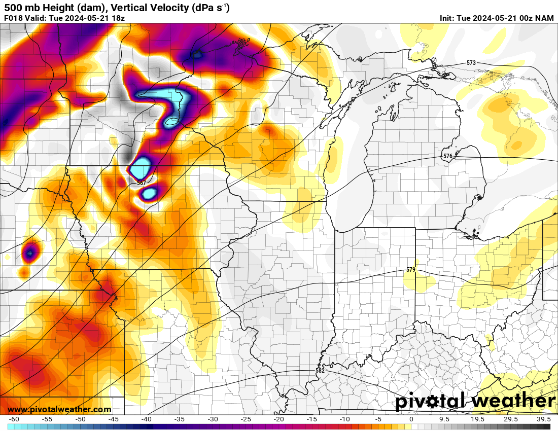
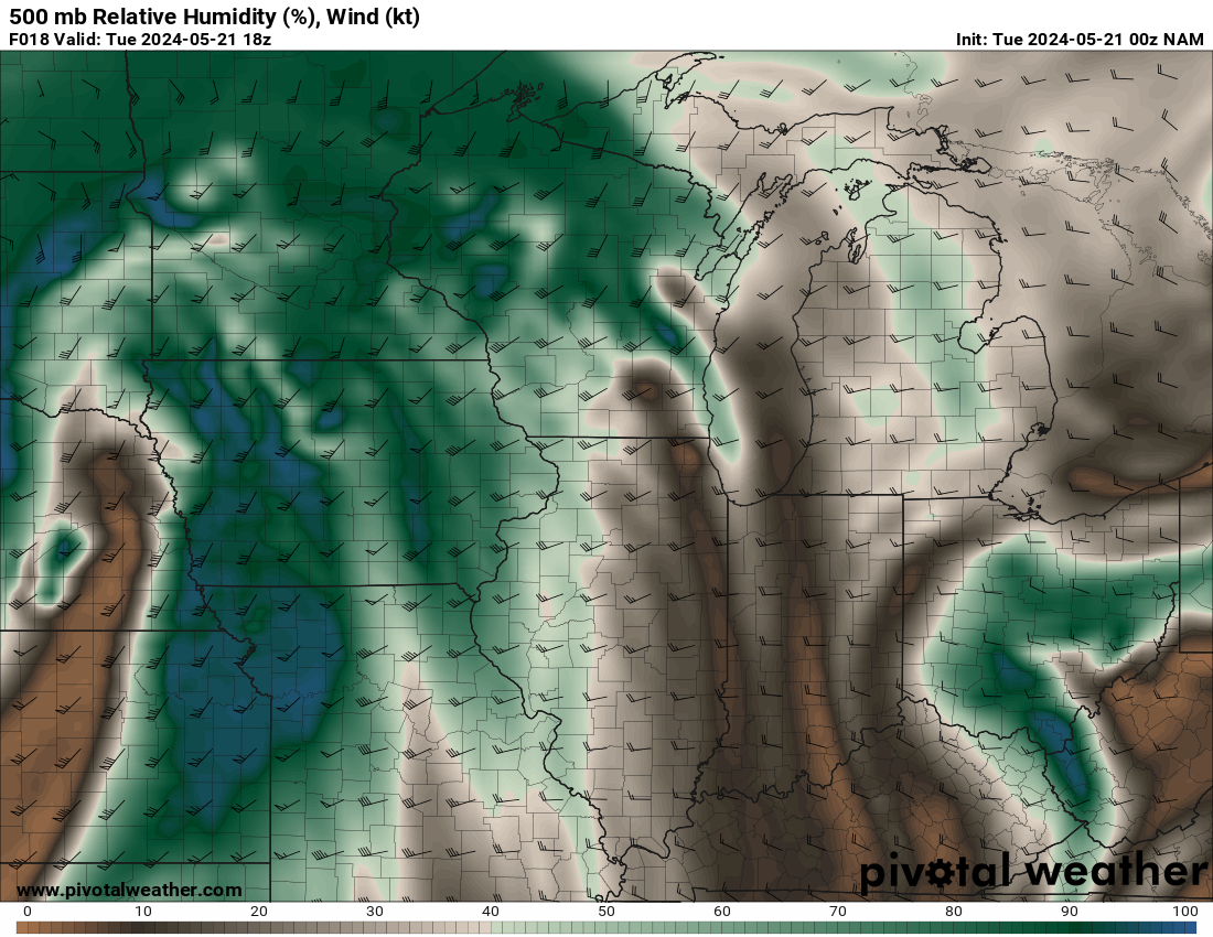
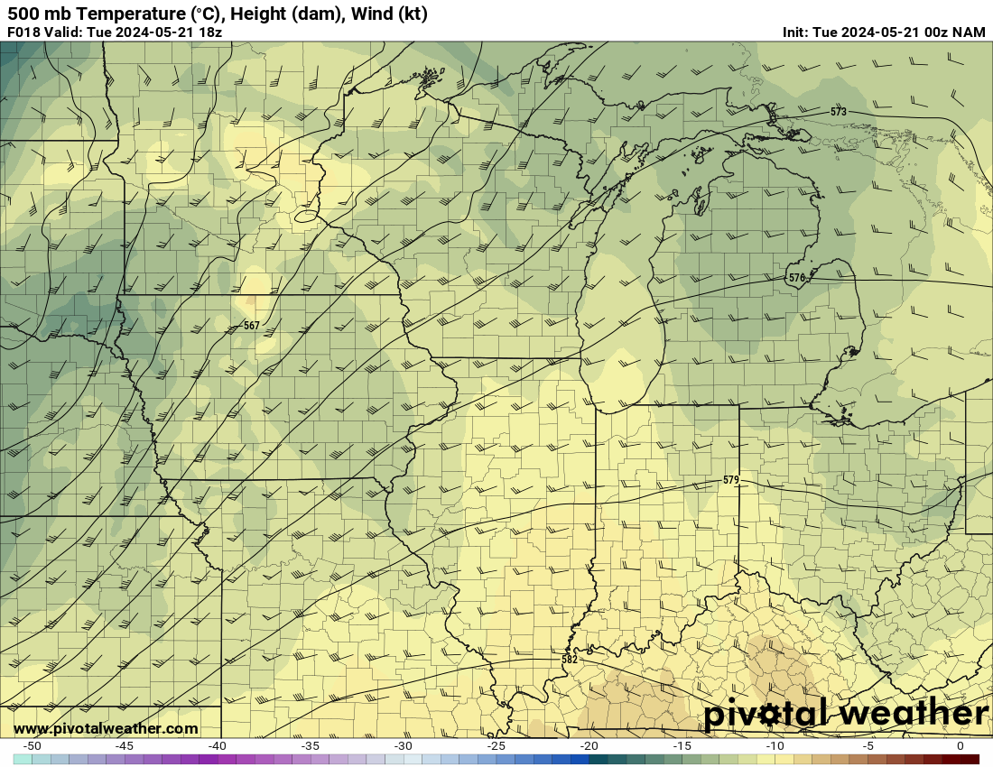
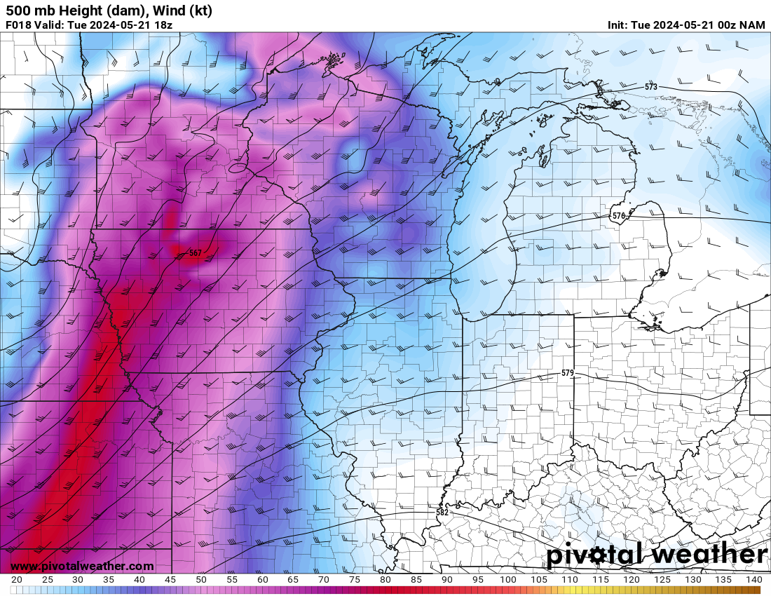
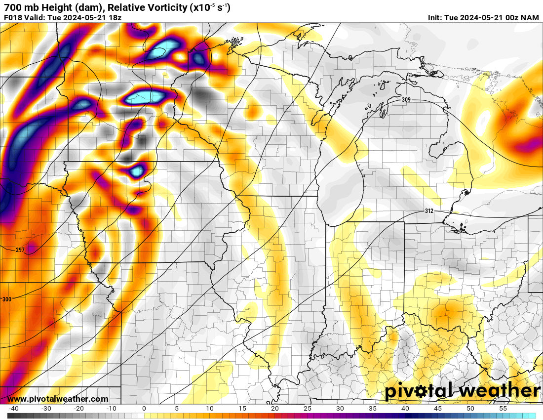
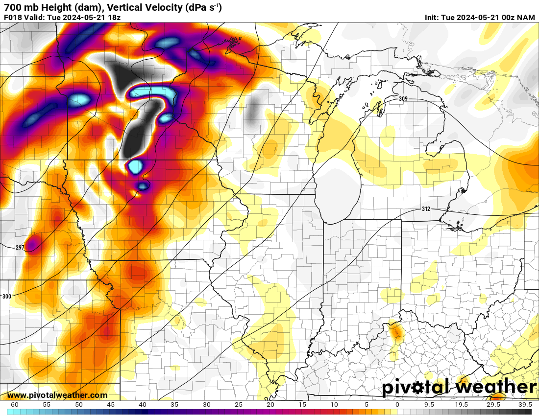
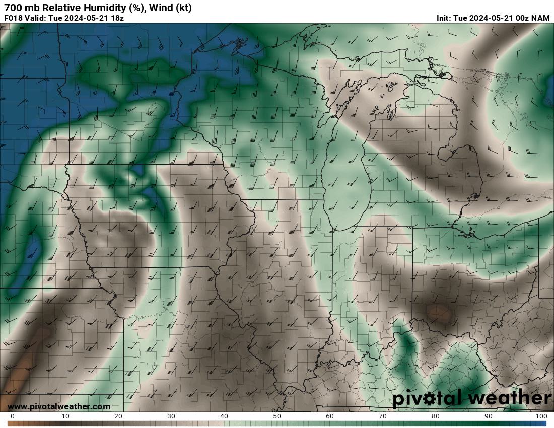
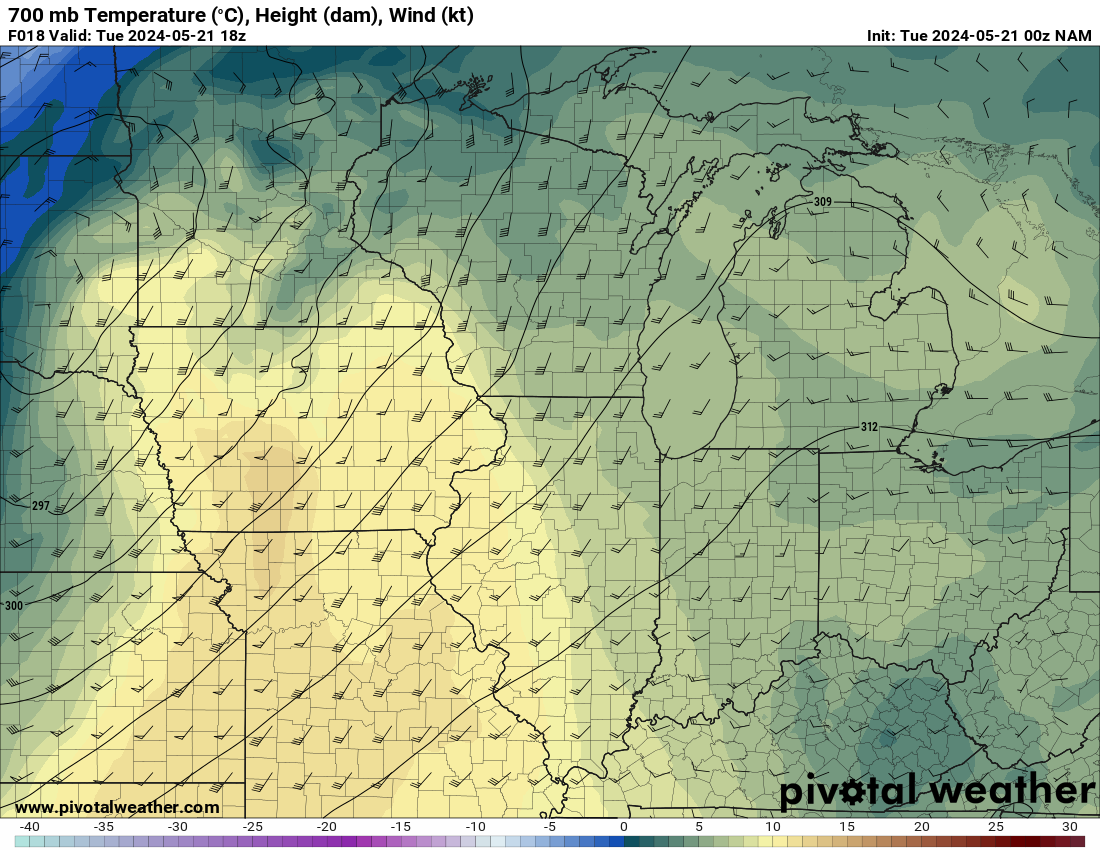
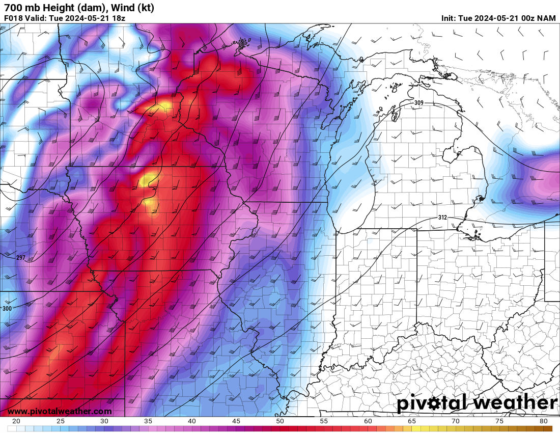
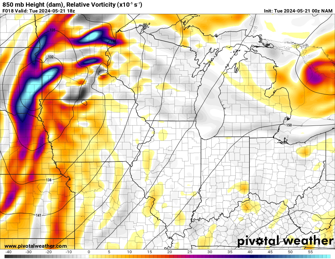
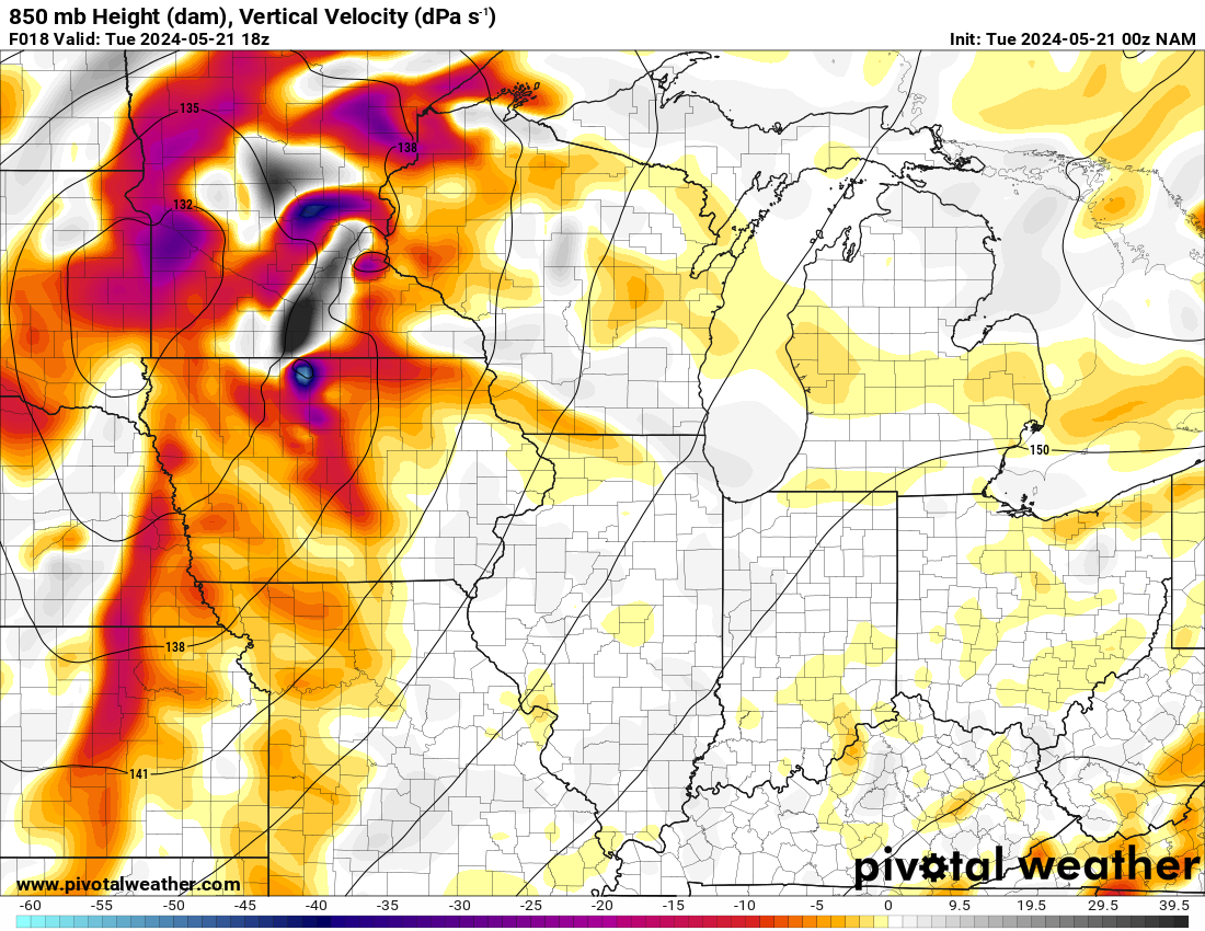
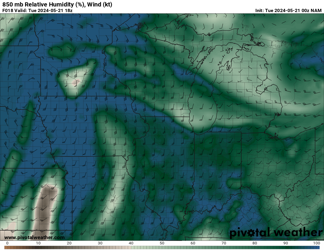
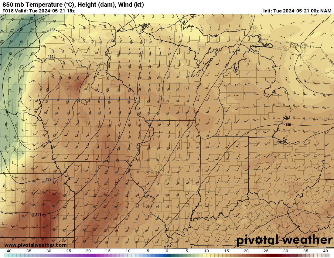
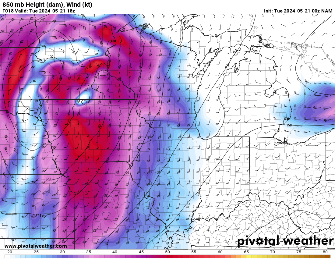
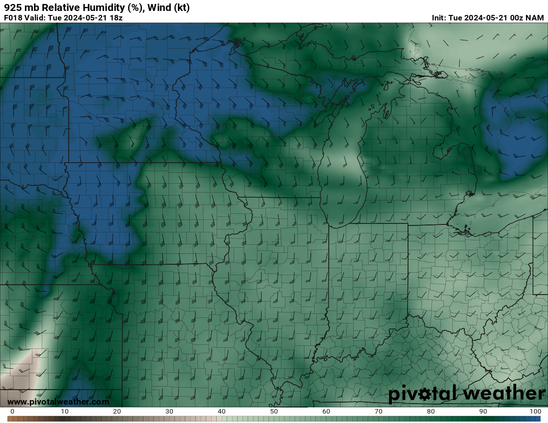
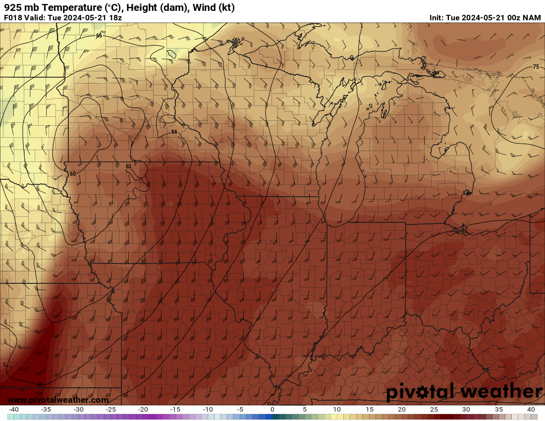
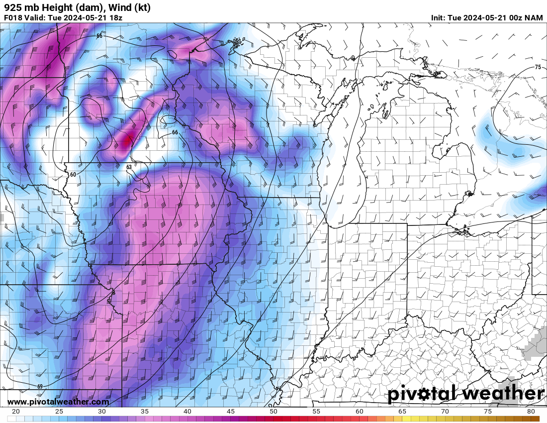
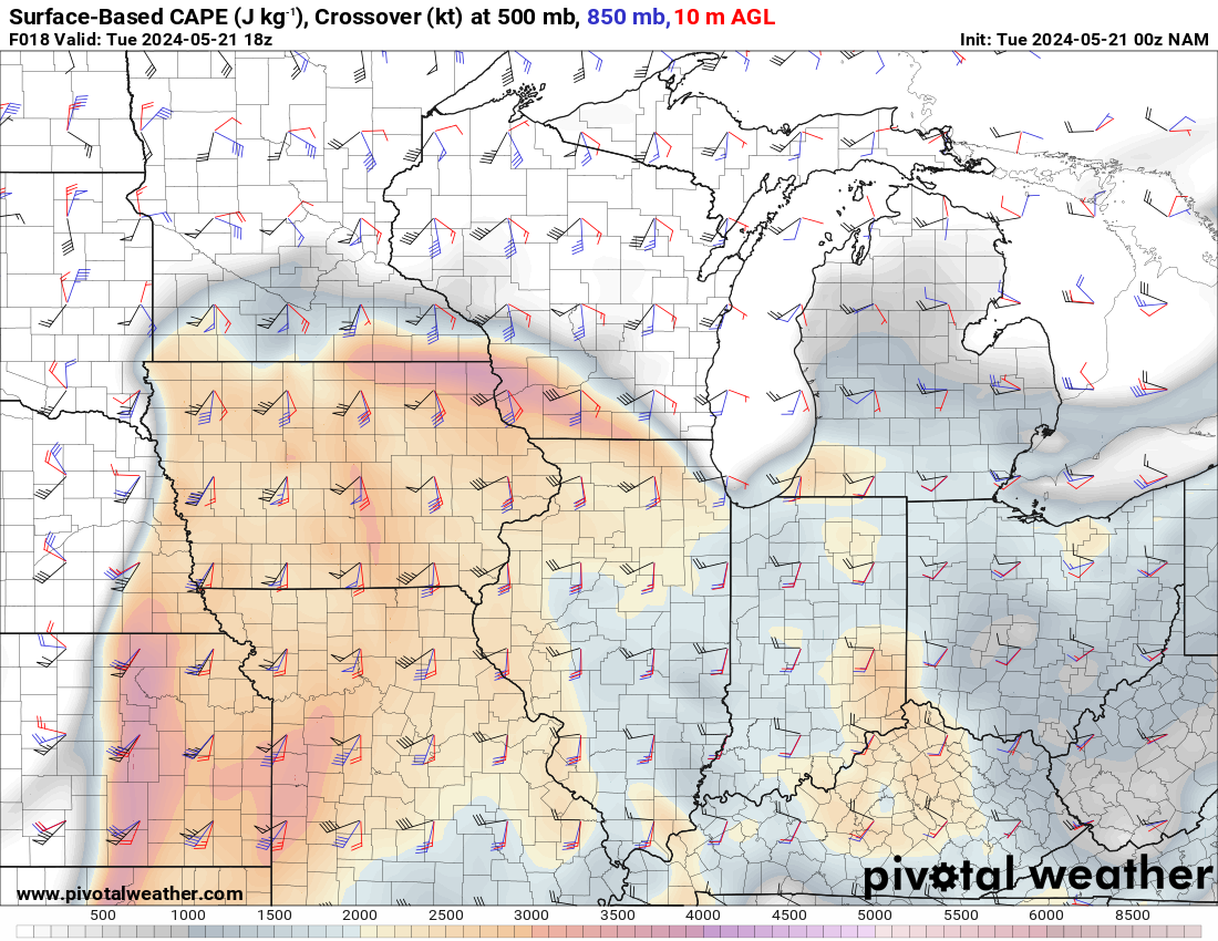
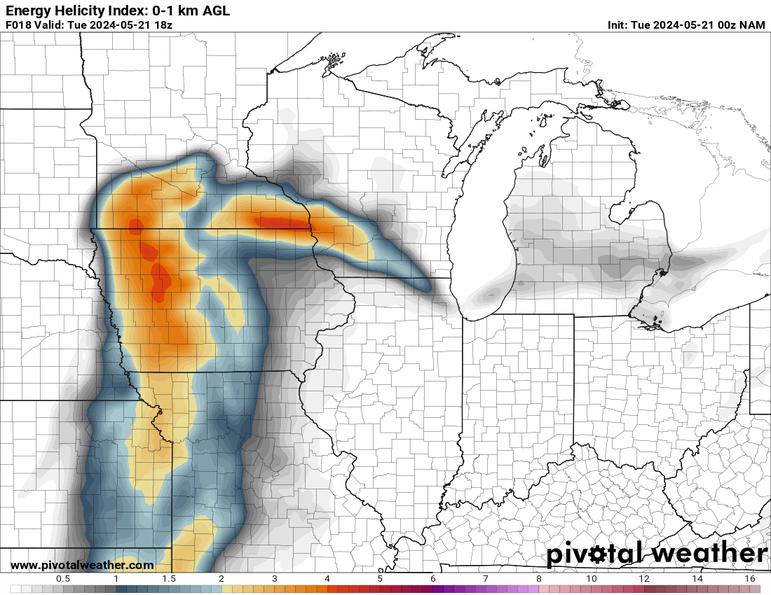
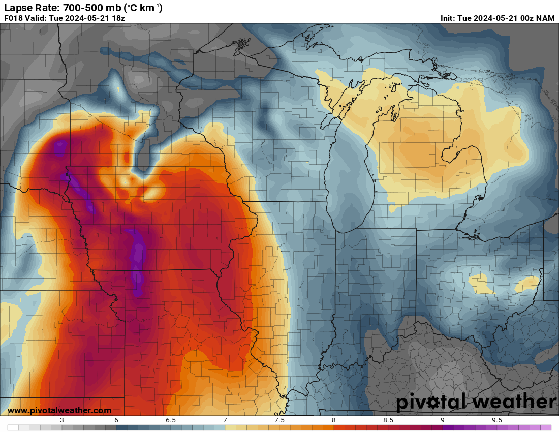
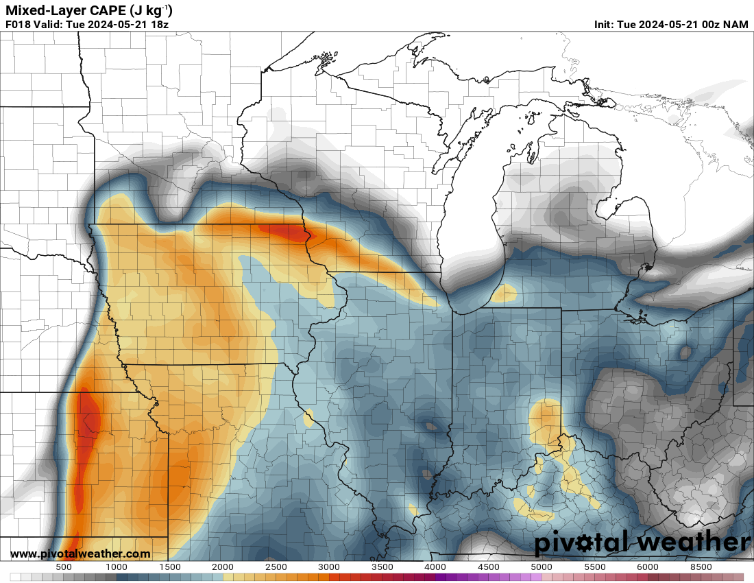
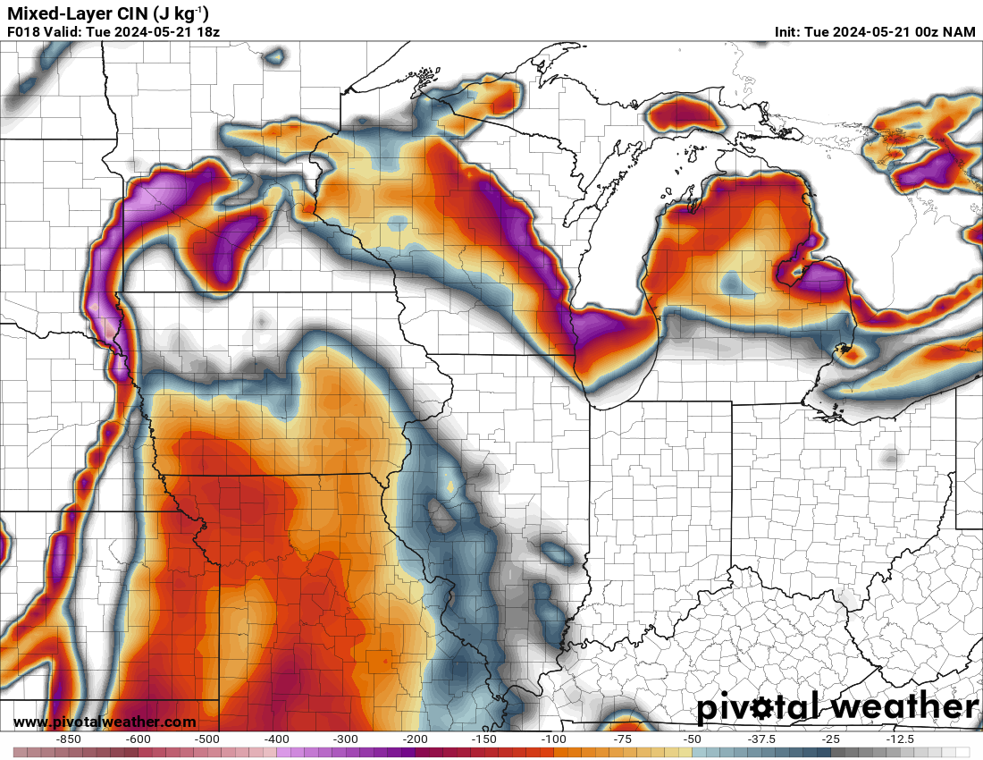
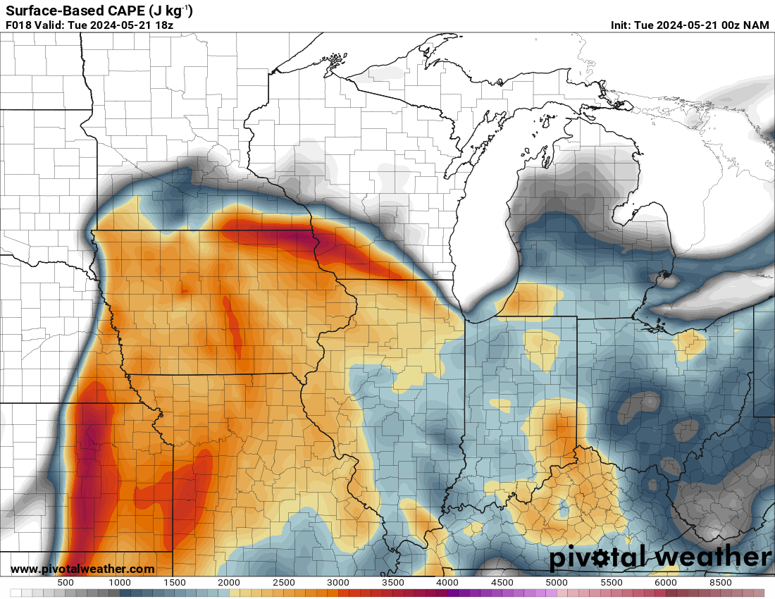
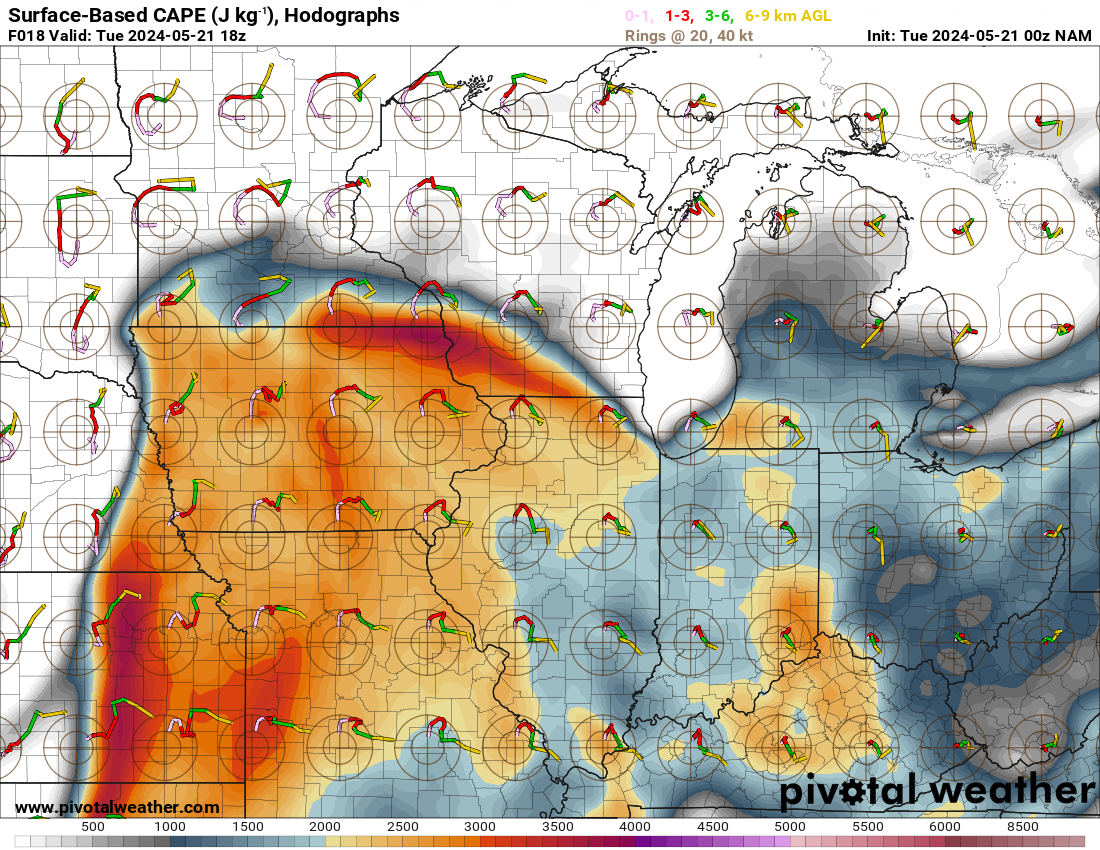
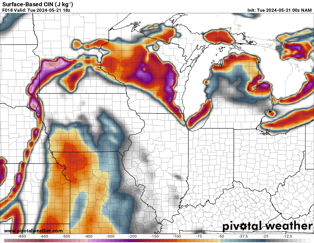
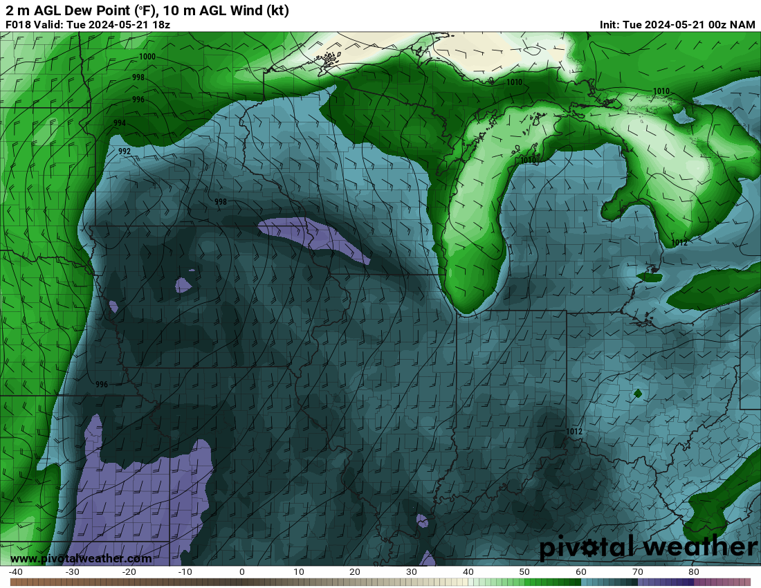
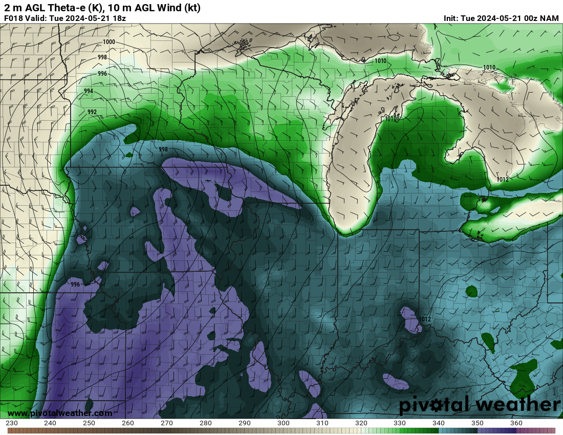
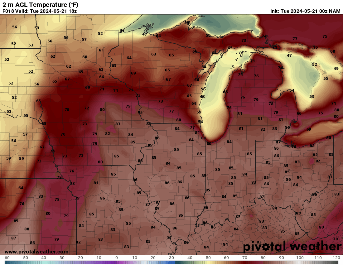
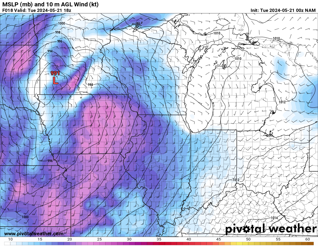
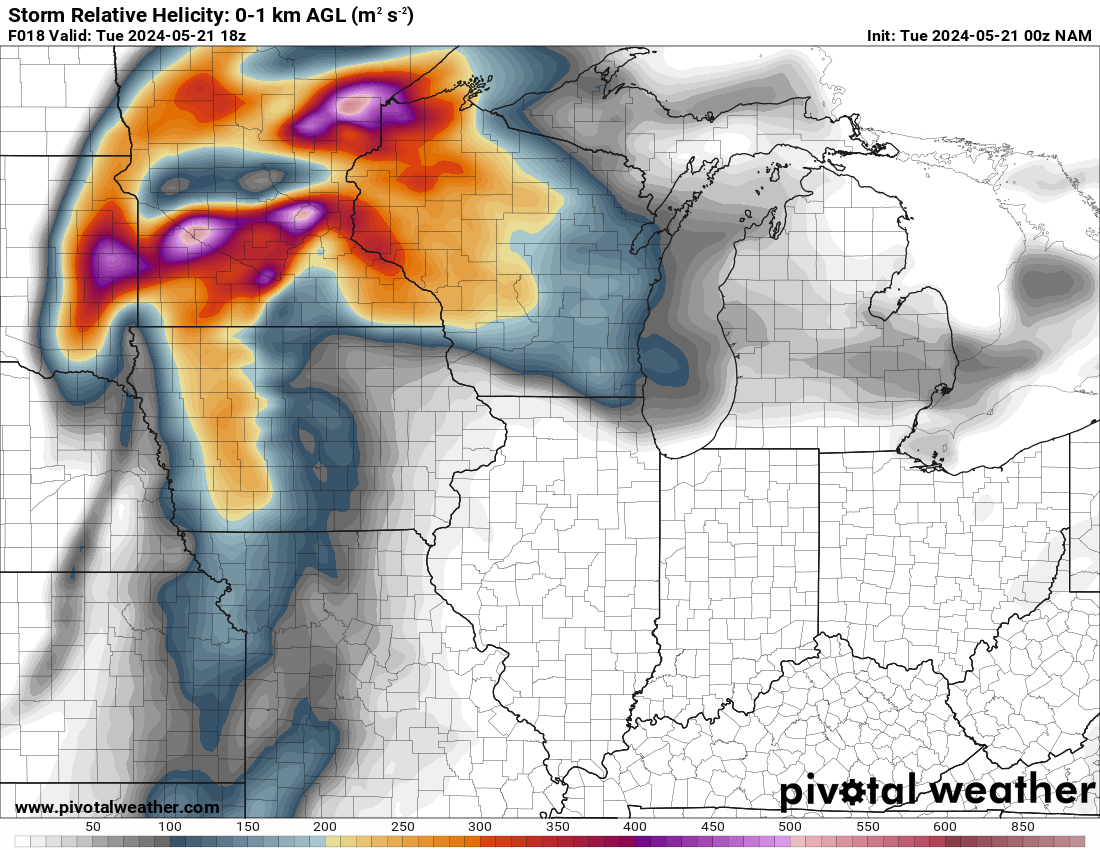
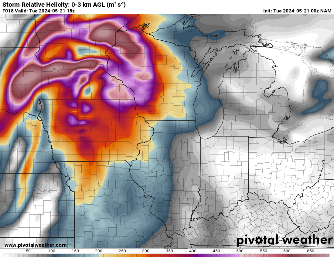
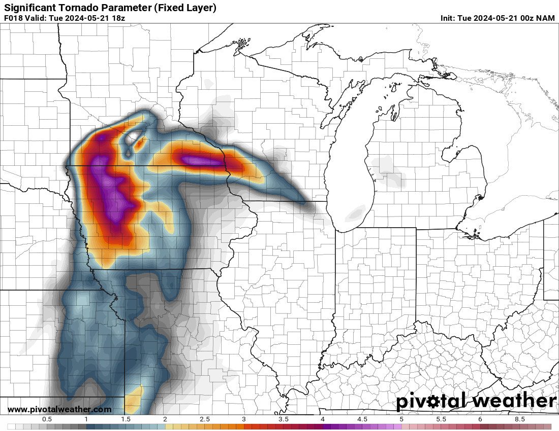
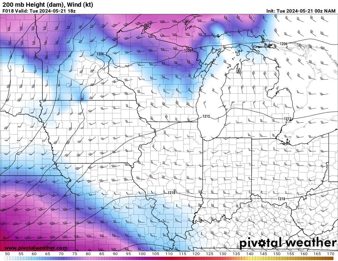
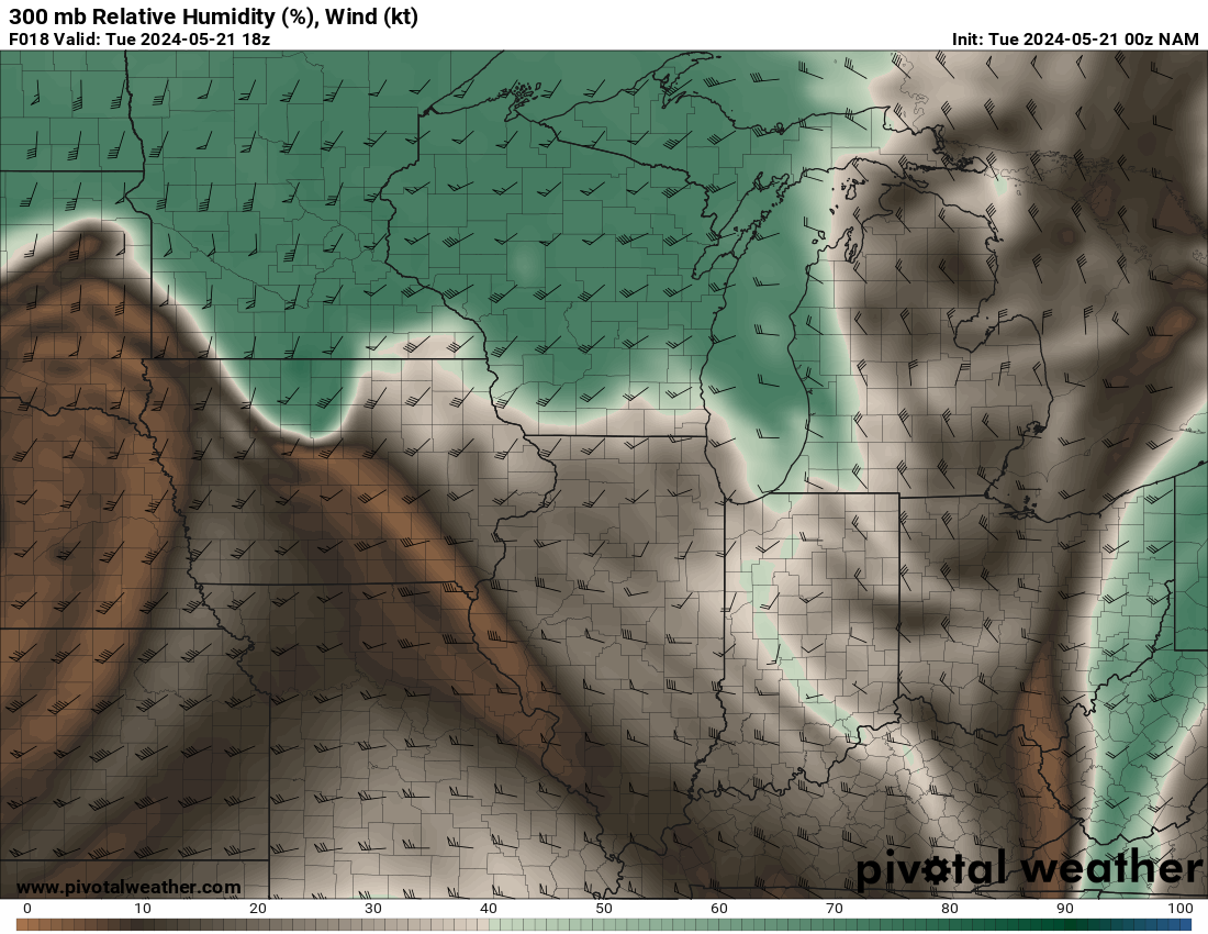
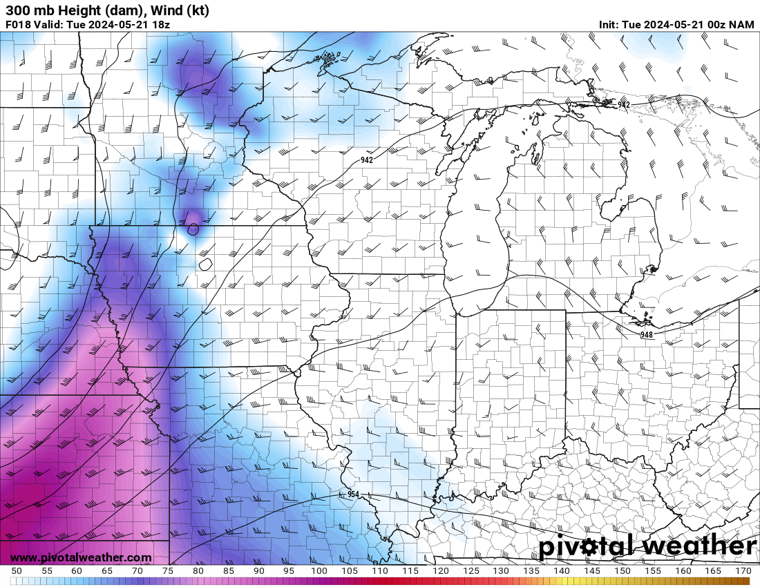
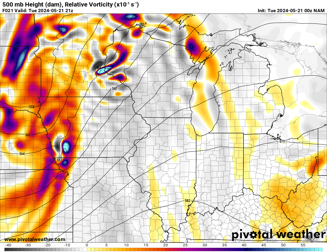
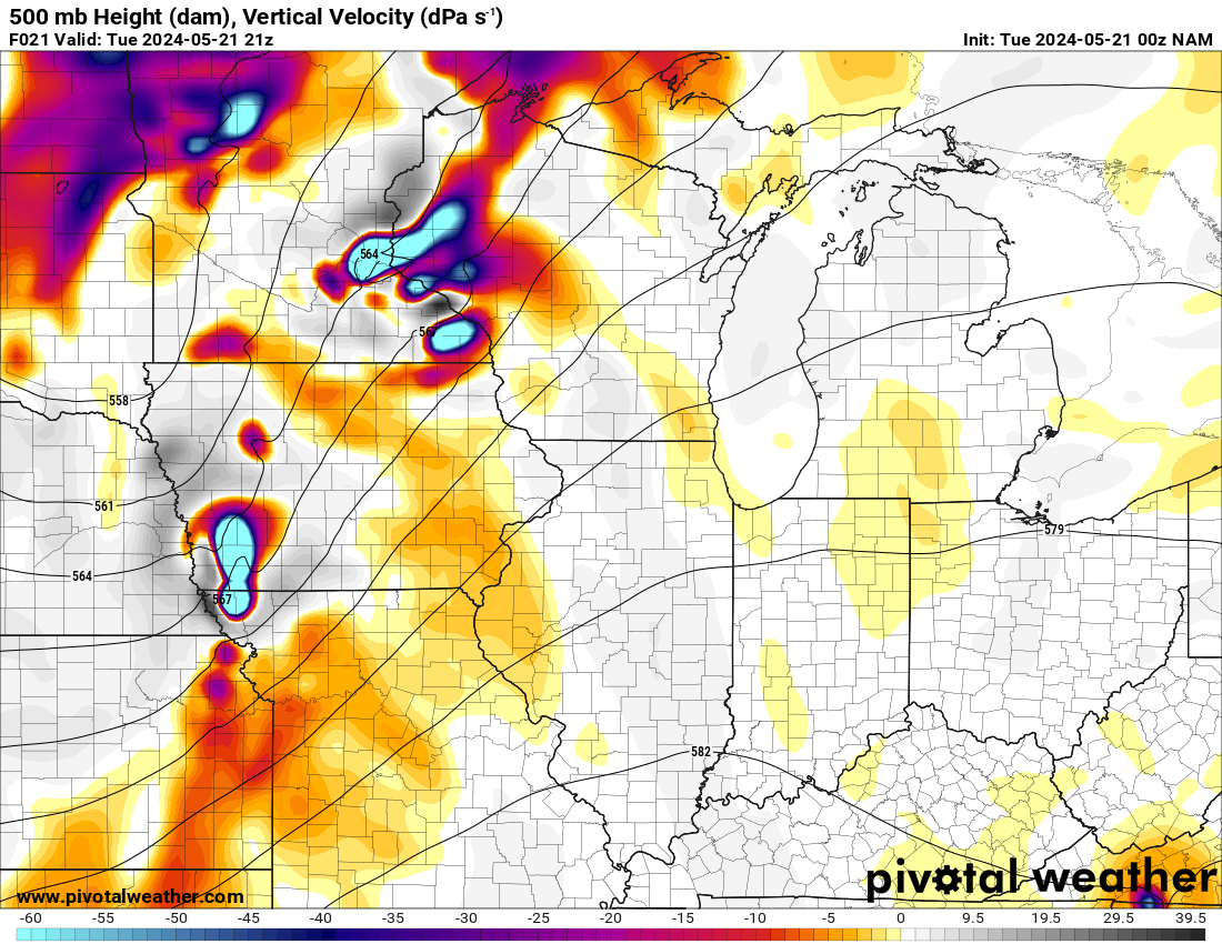
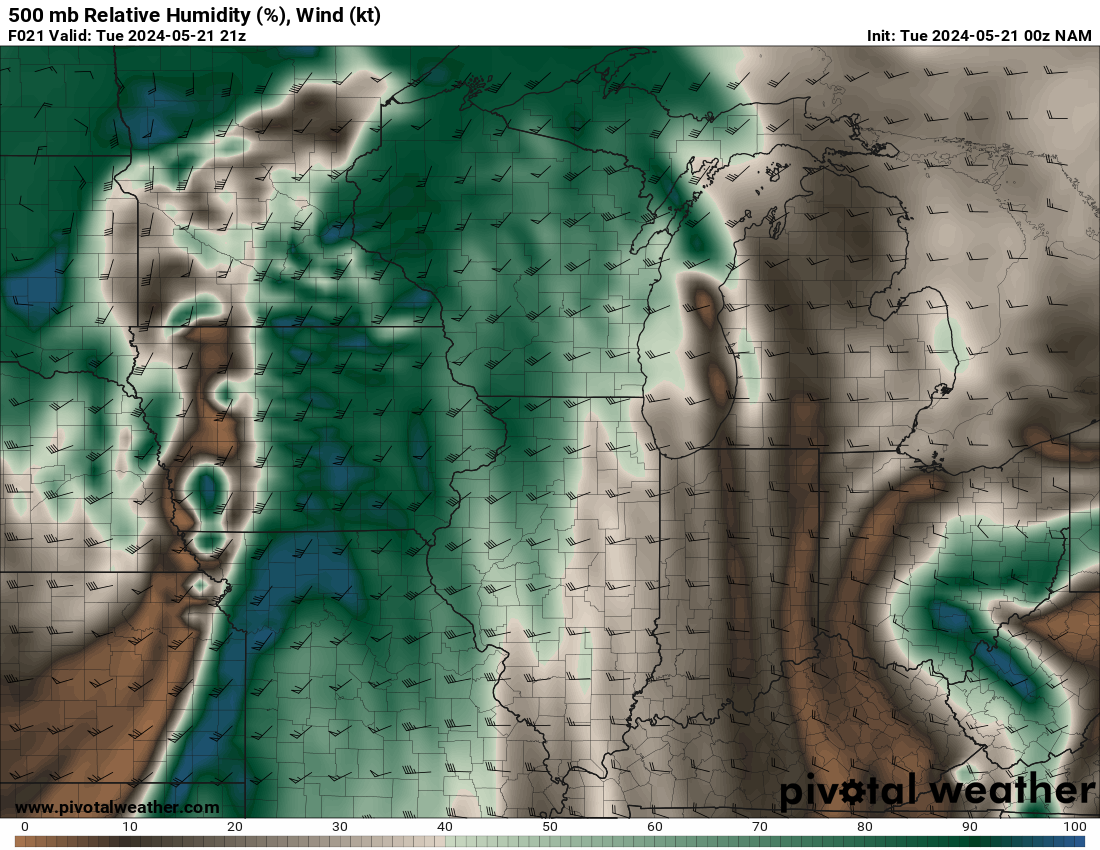
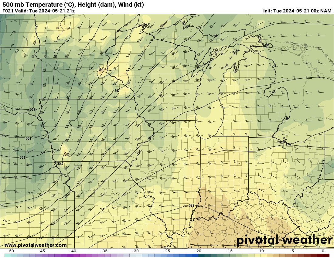
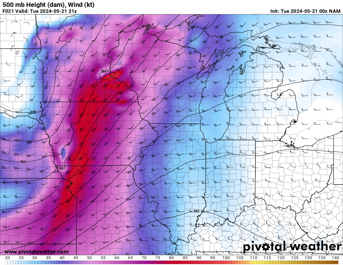
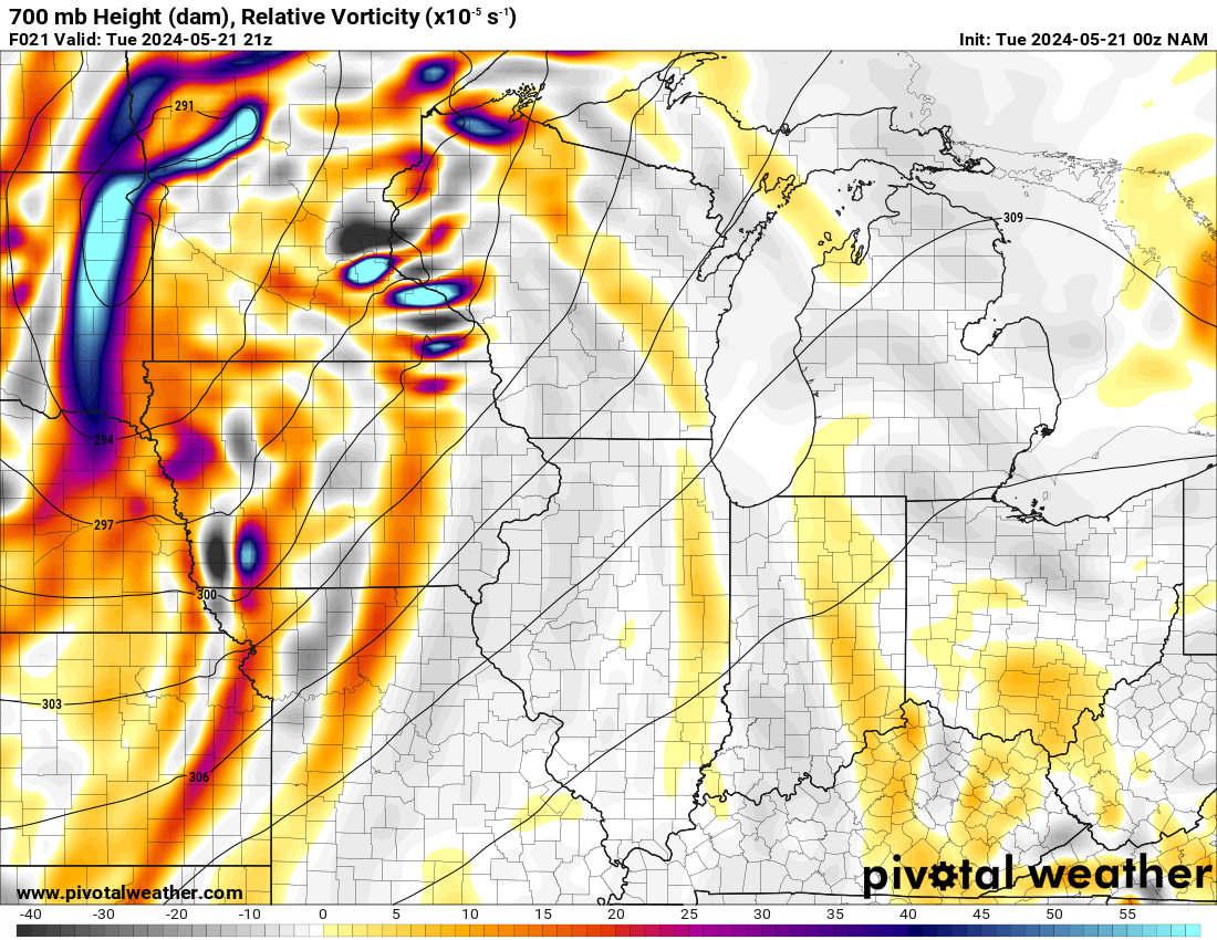
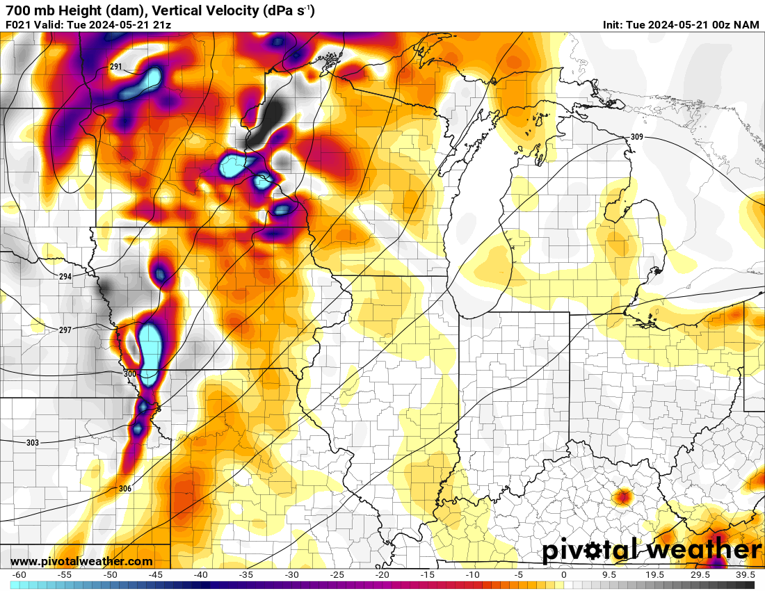
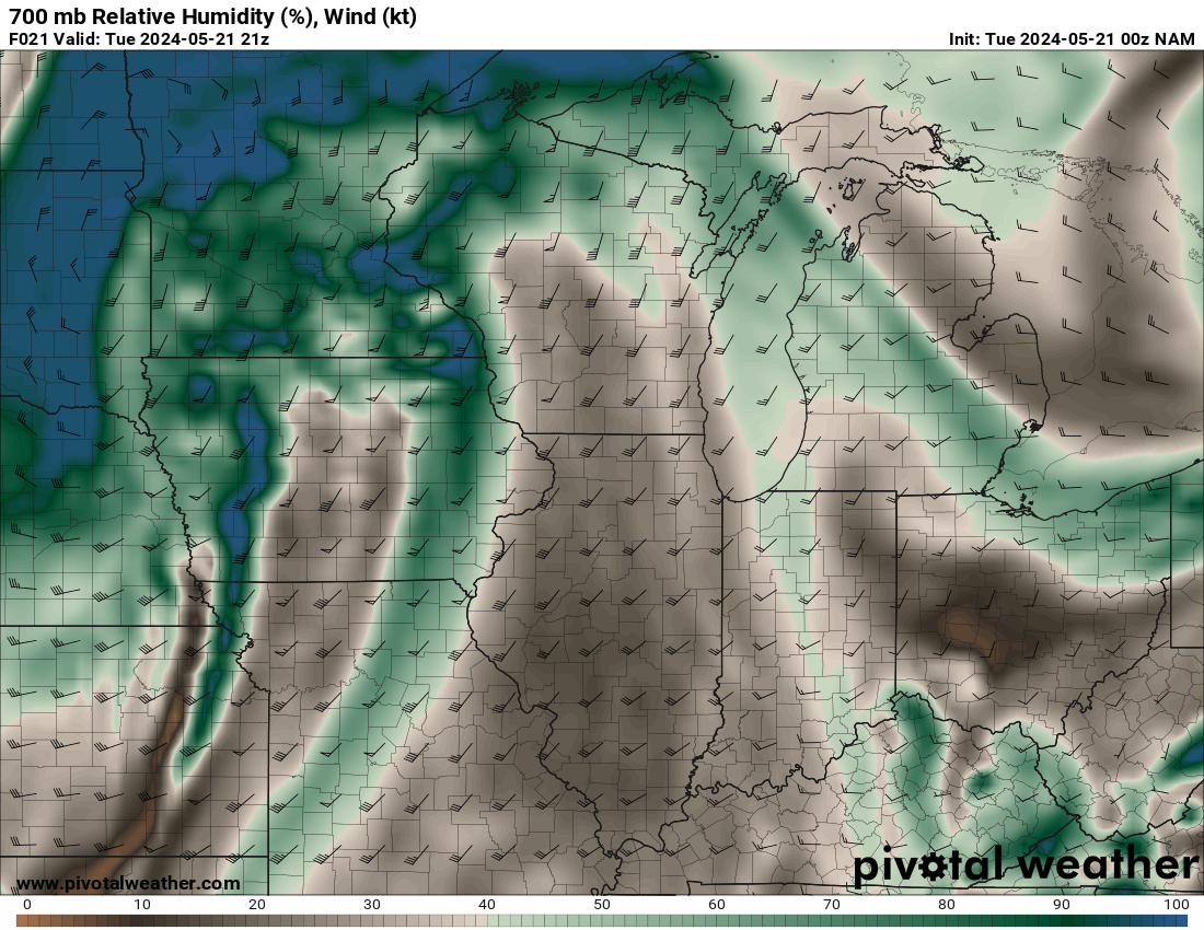
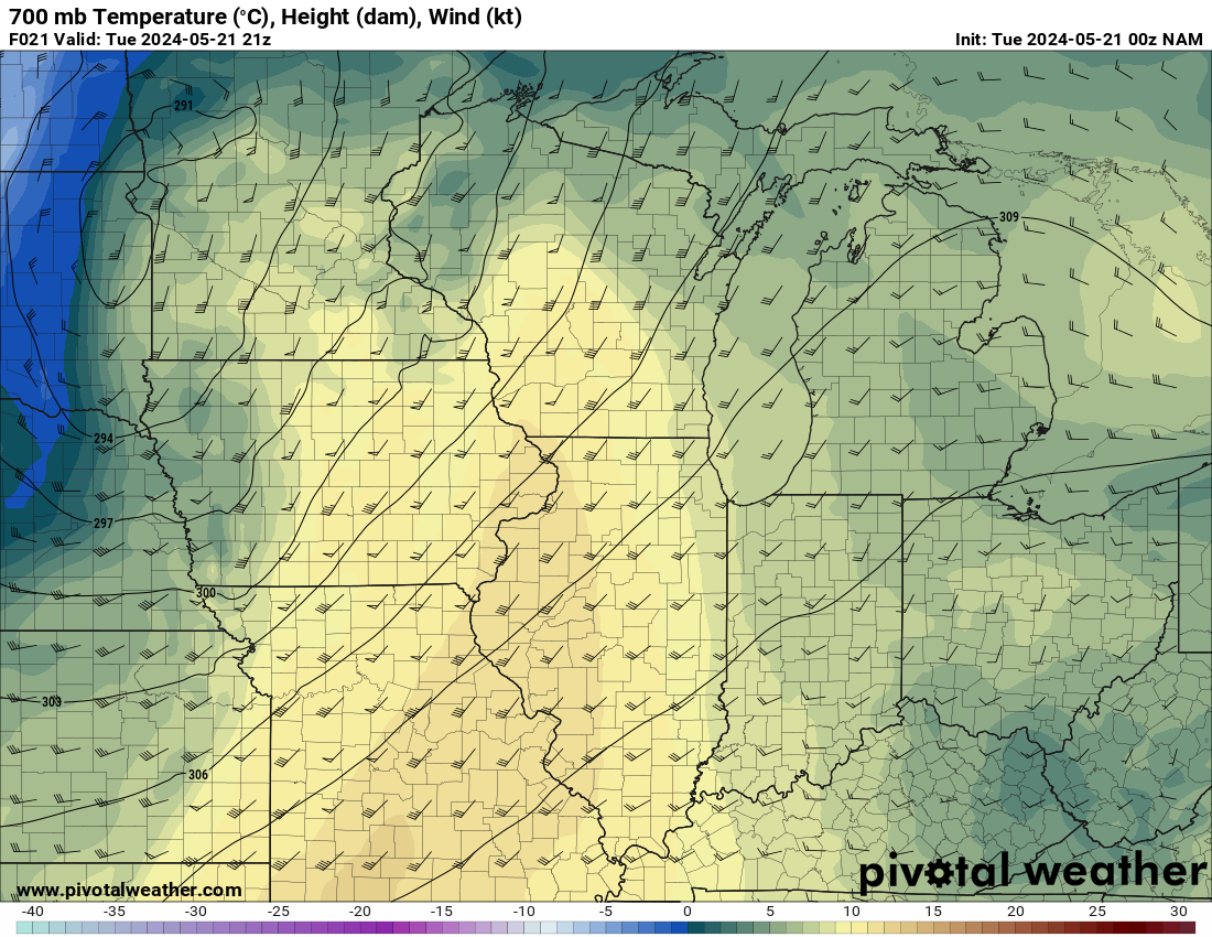
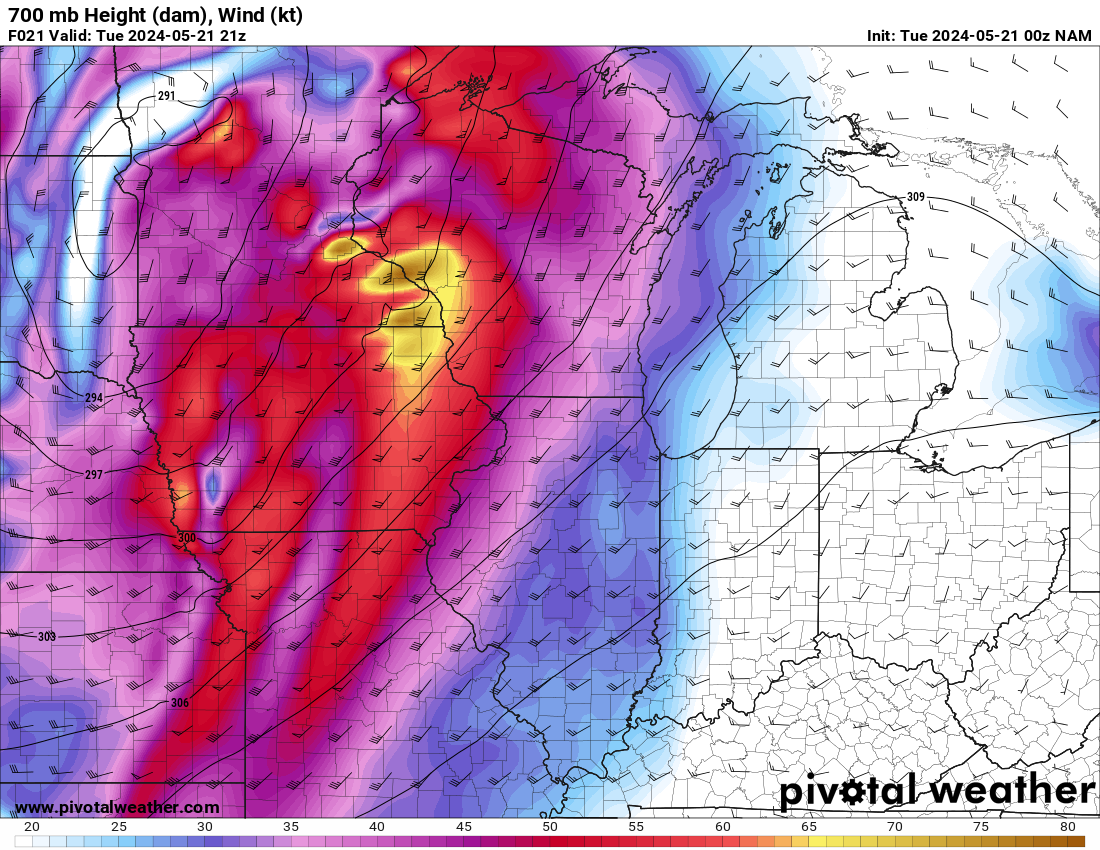
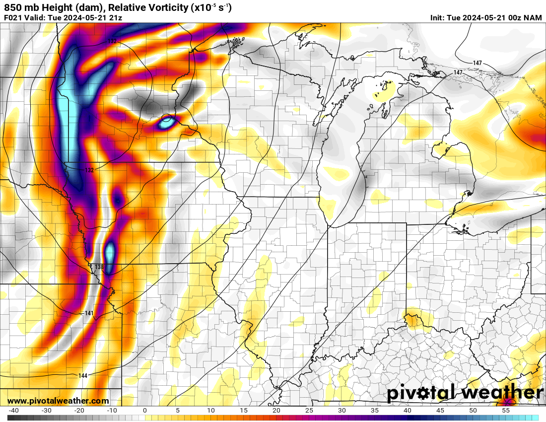
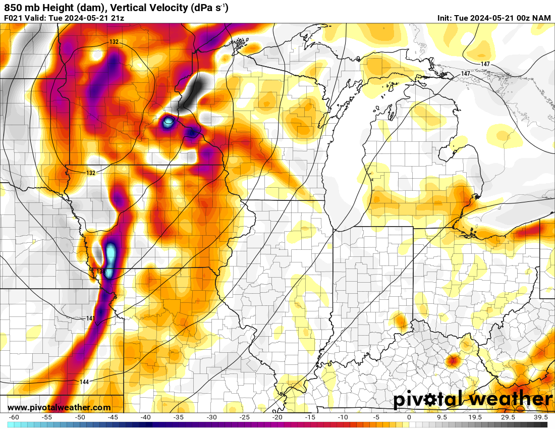
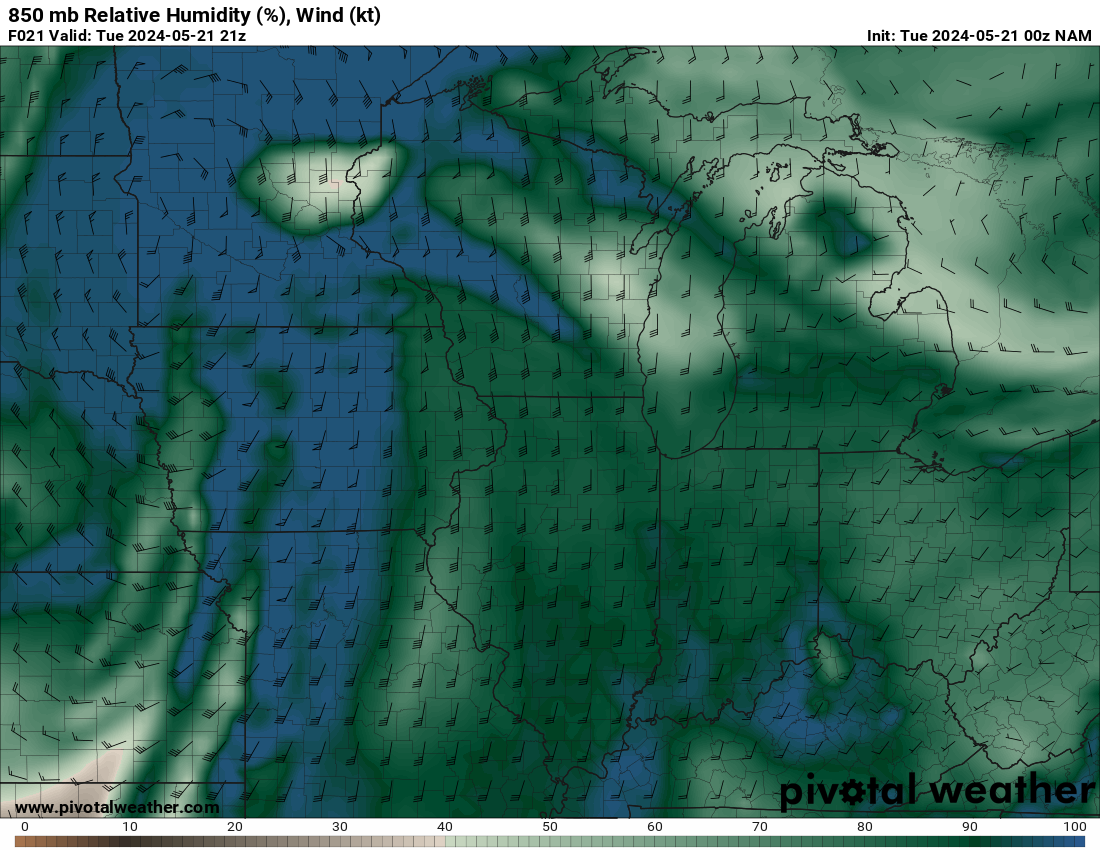
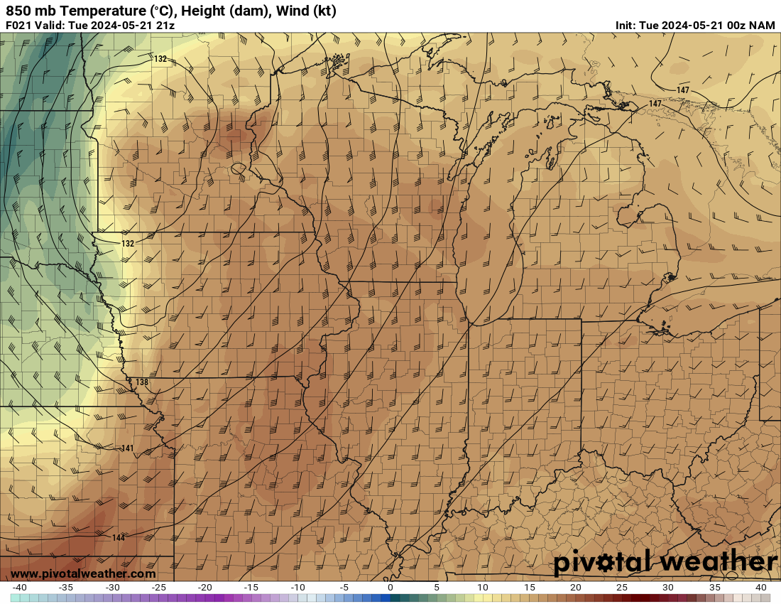
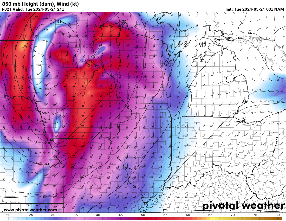
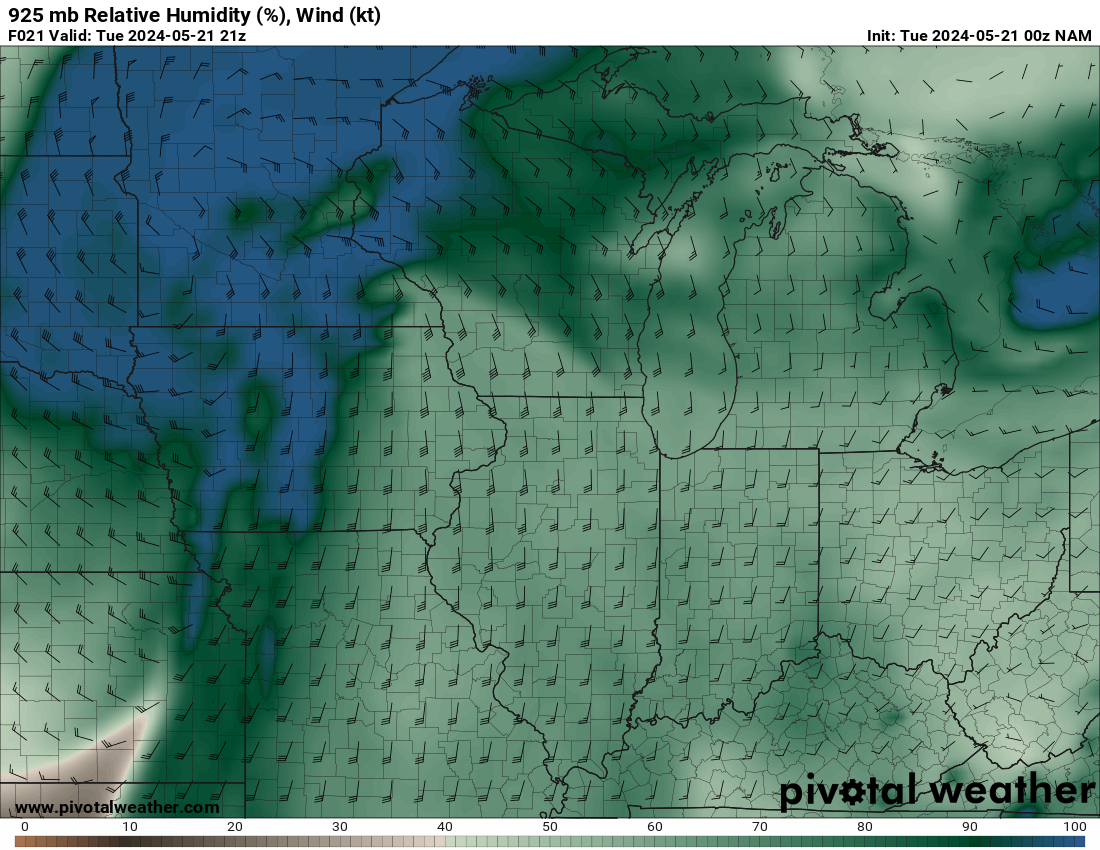
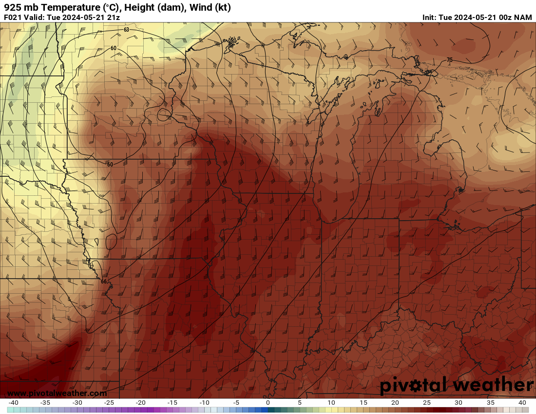
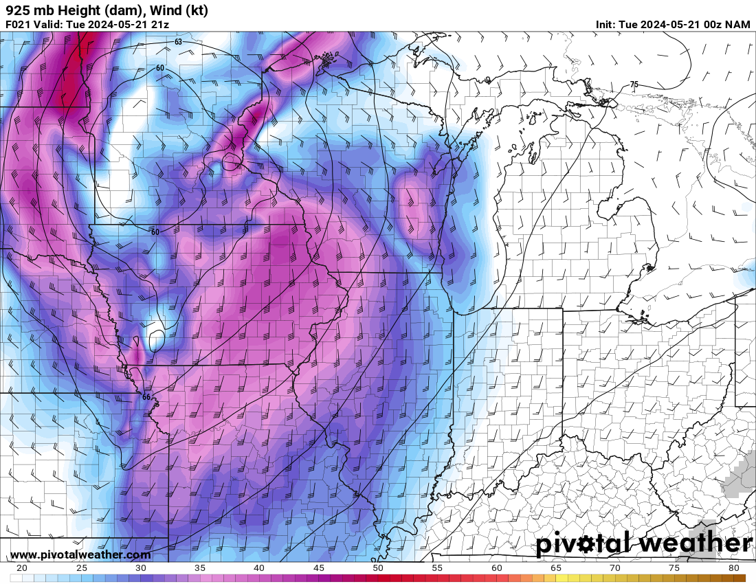
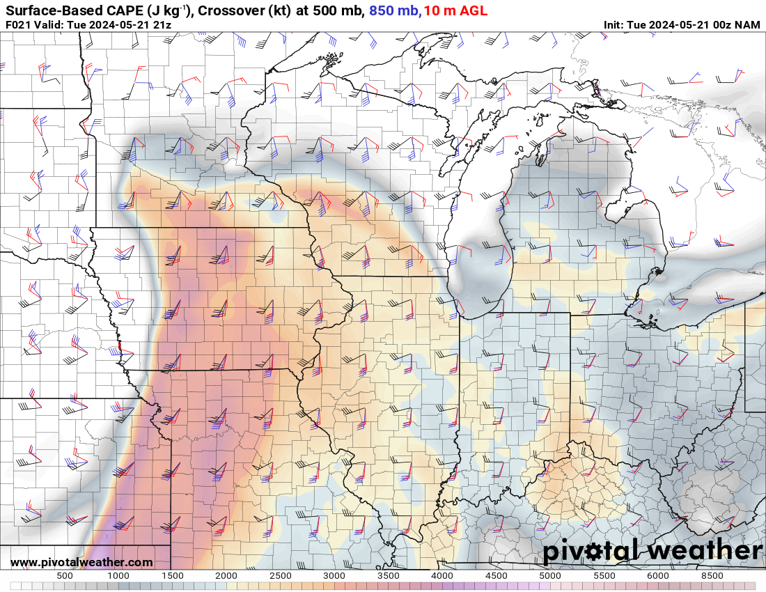
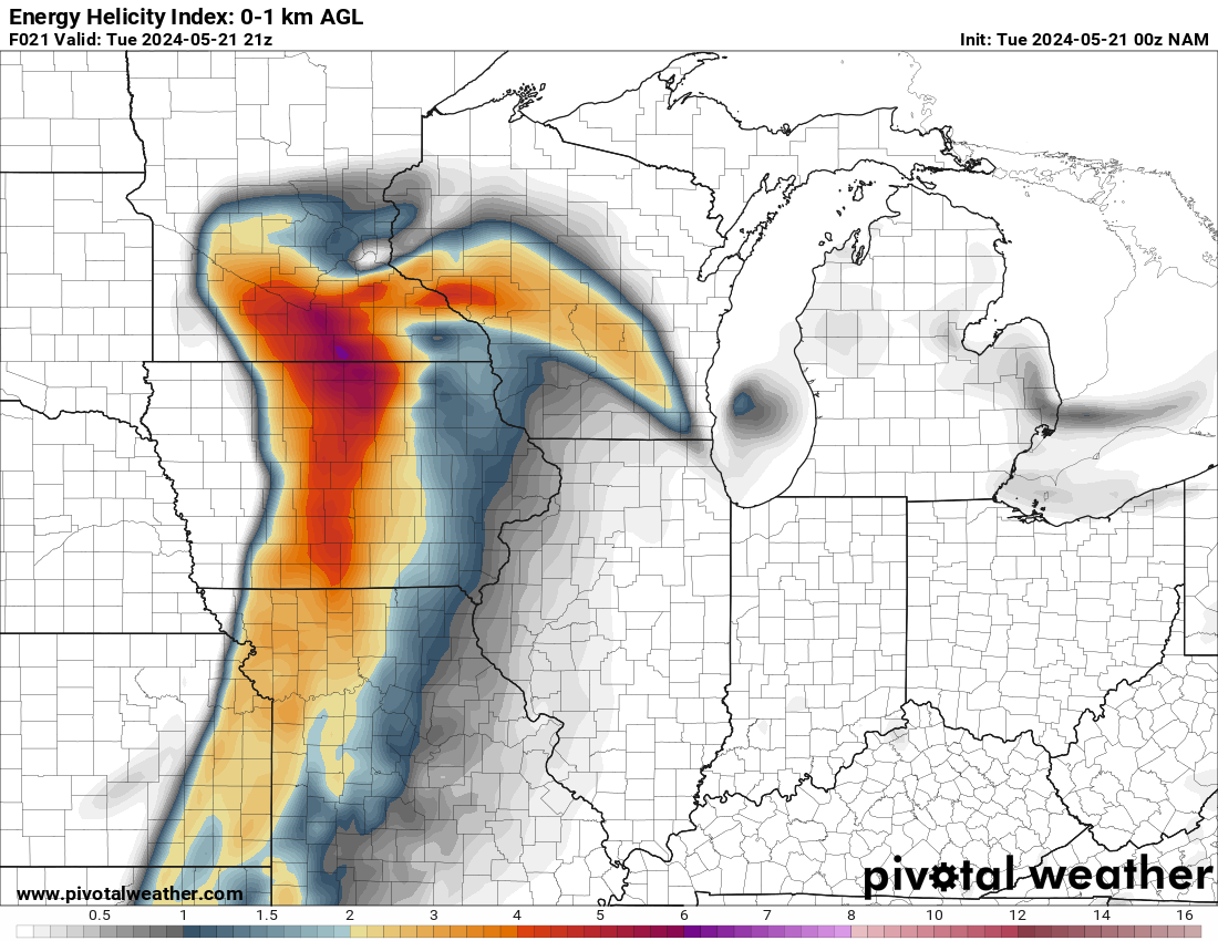
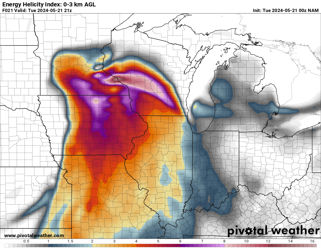
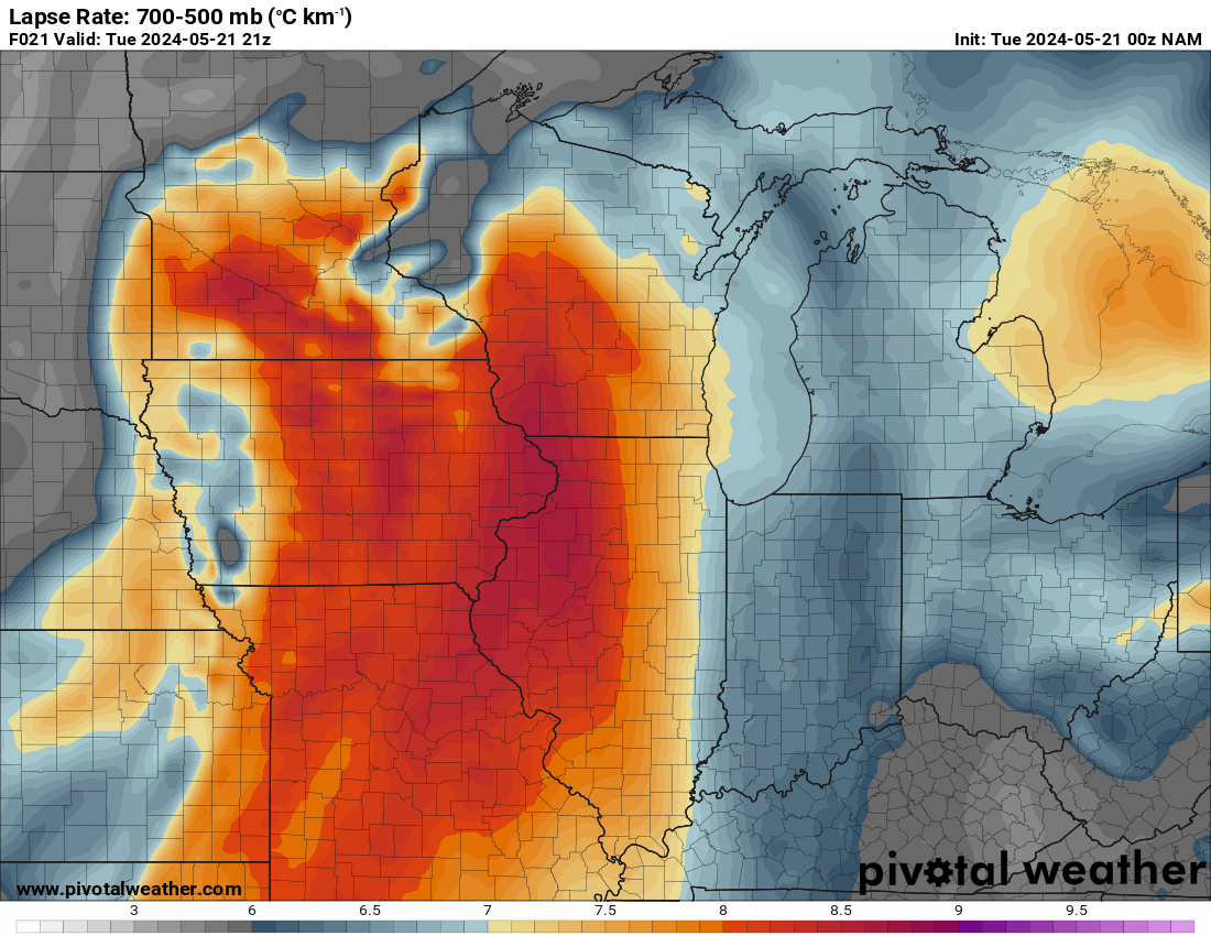
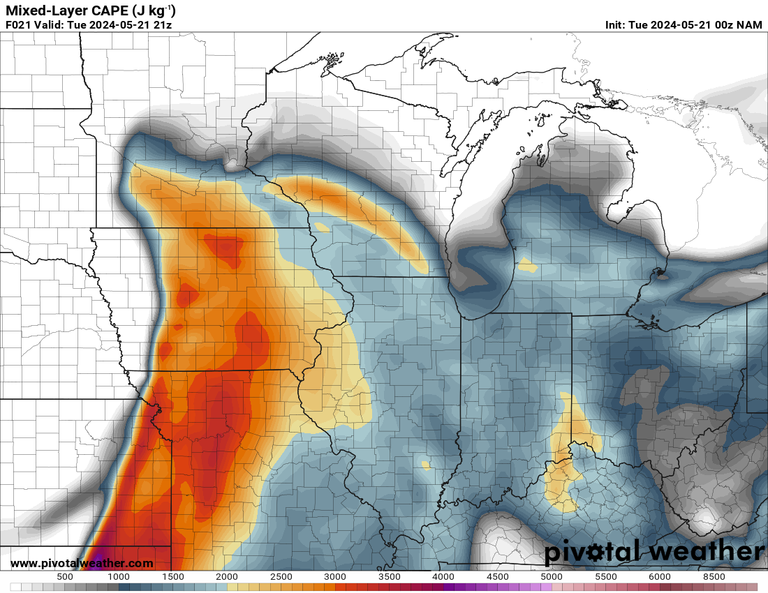
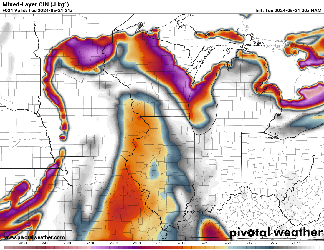
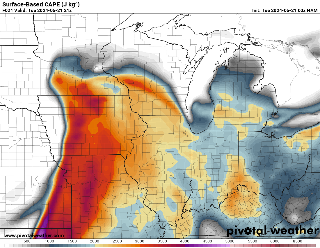
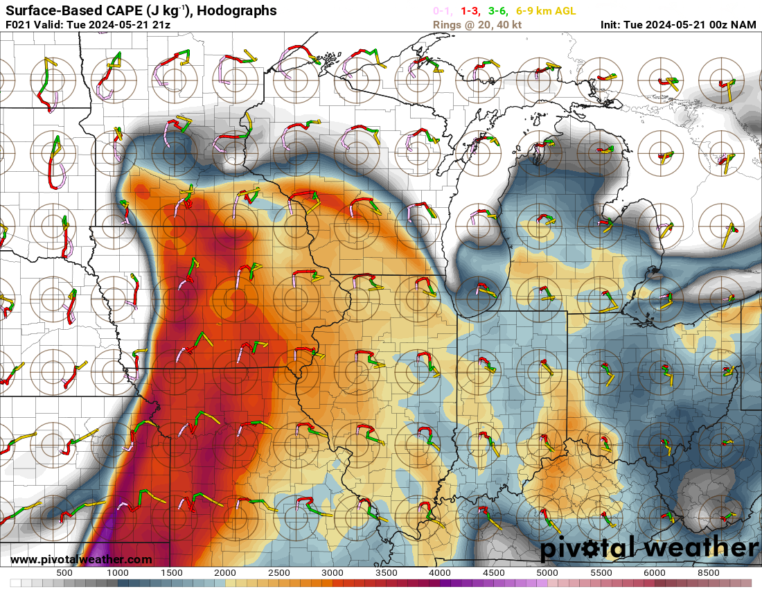
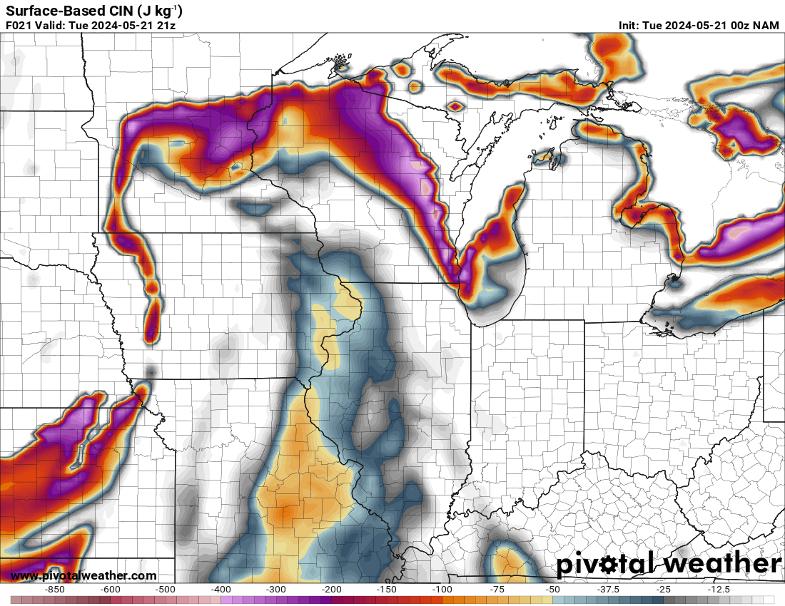
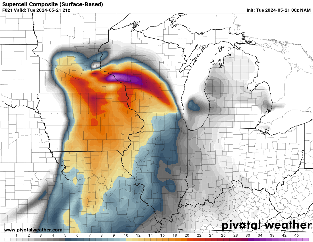
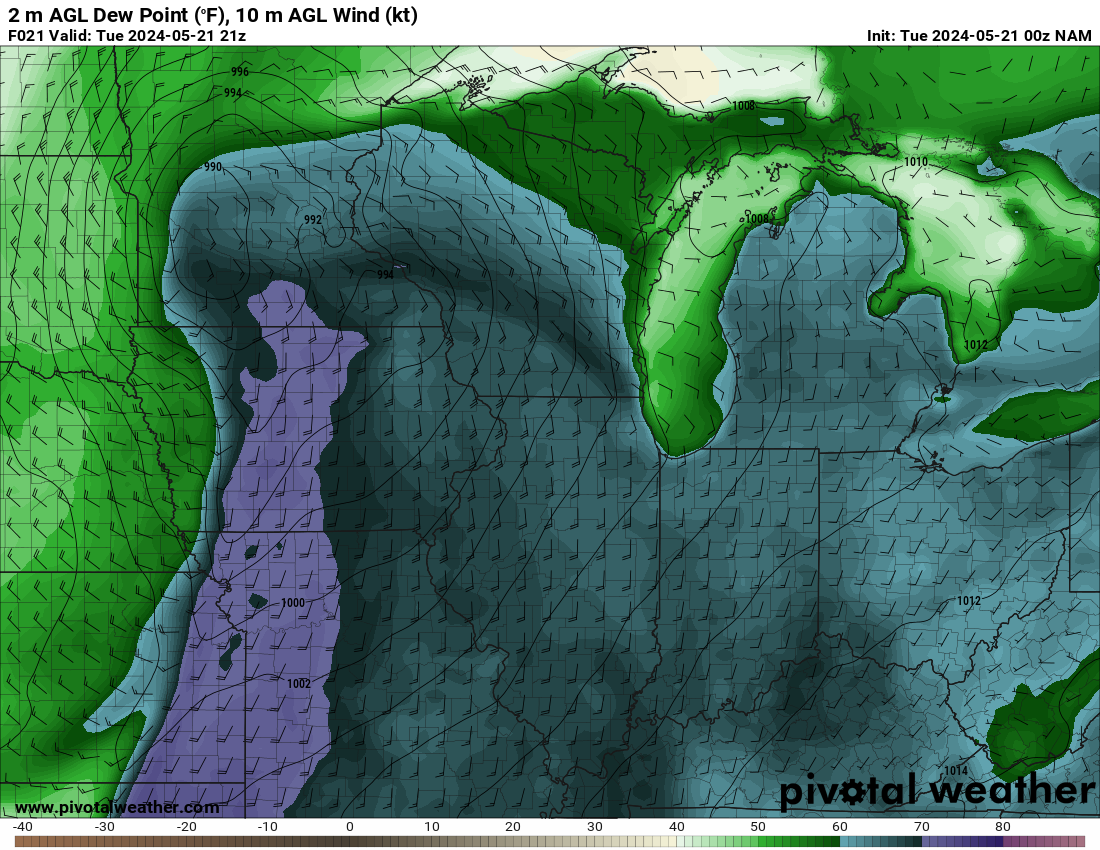
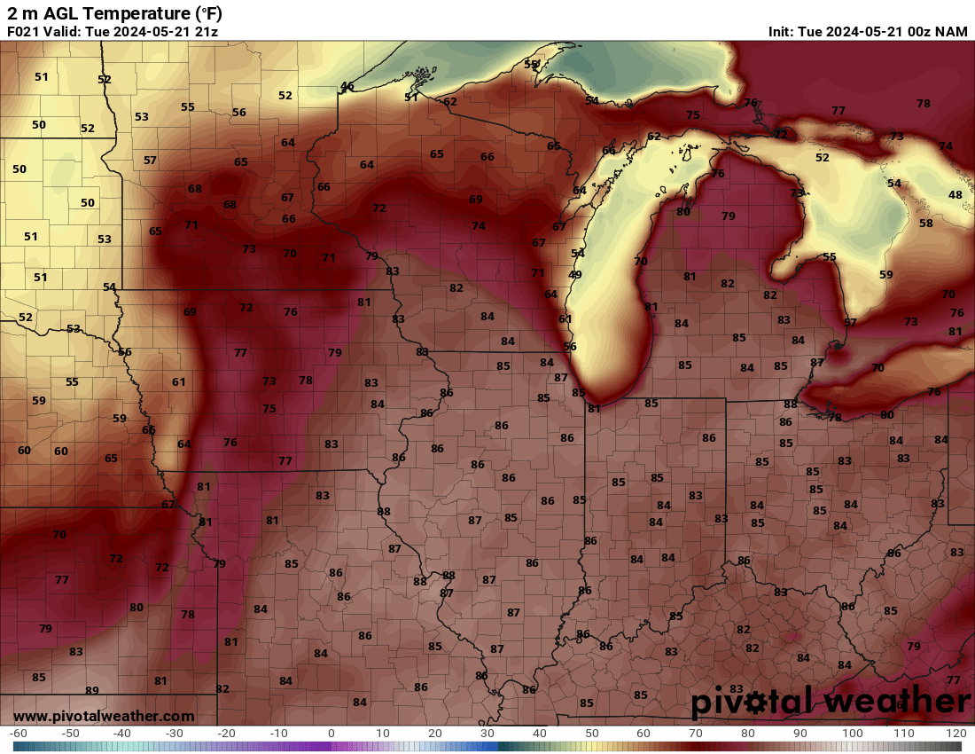
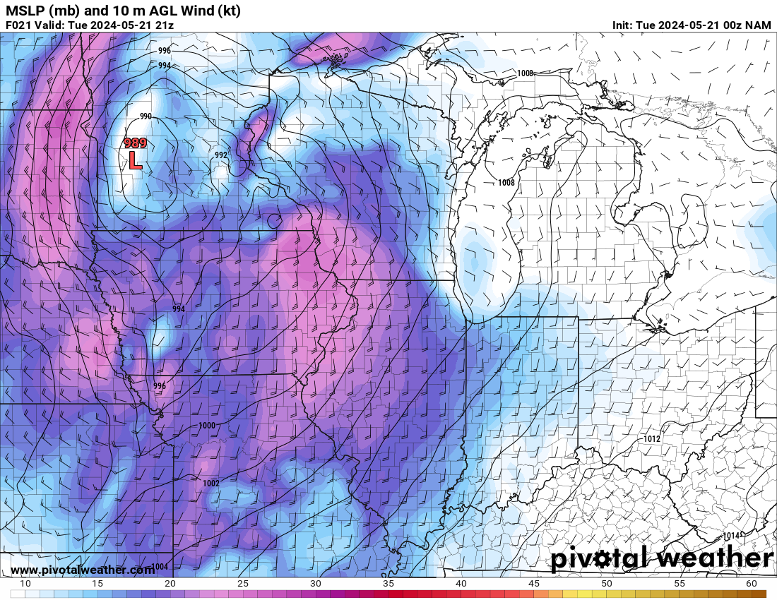
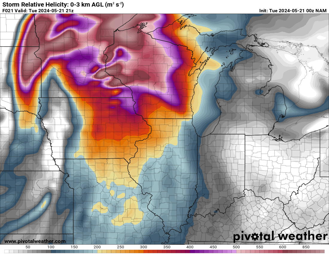
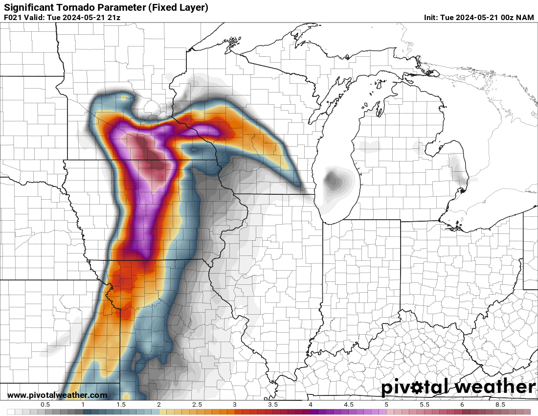
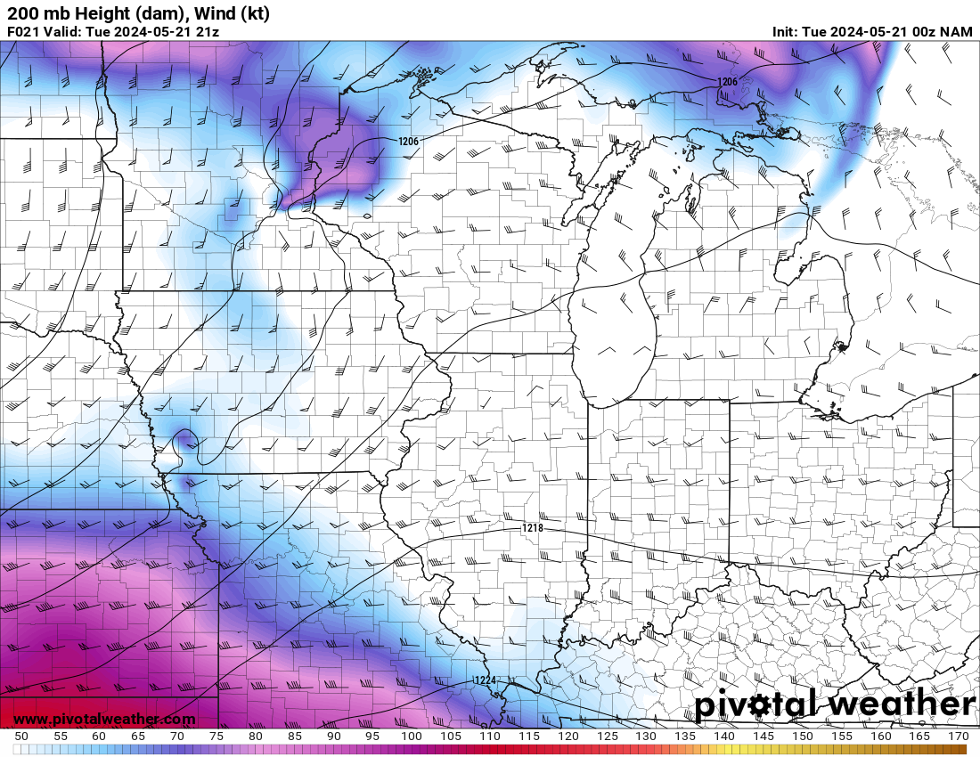
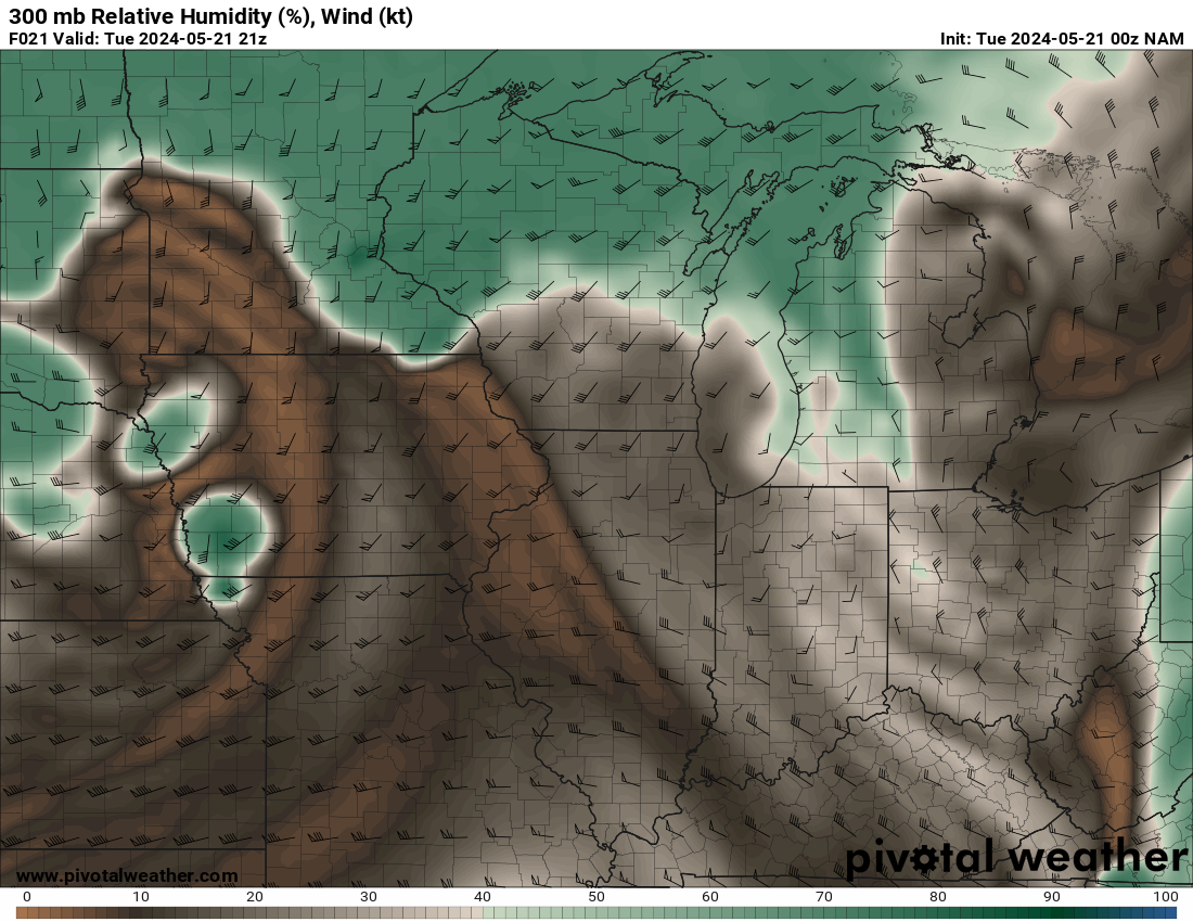
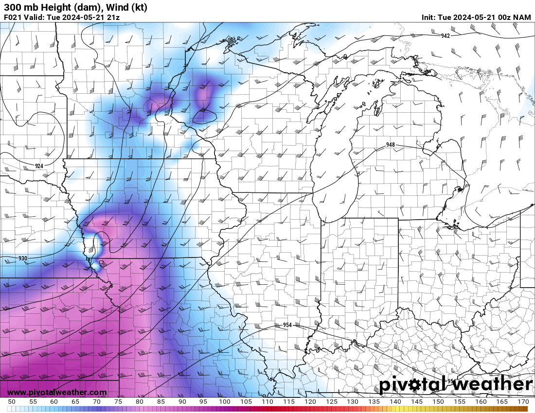
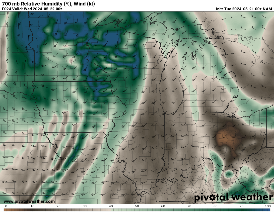
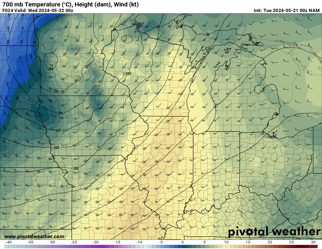
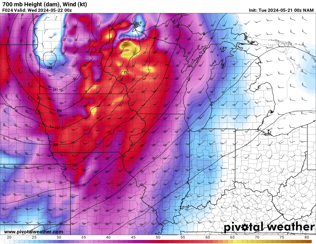
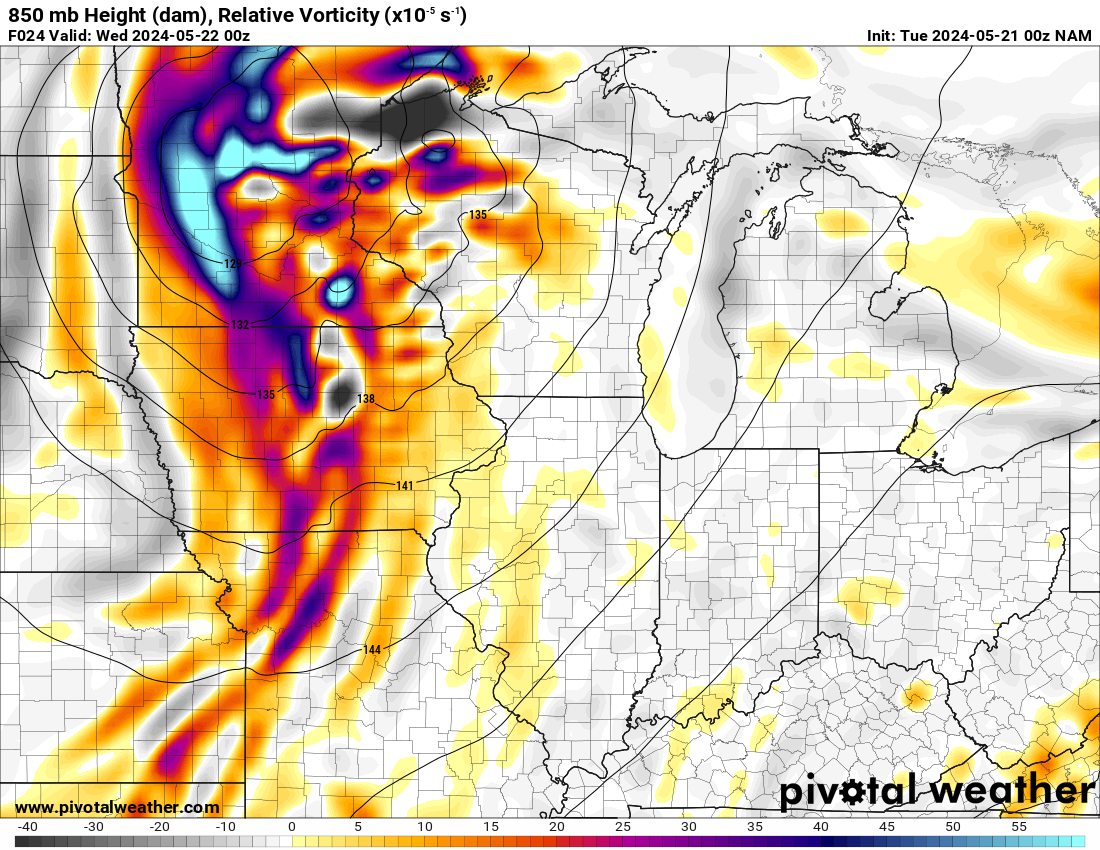
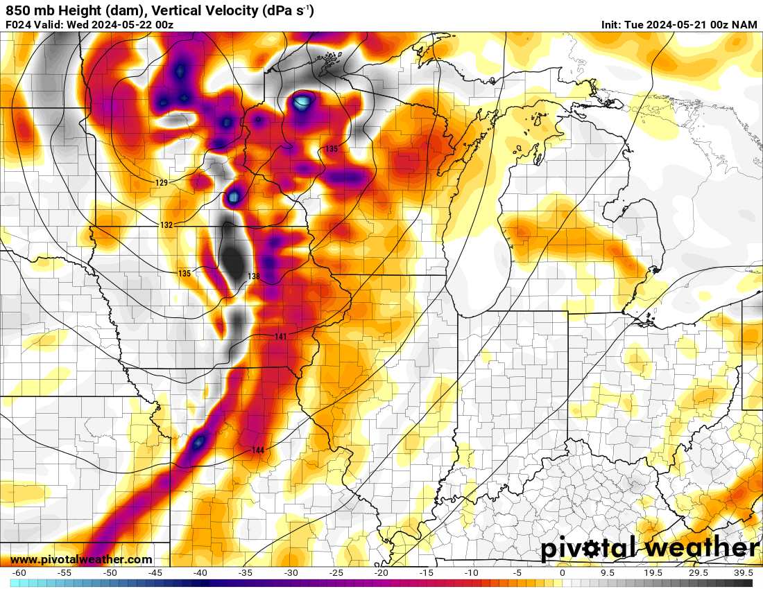
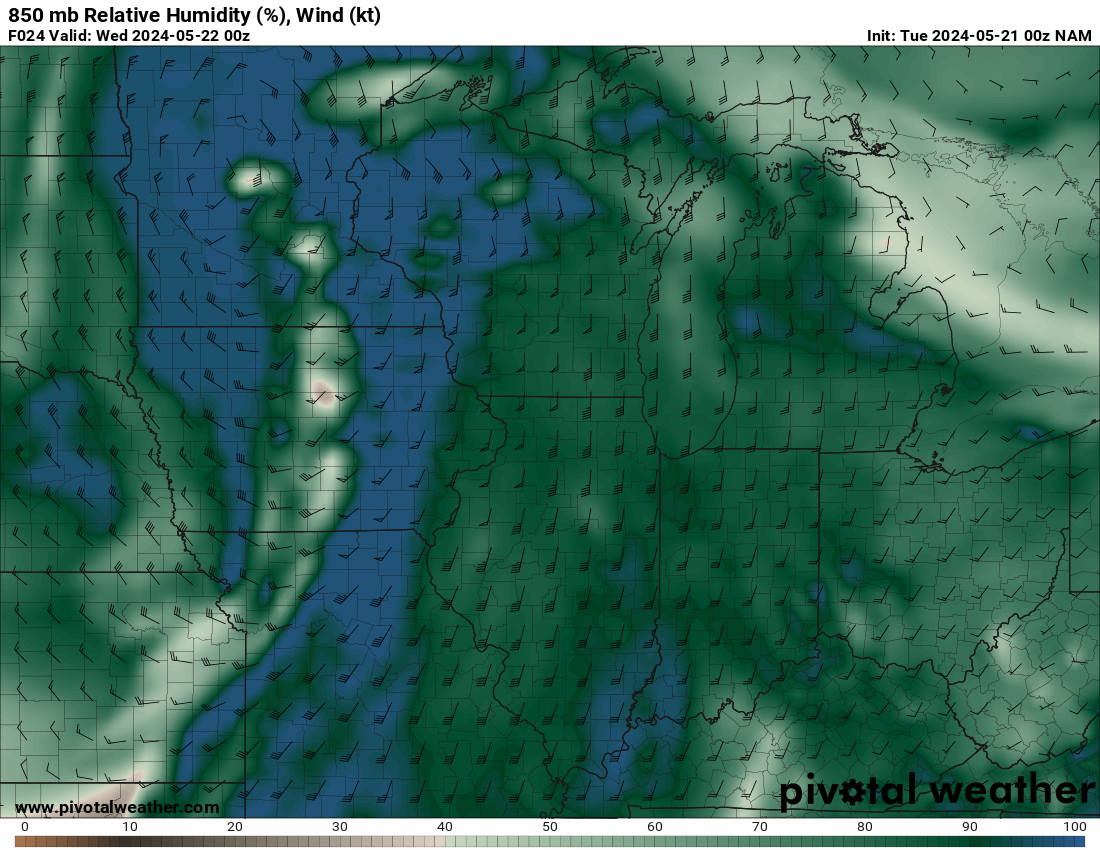
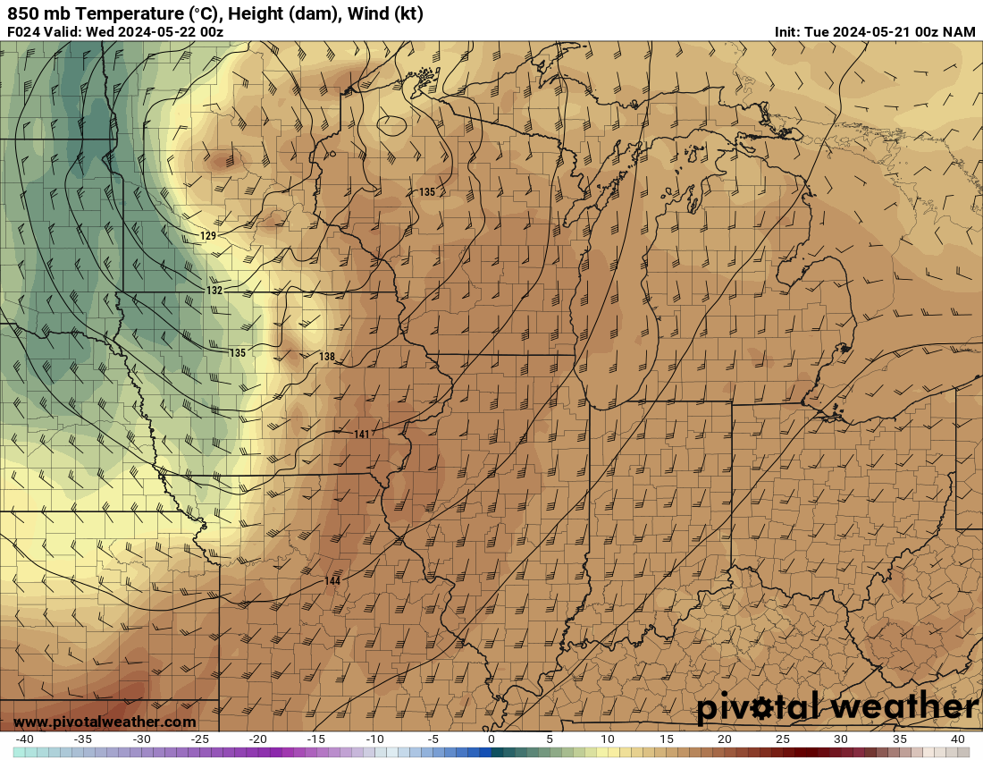
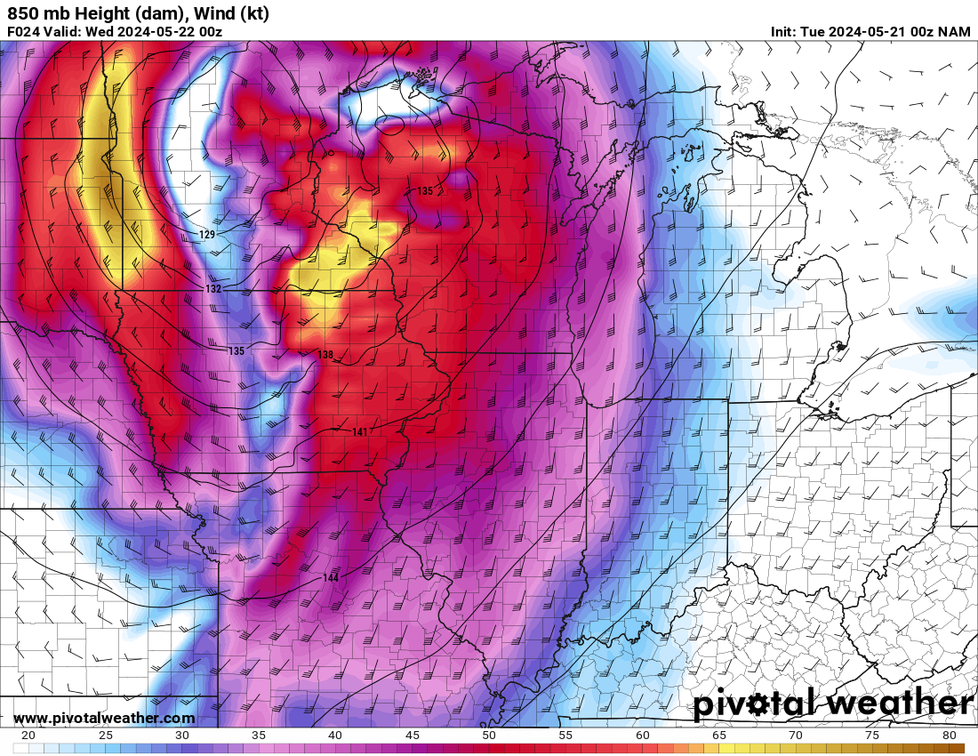
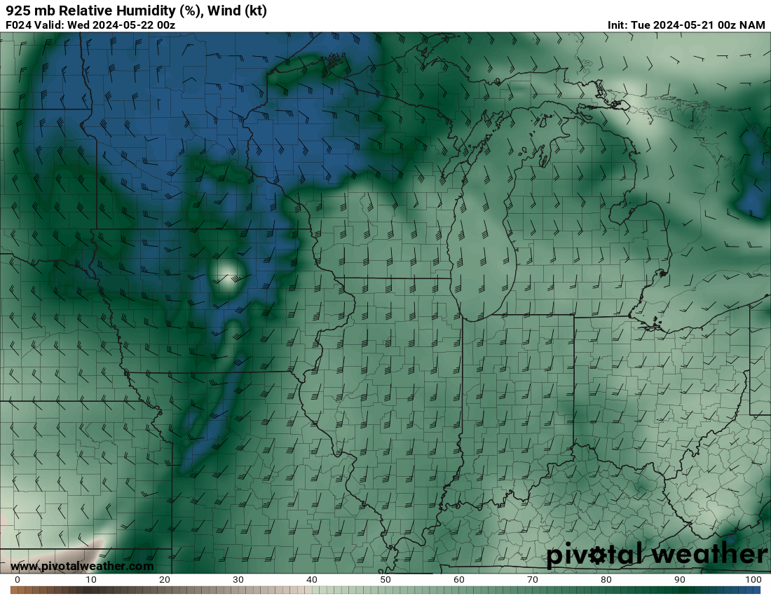
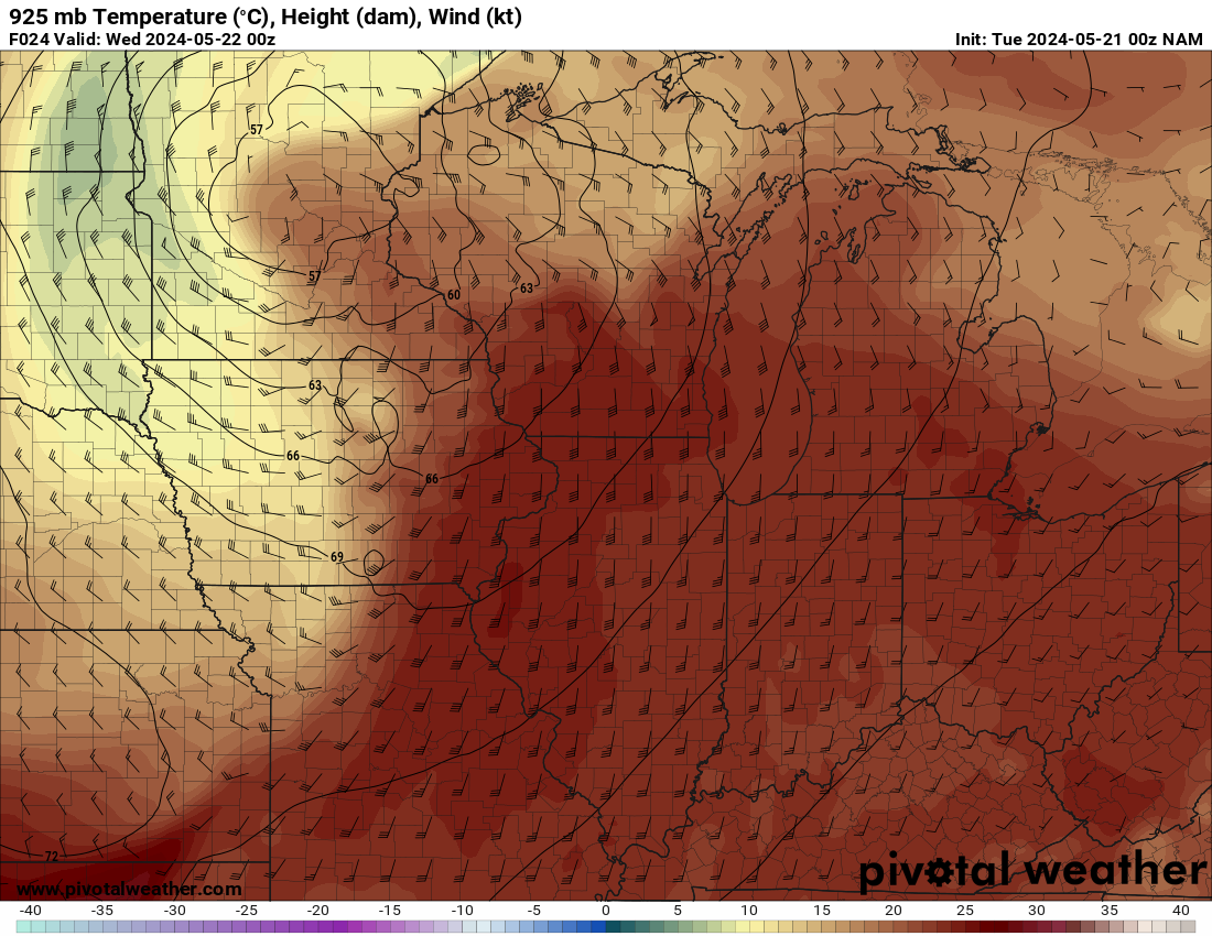
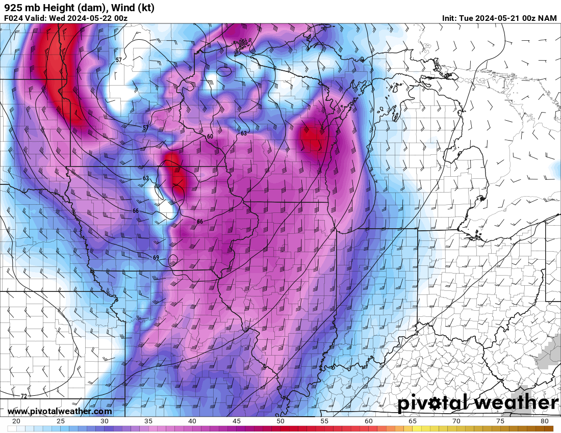
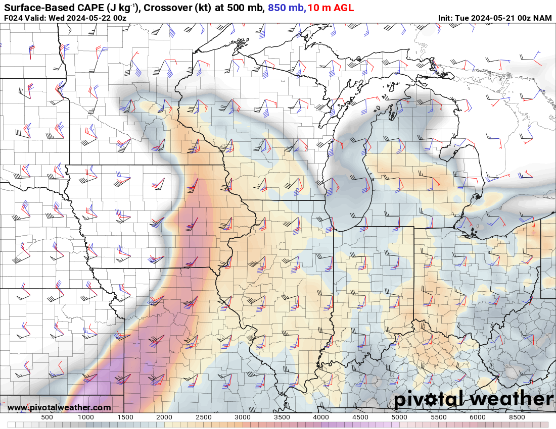
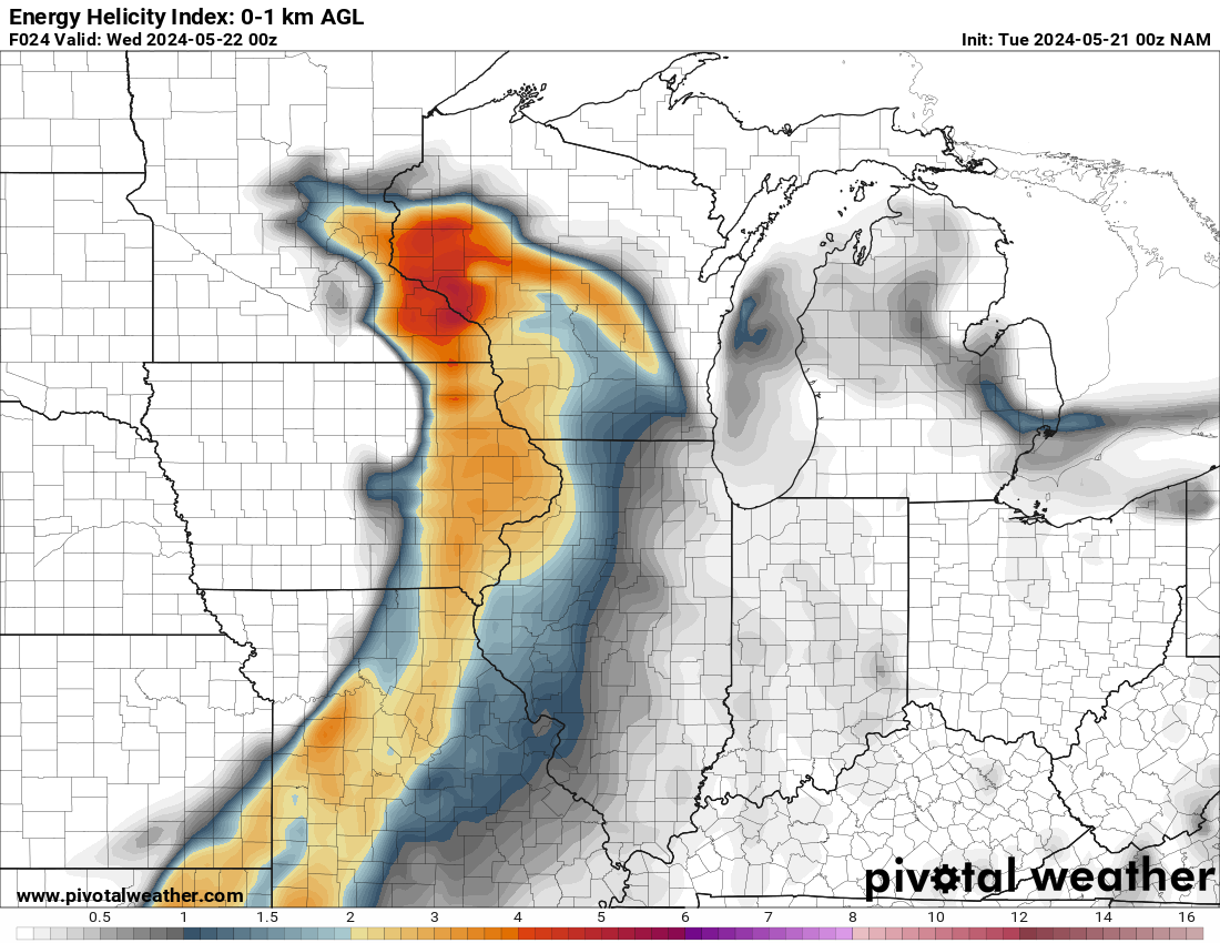
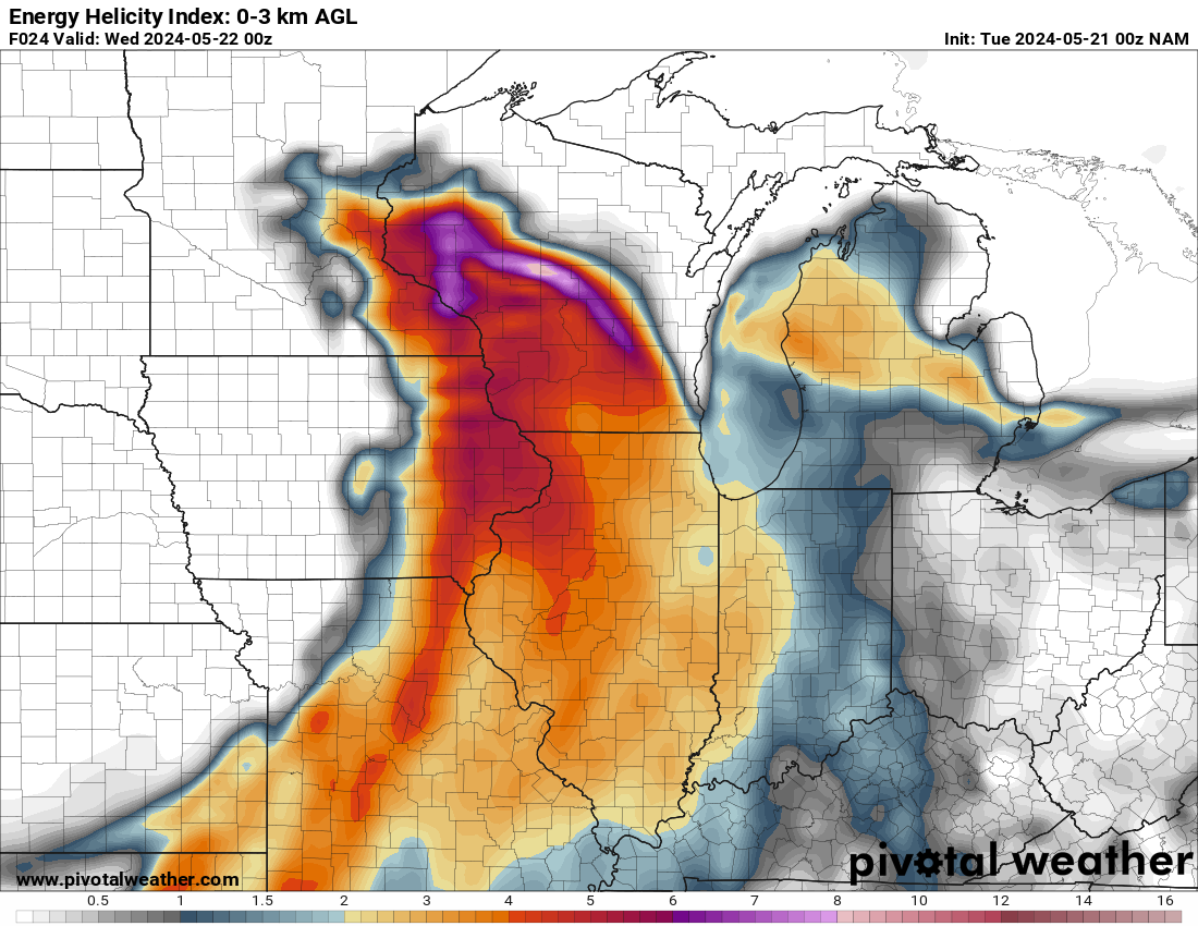
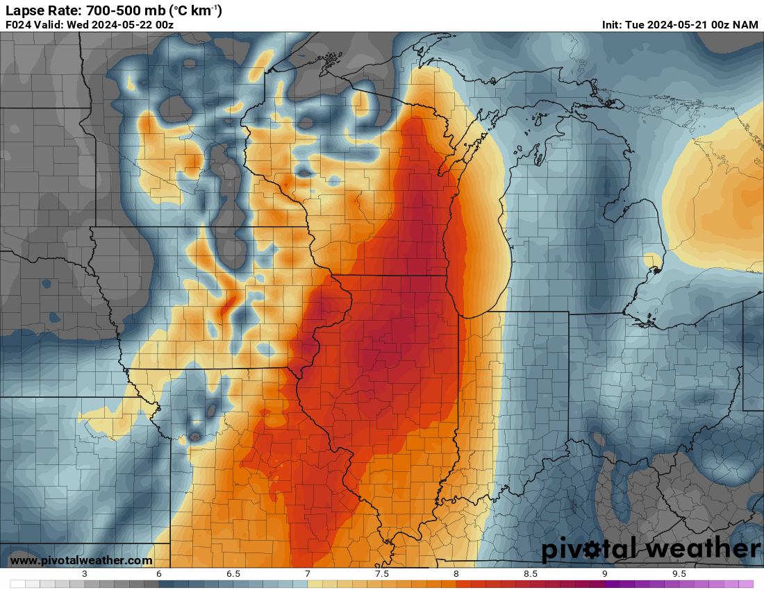
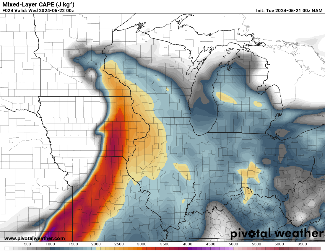
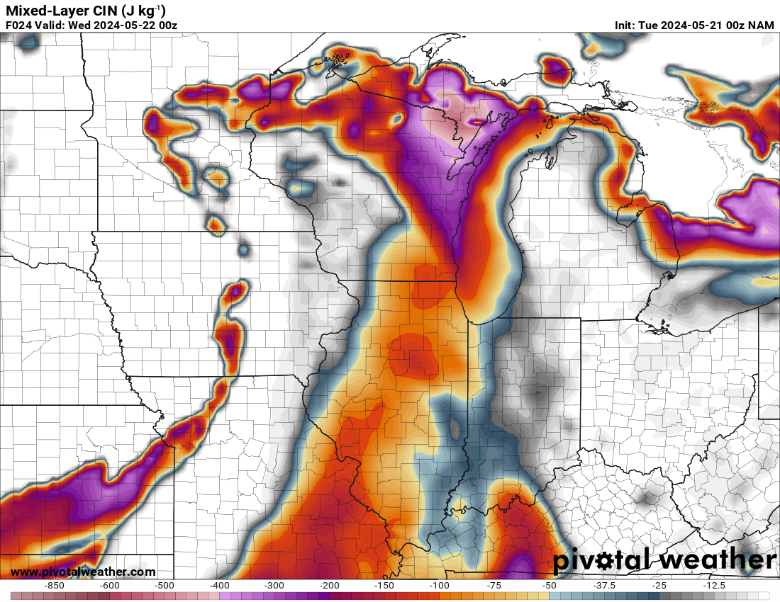
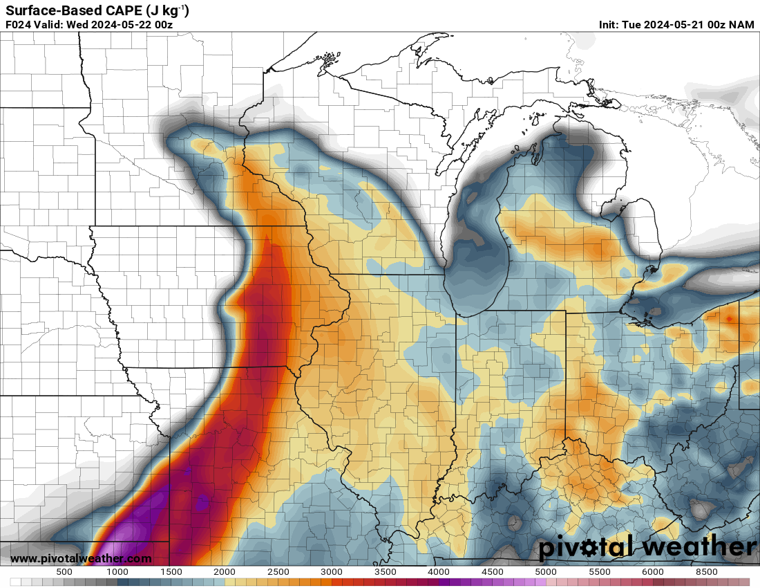
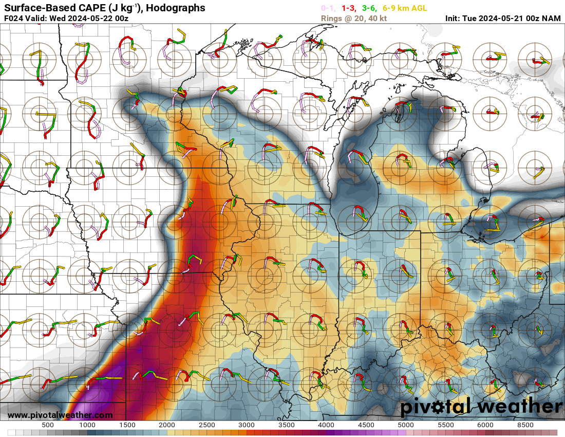
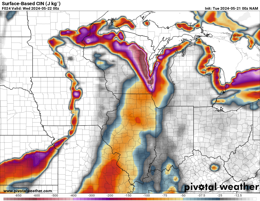
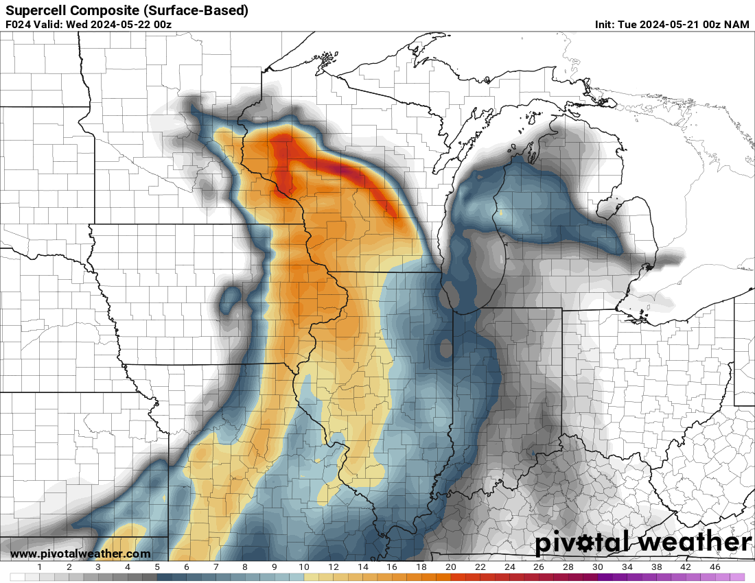
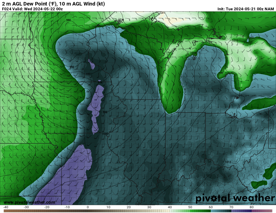
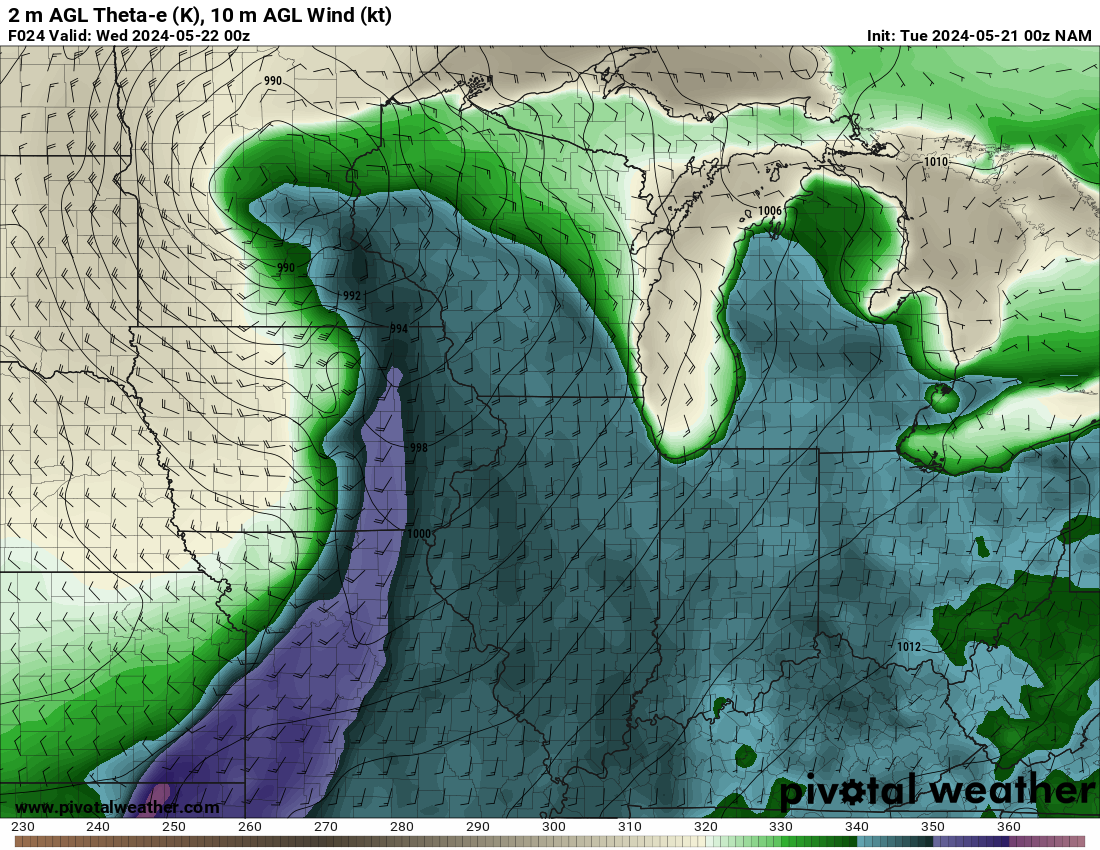
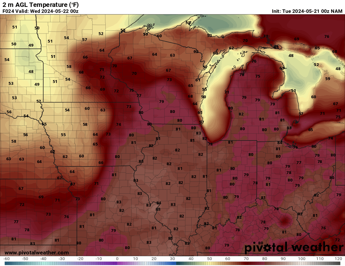
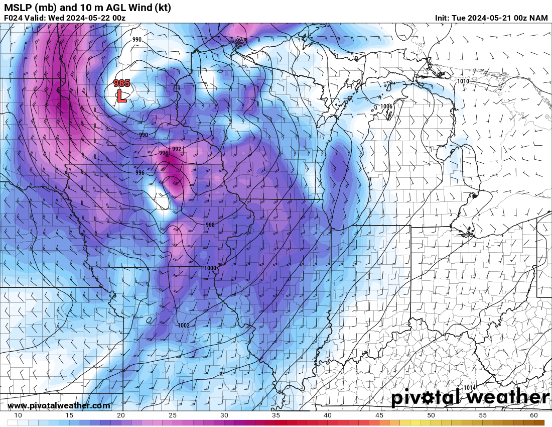
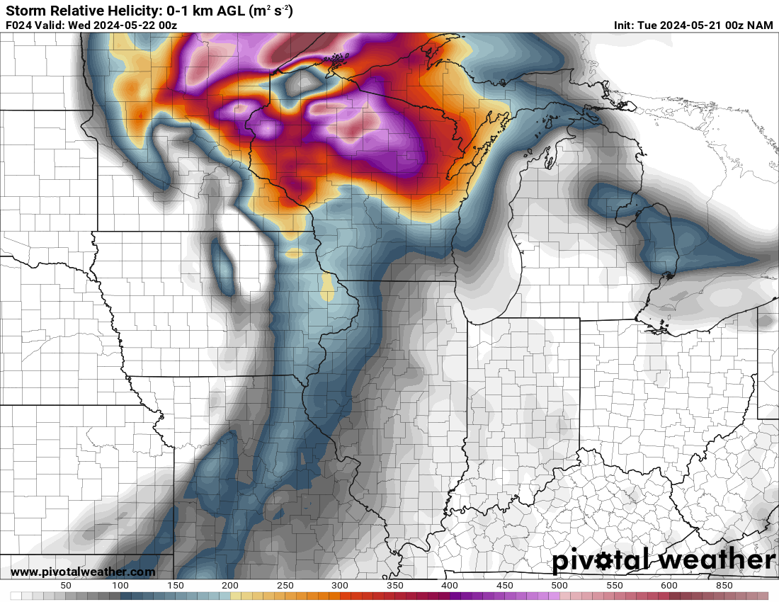
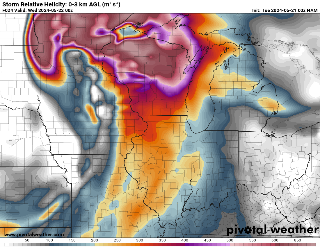
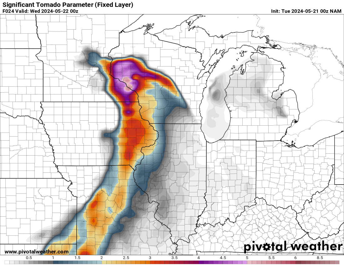
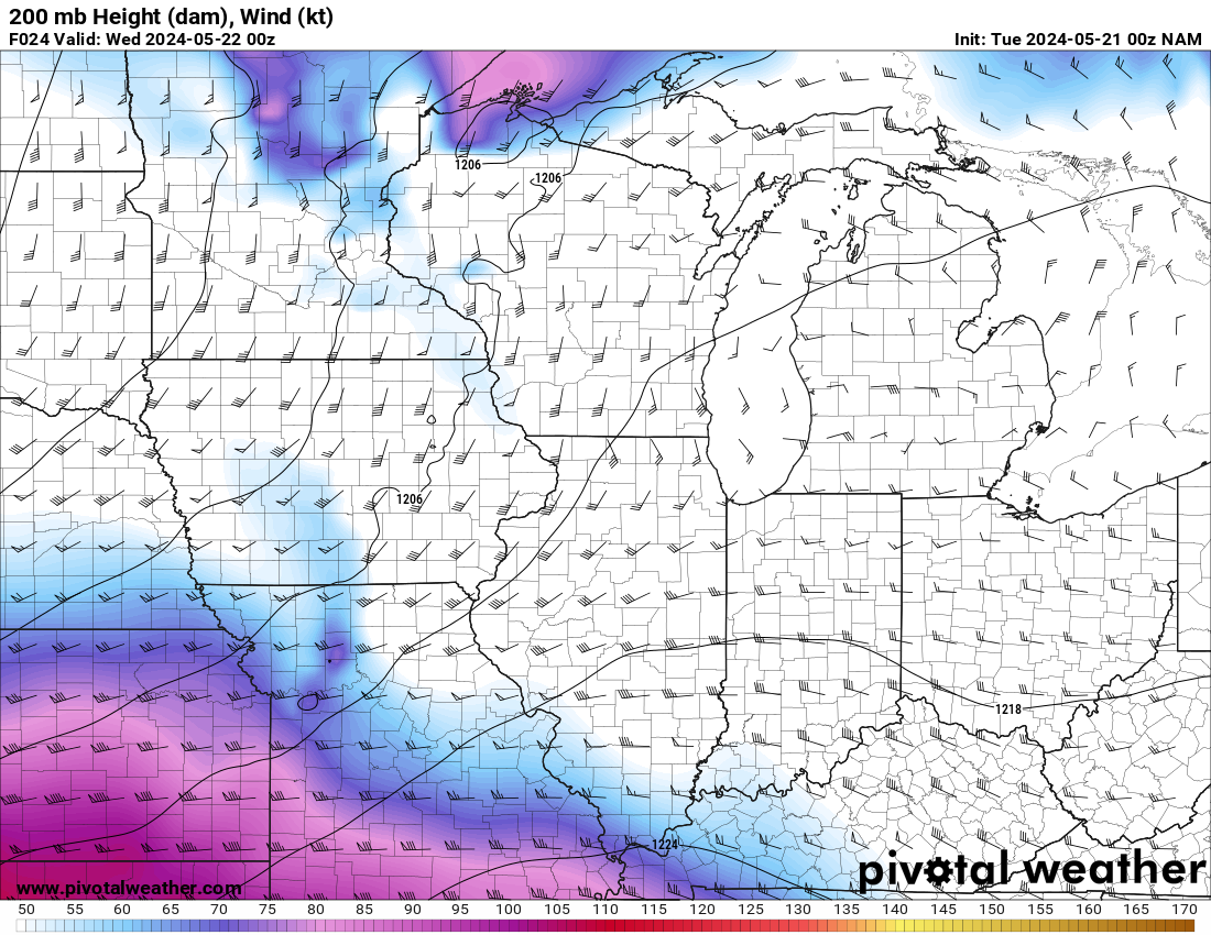
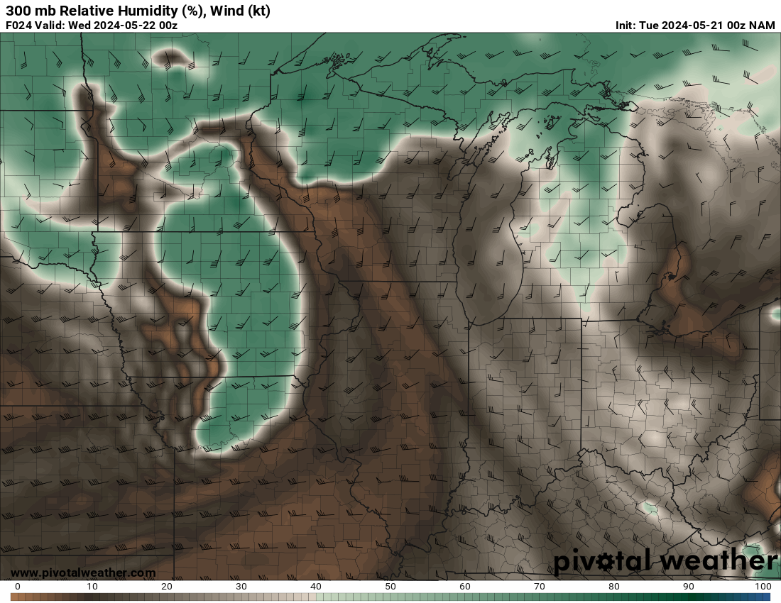
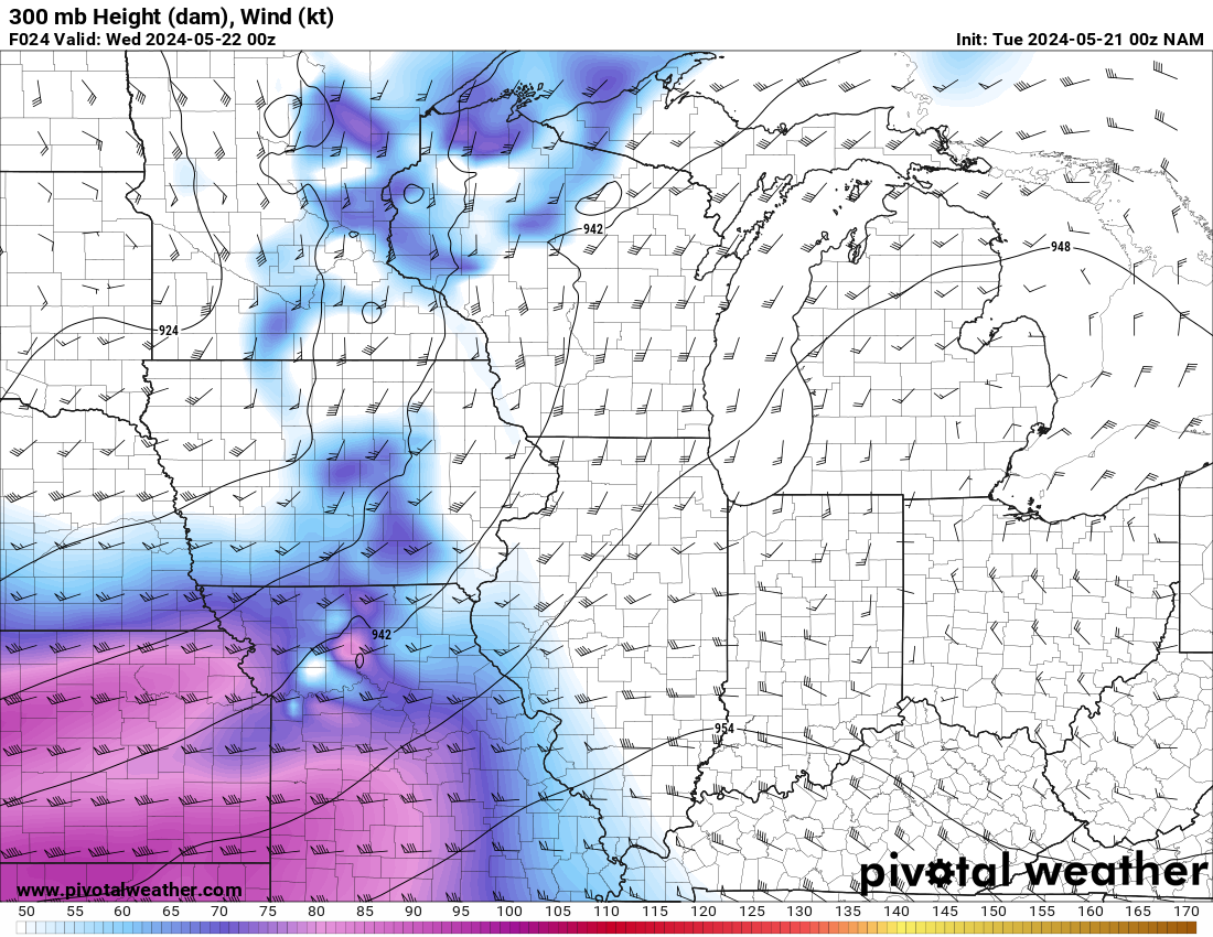
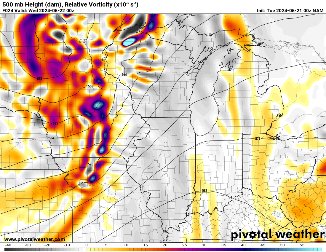
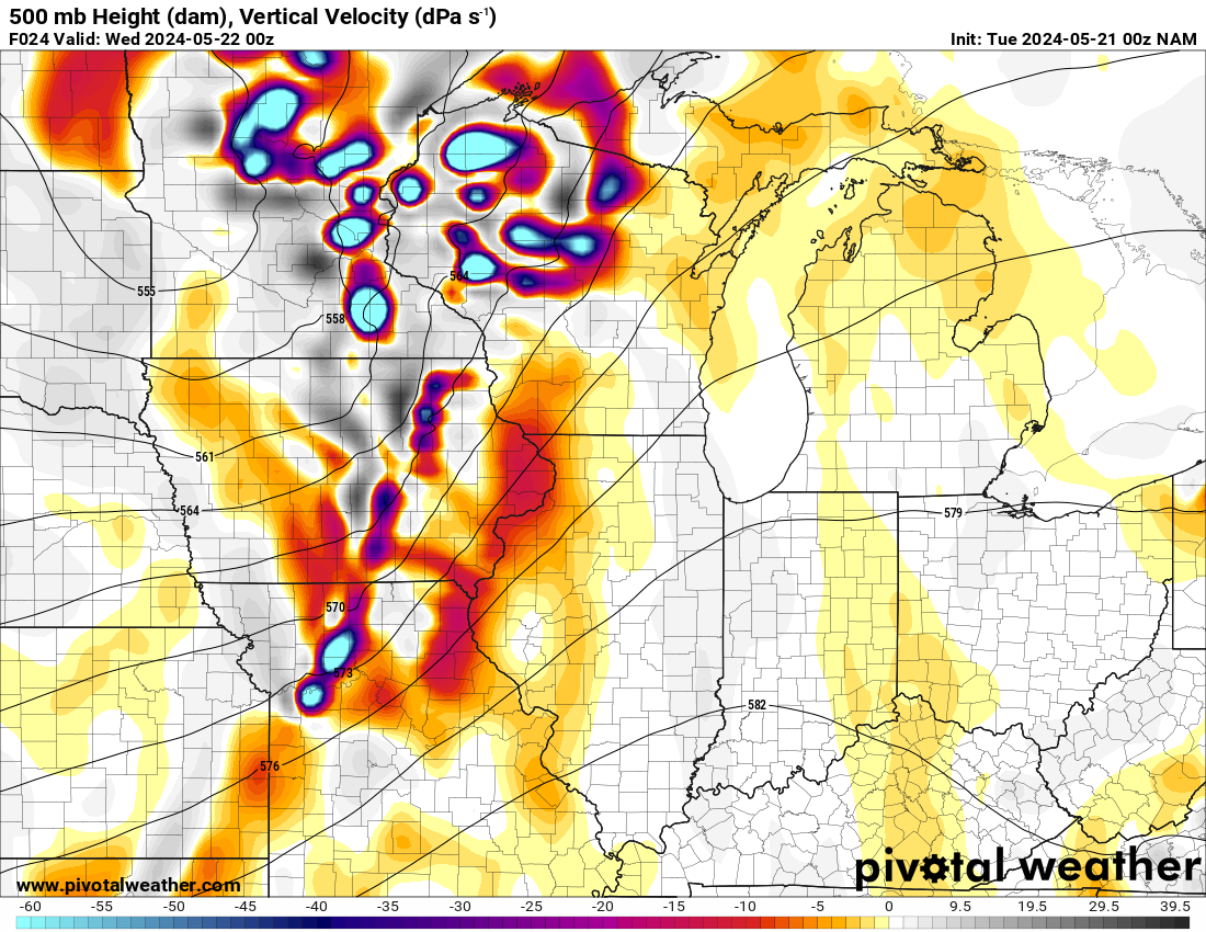
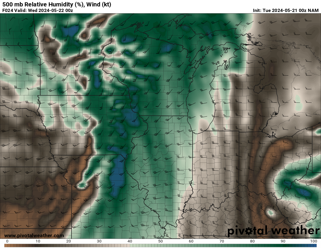
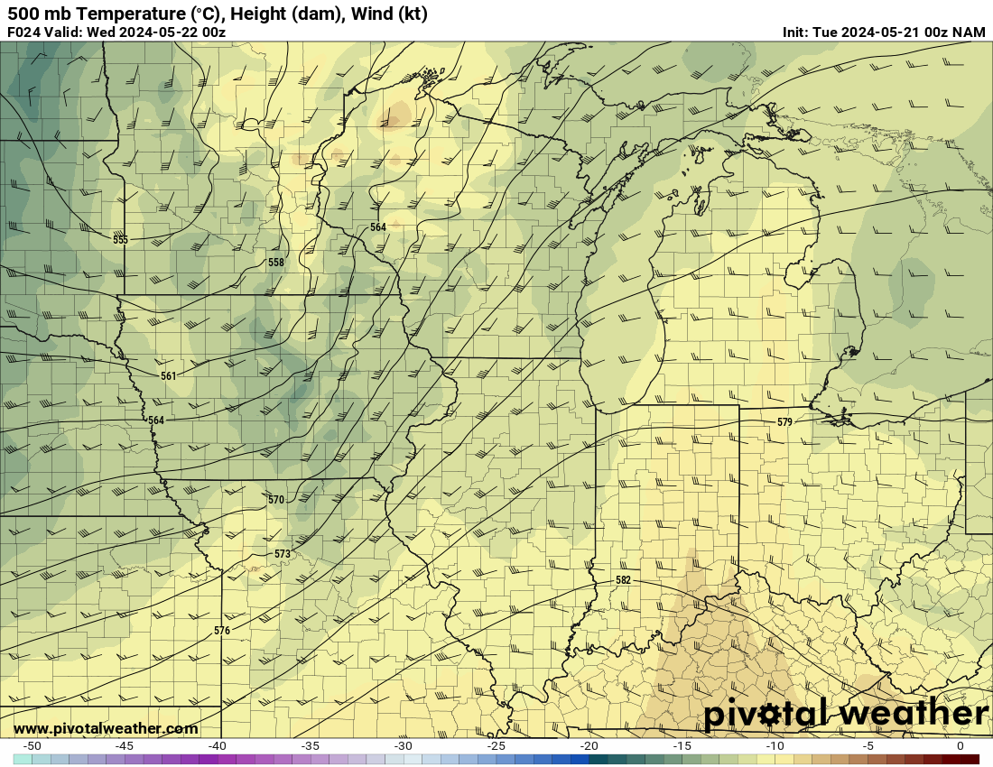
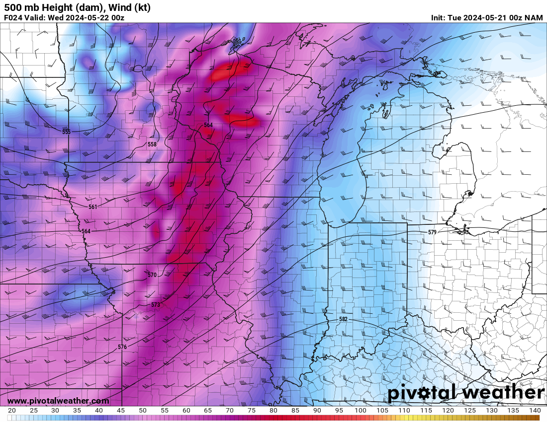
00Z NAM model from Monday evening


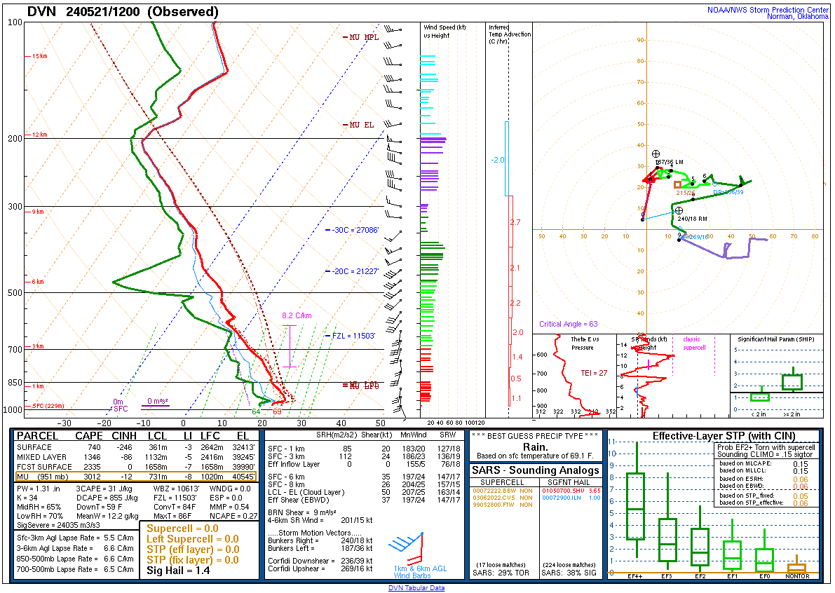
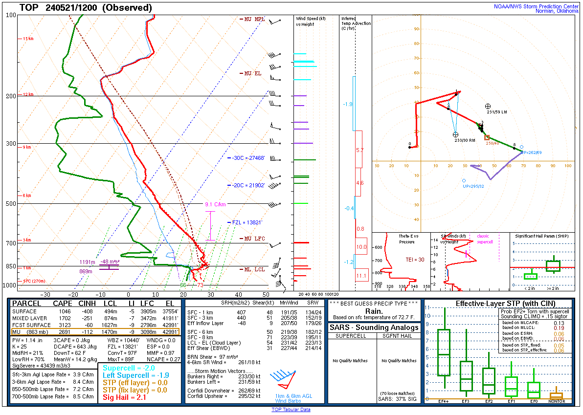
12z Morning Soundings
I woke up in KC Metro and knew I’d still have to go north. Unfortunately the hope of northwest Missouri would probably not pan out, but the positive is that I’d be in the Southwest part of Iowa. I headed north on I-29 to US71 northbound. I made it up to Villisca and hung out on US34. I headed west to Red Oak and filled up my gas tank.
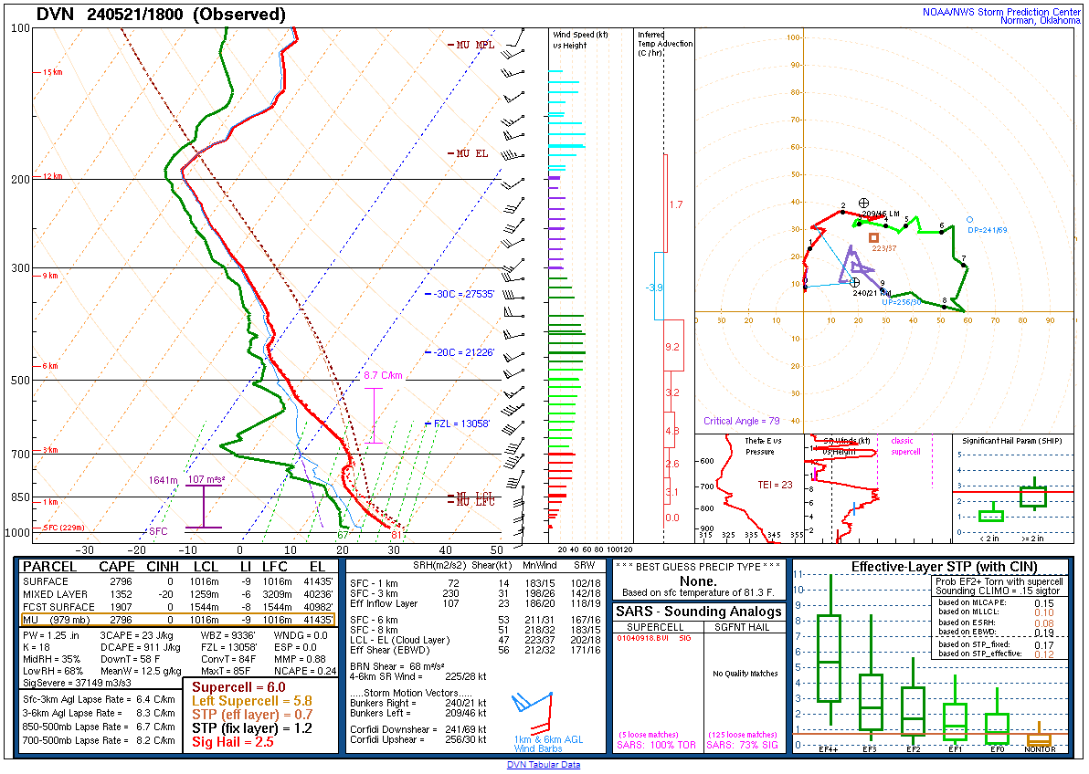
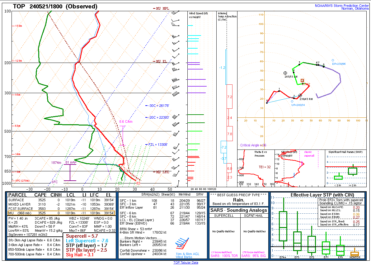
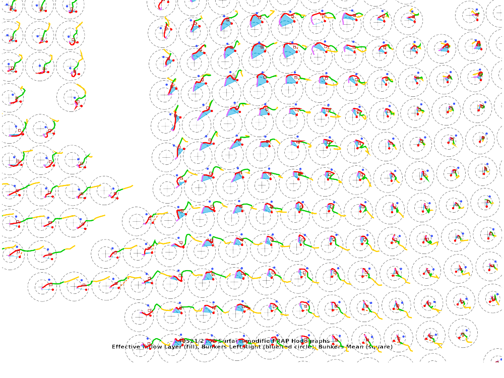
16Z SPC Mesoanalysis and Special Omaha (OAX) Sounding

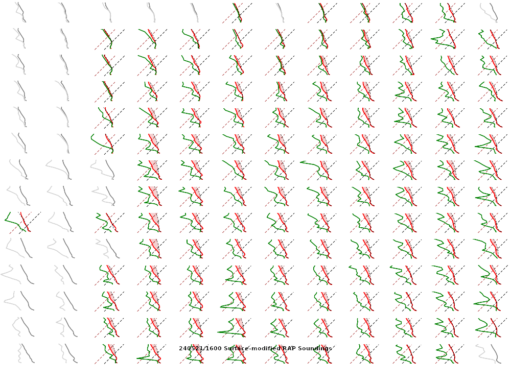
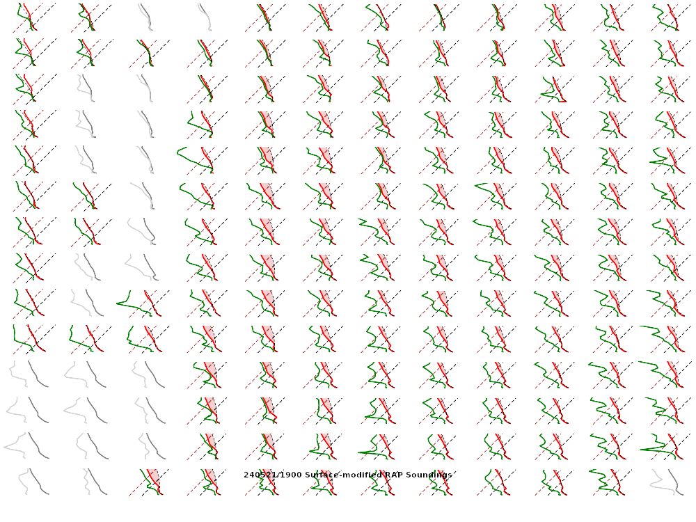
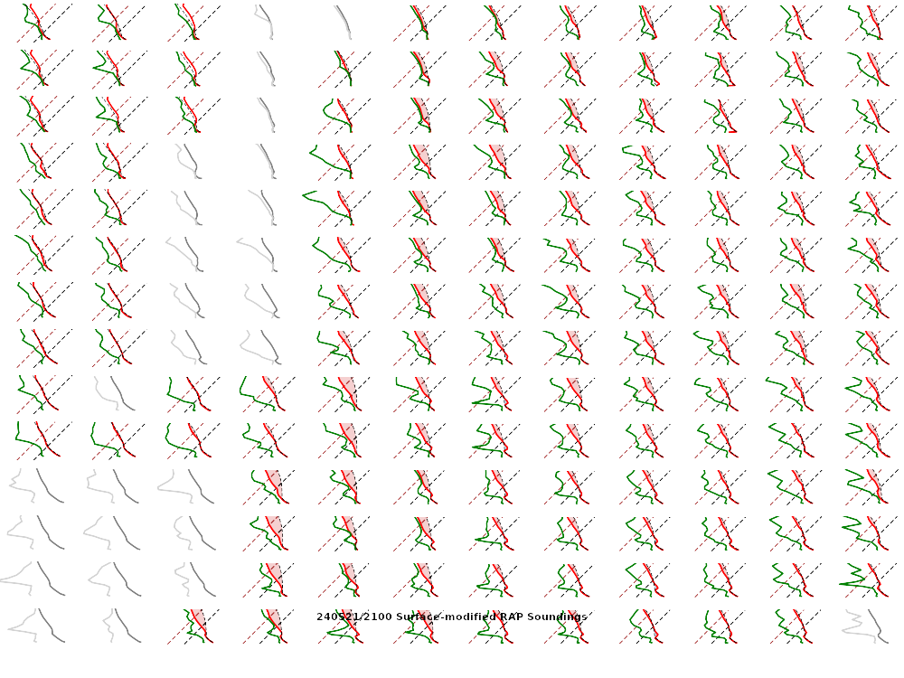
18Z SPC Mesoanalysis and Soundings

Convective Initiation in Eastern Nebraska

Storms had begun to fire in Eastern Nebraska and gone severe warned. After topping my tank in Red Oak, I headed west to US59 and south to IA-184 near Imogene. I’d observe the storms from a distance and would keep ahead, heading north through Strahan and Hastings before ending up north of 34 again. I proceeded approximately 8 miles north to Henderson and then headed east to Elliott.
Red Oak Iowa Tornado
As I was positioned ahead of the storm, I was sitting northeast of Red Oak west of Grant when the first tornado reports came in near Red Oak. Instead of continuing to give the storms their berth, I used that as an opportunity to drop south to US34 just east of Red Oak. I’d head east on US34 to catch the approaching storm from the southwest. The time was slightly before 3pm CDT.
Villisca Iowa Tornado
The first tornado I would witness would drop south of US34. The motion was very rapid, and debris was being kicked up, but the tornado was not fully condensed. It intensified as it moved off to the northeast, crossing US34 right at the US71 interchange. That’s where I’d film the encounter below.
After the tornado crossed US34, I headed up US71 and took the first road. My map showed the road going through. It did, however, it was minimum maintenance and I was not going to mess with that. I ended up giving up, and dropping back to US34.
Corning Iowa Tornado
As I headed east on US34, a new tornado would form again in the same fashion the first one did. It would spin up south of the highway and then move across the highway. Since I tried to go on the side road to witness the Villisca Iowa tornado, I was now behind the chaser hordes. Most of them were too busy filming or looking at their cell phones and not paying attention.
Prescott Iowa Tornado
As I pushed east, I wanted to pull off and get a look at the storm. Unfortunately that’d allow a lot of chasers to catch up to me, but I’d also catch another tornado happen directly behind me. The Prescott Tornado was fully condensed for a moment and was decently photogenic from my vantage point.
21Z SPC Mesoanalysis


Dropping South
I continued east on 34 towards Creston after the Prescott tornado. After going through Creston, I dropped south of town and eventually dropped south on US169. More storms had formed and I just planned to continue dropping south. With the 300mb winds on the RAP hitting NW Missouri, I was hoping to get on a good storm further south.
I got to Mt. Ayr and headed east. I was planning to just hit 35 and head home. I had observed 3 tornadoes and could be home around midnight.
Corydon Iowa Storm
I would continue east at 35 and head through Leon towards Corydon. Des Moines NWS had issued a blanket severe thunderstorm warning on the line to my north, but a more isolated storm was coming out of northern Missouri.

I’d give up after ending up near Milan, MO. The countryside there was quite pretty and the weather was decent, so I took a nice window down drive back to 35. I’d get home a little after 1am.
Links
- Villisca Iowa Tornado Video
- Corning Iowa Tornado Video
- Prescott Iowa Tornado Video
- National Weather Service Des Moines write-up of the May 21st event
- Stormtrack Events Thread for May 21, 2024
- Stormtrack Reports Thread for May 21, 2024
- Dan Robinson’s write-up of the May 21st Iowa event
- Brad Nelson’s recap of the Iowa Tornadoes


