Storm Chase Details
Miles Logged: 798
States Chased: NM, TX
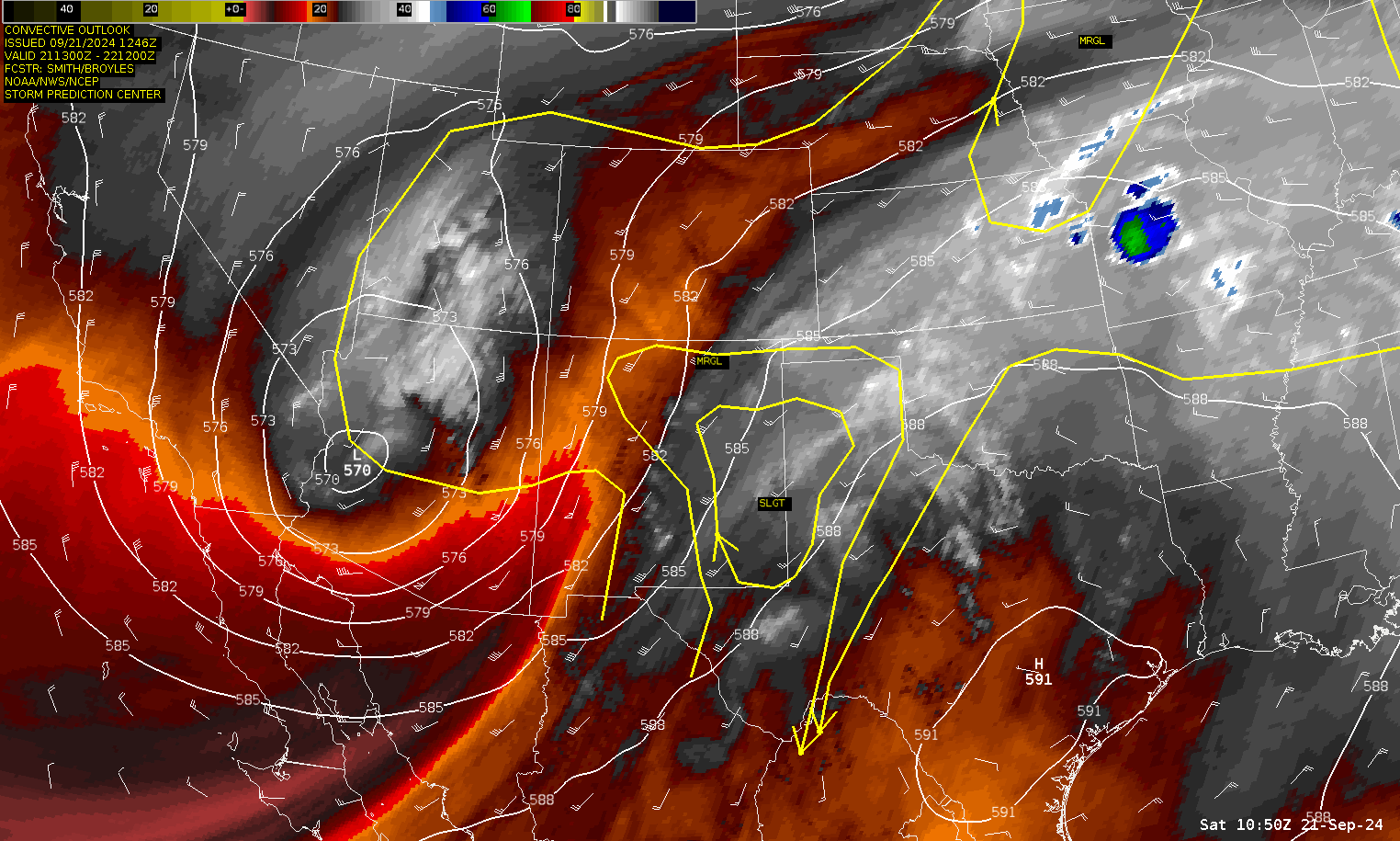
Severe Risks: SPC Outlooks
Severe Reports: Storm Reports
A compact trough ejecting over an extremely moist airmass in New Mexico and West Texas in September. Dewpoints were forecast to be seasonably high, with high 60s west of Lubbock.

Forecast
I was not keeping up with the daily model runs, but noticed a nice trough rolling through the southwest US on water vapor. Sure enough, models showed a decent chance of supercells for Saturday along the New Mexico/Texas border near Clovis.
00Z NAM
The 00Z NAM on Friday evening showed a mid afternoon show as the upper low ejected east into the moist and unstable airmass.


Forecasted soundings for Clovis, NM from 03Z RAP
The main focus was an area near Clovis, New Mexico. It appeared to be the sweet spot where tornadoes may form in the afternoon. Here’s some forecasted soundings from the RAP


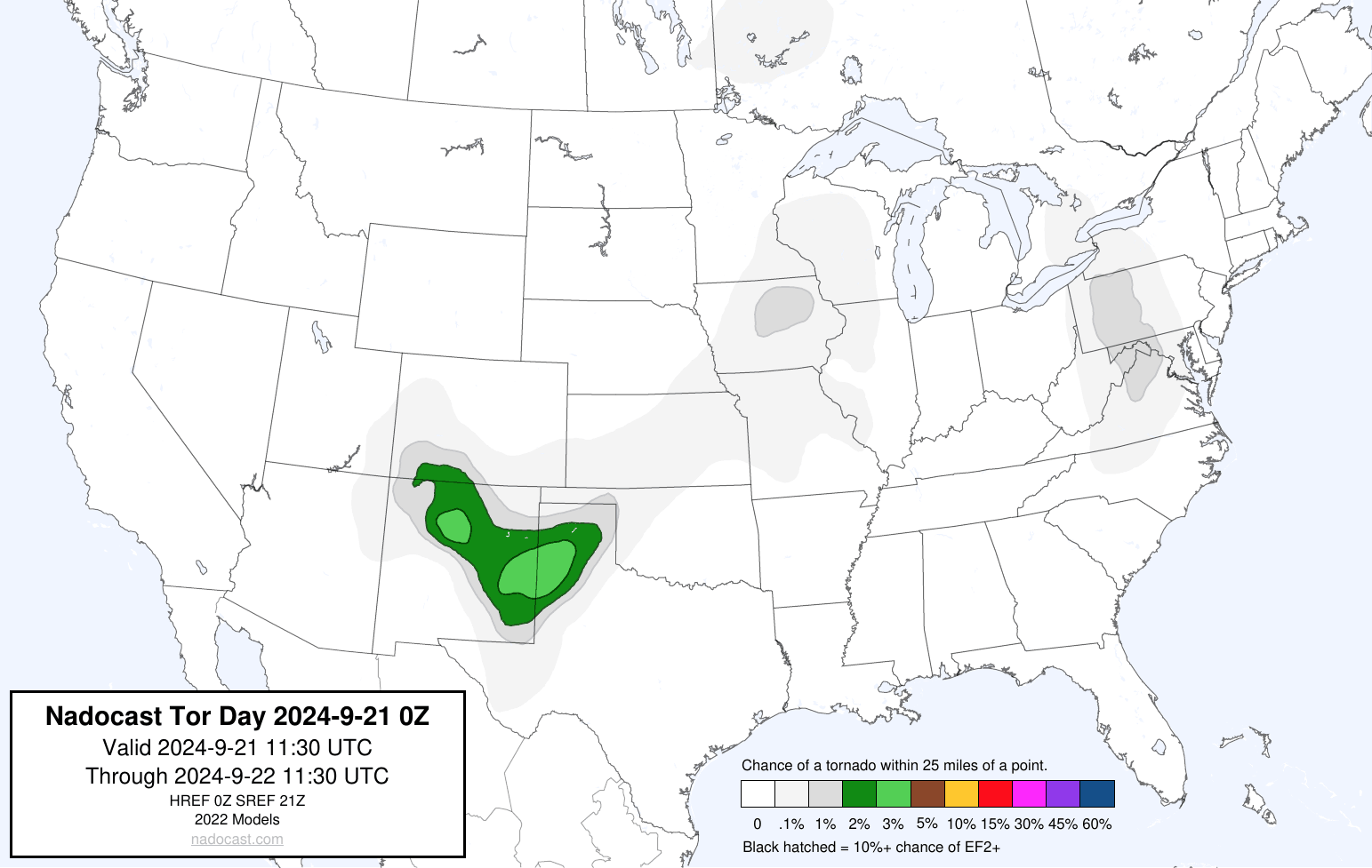
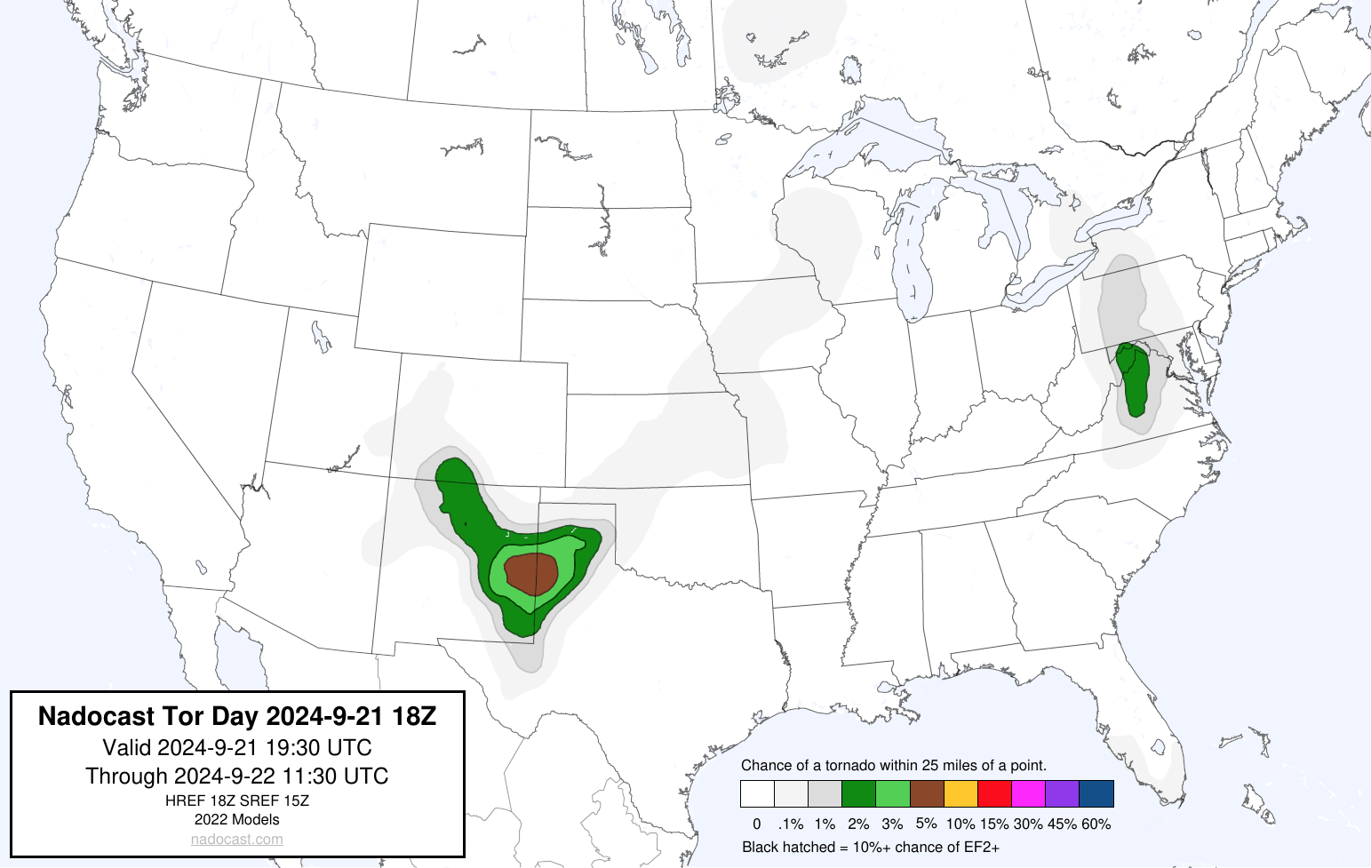
Nadocast
The nadocast forecast also highlighted the same area
Water Vapor at 9am CDT
As you can see, a potent upper level low is spinning over Arizona and ejecting a trough out over eastern New Mexico with some convection ongoing. We would depart by 10 am westbound on I-40 out of Oklahoma City.
Storms along the Texas/New Mexico Border
Heading westbound on I-40, we made it to Amarillo and headed south on I-27 before stopping for gas in Canyon. Storms were already in progress, with the best updrafts still to the west. We headed to Hereford, and then dropped south and west. Eventually we’d end up on a storm northeast of Clovis.

Heading East
We’d head east towards better looking storms on radar. I’d have to maneuver around hail, but would end up on a rotating wall cloud near Lazbuddie TX along Ranch Road 145 southwest of Dimmitt. I followed this storm northeast towards Dimmitt before giving up on it. It apparently produced a brief tornado shortly after.

I’d end up heading east through Kress and then through Silverton, Memphis and back to Norman.


